

Boldon Hills
Good walks are even better shared.
NZ3560 : Path on Boldon Hills
Anthony Foster Photo source
Overview
Exploration of Boldon Hills
Nestled in the Tyne and Wear region, the Boldon Hills rise up to 140 metres, offering a delightful escape for a day's hike. These modest elevations promise not just exercise, but a double dose of scenic beauty and a touch of history.
Geology
Boldon Hills are predominantly formed of Magnesian Limestone, a geological delight that contributes to the diversity of flora and fauna in the area. The peculiar landscape often leaves visitors marveling at the unique rock formations. You might even find a few ancient fossils if you look closely—perhaps a souvenir for a geology-loving friend!
Routes
The Boldon Hills Circular Walk is the mainstay of hiking options here. Stretching 5.5 km, it takes approximately 1.5 hours to complete at a moderate pace. Perfect for those who enjoy not just a good walk but also ambrosial views, this route winds through grassy trails and rocky outcrops.
Summit Features
At the summit, hikers are greeted by a charming little grassy knoll complete with a bench for break-taking moments (pun intended). It’s the ideal spot to catch your breath and possibly give your camera a workout.
Terrain Type
Expect a mix of grassy ground and rocky sections interspersed with woodlands. Make sure to keep your eyes peeled for the wide variety of wildlife, including birds that seem to take great joy in soaring above the hills.
Views
On clear days, the vistas from the summit might just steal your heart. You'll gaze across the urban tapestry of Sunderland and, if you're lucky, glimpse the shimmering North Sea beyond. Spring and early autumn bring the best views, with blooming wildflowers painting the landscape.
Hazards
While the trails are generally well-worn, do remain cautious of uneven surfaces, particularly when wet. You don’t want to turn your pleasant hike into a slip-and-slide adventure!
Nearby Summits
Not far from Boldon Hills, you'll find the Cleadon Hills and Harton Moor, making for great continuation hikes or exploration of the entire area.
Access
Getting here is a breeze! Nearest parking can be found at Boldon Community Centre, a mere 0.5 km away. Public transport operates frequently from Sunderland and South Shields, so jumping on a bus is always an option. The bustling town of Boldon Colliery serves as your closest urban haven.
Facilities
After your hike, the local cafes offer a chance to refuel and rehydrate. Should nature call, public toilets are conveniently located in the town centre.
History
The name Boldon conveys a sense of its rich heritage—'Bola's hill' reminds us not just of the landscape but of the lives once intertwined with these elevations. A trip here also offers a glimpse into the mining history that brought the region to life.
So, put on those hiking boots and make your way to Boldon Hills; whether for the exercise, the company of nature, or simply to score some epic Instagram shots, you're bound to leave with memories and perhaps a bit of mud on your boots!
Happy hiking!
Explore routes near Boldon Hills
Walks starting near this hill. Open a route to check its map, distance and full itinerary.
Jesmond Dene (extended) circular
View route
Ouseburn walk with Men Walking & Talking
View route
Jesmond Dene and Armstrong Park Circular
View route
Collingwood history walk: Bridge Hotel to Discovery Museum
View route
Route planning notes
These notes describe possible approaches. Check a route's map and access information when planning your walk.
Boldon Hills Circular Walk
A scenic circular route that navigates through the hills, perfect for those who enjoy varied terrain and the chance to spot wildlife.
Make a day of it, together
Find someone to share the walk with, or organise a day out along a route you like.
Photo Gallery
View all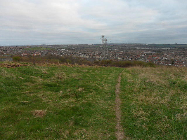 Photo could not load
NZ3560 : Path on Boldon Hills
Anthony Foster
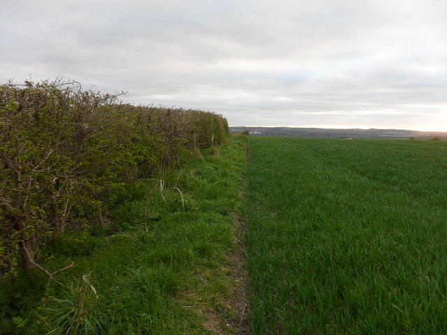 Photo could not load
NZ3560 : Boldon Hills: Approaching the summit
Anthony Foster
Hill facts and local notes
Classifications
Elevation
93m
305 ft
Prominence
59m
Coordinates
54.9353, -1.4549
NZ350601
OS Map
88
Explorer: 316E
At the Summit
The summit presents a grassy knoll and a wooden bench for weary hikers to rest and enjoy the vistas.
Terrain & Geology
The Boldon Hills are primarily composed of Magnesian Limestone, known for its distinctive landforms and rich biodiversity. This limestone results in unique quarry landscapes that offer striking views.
Views & Scenery
On a clear day, you can see as far as the North Sea and the cityscape of Sunderland, offering an expanse of both natural beauty and urban life.
History & Heritage
Name Origin
The name 'Boldon' is derived from the Old English 'Bola's hill', with 'Bola' as an Old Norse name and 'hill' indicating the geographical feature.
Historical Significance
Historically, the Boldon Hills have served as a natural landmark for local communities and have roots in the mining history of the region.
Getting There & Facilities
Parking
Parking available at the Boldon Community Centre (approx. 0.5 km from the hill), with spaces for around 30 vehicles.
Public Transport
Regular buses from Sunderland and South Shields serve Boldon; check local timetables for the latest routes.
Nearby Facilities
Nearby cafes in Boldon Colliery offer refreshments. Public toilets are available in the town centre.
Safety Information
Known Hazards
- Uneven terrain, especially after rain – watch your footing!
General Safety Tips
- Check weather conditions before setting out
- Carry appropriate clothing and equipment
- Let someone know your planned route
- Take a map, compass, and GPS device
- Carry emergency supplies: food, water, first aid kit, torch
Hills
Some common questions about the hills answered
Are there group walks up Boldon Hills?
Many walkers use Walkmates to join or organise walks with others. You can check for group walks around Boldon Hills through the maps
Are there other walkers around Boldon Hills?
Activity varies by location and time, but Walkmates lets you see whether others have shared walks or shown interest in this area. Find other people through the walking friends search walking friends for Boldon Hills search or of course create your own walk for Boldon Hills
Can I organise a walk to Boldon Hills?
Yes. If there aren’t any walks listed already, you can create a walk and make it available for others to join.
If you're signed up to Walkmates, you can create a walk to Boldon Hills.
How do I find a walk up this hill?
There are often multiple ways to walk this hill, depending on experience and route preference. Walkmates helps you explore walks and routes that others have shared.
Can I suggest a new route up Boldon Hills?
Yes. You can suggest or create routes to share with others. Walkmates focuses on the social side of walking, so routes are used to help people organise walks and explore areas together, rather than as detailed navigation tools or route libraries.
Other uses really appreciate knowledgeable walkers sharing their routes. Share your favourite route to Boldon Hills here
The is an error or something incorrect about this hill. How do I let you know?
We always strive to keep the information on Walkmates as accurate as possible. If you find an error, please let us know through the contact form and we'll aim to correct it as quickly as possible
Community Discussion
Comments
Location
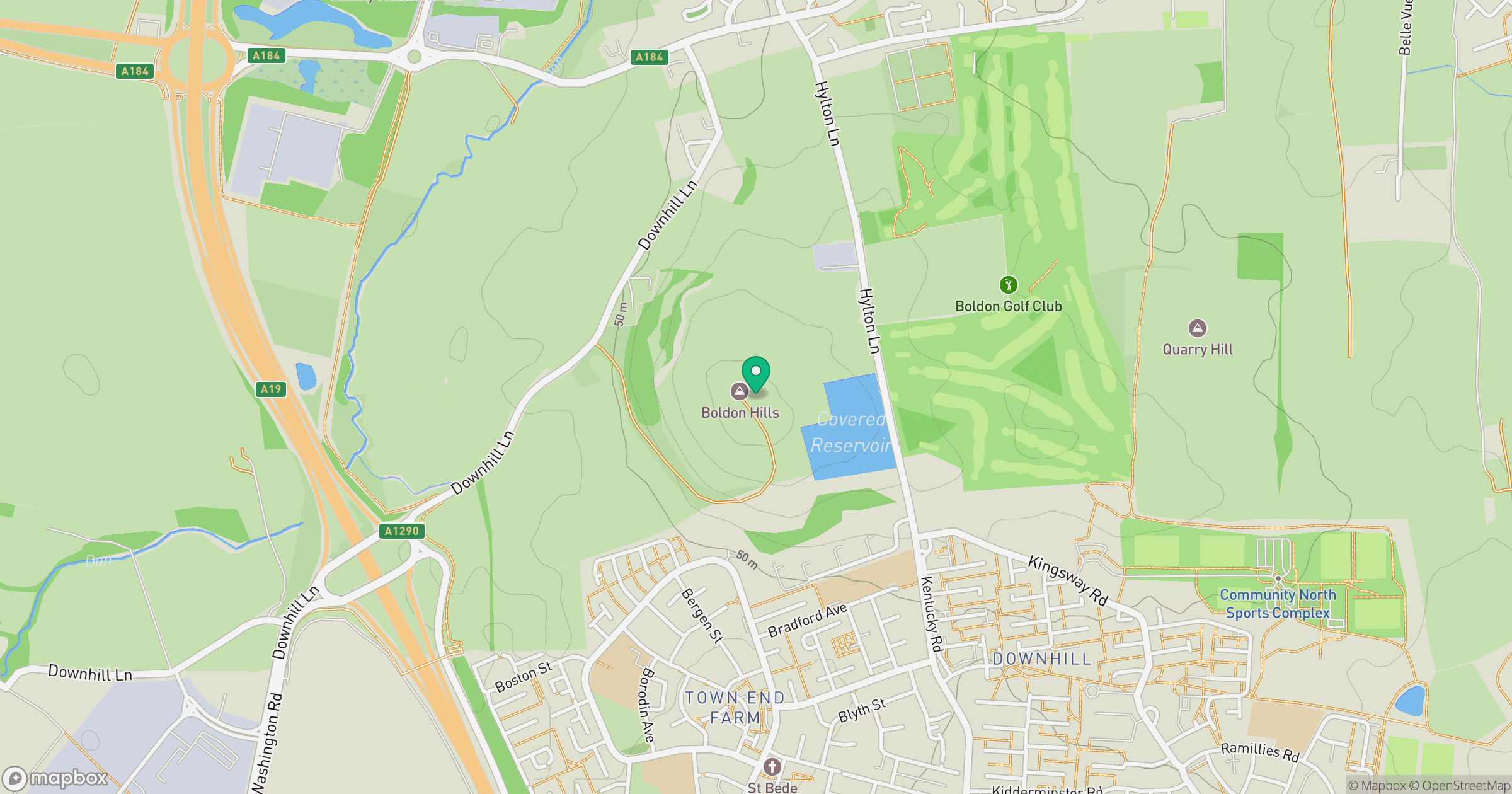
Grid reference: NZ350601
View on OpenStreetMapOpens a map in a new tab, centred on the hill.
Nearby Hills

The Cheviot
816m
Nine Standards Rigg
662m
Buckden Pike
702m

Cross Fell
893m
Rombalds Moor [Ilkley Moor]
402m
No comments yet. Be the first.