
Bockagh Hill
Good walks are even better shared.
Overview
Bockagh Hill: A Hidden Gem in Connemara
Bockagh Hill stands proud at 377 meters, a well-kept secret in the breathtaking landscapes of Connemara. Often overshadowed by its more famous neighbours, this hill offers enchanting views and a sense of solitude that seasoned hikers will relish.
Geology
The hill is primarily composed of granite and schist, distinguishing it with unique features left behind by ancient glaciers. It's a fine specimen for anyone interested in geology or simply enjoying the majesty of the natural world.
Route Description
The most popular route is the Bockagh Hill Circular Route. Starting from the quaint village of Letterfrack, it covers approximately 7.5 km and should take around 3.5 hours to complete. The path takes you through lush valleys and past rugged terrain, making it a delight for both seasoned adventurers and casual walkers alike. Don’t forget to pack a picnic, as the views make for a perfect lunch spot!
Terrain
Bockagh Hill features a mix of rocky outcrops and grassy slopes, with occasional boggy patches that dare you to test your luck—and the waterproofing of your boots! Watch your footing, and you’ll be rewarded with a smooth ascent.
Summit Features
The summit is marked by a sturdy trig point, providing not just a focal point for your photos, but also an excellent perch to soak in the vast expanse surrounding you. Just make sure not to lose your hat in the wind!
Views
Once you reach the top, prepare to be awestruck by sweeping views of the Twelve Bens mountain range and Kylemore Lough. On those rare clear days, the Atlantic Ocean sparkles in the distance, providing an excellent backdrop for those Instagram posts.
Hazards
Like all adventurous pursuits, hiking Bockagh Hill isn’t without its risks. Beware of loose stones, boggy areas, and quickly changing weather. A reliable windbreaker will be your best friend up there!
Access
The nearest parking is conveniently located at the trailhead in Letterfrack, with enough space for several vehicles. For those reliant on public transport, buses run from Galway to Letterfrack, and it's a short jaunt from Clifden.
Nearby Facilities
After your trek, why not reward yourself with a warm meal or refreshment? Letterfrack boasts a handful of charming cafes and pubs, perfect for unwinding after a brisk hike.
History
The name Bockagh comes from the Irish 'Bóthar', reflecting the ancient paths that meander through this part of Connemara. This little hill is steeped in local folklore and memories, making it not just a physical journey, but a journey through time too!
In conclusion, Bockagh Hill offers a fantastic hiking experience away from the bustling crowds. So lace up your boots, grab your walking stick, and get ready to make some memories!
Explore routes near Bockagh Hill
Public walks starting within 80 km of this hill. Nearby does not mean a route reaches the summit; check its map and access before setting out.
Route planning notes
These notes describe possible approaches, not verified navigable routes or permission to cross land. Check current paths, local access rules and conditions before setting out.
Bockagh Hill Circular Route
A scenic circular hike that starts from the small village nearby, taking you across lush valleys and rocky outcrops.
Make a day of it, together
Find someone to share the walk with, or organise a day out along a route you like.
Hill facts and local notes
Classifications
Elevation
227m
745 ft
Prominence
105m
Coordinates
53.9353, -8.6067
M602986
OS Map
32
At the Summit
The summit is marked by a prominent trig point, surrounded by panoramic views of the rugged Connemara landscape. It’s the perfect spot for a selfie—if you can keep the selfie stick steady in the wind!
Terrain & Geology
Primarily composed of granite and schist, with fascinating glacial features due to past ice ages. The landscape gives way to rugged terrain, creating a playground for geologists and nature enthusiasts alike.
Views & Scenery
You can gaze upon the Twelve Bens mountain range, the tranquil waters of Kylemore Lough, and on a clear day, even as far as the Atlantic Ocean.
History & Heritage
Name Origin
Bockagh is derived from the Irish term 'Bóthar', meaning a path or way, echoing the ancient trails that once crossed its slopes.
Historical Significance
This area is rich in folklore and history, notably linked to the local pilgrimage routes leading to nearby holy sites.
Getting There & Facilities
Check current local access restrictions, parking rules and transport timetables before travelling. These notes do not confirm public access to the summit.
Parking
There is a small gravel car park at the trailhead on the edge of the village of Letterfrack, accommodating several vehicles.
Public Transport
Buses run from Galway to Letterfrack, with some links from the nearby town of Clifden.
Nearby Facilities
Facilities in Letterfrack include a couple of cafes, pubs, and public toilets. Grab a hot drink before setting off—it could be a chilly climb!
Safety Information
Known Hazards
- Be mindful of loose stones and boggy areas. Weather can change quickly, so always be prepared for a bit of rain or a strong breeze. And don’t forget, the summit is not the place to test the limits of your windbreaker!
General Safety Tips
- Check weather conditions before setting out
- Carry appropriate clothing and equipment
- Let someone know your planned route
- Take a map, compass, and GPS device
- Carry emergency supplies: food, water, first aid kit, torch
Hills
Some common questions about the hills answered
Are there group walks up Bockagh Hill?
Many walkers use Walkmates to join or organise walks with others. You can check for group walks around Bockagh Hill through the maps
Are there other walkers around Bockagh Hill?
Activity varies by location and time, but Walkmates lets you see whether others have shared walks or shown interest in this area. Find other people through the walking friends search walking friends for Bockagh Hill search or of course create your own walk for Bockagh Hill
Can I organise a walk to Bockagh Hill?
Yes. If there aren’t any walks listed already, you can create a walk and make it available for others to join.
If you're signed up to Walkmates, you can create a walk to Bockagh Hill.
How do I find a walk up this hill?
There are often multiple ways to walk this hill, depending on experience and route preference. Walkmates helps you explore walks and routes that others have shared.
Can I suggest a new route up Bockagh Hill?
Yes. You can suggest or create routes to share with others. Walkmates focuses on the social side of walking, so routes are used to help people organise walks and explore areas together, rather than as detailed navigation tools or route libraries.
Other uses really appreciate knowledgeable walkers sharing their routes. Share your favourite route to Bockagh Hill here
The is an error or something incorrect about this hill. How do I let you know?
We always strive to keep the information on Walkmates as accurate as possible. If you find an error, please let us know through the contact form and we'll aim to correct it as quickly as possible
Community Discussion
Comments
Location
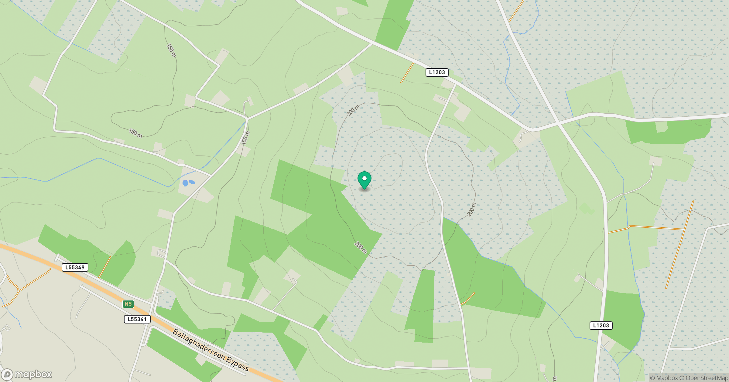
Grid reference: M602986
View on OpenStreetMapOpens a map in a new tab, centred on the hill.
Hills within 30 km
Straight-line distance, not a walking route or confirmation of access.
Mullaghanoe [Mullach an O]
234m
Knocknashee [Knocknashee Common] [Cnoc na Si]
276m
Knock Hill
213m
Keshcorran [Ceis Chorainn]
359m
Curlew Mountain [An Corrshliabh]
262m
No comments yet. Be the first.