
Slieveward
Good walks are even better shared.
Overview
Slieveward: An Overview
If you’re looking for a delightful hike in the heart of the Cooley Mountains, look no further than Slieveward! Towering at an elevation of 462 meters, this Marilyn offers both accessible paths and breathtaking views, making it a popular destination for hikers of all levels.
Geology
Now, let’s talk about the fascinating geology up here. Slieveward is predominantly made of sandstone and shale. This blend has created a rugged landscape perfect for the seasoned geologist—or just those who enjoy an afternoon rock-spotting! The beautiful rocky outcrops shaped by years of weathering might inspire thoughts of ancient tales when the area was a bustling forge.
Route
The most popular route is the Slieveward Loop, which is approximately 5 km in length. Expect to spend about 2.5 hours getting to know the area, while partaking in the sport of dodging wet patches! This moderate hike is great for many, so gather your friends and enjoy the fresh air. Just remember to take it slow and enjoy the views.
Summit Features
At the summit, you’ll find a modest but charming cairn, where you can take a moment to appreciate the stunning panorama. Rain or shine, the expansive views stretch across the magnificent Cooley Peninsula and beyond, a truly spectacular sight.
Terrain
A mixed terrain waits for your adventuring feet—some grassy slopes, rocky outcrops, and yes, those pesky boggy bits. So it’s advisable to wear sturdy boots and, possibly, a good sense of humour for when you do a little unintentional mud dance!
Views
Get your camera ready! At the top, you’ll be rewarded with views of the Mourne Mountains to the north and a glistening Carlingford Lough. Late spring and early autumn are the best times for those stunning vistas, so plan your trek accordingly.
Hazards
Do be warned—this isn't a stroll through the park. Paths can be quite wet, particularly in the winter months, and livestock may occasionally surprise you by appearing on the trail. Remember, that’s their territory!
Nearby Summits
If you’re feeling particularly energetic, consider adding a few extra summits to your itinerary, such as Carlingford Mountain and Raven Hill, both offering their own unique views and challenges.
Access
To access this beautiful hike, you will find a small parking area at the end of a narrow access road. And while public transport options are limited, a short taxi ride can take you closer to the action if you’re coming from Carlingford, the nearest village where you can find all the amenities you need.
Facilities
After your hike, make sure to swing by one of the many delightful cafes or restaurants in Carlingford for a well-deserved bite to eat, because nothing quite beats the satisfaction of a hearty meal after a day in the hills!
History
The name ‘Slieveward’, meaning ‘mountain of the forge’, comes from ancient times when the region had historical significance in iron work. The mountain is steeped in age-old folklore and stories that have been passed through generations, lending it a cultural significance that beckons many to explore its slopes.
Happy hiking, and may your paths be clear and your boots dry!
Explore routes near Slieveward
Public walks starting within 80 km of this hill. Nearby does not mean a route reaches the summit; check its map and access before setting out.
Route planning notes
These notes describe possible approaches, not verified navigable routes or permission to cross land. Check current paths, local access rules and conditions before setting out.
Slieveward Loop
A scenic loop starting from the end of a narrow lane, showcasing the stunning views of the surrounding landscape and the opportunity to spot local wildlife.
Make a day of it, together
Find someone to share the walk with, or organise a day out along a route you like.
Hill facts and local notes
Classifications
Elevation
199m
653 ft
Prominence
113m
Coordinates
54.1927, -8.5262
G657272
OS Map
25
At the Summit
At the summit, you will find a modest cairn marking the top of Slieveward, along with panoramic views that extend as far as the Mourne Mountains to the north.
Terrain & Geology
The mountain is predominantly composed of sandstone and shale, offering an interesting mix of geological formations that tell tales of ancient landscapes. You'll find plenty of rocky outcrops and weathered stones that have stood the test of time—or the test of a good old Irish rain, at least!
Views & Scenery
From the summit, you can see the sprawling landscape of the Cooley Peninsula, the Mourne Mountains, and the shimmering waters of Carlingford Lough.
History & Heritage
Name Origin
The name 'Slieveward' comes from the Irish 'Sliabh Fhorga', which translates to 'mountain of the forge', perhaps indicating the area's historical significance in iron working.
Historical Significance
The mountain is deeply embedded in the local folklore and history, often linked with ancient tales and legends of the Cooley Peninsula.
Getting There & Facilities
Check current local access restrictions, parking rules and transport timetables before travelling. These notes do not confirm public access to the summit.
Parking
There's a small parking area at the end of the access road near the start of the Slieveward Loop, suitable for a handful of cars.
Public Transport
While there's limited public transport directly to the mountain, buses from Carlingford run regularly, and a short taxi ride can get you closer.
Nearby Facilities
Carlingford offers several cafes, restaurants, and toilets, making it a great stop before or after your hike—because nothing pairs better with a hike than a nice cup of tea!
Safety Information
Known Hazards
- Wet and slippery paths, particularly in winter; occasional livestock on the trails, and sudden weather changes typical of the Irish climate.
General Safety Tips
- Check weather conditions before setting out
- Carry appropriate clothing and equipment
- Let someone know your planned route
- Take a map, compass, and GPS device
- Carry emergency supplies: food, water, first aid kit, torch
Hills
Some common questions about the hills answered
Are there group walks up Slieveward?
Many walkers use Walkmates to join or organise walks with others. You can check for group walks around Slieveward through the maps
Are there other walkers around Slieveward?
Activity varies by location and time, but Walkmates lets you see whether others have shared walks or shown interest in this area. Find other people through the walking friends search walking friends for Slieveward search or of course create your own walk for Slieveward
Can I organise a walk to Slieveward?
Yes. If there aren’t any walks listed already, you can create a walk and make it available for others to join.
If you're signed up to Walkmates, you can create a walk to Slieveward.
How do I find a walk up this hill?
There are often multiple ways to walk this hill, depending on experience and route preference. Walkmates helps you explore walks and routes that others have shared.
Can I suggest a new route up Slieveward?
Yes. You can suggest or create routes to share with others. Walkmates focuses on the social side of walking, so routes are used to help people organise walks and explore areas together, rather than as detailed navigation tools or route libraries.
Other uses really appreciate knowledgeable walkers sharing their routes. Share your favourite route to Slieveward here
The is an error or something incorrect about this hill. How do I let you know?
We always strive to keep the information on Walkmates as accurate as possible. If you find an error, please let us know through the contact form and we'll aim to correct it as quickly as possible
Community Discussion
Comments
Location
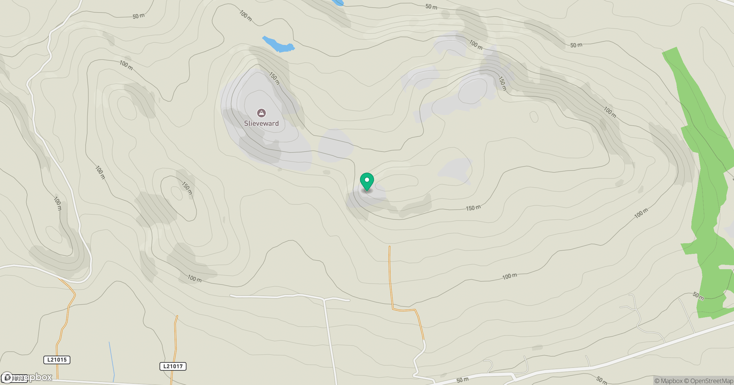
Grid reference: G657272
View on OpenStreetMapOpens a map in a new tab, centred on the hill.
Hills within 30 km
Straight-line distance, not a walking route or confirmation of access.
No comments yet. Be the first.