

Ben Griam Mor
Good walks are even better shared.
Overview
Ben Griam Mor: The Grimy Giant of the Highlands
Nestled in the stunning Scottish Highlands, Ben Griam Mor is a true Munro that beckons hikers and outdoor enthusiasts alike. Standing tall at 749 meters, this peak offers both challenge and charm.
Geology
Ben Griam Mor is primarily composed of metamorphic schists, reflecting the complex geological history of the region. These rocks are particularly fascinating for those inclined towards geology, with their layers telling tales older than time itself. Just remember—what goes up must come down, particularly your footing.
Access and Parking
To access Ben Griam Mor, the nearest parking can be found off the A9 at coordinates NC 796 392. Nothing too extravagant, but hey, it’s the mountains that matter! If you're relying on public transport, the bus stop along the A9 is your best bet, with services heading to Lairg, the nearest town, about 20 km away.
The Route
One popular route is the Griam Beag Circuit. This moderate trek takes you from the A9, allowing you to take in the phenomenal sights, including both Ben Griam Mor and Ben Griam Beag. The total distance is roughly 14 km, which can be comfortably covered in about 5 hours, depending on your pace (and how long you enjoy those views).
Summit Features
Upon reaching the summit, adventurers are greeted by a prominent cairn standing proudly against the elements. It’s an excellent spot for a well-deserved break—just beware of the cheeky midges who might fancy your lunch!
Terrain and Hazard Awareness
The terrain varies, showcasing rocky outcrops followed by swathes of grassy plains, with some boggy patches to keep your senses keen. Highland weather can be as unpredictable as a cat on a hot tin roof, so remain alert for sudden changes. Good hiking boots are essential to handle both the rocky sections and the inevitable bogs.
Views
The vistas from the summit are nothing short of spectacular. On a clear day, you’ll be treated to views over the flow country to the north, and the more distant peaks of Sutherland in the south. The best times for these breathtaking views are late spring to early autumn when the weather is at its best.
Nearby Summits
If you're itching for more adventure, consider tackling the nearby Ben Griam Beag or the impressive Ben Klibreck, which at 961 meters, is no slouch in the height department.
Facilities
Although Ben Griam Mor offers no facilities on the mountain, the nearby town of Lairg has everything a weary walker could need — accommodations, cafes for that post-hike cake, and shops for your last-minute supplies.
History
Ben Griam Mor's name translates to 'Grim Mountain', which fits the rugged landscape perfectly. Rich in local folklore, this area is steeped in stories of ancient clans and the resilient Highland spirit.
In conclusion, whether you're keen on conquering peaks or simply enjoying the scenic beauty, Ben Griam Mor is a mountain that certainly delivers. So lace up those hiking boots, pack some snacks (and insect repellent!), and get out there!
Remember, the hills are calling and you must go!
Explore routes near Ben Griam Mor
Public walks starting within 80 km of this hill. Nearby does not mean a route reaches the summit; check its map and access before setting out.
Ben Klibreck
View route
Loch Migdale from Torroy: Spinningdale pinewood and loch shore walk
View route
Findhorn guided night walk
View route
Culbin Forest: Hill 99, Gravel Pit Ponds and Dragonfly Pool
View route
Route planning notes
These notes describe possible approaches, not verified navigable routes or permission to cross land. Check current paths, local access rules and conditions before setting out.
Griam Beag Circuit
Starting from the A9 road, this circuit takes in both Ben Griam Mor and its nearby sibling, Ben Griam Beag, offering a scenic trek through rugged wilderness.
Make a day of it, together
Find someone to share the walk with, or organise a day out along a route you like.
Photo Gallery
View all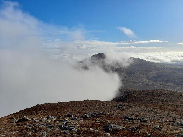 Photo could not load
NC8039 : Ben Griam Beg from Ben Griam Mor
David Bremner
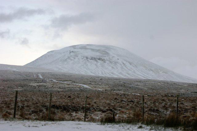 Photo could not load
NC8038 : Ben Griam Mor
Rob Newman
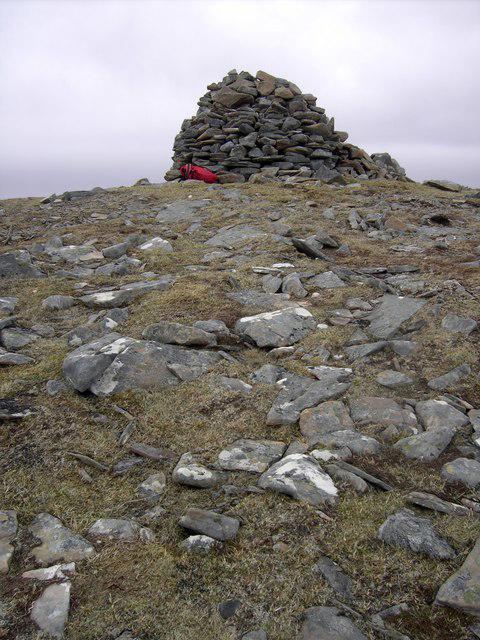 Photo could not load
NC8038 : Summit of Ben Griam Mor
Colin Kinnear
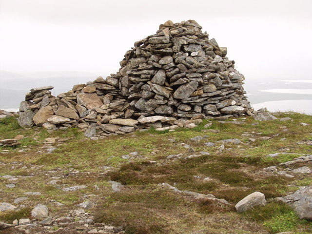 Photo could not load
NC8038 : Ben Griam Mor summit cairn
Mick Crawley
Hill facts and local notes
Classifications
Elevation
590m
1,936 ft
Prominence
433m
Coordinates
58.3227, -4.0393
NC806389
OS Map
17
Explorer: 448S 449S
At the Summit
The summit is marked by a large cairn, providing a perfect spot for a celebratory snack — just make sure the midges don't steal your sandwich!
Terrain & Geology
Ben Griam Mor is primarily composed of metamorphic rocks, specifically schists, which offer a fascinating glimpse into the geological history of the Highlands. The striking formations provide excellent photo opportunities, so make sure your camera is charged!
Views & Scenery
On a clear day, enjoy breathtaking views of the flow country and Caithness. To the south, catch a glimpse of the majestic peaks of the nearby Sutherland mountains.
History & Heritage
Name Origin
The name 'Ben Griam' combines the Scottish Gaelic 'Ben' (mountain) with 'Griam,' which is derived from the Norse word for 'grim'. So, you know you're in for a treat!
Historical Significance
The mountain holds significance in local folklore, often associated with tales of ancient clans and the rugged spirit of the Highlanders.
Getting There & Facilities
Check current local access restrictions, parking rules and transport timetables before travelling. These notes do not confirm public access to the summit.
Parking
There is a small parking area just off the A9 at NC 796 392. Always best to arrive early as space can be limited.
Public Transport
Public transport options are limited; the nearest bus stop is along the A9, with services to Lairg.
Nearby Facilities
While there are no facilities on the mountain itself, Lairg offers accommodations, cafes, and shops. Perfect for refuelling after a day in the hills!
Safety Information
Known Hazards
- Watch out for sudden weather changes typical of the Highlands. Keep an eye out for slippery rocks and boggy patches!
General Safety Tips
- Check weather conditions before setting out
- Carry appropriate clothing and equipment
- Let someone know your planned route
- Take a map, compass, and GPS device
- Carry emergency supplies: food, water, first aid kit, torch
Hills
Some common questions about the hills answered
Are there group walks up Ben Griam Mor?
Many walkers use Walkmates to join or organise walks with others. You can check for group walks around Ben Griam Mor through the maps
Are there other walkers around Ben Griam Mor?
Activity varies by location and time, but Walkmates lets you see whether others have shared walks or shown interest in this area. Find other people through the walking friends search walking friends for Ben Griam Mor search or of course create your own walk for Ben Griam Mor
Can I organise a walk to Ben Griam Mor?
Yes. If there aren’t any walks listed already, you can create a walk and make it available for others to join.
If you're signed up to Walkmates, you can create a walk to Ben Griam Mor.
How do I find a walk up this hill?
There are often multiple ways to walk this hill, depending on experience and route preference. Walkmates helps you explore walks and routes that others have shared.
Can I suggest a new route up Ben Griam Mor?
Yes. You can suggest or create routes to share with others. Walkmates focuses on the social side of walking, so routes are used to help people organise walks and explore areas together, rather than as detailed navigation tools or route libraries.
Other uses really appreciate knowledgeable walkers sharing their routes. Share your favourite route to Ben Griam Mor here
The is an error or something incorrect about this hill. How do I let you know?
We always strive to keep the information on Walkmates as accurate as possible. If you find an error, please let us know through the contact form and we'll aim to correct it as quickly as possible
Community Discussion
Comments
Location
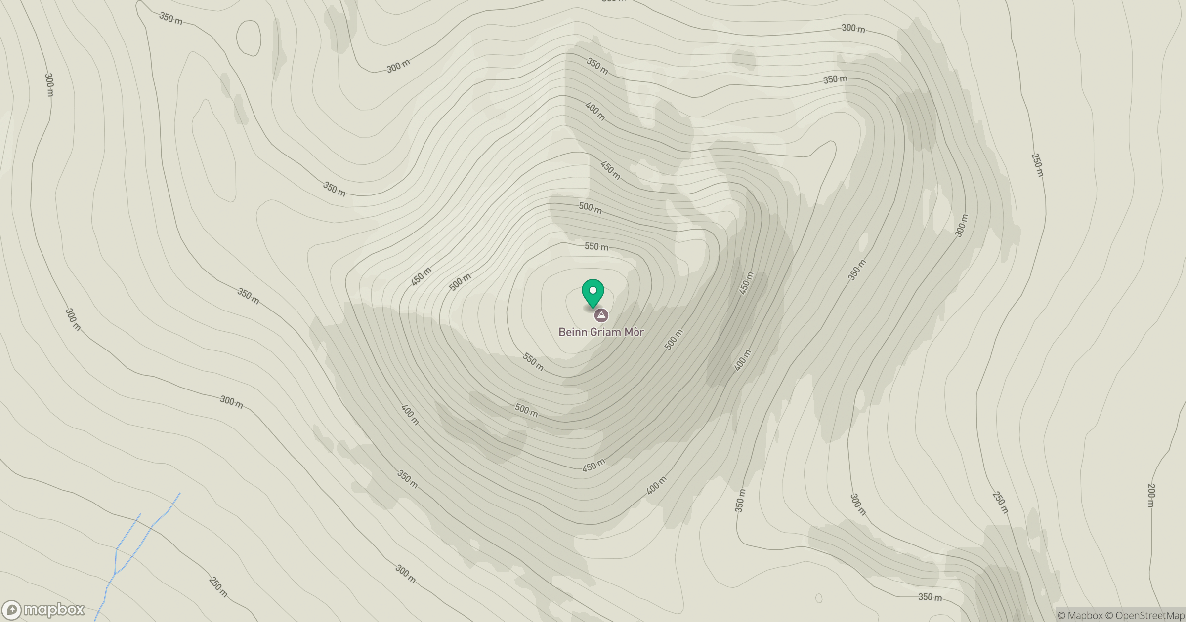
Grid reference: NC806389
View on OpenStreetMapOpens a map in a new tab, centred on the hill.
Hills within 30 km
Straight-line distance, not a walking route or confirmation of access.
Ben Loyal - An Caisteal
764m
Meall a' Bhuirich
407m
Beinn a' Mhadaidh
403m
Creag nam Fiadh
387m
Beinn Rosail
260m
No comments yet. Be the first.