

Beinn Smeorail
Good walks are even better shared.
Overview
Beinn Smeorail: A Highland Gem
Overview
Beinn Smeorail towers at an elevation of 792 meters, proudly classified as a Marilyn. This captivating mountain sits in the heart of the Scottish Highlands, serving as both a challenge and a delight for outdoor enthusiasts.
Geological Wonders
The rocks of Beinn Smeorail tell a story millions of years in the making. Composed mainly of Lewisian gneiss, the mountain showcases stunning geological features. Learning about these ancient formations can add a layer of intrigue to your hike.
Hiking Routes
One of the most popular routes to the summit begins at the Rhug Riverside. This journey of approximately 7.5 km offers both moderate challenges and impressive views, perfect for those looking for a rewarding day in nature. The trail winds through vibrant heather and rocky outcrops, culminating at the summit.
Summit Features
Upon reaching the top, hikers are greeted by a modest cairn—a great spot for a well-deserved break or a photo op. It’s a public duty to document your feat, after all!
Terrain and Views
The terrain changes between rocky and grassy patches, providing diverse scenery as you ascend. On a clear day, the summit boasts breathtaking views of the surrounding Highlands, including neighboring peaks such as Beinn Alligin and Liathach. You're in for a treat!
Hazards to Consider
While the allure of Beinn Smeorail is undeniable, it’s crucial to be cautious. Unpredictable weather and tricky terrain could catch the unwary. Always check the forecast before heading out, and bring appropriate gear.
Access Details
Access to Beinn Smeorail is straightforward, with parking available at the Rhug Riverside. For those reliant on public transport, the nearest bus service runs from Kinlochewe, with taxis available to complete the journey.
Nearby Facilities
Although the mountain doesn't offer many facilities, Lochcarron isn't far away, boasting excellent cafes and shops for hikers to stock up on supplies or indulge in a warm meal after their adventure.
Historical Significance
Beyond its geological and natural beauty, Beinn Smeorail carries a rich tapestry of local history. Its name hints at mythical creatures, adding an enchanting flavour to your hiking experience.
In summary, Beinn Smeorail is not just a hike; it’s a journey through time and nature. Whether you’re a seasoned pro or a casual walker, this Highland beauty will leave a lasting impression.
Conclusion
So lace up your boots, pack a lunch (maybe a wee dram for later?), and head out to Beinn Smeorail. The Highlands are calling!
Explore routes near Beinn Smeorail
Public walks starting within 80 km of this hill. Nearby does not mean a route reaches the summit; check its map and access before setting out.
Loch Migdale from Torroy: Spinningdale pinewood and loch shore walk
View route
Ben Klibreck
View route
Findhorn guided night walk
View route
Culbin Forest: Hill 99, Gravel Pit Ponds and Dragonfly Pool
View route
Route planning notes
These notes describe possible approaches, not verified navigable routes or permission to cross land. Check current paths, local access rules and conditions before setting out.
Approach from Rhug Riverside
A scenic route starting from the Rhug Riverside, gently ascending through heather-covered slopes and rocky outcrops, culminating at the summit with breathtaking panoramic views.
Make a day of it, together
Find someone to share the walk with, or organise a day out along a route you like.
Photo Gallery
View all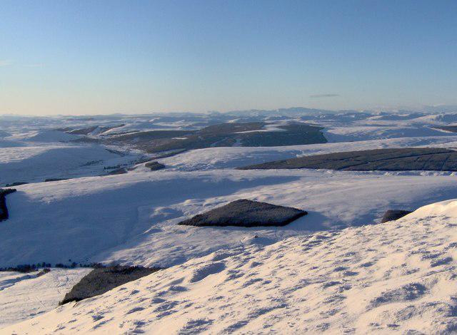 Photo could not load
NC8611 : Beinn Smeorail
John A Ross
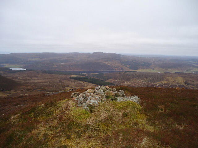 Photo could not load
NC8611 : The summit of Ben Smeorail
Michael Earnshaw
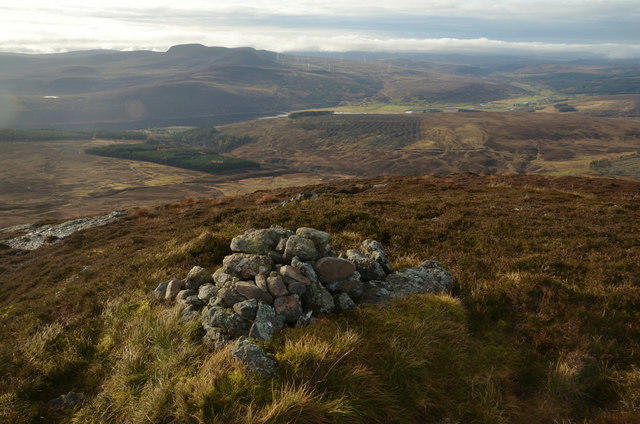 Photo could not load
NC8611 : Summit Cairn on Beinn Smeorail, Sutherland
Andrew Tryon
Hill facts and local notes
Classifications
Elevation
486m
1,594 ft
Prominence
104m
Coordinates
58.0796, -3.9305
NC862116
OS Map
17
Explorer: 444W
At the Summit
The summit features a modest cairn that serves as a perfect spot for a well-deserved snack and an impressive view over the surrounding moors and mountains. Remember to take a selfie with the cairn; after all, if it’s not on social media, did it even happen?
Terrain & Geology
Beinn Smeorail is predominantly composed of ancient Lewisian gneiss, which showcases a fascinating array of metamorphic rock characteristics. The rugged terrain is a testament to the geological forces at play over billions of years, providing an interesting backdrop for any hiking adventure.
Views & Scenery
From the summit, you can enjoy stunning vistas of the surrounding mountains, including the familiar peaks of the North West Highlands, and the rolling hills of the adjacent glens.
History & Heritage
Name Origin
The name 'Beinn Smeorail' is thought to derive from Gaelic, meaning 'the mountain of the porpoise,' a nod to local folklore involving mythical creatures of the sea.
Historical Significance
Historically, Beinn Smeorail has been a landmark for local communities, often forming part of traditional routes and folk tales in Highland culture.
Getting There & Facilities
Check current local access restrictions, parking rules and transport timetables before travelling. These notes do not confirm public access to the summit.
Parking
The nearest parking area is at the Rhug Riverside, which offers a small layby accommodating several vehicles. Arrive early to secure a spot, especially in peak season.
Public Transport
The nearest public transport link is from the village of Kinlochewe, where bus services operate several times daily. From there, a short taxi ride can get you to Rhug Riverside.
Nearby Facilities
There are limited facilities directly on the mountain, but Lochcarron offers cafes and small shops for provisions, as well as public toilets.
Safety Information
Known Hazards
- Potential for unpredictable weather changes, especially in the Highlands. Loose rocks and textured terrain can also present tripping hazards. Always keep an eye on the sky—it's known for keeping a few surprises!
General Safety Tips
- Check weather conditions before setting out
- Carry appropriate clothing and equipment
- Let someone know your planned route
- Take a map, compass, and GPS device
- Carry emergency supplies: food, water, first aid kit, torch
Hills
Some common questions about the hills answered
Are there group walks up Beinn Smeorail?
Many walkers use Walkmates to join or organise walks with others. You can check for group walks around Beinn Smeorail through the maps
Are there other walkers around Beinn Smeorail?
Activity varies by location and time, but Walkmates lets you see whether others have shared walks or shown interest in this area. Find other people through the walking friends search walking friends for Beinn Smeorail search or of course create your own walk for Beinn Smeorail
Can I organise a walk to Beinn Smeorail?
Yes. If there aren’t any walks listed already, you can create a walk and make it available for others to join.
If you're signed up to Walkmates, you can create a walk to Beinn Smeorail.
How do I find a walk up this hill?
There are often multiple ways to walk this hill, depending on experience and route preference. Walkmates helps you explore walks and routes that others have shared.
Can I suggest a new route up Beinn Smeorail?
Yes. You can suggest or create routes to share with others. Walkmates focuses on the social side of walking, so routes are used to help people organise walks and explore areas together, rather than as detailed navigation tools or route libraries.
Other uses really appreciate knowledgeable walkers sharing their routes. Share your favourite route to Beinn Smeorail here
The is an error or something incorrect about this hill. How do I let you know?
We always strive to keep the information on Walkmates as accurate as possible. If you find an error, please let us know through the contact form and we'll aim to correct it as quickly as possible
Community Discussion
Comments
Location
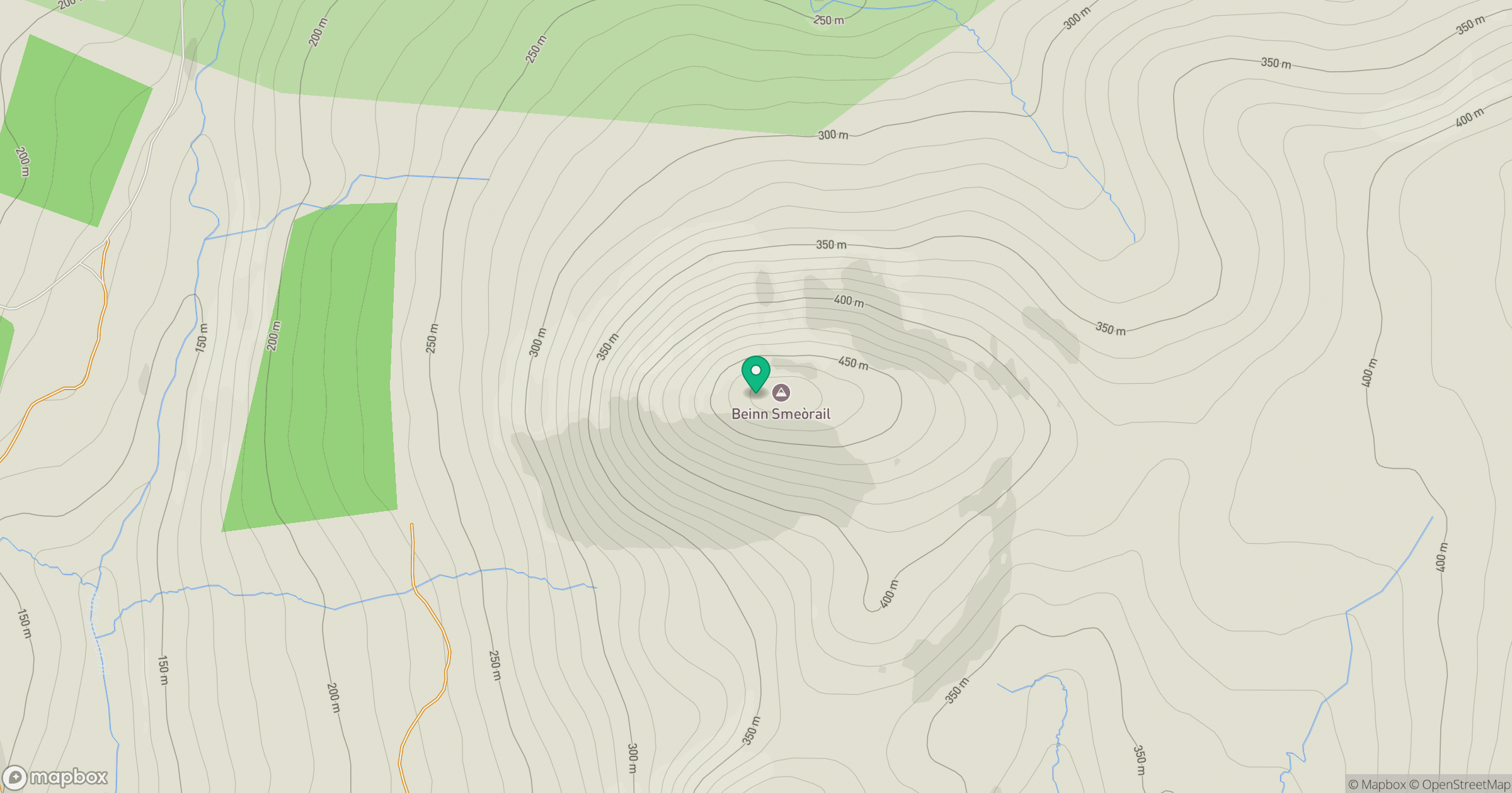
Grid reference: NC862116
View on OpenStreetMapOpens a map in a new tab, centred on the hill.
Hills within 30 km
Straight-line distance, not a walking route or confirmation of access.
No comments yet. Be the first.