
Beinn a' Mhadaidh
Good walks are even better shared.
Overview
Beinn a' Mhadaidh
Introduction
Beinn a' Mhadaidh, a superb Munro in the Scottish Highlands, stands majestically at 802 meters. Its rugged granite peaks entice hikers and climbers alike with challenging trails and breathtaking views.
Geology
This mountain is primarily granite, shaped by ages of glacial activity. Its rocky terrain provides excellent traction (good news for those not particularly fond of falling!) and showcases the stunning natural beauty typical of the Highlands.
Routes
If you choose the Northwest Ridge, you're in for a treat! This moderate hike is about 10 km and should take around 4 hours if you stop for those obligatory scenic photos. The ascent is gradual and accessible, making it a favourite among both seasoned walkers and novices eager to conquer a Munro.
Summit Features
At the peak, you'll find a substantial cairn, perfect for your post-hike selfie or a place to ponder life’s mysteries (like why you didn’t bring a snack). The views are simply remarkable and worth every step!
Terrain
Expect a mix of rocky paths and grassy slopes, but be cautious of those cheeky bogs that seem to appear out of nowhere. Good boots are a must!
Views
The summit provides a stunning panoramas of the surrounding Loch Slapin and the jagged silhouette of the Black Cuillin range. For the best photographic opportunities, aim for spring or early autumn when the sky tends to be clearer.
Hazards
Be prepared for some steep sections that can become slippery! Additionally, Highland weather can be fickle, so pack accordingly. Don’t be surprised if you encounter some wildlife, too; they certainly have the right of way!
Nearby Summits
If you're feeling frisky and would like to bag more peaks, nearby summits include Blaven and Sgurr na Stri, both promising rugged terrain and stunning views.
Access
The nearest parking is at Sligachan Hotel, which can get busy during the tourist season. If you're relying on public transport, buses run from Portree, about 20 km away.
Facilities
The Sligachan Hotel is a lifesaver with its welcome hot meals, drinks, and toilets. The whisky menu is not to be overlooked; it’s a lovely way to celebrate your summit ascent!
History
The name 'Beinn a' Mhadaidh' means 'Hill of the Dog', a nod to local folklore that many hikers enjoy sharing, especially after a long hike. The mountain has held a special place in the hearts of those who tread its slopes.
Happy hiking, and may your adventures on Beinn a' Mhadaidh be filled with joy and topped off with a wee dram when you return!
Explore routes near Beinn a' Mhadaidh
Public walks starting within 80 km of this hill. Nearby does not mean a route reaches the summit; check its map and access before setting out.
Ben Klibreck
View route
Loch Migdale from Torroy: Spinningdale pinewood and loch shore walk
View route
Route planning notes
These notes describe possible approaches, not verified navigable routes or permission to cross land. Check current paths, local access rules and conditions before setting out.
Northwest Ridge
A scenic route that offers a gradual ascent with panoramic views. Starting from the car park near the Glen Sligachan, this route takes you along the ridge with minimal technical difficulty.
Make a day of it, together
Find someone to share the walk with, or organise a day out along a route you like.
Hill facts and local notes
Classifications
Elevation
403m
1,323 ft
Prominence
147m
Coordinates
58.3447, -4.1047
NC768415
OS Map
10
Explorer: 448S
At the Summit
The summit is marked by a large cairn, providing an excellent point for photos and reflection (or just a great spot to catch your breath).
Terrain & Geology
Beinn a' Mhadaidh is primarily composed of granite, which gives rise to its rugged terrain and provides excellent grip for those ascending its slopes. The mountain's formation is characteristic of the granitic mountains of the Highlands, shaped by glacial erosion.
Views & Scenery
From the summit, hikers are treated to stunning views of the Black Cuillin, the vast expanses of Loch Slapin, and even glimpses of the Knoydart Peninsula on a clear day.
History & Heritage
Name Origin
The name 'Beinn a' Mhadaidh' translates to 'Hill of the Dog', a nod to local folklore which suggests a connection to the hunting dogs of ancient times.
Historical Significance
This mountain has been a favourite among local climbers for generations, often featured in tales and legends of Highland culture.
Getting There & Facilities
Check current local access restrictions, parking rules and transport timetables before travelling. These notes do not confirm public access to the summit.
Parking
The nearest parking is available at the Sligachan Hotel car park, located approximately 5 km from the start of the trail. It can fill up quickly during peak season, so arrive early!
Public Transport
Public transport is available via the bus service to Sligachan from nearby towns like Portree. Be sure to check local schedules.
Nearby Facilities
The Sligachan Hotel is nearby and provides dining options, toilets, and a cosy place to warm up after a long hike. Their whisky selection is second to none!
Safety Information
Known Hazards
- Steep rocky sections that may be slippery when wet, sudden weather changes in the Highlands, and the potential for encountering wildlife.
General Safety Tips
- Check weather conditions before setting out
- Carry appropriate clothing and equipment
- Let someone know your planned route
- Take a map, compass, and GPS device
- Carry emergency supplies: food, water, first aid kit, torch
Hills
Some common questions about the hills answered
Are there group walks up Beinn a' Mhadaidh?
Many walkers use Walkmates to join or organise walks with others. You can check for group walks around Beinn a' Mhadaidh through the maps
Are there other walkers around Beinn a' Mhadaidh?
Activity varies by location and time, but Walkmates lets you see whether others have shared walks or shown interest in this area. Find other people through the walking friends search walking friends for Beinn a' Mhadaidh search or of course create your own walk for Beinn a' Mhadaidh
Can I organise a walk to Beinn a' Mhadaidh?
Yes. If there aren’t any walks listed already, you can create a walk and make it available for others to join.
If you're signed up to Walkmates, you can create a walk to Beinn a' Mhadaidh.
How do I find a walk up this hill?
There are often multiple ways to walk this hill, depending on experience and route preference. Walkmates helps you explore walks and routes that others have shared.
Can I suggest a new route up Beinn a' Mhadaidh?
Yes. You can suggest or create routes to share with others. Walkmates focuses on the social side of walking, so routes are used to help people organise walks and explore areas together, rather than as detailed navigation tools or route libraries.
Other uses really appreciate knowledgeable walkers sharing their routes. Share your favourite route to Beinn a' Mhadaidh here
The is an error or something incorrect about this hill. How do I let you know?
We always strive to keep the information on Walkmates as accurate as possible. If you find an error, please let us know through the contact form and we'll aim to correct it as quickly as possible
Community Discussion
Comments
Location
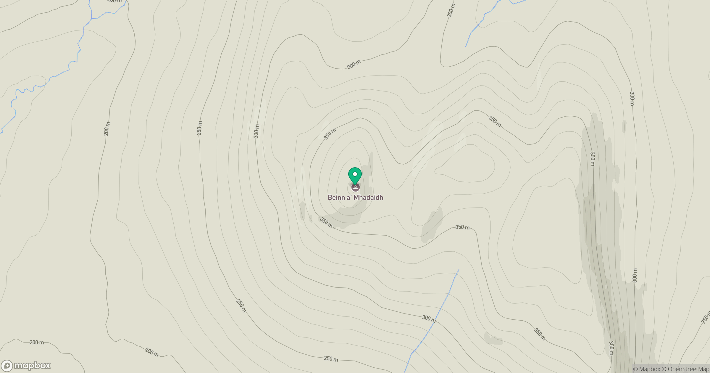
Grid reference: NC768415
View on OpenStreetMapOpens a map in a new tab, centred on the hill.
Hills within 30 km
Straight-line distance, not a walking route or confirmation of access.
Ben Loyal - An Caisteal
764m
Ben Griam Mor
590m
Beinn Rosail
260m
Meall a' Bhuirich
407m
Ben Armine
705m
No comments yet. Be the first.