
Beinn Tarsuinn
Good walks are even better shared.
Overview
Beinn Tarsuinn: A Hidden Gem in the Scottish Highlands
Nestled within the stunning Scottish Highlands, Beinn Tarsuinn is a Graham that offers a wonderful mix of accessible routes and remarkable views, perfect for adventurers and casual walkers alike.
Geology
Beinn Tarsuinn is a masterpiece of nature, crafted primarily from quartzite and schist, with rocky outcrops that tell the story of geological transformations over millennia. The rugged stones and unique patterns formed on the mountain create a fascinating landscape that is as captivating as it is scenic.
Routes
Two main routes lead you to the summit:
- Drumraur Forest Route: An 8 km moderate trek through lush woodland that is suitable for families and less experienced walkers. Expect to enjoy beautiful flora and perhaps even spot a curious deer or two along the way.
- North Ridge Route: Challenging but rewarding, this shorter 5.5 km path is ideal for those looking to test their mettle. Be prepared for some steeper sections and rewarding views!
Summit Features
At the summit, you'll find a conspicuous cairn, perfect for snapping a triumphant selfie. Bring a snack to celebrate your achievement with a breathtaking backdrop - calories don't count in the great outdoors!
Terrain and Views
Expect a varied terrain that features rocky sections and gentle grassy slopes, making each step an adventure of its own. The views from the top are nothing short of spectacular, from Ben Cruachan towering over the landscape to the enchanting Loch Awe shimmering far down below. For the best sights, visit during late spring through early autumn.
Hazards
As with any highland adventure, keep an eye on weather conditions – they can flip quicker than a pancake! The North Ridge can get boggy post-rain, so sturdy boots are your best friends here.
Access
To access Beinn Tarsuinn, park near Dalavich, just a few kilometers from the trailhead. Although public transport options are limited, a bus service from Oban can get you close, so be sure to plan accordingly. The vibrant town of Oban, approximately 25 km away, offers a great base with additional amenities and services.
Facilities
While there are no facilities on the mountain itself, head to Dalavich post-hike for a warm beverage and a chance to regale locals with your tales of adventure. The area has a small shop and a café to satisfy your post-hike cravings.
History
In Gaelic, Beinn Tarsuinn translates to 'the cross hill', likely a nod to its role as a navigational marker across the rugged terrain. With a rich history of human activity and natural wonders, your journey here will connect you with both past and present.
So lace up those boots, pack a hearty lunch, and set off for Beinn Tarsuinn. Whether you're a seasoned hiker or just looking to stretch your legs surrounded by unmatched beauty, this hidden gem in the Scottish Highlands is calling your name.
Explore routes near Beinn Tarsuinn
Walks starting near this hill. Open a route to check its map, distance and full itinerary.
Goatfell from Cladach
View route
Bishop’s Glen group walk
View route
West Bay walk and talk
View route
West Bay walk and talk
View route
Route planning notes
These notes describe possible approaches. Check a route's map and access information when planning your walk.
Drumraur Forest Route
A picturesque path that meanders through the ancient woodland before leading up to the mountain. A gentle introduction to the wild Scottish landscape.
North Ridge Route
A more direct ascent, this route features some steep sections and rocky scrambles that reward you with striking views.
Make a day of it, together
Find someone to share the walk with, or organise a day out along a route you like.
Hill facts and local notes
Classifications
Elevation
826m
2,710 ft
Prominence
237m
Coordinates
55.6215, -5.2421
NR959412
OS Map
62 69
Explorer: 361N
At the Summit
The summit boasts a prominent cairn that symbolizes the hard work of many an intrepid climber. On a clear day, it's the perfect spot for a victory snack.
Terrain & Geology
Beinn Tarsuinn is primarily composed of a mix of quartzite and schist. The rocky outcrops offer fascinating geological formations that have stood the test of time, witnessing the relentless forces of nature.
Views & Scenery
From the summit, you can see the rugged beauty of the surrounding hills, with the stunning Loch Awe shimmering in the distance, and Ben Cruachan rising majestically.
History & Heritage
Name Origin
The name 'Beinn Tarsuinn' translates to 'the cross hill' in Gaelic, possibly referring to its shape or its significance as a landmark.
Historical Significance
The region has a rich history of both natural and human activity, with evidence of ancient settlements and the enduring tradition of hill walking.
Getting There & Facilities
Parking
Parking available near the village of Dalavich, approximately 3 km from the trailhead.
Public Transport
Limited bus services available from Oban; be sure to check the schedule ahead of time.
Nearby Facilities
There are no facilities directly on the mountain, but Dalavich has a small shop and a café for refreshments. Toilets are also available in the village.
Safety Information
Known Hazards
- Be aware of changing weather conditions which can occur rapidly; section of the North Ridge may be boggy or slippery, especially after rain.
General Safety Tips
- Check weather conditions before setting out
- Carry appropriate clothing and equipment
- Let someone know your planned route
- Take a map, compass, and GPS device
- Carry emergency supplies: food, water, first aid kit, torch
Hills
Some common questions about the hills answered
Are there group walks up Beinn Tarsuinn?
Many walkers use Walkmates to join or organise walks with others. You can check for group walks around Beinn Tarsuinn through the maps
Are there other walkers around Beinn Tarsuinn?
Activity varies by location and time, but Walkmates lets you see whether others have shared walks or shown interest in this area. Find other people through the walking friends search walking friends for Beinn Tarsuinn search or of course create your own walk for Beinn Tarsuinn
Can I organise a walk to Beinn Tarsuinn?
Yes. If there aren’t any walks listed already, you can create a walk and make it available for others to join.
If you're signed up to Walkmates, you can create a walk to Beinn Tarsuinn.
How do I find a walk up this hill?
There are often multiple ways to walk this hill, depending on experience and route preference. Walkmates helps you explore walks and routes that others have shared.
Can I suggest a new route up Beinn Tarsuinn?
Yes. You can suggest or create routes to share with others. Walkmates focuses on the social side of walking, so routes are used to help people organise walks and explore areas together, rather than as detailed navigation tools or route libraries.
Other uses really appreciate knowledgeable walkers sharing their routes. Share your favourite route to Beinn Tarsuinn here
The is an error or something incorrect about this hill. How do I let you know?
We always strive to keep the information on Walkmates as accurate as possible. If you find an error, please let us know through the contact form and we'll aim to correct it as quickly as possible
Community Discussion
Comments
Location
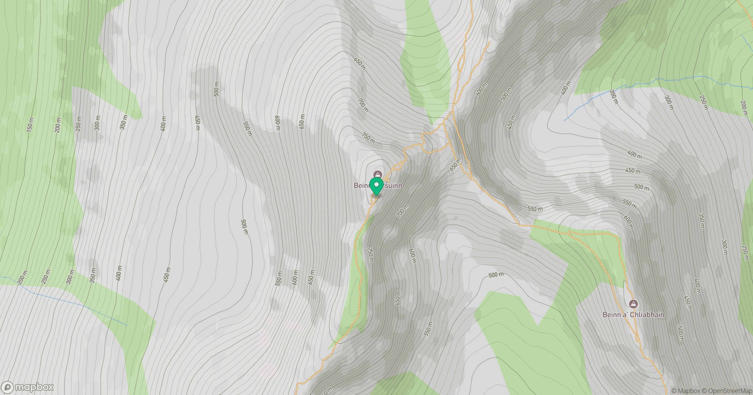
Grid reference: NR959412
View on OpenStreetMapOpens a map in a new tab, centred on the hill.
Nearby Hills
Cir Mhor
798m
Goatfell [Goat Fell]
875m
Ailsa Craig
339m
Beinn Ghlas
420m
![The Cobbler [Ben Arthur]](https://cdn.walkmates.com/gallery-images/a1b697040769474a8338b3fb586ebc7a.jpg)
The Cobbler [Ben Arthur]
887m
No comments yet. Be the first.