
Beinn Dearg
Good walks are even better shared.
Overview
Beinn Dearg
Beinn Dearg, sitting proudly at an elevation of 888 meters, is one of Scotland’s famed Munros located in the spectacular Scottish Highlands.
Geology
The mountain is famous for its impressive granite and gneiss rock formations, which showcase the powerful forces of nature that shaped Scotland’s landscape. The glacial valleys and unique geological features provide both a visual feast and a fascinating geological study.
Routes
There are several routes available for those eager to tackle Beinn Dearg. The Glen Douchary Route is a local favourite, offering a moderate challenge through stunning landscapes. The Morar River Route is another option, taking you along the beautiful river valley with more wildlife to admire.
Terrain
Expect a rugged terrain with rocky outcrops and grassy slopes. While it’s a thrilling hike, it’s worth remembering to wear sturdy shoes and be cautious of the boggy areas, especially after rain.
Summit Features
Upon reaching the summit, you’ll be greeted by a substantial stone cairn and a trig point, perfect for that all-important photo opportunity. Don’t forget to take a moment to appreciate your surroundings and catch your breath!
Views
The views from Beinn Dearg are nothing short of captivating. On a clear day, you’ll catch sight of the magnificent Cairngorms and the ethereal Loch Ness shimmering in the distance. Spring and autumn are ideal times for hiking here, as the weather is often more forgiving and the scenery bursting with life and colour.
Hazards
As always in the Highlands, keep an eye on the weather! Conditions can change rapidly, turning even the most benign of hikes into a challenging trek. Be prepared, know your limits, and it’s always wise to tell someone your plans before heading out.
Access
For access, head to the parking area at the end of Glen Douchary road. It’s an easy spot to find, though it’s best to arrive early during peak hiking season.
Facilities
Once you've conquered the summit, feel free to reward yourself with a visit to one of Newtonmore's cafes for a well-deserved slice of cake or a hot drink. Although there are no facilities directly on the mountain, proper planning ensures you’ll be well taken care of.
History
The name 'Beinn Dearg' indeed fits, as the mountain often glows a lovely reddish hue during sunset – a sight that’s sure to inspire anyone! Throughout history, this Munro has captured the hearts (and leg muscles) of adventurers and hikers alike.
So pack your rucksack, lace up those boots, and set off to experience the beauty and allure of Beinn Dearg – just remember to bring a sense of adventure with you!
Happy hiking!
Explore routes near Beinn Dearg
Walks starting near this hill. Open a route to check its map, distance and full itinerary.
Route planning notes
These notes describe possible approaches. Check a route's map and access information when planning your walk.
Glen Douchary Route
A scenic and well-trodden path that winds through the stunning landscapes of Glen Douchary, leading to the summit of Beinn Dearg.
Morar River Route
This route follows the Morar River valley and provides a slightly longer trek with beautiful views of the river and associated wildlife.
Make a day of it, together
Find someone to share the walk with, or organise a day out along a route you like.
Hill facts and local notes
Classifications
Elevation
424m
1,390 ft
Prominence
151m
Coordinates
58.5463, -4.9577
NC279658
OS Map
9
Explorer: 446
At the Summit
The summit features a large stone cairn that stands as a testament to the efforts of countless hikers who have reached the top. There is also an impressive trig point for those who enjoy a bit of surveying.
Terrain & Geology
Beinn Dearg is primarily composed of granite and gneiss formations, which give the mountain its prominent and rugged features. The area also features interesting glacially shaped valleys.
Views & Scenery
From the summit, you can enjoy breathtaking views of the surrounding Monadhliath and the distant peaks of the Cairngorms. The shimmering Loch Ness is also visible on a clear day.
History & Heritage
Name Origin
The name 'Beinn Dearg' translates to 'Red Mountain' in Scots Gaelic, likely referring to the reddish hues of the rocky terrain at certain times of the day.
Historical Significance
Beinn Dearg has long been a favourite among Scottish outdoor enthusiasts and is often included in Munro baggers' lists.
Getting There & Facilities
Parking
There is a parking area at the end of the Glen Douchary road, approximately 3 km from the start of the hiking trail.
Public Transport
Regular bus services connect nearby towns, though a car is recommended for the best access.
Nearby Facilities
There are no facilities directly on the mountain, but Newtonmore offers cafes and shops for pre- or post-hike refreshments. Public toilets are also available in the village.
Safety Information
Known Hazards
- Beware of changing weather conditions, especially in winter. Some sections can be slippery when wet, and visibility can change in moments.
General Safety Tips
- Check weather conditions before setting out
- Carry appropriate clothing and equipment
- Let someone know your planned route
- Take a map, compass, and GPS device
- Carry emergency supplies: food, water, first aid kit, torch
Hills
Some common questions about the hills answered
Are there group walks up Beinn Dearg?
Many walkers use Walkmates to join or organise walks with others. You can check for group walks around Beinn Dearg through the maps
Are there other walkers around Beinn Dearg?
Activity varies by location and time, but Walkmates lets you see whether others have shared walks or shown interest in this area. Find other people through the walking friends search walking friends for Beinn Dearg search or of course create your own walk for Beinn Dearg
Can I organise a walk to Beinn Dearg?
Yes. If there aren’t any walks listed already, you can create a walk and make it available for others to join.
If you're signed up to Walkmates, you can create a walk to Beinn Dearg.
How do I find a walk up this hill?
There are often multiple ways to walk this hill, depending on experience and route preference. Walkmates helps you explore walks and routes that others have shared.
Can I suggest a new route up Beinn Dearg?
Yes. You can suggest or create routes to share with others. Walkmates focuses on the social side of walking, so routes are used to help people organise walks and explore areas together, rather than as detailed navigation tools or route libraries.
Other uses really appreciate knowledgeable walkers sharing their routes. Share your favourite route to Beinn Dearg here
The is an error or something incorrect about this hill. How do I let you know?
We always strive to keep the information on Walkmates as accurate as possible. If you find an error, please let us know through the contact form and we'll aim to correct it as quickly as possible
Community Discussion
Comments
Location
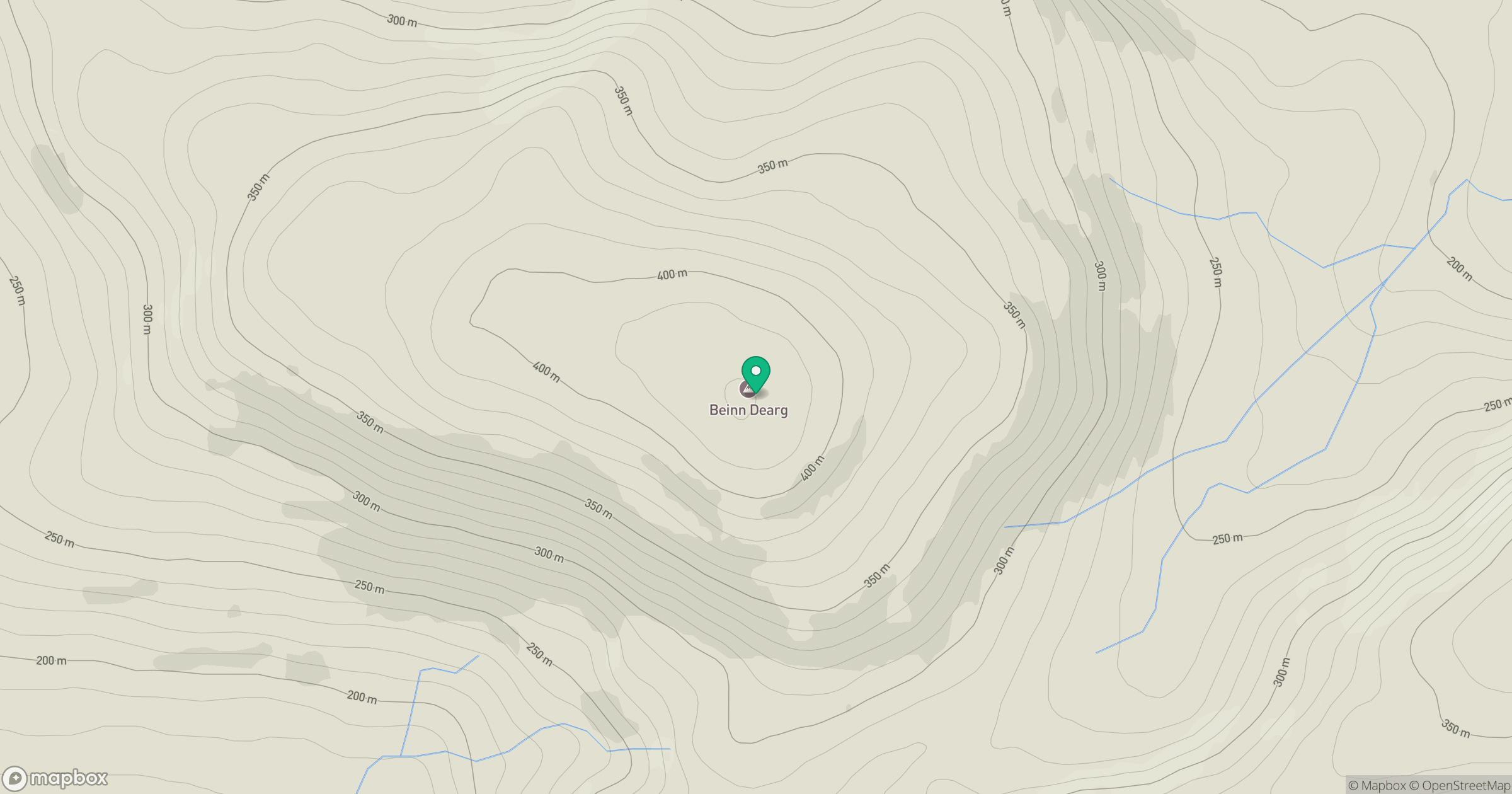
Grid reference: NC279658
View on OpenStreetMapOpens a map in a new tab, centred on the hill.
Nearby Hills
Ben Stack
721m
Quinag - Sail Ghorm [Sail Gorm]
776m
Quinag - Sail Gharbh
809m
Quinag - Spidean Coinich
764m
Ben Hope
927m
No comments yet. Be the first.