

An Grianan
Good walks are even better shared.
NC2662 : An Grianan Cairn
Colin Kinnear Photo source
Overview
An Grianan
An Grianan, known as 'The Sunny Place', stands proud at 206 meters in the breathtaking Northwest of Ireland. Located in County Donegal, this little gem packs a punch with its stunning views and rich history.
Geology
This hill is primarily made of granite, offering a sturdy base for hikers. As you trek, you'll spot glacial features carved from the Ice Age, which are a fascinating point for geology enthusiasts. Perhaps a good excuse to have a chat about rocks, no?
Routes
An Grianan Circular Trail
- Distance: 5.0 km
- Time: 2 hours
- Difficulty: Moderate
This lovely circular trail encapsulates the breathtaking landscapes surrounding An Grianan. Perfect for all levels, bring along your walking buddy and enjoy a bit of banter along the way.
Summit Ascent Trail
- Distance: 2.0 km
- Time: 1 hour
- Difficulty: Challenging
For those who like to cut to the chase, the Summit Ascent Trail is a direct route to the top. Brace yourself for a few rocky bits, but the summit view is worth every drop of sweat!
Summit Features
Once you’ve reached the top, you’ll find a stone fort, or 'rath', which is a remarkable testament to the area's ancient past. Don’t forget to snap a photo by the cairn marking the highest point!
Terrain Type
Expect to encounter grassy paths interspersed with rocky outcrops. Footwear that offers good grip is highly recommended, particularly after rain; slipping and sliding isn't as fashionable as it sounds.
Views
From the top, the panoramic views over Lough Swilly and toward the Derryveagh Mountains are simply stunning. Spring and early summer bring vibrant greens, while autumn offers a lovely display of colours. Just be warned—the view is so good, you might be tempted to set up camp!
Hazards
Keep your wits about you! Hazards include slippery rock sections and uneven terrain. The weather can also change with little notice, so be prepared. A hat or sunscreen won’t go amiss, even if it looks cloudy at the trailhead.
Nearby Summits
If you fancy some more hiking, nearby summits like Bincleaves and Glenveagh Mountain offer additional adventures for the intrepid hiker.
Access
Nearest Parking
A small parking area at the base accommodates about 10 vehicles. Getting here early increases your odds of snagging a spot!
Public Transport
Buncrana provides bus services connecting to and from Derry and Donegal, making it relatively accessible even if you don’t fancy driving.
Nearest Town
Buncrana is your closest town, just 10 km away, and packed with amenities.
Facilities
While the trailhead itself has limited facilities, Buncrana is your go-to for cafes and toilets. Remember to hydrate, folks; the summit awaits!
History
An Grianan means 'The Sunny Place' in Irish, and for good reason—just look at those views! The fort atop the hill hints at its ancient significance, linking modern hikers with generations past. A thrilling thought while you enjoy the scenery, isn’t it?
Now, pack your bags, lace up those boots, and get ready to explore An Grianan—the mountain that promises both adventure and a touch of history!
Explore routes near An Grianan
Walks starting near this hill. Open a route to check its map, distance and full itinerary.
Route planning notes
These notes describe possible approaches. Check a route's map and access information when planning your walk.
An Grianan Circular Trail
A scenic route that encircles the hill, offering stunning views throughout the hike.
Summit Ascent Trail
This direct route takes you to the summit, perfect for those looking for a quick thrill.
Make a day of it, together
Find someone to share the walk with, or organise a day out along a route you like.
Photo Gallery
View all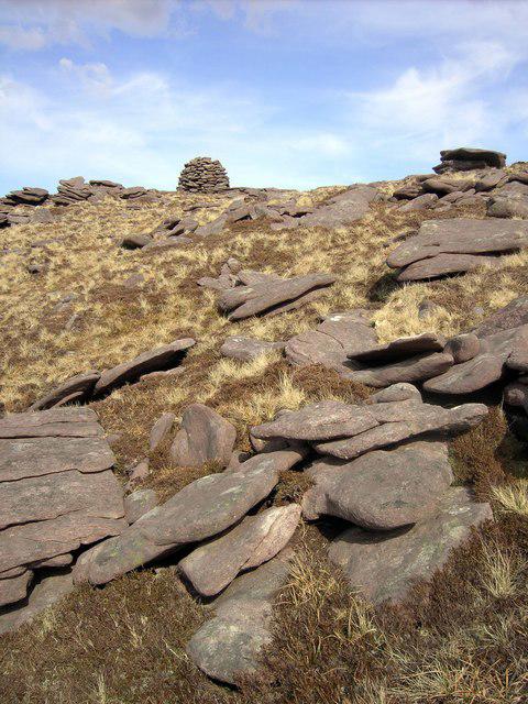 Photo could not load
NC2662 : An Grianan Cairn
Colin Kinnear
Hill facts and local notes
Classifications
Elevation
467m
1,532 ft
Prominence
154m
Coordinates
58.5178, -4.9812
NC264627
OS Map
9
Explorer: 446
At the Summit
The summit features a well-built stone fort, or 'rath', which adds a touch of historical intrigue. There’s also a small cairn marking the highest point.
Terrain & Geology
An Grianan is primarily composed of granite, providing a sturdy and scenic backdrop for hikers. The area features interesting glacial features and slight weathering patterns that tell the tale of the Ice Age.
Views & Scenery
On a clear day, you can see the stunning coastline of Donegal and the distant mountains of Derryveagh. Keep an eye out for the majestic Lough Swilly as well.
History & Heritage
Name Origin
An Grianan translates to 'The Sunny Place' in Irish, hinting at its panoramic views and sunny days.
Historical Significance
Historically, the site has been inhabited for centuries and believed to be a fortification from an ancient culture, linking it to local myths and legends.
Getting There & Facilities
Parking
There is a small parking area located at the base of the hill, just off the main road. It can accommodate around 10 vehicles.
Public Transport
The nearest public transport options are in the town of Buncrana, where bus services connect to Derry and Donegal.
Nearby Facilities
Buncrana offers several cafes, shops, and public toilets. However, facilities at the trailhead are limited, so it's best to explore further in the town.
Safety Information
Known Hazards
- Slippery rock sections after rain, uneven terrain, and the potential for rapidly changing weather conditions.
General Safety Tips
- Check weather conditions before setting out
- Carry appropriate clothing and equipment
- Let someone know your planned route
- Take a map, compass, and GPS device
- Carry emergency supplies: food, water, first aid kit, torch
Hills
Some common questions about the hills answered
Are there group walks up An Grianan?
Many walkers use Walkmates to join or organise walks with others. You can check for group walks around An Grianan through the maps
Are there other walkers around An Grianan?
Activity varies by location and time, but Walkmates lets you see whether others have shared walks or shown interest in this area. Find other people through the walking friends search walking friends for An Grianan search or of course create your own walk for An Grianan
Can I organise a walk to An Grianan?
Yes. If there aren’t any walks listed already, you can create a walk and make it available for others to join.
If you're signed up to Walkmates, you can create a walk to An Grianan.
How do I find a walk up this hill?
There are often multiple ways to walk this hill, depending on experience and route preference. Walkmates helps you explore walks and routes that others have shared.
Can I suggest a new route up An Grianan?
Yes. You can suggest or create routes to share with others. Walkmates focuses on the social side of walking, so routes are used to help people organise walks and explore areas together, rather than as detailed navigation tools or route libraries.
Other uses really appreciate knowledgeable walkers sharing their routes. Share your favourite route to An Grianan here
The is an error or something incorrect about this hill. How do I let you know?
We always strive to keep the information on Walkmates as accurate as possible. If you find an error, please let us know through the contact form and we'll aim to correct it as quickly as possible
Community Discussion
Comments
Location
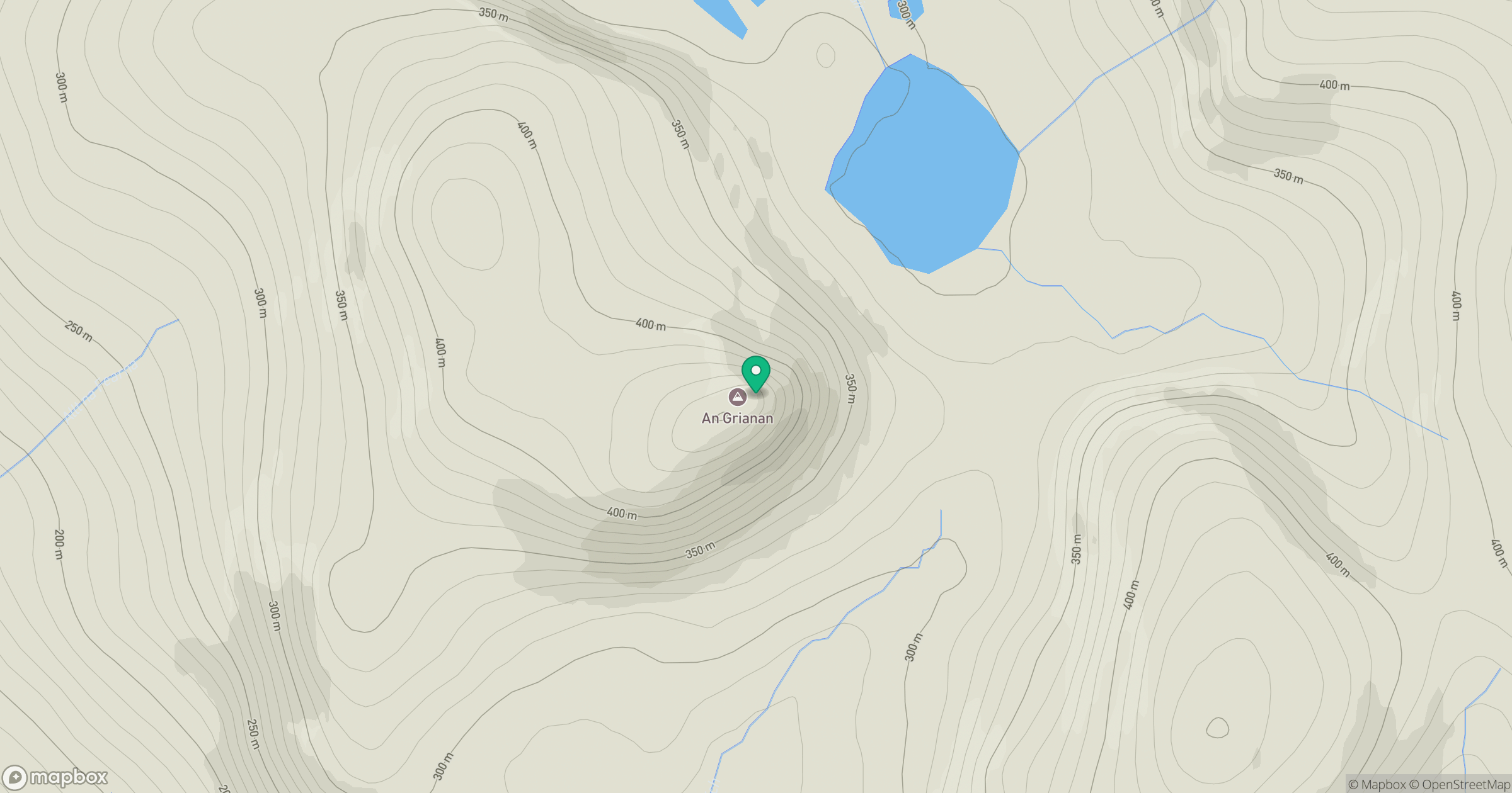
Grid reference: NC264627
View on OpenStreetMapOpens a map in a new tab, centred on the hill.
Nearby Hills
Ben Stack
721m
Quinag - Sail Ghorm [Sail Gorm]
776m
Quinag - Sail Gharbh
809m
Quinag - Spidean Coinich
764m
Ben Hope
927m
No comments yet. Be the first.