
Beacon Hill
Good walks are even better shared.
Overview
Beacon Hill is a 248 m rocky hill in Charnwood Forest, Leicestershire, near Woodhouse Eaves and south of Loughborough. Woodland paths rise to open heathland, ancient grey-green crags and wide views over the surrounding countryside. The country park offers a short summit visit from its upper car park or longer walks through the woods and neighbouring Broombriggs. A trig point and toposcope mark the summit area, while the highest natural ground is on nearby rock outcrops.
Beacon Hill, Leicestershire
Beacon Hill is a 248 m rocky hill in Charnwood Forest, Leicestershire, near Woodhouse Eaves and south of Loughborough. Woodland paths rise to open heathland, ancient grey-green crags and wide views over the surrounding countryside. The country park offers a short summit visit from its upper car park or longer walks through the woods and neighbouring Broombriggs. A trig point and toposcope mark the summit area, while the highest natural ground is on nearby rock outcrops.
Summit and landscape
The summit area has rocky outcrops, a trig point and a toposcope. The hill database identifies an outcrop 50 m east-southeast of the trig as the 248 m high point, with an outcrop 2 m west-northwest equally high. The Old Man of the Beacon is a rock formation beside the path below the summit. Take care on the rocks and leave the protected geology and earthworks undisturbed.
Beacon Hill exposes hard Precambrian rocks formed from marine deposits rich in volcanic ash about 600 million years ago. Bedding records deposition on the sea floor; later compression and folding produced cleavage cutting across the layers. These resistant grey-green rocks form the hill’s craggy summit and belong to the Charnwood geological landscape.
The open summit gives wide views across Charnwood Forest and the Leicestershire countryside. A toposcope helps identify landmarks, and benches provide places to pause below the rocks.
Walks
Upper car park summit return
Start at the upper car park off Beacon Road (LE12 8SP). Follow the signed made path uphill to the rocky summit area, trig point and toposcope, then return by the same path to the same car park. The highest natural rocks are around the trig: an outcrop 50 m east-southeast and an equally high outcrop 2 m west-northwest. Keep clear of rock edges and give grazing animals space. This is the shortest approach from the park’s two car parks, with a steeper, uneven final section.
Woodhouse Eaves and Broombriggs circuit
From the village-hall car park on Main Street, Woodhouse Eaves, walk up Maplewell Road and enter Broombriggs beside no. 100. Follow the permissive paths past Long Stye Spinney and around Broombriggs House, then descend its drive to cross the B591. Climb the main Beacon Hill path past the upper car park and take the summit spur to the trig and rocky viewpoint. Rejoin the main track and descend to the lower car park. Follow the woodland-edge path and signed gates back across the B591 to Broombriggs/Windmill Hill car park, then continue beside Windmill Hill to Maplewell Road and the village start. The Leicestershire Footpaths Association gives 6.5 km for its base circuit; allow extra for the summit detour. Take care at both road crossings and around livestock.
Old John and Beacon Hill from Newtown Linford
Start and finish at Bradgate Park’s Newtown Linford car park (LE6 0HB, SK523098). Climb via Tyburn, the war memorial and Old John, then leave through Hunts Hill. Cross to Benscliffe Road and follow the Leicestershire Round through Rough Hill Wood and the golf course to Woodhouse Eaves. Use Mill Road and the Windmill Hill path to cross Beacon Road and climb pedestrian paths to Beacon Hill’s summit area. Descend south through the upper car park and woodland; cross towards Copt Oak, then take the signed lane and paths past Ulverscroft Priory. Continue on Ulverscroft Lane, take the signed Newtown Linford path across fields and woodland, and use the slab-footbridge turn to return through the village. Walking Britain gives 14.2 km, 273 m ascent and about 4 hours 50 minutes for this full circuit. Keep to waymarks across golf fairways; expect road walking, crossings, livestock and deer.
Access and facilities
The upper car park is off Beacon Road, LE12 8SP (SK 51034 14457), close to the summit; the lower car park is off Breakback Road, LE12 8TA (SK 52214 14836), beside the café and woodland trails. Both charge for parking. The council lists contactless payment at the lower car park and cash only at the upper. Entry starts at 7am, with seasonal closing times; check the entrance signs before walking.
Centrebus 154 links Leicester and Loughborough via Woodhouse Eaves. Use the operator’s current timetable and service alerts, then plan the walk from the village to the park. Check the return service before setting off.
The country park has toilets, picnic areas, benches and a café by the lower car park, with a natural play area and rhododendron labyrinth nearby. Woodhouse Eaves has further refreshment options. Check current café and toilet hours. Fires, barbecues and camping stoves require council consent.
History
The name recalls the hill’s use as a signalling-beacon site; Historic England records that no trace of the beacon remains. Earthworks around Beacon Hill form a scheduled hillfort with an associated enclosure and boundary. A Late Bronze Age founder’s hoard found in 1858 included spearheads and a socketed axe, suggesting bronze-working, refuge or trade. The hill was formerly part of the Beaumanor estate and was used for military training and storage during the Second World War. Leicestershire County Council records purchasing it in 1947 as public open space.
Care on the hill
- Uneven summit rocks and steep paths can be slippery when wet; stay clear of edges.
- Cattle, sheep and alpacas graze the park. Give animals space and keep dogs controlled and on a lead around livestock.
- Use pedestrian paths to the summit and watch for cyclists and horses on shared tracks.
- The Broombriggs and Newtown Linford circuits include road crossings; the longer walk also crosses golf fairways and Bradgate Park’s deer country.
- Protect the heathland, geology and archaeological remains. Follow signs, keep out of closed areas, and do not collect rocks or fossils.
Wet leaves, mud and ice can make paths and rocks slippery. Follow any temporary woodland-work or conservation diversions, including signs around Jewels Hill. Car-park entry hours shorten in autumn and winter; check the posted locking time before setting off.
Explore routes near Beacon Hill
Walks starting near this hill. Open a route to check its map, distance and full itinerary.
Beacon Hill: summit views and woodland circuit
View route
Swithland Wood: ancient woodland and Stocking Wood circuit
View route
Bradgate Park: Old John, the memorial and River Lin
View route
Sence Valley lakes and Stonebridge Pool
View route
Route planning notes
These notes describe possible approaches. Check a route's map and access information when planning your walk.
Upper car park summit return
Start at the upper car park off Beacon Road (LE12 8SP). Follow the signed made path uphill to the rocky summit area, trig point and toposcope, then return by the same path to the same car park. The highest natural rocks are around the trig: an outcrop 50 m east-southeast and an equally high outcrop 2 m west-northwest. Keep clear of rock edges and give grazing animals space. This is the shortest approach from the park’s two car parks, with a steeper, uneven final section.
Woodhouse Eaves and Broombriggs circuit
From the village-hall car park on Main Street, Woodhouse Eaves, walk up Maplewell Road and enter Broombriggs beside no. 100. Follow the permissive paths past Long Stye Spinney and around Broombriggs House, then descend its drive to cross the B591. Climb the main Beacon Hill path past the upper car park and take the summit spur to the trig and rocky viewpoint. Rejoin the main track and descend to the lower car park. Follow the woodland-edge path and signed gates back across the B591 to Broombriggs/Windmill Hill car park, then continue beside Windmill Hill to Maplewell Road and the village start. The Leicestershire Footpaths Association gives 6.5 km for its base circuit; allow extra for the summit detour. Take care at both road crossings and around livestock.
Old John and Beacon Hill from Newtown Linford
Start and finish at Bradgate Park’s Newtown Linford car park (LE6 0HB, SK523098). Climb via Tyburn, the war memorial and Old John, then leave through Hunts Hill. Cross to Benscliffe Road and follow the Leicestershire Round through Rough Hill Wood and the golf course to Woodhouse Eaves. Use Mill Road and the Windmill Hill path to cross Beacon Road and climb pedestrian paths to Beacon Hill’s summit area. Descend south through the upper car park and woodland; cross towards Copt Oak, then take the signed lane and paths past Ulverscroft Priory. Continue on Ulverscroft Lane, take the signed Newtown Linford path across fields and woodland, and use the slab-footbridge turn to return through the village. Walking Britain gives 14.2 km, 273 m ascent and about 4 hours 50 minutes for this full circuit. Keep to waymarks across golf fairways; expect road walking, crossings, livestock and deer.
Make a day of it, together
Find someone to share the walk with, or organise a day out along a route you like.
Hill facts and local notes
Classifications
Elevation
248m
814 ft
Prominence
62m
Coordinates
52.7284, -1.2465
SK509147
OS Map
129
Explorer: 245E 246
At the Summit
The summit area has rocky outcrops, a trig point and a toposcope. The hill database identifies an outcrop 50 m east-southeast of the trig as the 248 m high point, with an outcrop 2 m west-northwest equally high. The Old Man of the Beacon is a rock formation beside the path below the summit. Take care on the rocks and leave the protected geology and earthworks undisturbed.
Terrain & Geology
Beacon Hill exposes hard Precambrian rocks formed from marine deposits rich in volcanic ash about 600 million years ago. Bedding records deposition on the sea floor; later compression and folding produced cleavage cutting across the layers. These resistant grey-green rocks form the hill’s craggy summit and belong to the Charnwood geological landscape.
Views & Scenery
The open summit gives wide views across Charnwood Forest and the Leicestershire countryside. A toposcope helps identify landmarks, and benches provide places to pause below the rocks.
Best Seasons
Spring bluebells brighten parts of the woodland, summer flowers colour the meadows, and autumn brings changing leaf colours along the park trails.
History & Heritage
Name Origin
The name recalls the hill’s use as a signalling-beacon site; Historic England records that no trace of the beacon remains.
Historical Significance
Earthworks around Beacon Hill form a scheduled hillfort with an associated enclosure and boundary. A Late Bronze Age founder’s hoard found in 1858 included spearheads and a socketed axe, suggesting bronze-working, refuge or trade. The hill was formerly part of the Beaumanor estate and was used for military training and storage during the Second World War. Leicestershire County Council records purchasing it in 1947 as public open space.
Getting There & Facilities
Parking
The upper car park is off Beacon Road, LE12 8SP (SK 51034 14457), close to the summit; the lower car park is off Breakback Road, LE12 8TA (SK 52214 14836), beside the café and woodland trails. Both charge for parking. The council lists contactless payment at the lower car park and cash only at the upper. Entry starts at 7am, with seasonal closing times; check the entrance signs before walking.
Public Transport
Centrebus 154 links Leicester and Loughborough via Woodhouse Eaves. Use the operator’s current timetable and service alerts, then plan the walk from the village to the park. Check the return service before setting off.
Nearby Facilities
The country park has toilets, picnic areas, benches and a café by the lower car park, with a natural play area and rhododendron labyrinth nearby. Woodhouse Eaves has further refreshment options. Check current café and toilet hours. Fires, barbecues and camping stoves require council consent.
Safety Information
Known Hazards
- Uneven summit rocks and steep paths can be slippery when wet; stay clear of edges.
- Cattle, sheep and alpacas graze the park. Give animals space and keep dogs controlled and on a lead around livestock.
- Use pedestrian paths to the summit and watch for cyclists and horses on shared tracks.
- The Broombriggs and Newtown Linford circuits include road crossings; the longer walk also crosses golf fairways and Bradgate Park’s deer country.
- Protect the heathland, geology and archaeological remains. Follow signs, keep out of closed areas, and do not collect rocks or fossils.
Seasonal Hazards
Wet leaves, mud and ice can make paths and rocks slippery. Follow any temporary woodland-work or conservation diversions, including signs around Jewels Hill. Car-park entry hours shorten in autumn and winter; check the posted locking time before setting off.
General Safety Tips
- Check weather conditions before setting out
- Carry appropriate clothing and equipment
- Let someone know your planned route
- Take a map, compass, and GPS device
- Carry emergency supplies: food, water, first aid kit, torch
Hills
Some common questions about the hills answered
Are there group walks up Beacon Hill?
Many walkers use Walkmates to join or organise walks with others. You can check for group walks around Beacon Hill through the maps
Are there other walkers around Beacon Hill?
Activity varies by location and time, but Walkmates lets you see whether others have shared walks or shown interest in this area. Find other people through the walking friends search walking friends for Beacon Hill search or of course create your own walk for Beacon Hill
Can I organise a walk to Beacon Hill?
Yes. If there aren’t any walks listed already, you can create a walk and make it available for others to join.
If you're signed up to Walkmates, you can create a walk to Beacon Hill.
How do I find a walk up this hill?
There are often multiple ways to walk this hill, depending on experience and route preference. Walkmates helps you explore walks and routes that others have shared.
Can I suggest a new route up Beacon Hill?
Yes. You can suggest or create routes to share with others. Walkmates focuses on the social side of walking, so routes are used to help people organise walks and explore areas together, rather than as detailed navigation tools or route libraries.
Other uses really appreciate knowledgeable walkers sharing their routes. Share your favourite route to Beacon Hill here
The is an error or something incorrect about this hill. How do I let you know?
We always strive to keep the information on Walkmates as accurate as possible. If you find an error, please let us know through the contact form and we'll aim to correct it as quickly as possible
Community Discussion
Comments
Location
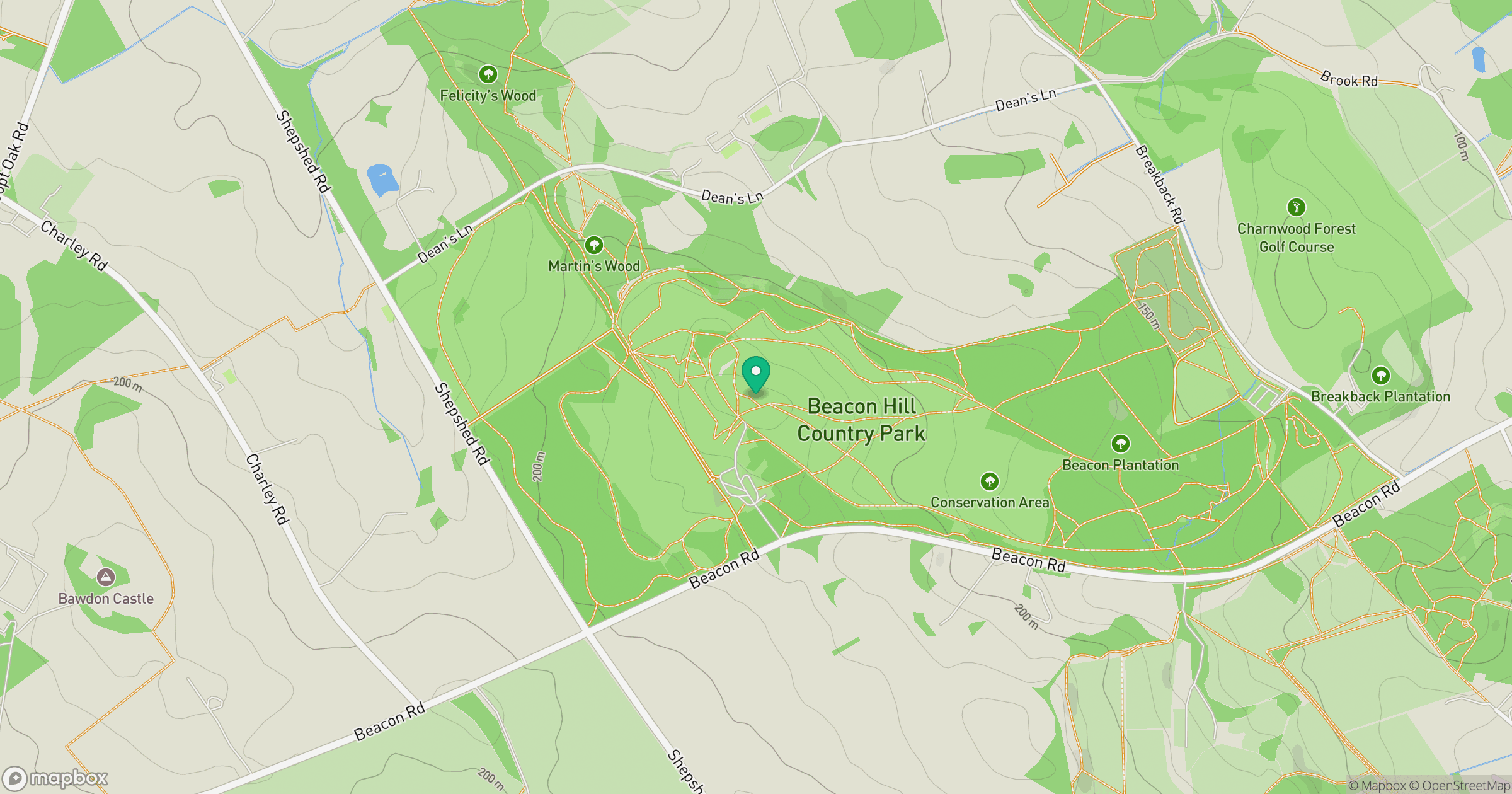
Grid reference: SK509147
View on OpenStreetMapOpens a map in a new tab, centred on the hill.
Nearby Hills
The Roaches
505m
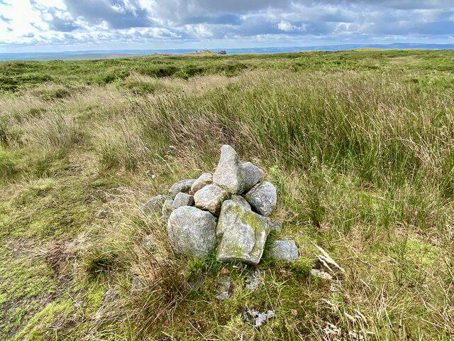
Kinder Scout
636m
Worcestershire Beacon
425m
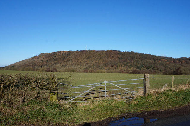
The Wrekin
407m
Rombalds Moor [Ilkley Moor]
402m
No comments yet. Be the first.