

Ballard Down
Good walks are even better shared.
SZ0281 : Old Boundary Marker by Purbeck Way, Ballard Down, Studland parish
Milestone Society Photo source
Overview
Ballard Down
Overview
Ballard Down is a delightful Marilyn located in the picturesque region of Dorset, renowned for its coastal scenery and rich geological features. At an elevation of 134 meters, it may not be the highest peak in the area, but it offers panoramic views that are hard to beat.
Geology
This majestic hill is primarily composed of chalk, a soft material formed over millions of years from marine organisms. Geologists and nature enthusiasts alike will find plenty of interest in the striking landforms and the unique flora that thrives here.
Routes
A popular choice is the Ballard Down Circular Trail, starting from Swanage. This route takes you around the hill, showcasing some of the best views in the region. With a distance of 7.5 km, it’s manageable for most hikers and should take about 2.5 hours, making it a perfect half-day trip.
Summit Features
Reaching the summit, you'll be greeted by a solid trig point. This iconic marker is your gateway to stunning vistas. Don’t forget your camera—you’ll want to capture the breathtaking scenery.
Terrain
The terrain is mainly grassy, with well-defined paths making for a pleasant walking experience. There are a few steeper sections, adding a bit of a challenge without going overboard.
Views
From the top, you’ll be treated to sweeping views of the Isle of Purbeck, the shimmering English Channel, and the rugged coastline. The best time to soak in these sights is during the spring and summer months when the weather is at its best.
Hazards
As with many coastal walks, caution is essential. Some cliffs along the south face are steep, so keep away from the edge—this is not a good spot for selfies if you value your footing! Also, be mindful of the uneven terrain, especially if it's been raining.
Nearby Summits
If you're keen to explore further afield, consider visiting nearby Peveril Point or the northern peak of Ballard Down. Both offer additional hiking opportunities and captivating views.
Access
For those driving, parking can be tricky near the summit, so your best bet is Swanage. There are numerous cafes and public toilets in town, letting you fuel up before or after your hike.
Public transport is available via the Purbeck Breezer bus service from Wareham, particularly in the warmer months, making this an accessible adventure.
History
The name ‘Ballard Down’ has intriguing roots, possibly meaning 'the place of the bear,' although no one has spotted a bear here in centuries. Historically, this area played a vital role in the local military strategy during various conflicts and has remnants of ancient earthworks that speak to its significance over centuries.
In summary, Ballard Down is not just a hill, but a delightful mix of natural beauty, history, and geological interest, making it a must-visit for anyone looking to stretch their legs in Dorset!
Happy hiking!
Explore routes near Ballard Down
Walks starting near this hill. Open a route to check its map, distance and full itinerary.
Commoners’ Ways: Kingston, Corfe Castle and Blashenwell
View route
Bournemouth Walk with Men Walking & Talking
View route
Durdle Door coastal walk
View route
Badbury Rings and The Oaks from Heron Drove, Dorset
View route
Route planning notes
These notes describe possible approaches. Check a route's map and access information when planning your walk.
Ballard Down Circular Trail
A classic circular route starting from the village of Swanage, offering stunning views over Studland Bay and Purbeck Hills.
Make a day of it, together
Find someone to share the walk with, or organise a day out along a route you like.
Photo Gallery
View all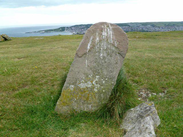 Photo could not load
SZ0281 : Old Boundary Marker by Purbeck Way, Ballard Down, Studland parish
Milestone Society
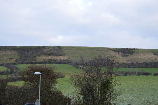 Photo could not load
SZ0281 : The Purbeck Ridge
N Chadwick
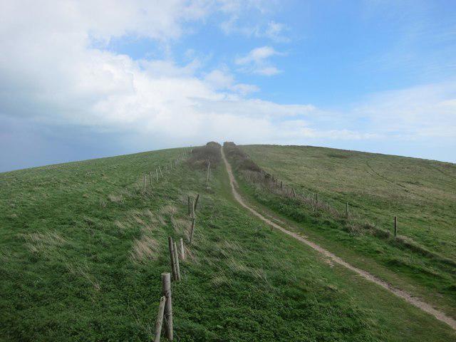 Photo could not load
SZ0281 : Footpath ascending Ballard Down
Dr Duncan Pepper
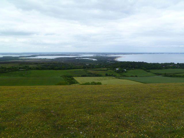 Photo could not load
SZ0281 : Ballard Down, view
Mike Faherty
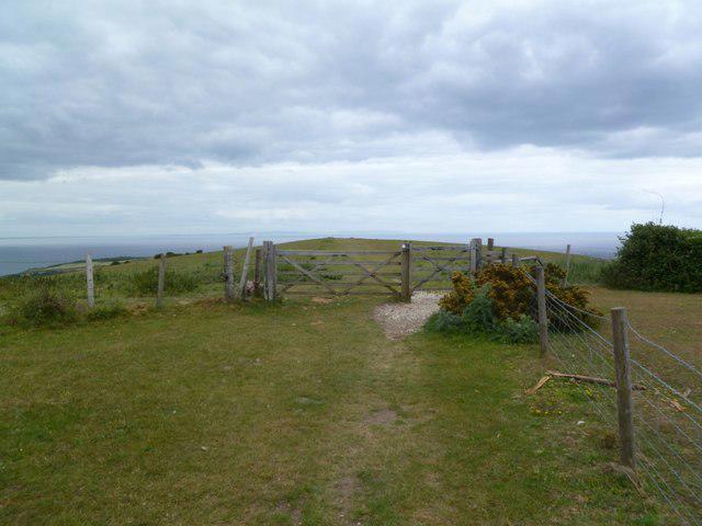 Photo could not load
SZ0281 : Ballard Down, gate
Mike Faherty
Hill facts and local notes
Classifications
Elevation
162m
531 ft
Prominence
65m
Coordinates
50.6310, -1.9658
SZ025812
OS Map
195
Explorer: OL15E
At the Summit
The summit features a large, well-placed trig point that serves as a perfect photo opportunity, overlooking the sweeping coastal vistas.
Terrain & Geology
Ballard Down primarily consists of chalk, a soft, white rock formed from marine organisms that offers fascinating exposure to the Earth's geological history.
Views & Scenery
Views extend to the Isle of Purbeck, the English Channel, and the jagged coastline of Dorset.
History & Heritage
Name Origin
The name 'Ballard' might derive from the old English 'Bealuweard,' meaning 'the place of the bear.' Not that anyone has seen a bear up here since the Stone Age.
Historical Significance
Historically, this area was significant in both military strategy and agriculture, with remnants of ancient earthworks still visible.
Getting There & Facilities
Parking
There is a small car park at the top of Ballard Down, however, spaces are limited. Parking in Swanage is recommended, approximately 2.5 km walk away.
Public Transport
Swanage can be accessed via the Purbeck Breezer bus service from Wareham, particularly in the summer months.
Nearby Facilities
There are public toilets and cafes in Swanage that offer a range of refreshments; ideal for fuelling up before or after your adventure.
Safety Information
Known Hazards
- Be wary of steep cliffs on the south side; while the views are spectacular, falling is not recommended!
- The terrain can be uneven, so watch your step, especially in wetter conditions.
General Safety Tips
- Check weather conditions before setting out
- Carry appropriate clothing and equipment
- Let someone know your planned route
- Take a map, compass, and GPS device
- Carry emergency supplies: food, water, first aid kit, torch
Hills
Some common questions about the hills answered
Are there group walks up Ballard Down?
Many walkers use Walkmates to join or organise walks with others. You can check for group walks around Ballard Down through the maps
Are there other walkers around Ballard Down?
Activity varies by location and time, but Walkmates lets you see whether others have shared walks or shown interest in this area. Find other people through the walking friends search walking friends for Ballard Down search or of course create your own walk for Ballard Down
Can I organise a walk to Ballard Down?
Yes. If there aren’t any walks listed already, you can create a walk and make it available for others to join.
If you're signed up to Walkmates, you can create a walk to Ballard Down.
How do I find a walk up this hill?
There are often multiple ways to walk this hill, depending on experience and route preference. Walkmates helps you explore walks and routes that others have shared.
Can I suggest a new route up Ballard Down?
Yes. You can suggest or create routes to share with others. Walkmates focuses on the social side of walking, so routes are used to help people organise walks and explore areas together, rather than as detailed navigation tools or route libraries.
Other uses really appreciate knowledgeable walkers sharing their routes. Share your favourite route to Ballard Down here
The is an error or something incorrect about this hill. How do I let you know?
We always strive to keep the information on Walkmates as accurate as possible. If you find an error, please let us know through the contact form and we'll aim to correct it as quickly as possible
Community Discussion
Comments
Location
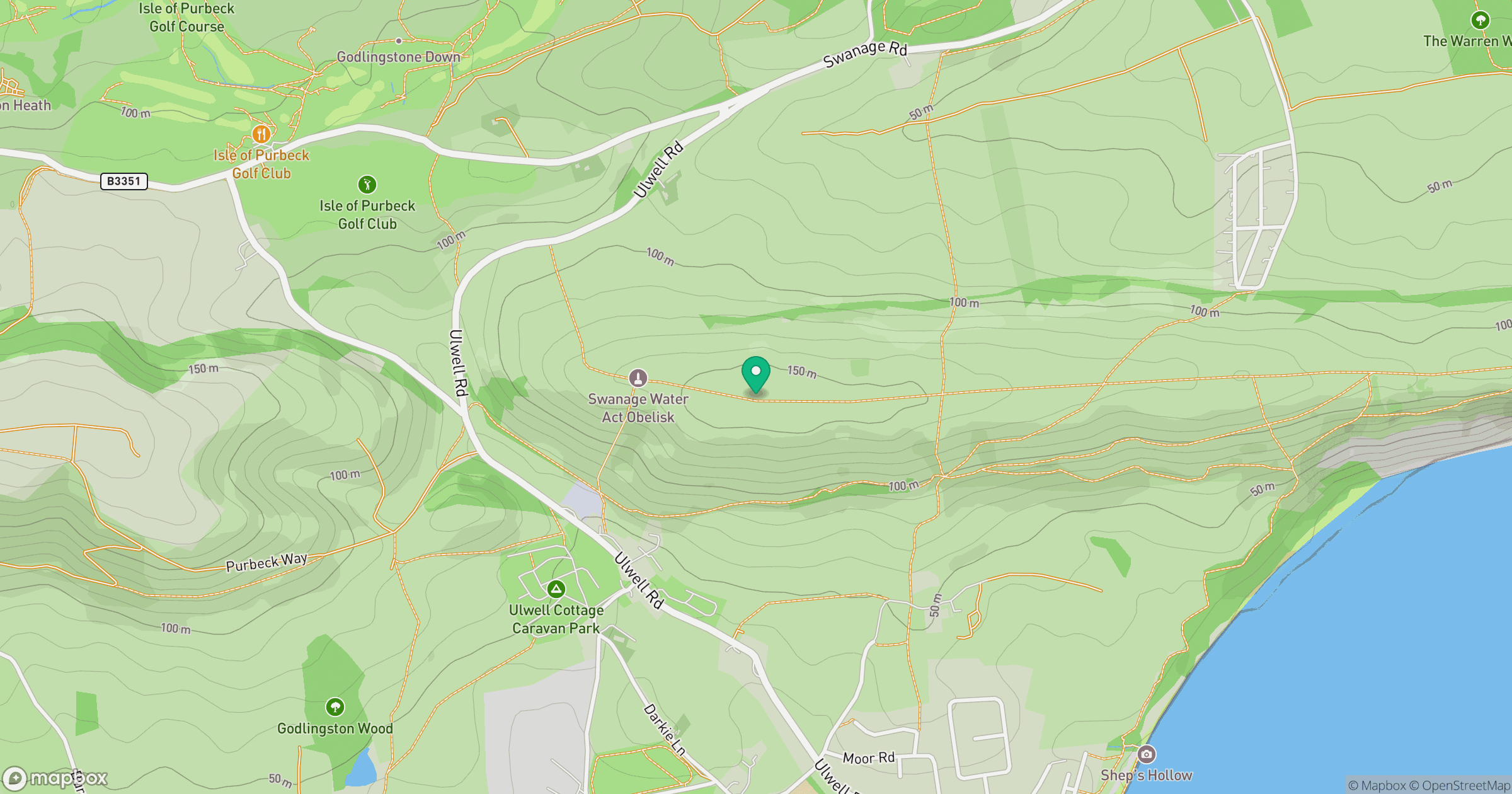
Grid reference: SZ025812
View on OpenStreetMapOpens a map in a new tab, centred on the hill.
Nearby Hills
Glastonbury Tor
158m
Worcestershire Beacon
425m
Leith Hill
294m

Dunkery Beacon
520m
Ditchling Beacon
248m
No comments yet. Be the first.