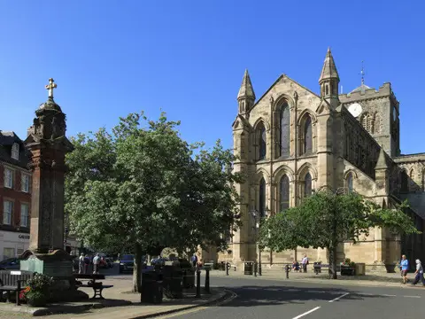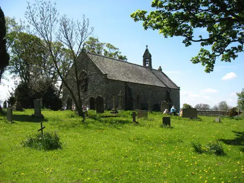

Image shared for Heavenfield to Hexham, the Way of Light
Countryside Point to point

Heavenfield to Hexham, the Way of Light

Walk

Northumberland

Distance
4.9 mi
Walking time
2h–2h 40m
Difficulty
Medium
PaulWalkmates Route by PaulWalkmates

Save the route to find it later. Follow it to hear when a date is added.

About this walk

Follow the first stage of the Way of Light from St Oswald's Church at Heavenfield to Hexham Abbey. The high fields give wide views across the Tyne valley before the route descends past a conifer plantation and through farmland towards Acomb. There are gates, steps and small stream crossings along the way, so boots are useful after rain.

On the signed field path below Heavenfield, the exposed sandstone slabs are an opportunity to look for traces of glaciation. Northumberland Wildlife Trust identifies the Fallowfield outcrop here as sandstone smoothed and scratched by moving ice. Keep to the footpath, take care on wet rock and leave the surface undisturbed. This is not the former Fallowfield mine.

Pass through Acomb and follow the field path to St John Lee Church. Quiet lanes lead down to the bridge over the A69, then a tree-lined lane takes you to the road bridge across the Tyne. Continue into Hexham, climb Hallstile Bank and follow the cobbled Back Row. The final turns pass St Wilfrid's Arch and take you through the park beside the abbey.

Use the existing footbridges at stream crossings and the pavements on road bridges. Take care crossing the B6318 and on the lanes, and follow local signs and any current closures. Mapped paths and bridges are not a guarantee of present ground or structural conditions.

Allow around three hours, with longer for church visits. This is a linear walk and Heavenfield has no suitable public parking or bus service. Arrange a lift or taxi to the start before setting off. If leaving a car in Hexham, use the long-stay section at Wentworth and check the bay signs.

Geological locality source: https://www.nwt.org.uk/sites/default/files/2021-10/Rock_festival_Fallowfield.pdf
Way of Light route information: https://www.thisisdurham.com/northernsaints/trails/the-way-of-light-p1043541

Walk details

Walk type
Point to point
Category
Countryside
Distance
4.9 mi (7.8 km)
Walking time
2h–2h 40m
Walking time excludes breaks. Allow extra time for stops and conditions. Ascent is not yet included; allow extra time for climbs.
Explorer
Yes, off the beaten track

Route map

Use the route details to plan your walk

If the map image does not load, the route description and starting-point details are still on this page.

The interactive map will load when you reach this section.

Where to start

Directions to start

Walking on your own?

Start when you're ready and add the walk to your history. No group date needed.

Make this route part of your day

For walkers

Saving and preparing a route

Watch: portrait video or landscape video.

Saving and preparing a route

Read the steps
  1. Open a route and read the practical notes.
  2. Save it to your Saved Walks, then open it again from there.
  3. Check the route map and elevation profile before setting off. Reopen the details on the day.

Saved Walks needs an account. Reopening the website needs a connection; check access, weather and your own navigation before you go.
See how to plan a walk with others

This walk is waiting for a date

Not ready to pick a date? Follow it and you'll hear when somebody else does.

No commitment. You can follow it now and pick a date later.

Along the route

11 places
Information
Navigation · 0.1 mi along
Parking
Essentials · 0.1 mi along
Miner's Arms
Pub · 2.2 mi along
Moot Hall
Castle · 4.4 mi along
The Forum
Pub · 4.4 mi along
31 Market Place
Restaurant · 4.4 mi along
The Small World Cafe
Cafe · 4.4 mi along
Little Mexico
Restaurant · 4.5 mi along
Heart of Northumberland
Pub · 4.5 mi along
Parking
Essentials · 4.6 mi along
Queen's Hall Cafe
Cafe · 4.8 mi along

Terms of Service

Joining a walk

A few things to know before you make plans.

Can I join if no one else is going?

You can be the first to join a scheduled walk. A suggested date is an idea for a group walk; choose Set this date up to organise it. Check the participant list and meeting details before setting off.

What if there is no date yet?

Choose Put a date on this walk to organise a group walk. Not ready to choose a day? Follow the route for scheduling updates, or save it for later.

What does the organiser do?

The organiser sets the date and meeting details and helps the group get started. They are a fellow walker and may be new to the route too.

Each walker is responsible for their own safety and navigation. Check the route, weather, equipment and whether the walk suits your experience and fitness.

Can I walk this route on my own?

Yes. Choose Walk this route on your own to open the start screen, then start when you are ready. Finish the walk to add it to your walking history. You do not need a group date.

What happens after I join?

Use the walk page to check meeting details, updates and who is going. Check in from 24 hours before the start to let the group know you still plan to come.

How do I confirm plans with the group?

Check the participant list and check-ins, and message the organiser or other walkers to confirm where to meet and who is coming. This is especially useful when the group is small.

Privacy preferences

Necessary storage supports sign-in, security and your privacy choice. It is always on. Google Analytics, Mixpanel and Simple Analytics measure site usage only with your permission. Session recording is off. Rejecting analytics does not affect access.

Your choice lasts up to 180 days. If you accept analytics, a separate receipt records acceptance, the notice version and server time and is scheduled for deletion after 180 days. The receipt contains no account, IP address or browser details. Refusal and withdrawal stay in this browser. You can change your choice here at any time.

Read our privacy policy