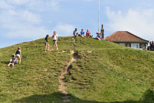
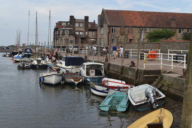
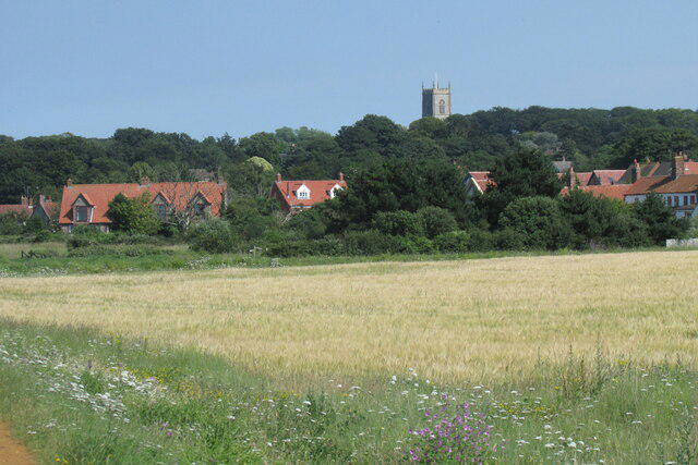
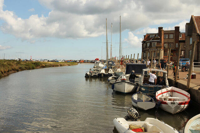
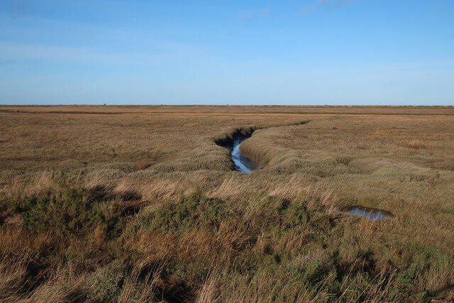
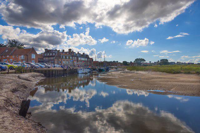
Image shared for Blakeney Freshes and Cley Harbour Coastal Path
Coastal Out & back

Blakeney Freshes and Cley Harbour Coastal Path

Walk

Norfolk

Distance
5.1 mi
Est. time
2h 45m
Difficulty
Medium
PaulWalkmates Route by PaulWalkmates

Save the route to find it later. Follow it to hear when a date is added.

About this walk

Start at the visitor side of Coronation Car Park off Blakeney High Street. Leave by the short access drive, turn downhill on the High Street and reach the quay. Cross the quayside parking area to the raised Norfolk Coast Path on its eastern side. Follow the sea wall north around Blakeney Freshes, then east beside the harbour channel. At the eastern bend keep to the bank as it turns south alongside the River Glaven, with views towards Cley Windmill and the village. Continue to the end of the footpath above the A149 at Cley harbour, then retrace the same coast path to Blakeney Quay and the High Street car park. This is an out-and-back walk; it does not cross the A149 or enter the private windmill grounds.

Allow about 2 hours 45 minutes for the full walk and a few birdwatching stops. The ground is mostly level, but the raised banks have uneven dirt, grass and compacted surfaces. There are steps or a steep bank at the quay access, and wet weather can leave mud and puddles. The marsh landscape is open to wind. Keep to the marked bank paths, give grazing animals space and keep dogs under close control. Do not leave the path to cross the harbour or saltmarsh towards Blakeney Point. Avoid this exposed coast in storms, tidal surge warnings or flooding, and check local signs before setting out.

Coronation visitor parking is pay and display, with a separate permit-only area that visitors must avoid. It operates 24 hours; check the machine for current charges. The tidal Carnser quay car park is not the parking start for this walk. Toilets and refreshments are available around Blakeney village and the quay, subject to opening times.

Route checked against the National Trust Blakeney Freshes coastal walk and the Norfolk Trails map published by Blakeney Parish Council. The walk uses the eastern sea-wall section and returns the same way, avoiding the Morston embankment works and diversion announced for autumn 2026.

Walk details

County
Norfolk
Walk type
Out & back
Category
Coastal
Distance
5.1 mi (8.2 km)
Est. time
2h 45m
Explorer
Yes, off the beaten track

Route map

Use the route details to plan your walk

If the map image does not load, the route description and starting-point details are still on this page.

The interactive map will load when you reach this section.

Where to start

Directions to start

Walking on your own?

Start when you're ready and add the walk to your history. No group date needed.

Make this route part of your day

For walkers

Saving and preparing a route

Watch: portrait video or landscape video.

Saving and preparing a route

Read the steps
  1. Open a route and read the practical notes.
  2. Save it to your Saved Walks, then open it again from there.
  3. Check the route map and elevation profile before setting off. Reopen the details on the day.

Saved Walks needs an account. Reopening the website needs a connection; check access, weather and your own navigation before you go.
See how to plan a walk with others

This walk is waiting for a date

Not ready to pick a date? Follow it and you'll hear when somebody else does.

No commitment. You can follow it now and pick a date later.

Along the route

21 places
The White Horse
Pub · 0.1 mi along
The Moorings
Restaurant · 0.1 mi along
Guildhall
Ruins · 0.1 mi along
Birdys Bakehouse
Cafe · 0.2 mi along
Norfolk Coast Path
Guidepost · 0.2 mi along
Seafood & Sandwiches
Cafe · 0.2 mi along
Blakeney Carnser Car Park
Parking · 0.3 mi along
Blakeney Parish Dinghy Park
Information · 0.3 mi along
Protection of sea defences
Information · 0.4 mi along
Discover the Glaven Eel
Information · 0.4 mi along
Information
Navigation · 0.8 mi along
Information
Navigation · 1.8 mi along
Norfolk Coast Path
Guidepost · 2.3 mi along
Information
Navigation · 2.5 mi along
Norfolk Coast Path
Guidepost · 2.5 mi along
Parking
Essentials · 2.5 mi along
Information
Navigation · 4.8 mi along
The Quay Toilets
Toilets · 4.9 mi along
Two Magpies Bakery
Cafe · 4.9 mi along
Coronation Car Park (Visitor Parking)
Parking · 5.1 mi along
Coronation Car Park (Permit Holders)
Parking · 5.1 mi along

Terms of Service

Joining a walk

A few things to know before you make plans.

Can I join if no one else is going?

You can be the first to join a scheduled walk. A suggested date is an idea for a group walk; choose Set this date up to organise it. Check the participant list and meeting details before setting off.

What if there is no date yet?

Choose Put a date on this walk to organise a group walk. Not ready to choose a day? Follow the route for scheduling updates, or save it for later.

What does the organiser do?

The organiser sets the date and meeting details and helps the group get started. They are a fellow walker and may be new to the route too.

Each walker is responsible for their own safety and navigation. Check the route, weather, equipment and whether the walk suits your experience and fitness.

Can I walk this route on my own?

Yes. Choose Walk this route on your own to open the start screen, then start when you are ready. Finish the walk to add it to your walking history. You do not need a group date.

What happens after I join?

Use the walk page to check meeting details, updates and who is going. Check in from 24 hours before the start to let the group know you still plan to come.

How do I confirm plans with the group?

Check the participant list and check-ins, and message the organiser or other walkers to confirm where to meet and who is coming. This is especially useful when the group is small.