
Tower Hill
Good walks are even better shared.
Overview
Exploring Tower Hill
Tower Hill stands proudly at 274 meters, offering adventurers a delightful challenge and a chance to soak in the wonders of North East Tasmania. Its geological composition is steeped in volcanic origins, having been shaped by nature’s fiery enthusiasm. This mountain is classified as a Marilyn, which means it’s got enough prominence to be noticeable without being overly intimidating—unless you're scared of a bit of exercise!
Route Information
The primary route starts at Cradle Mountain-Lake St Clair National Park. Spanning approximately 6.5 km, it takes around 2 hours to ascend this modestly challenging path. Be sure to wear sturdy shoes since the terrain can get a bit rocky, and you wouldn’t want to go tumbling down without a proper grip!
Summit Features
At the summit, you will find a sturdy trig point, perfect for that victory snap! The rocky outcrop adds to the splendid views that await the intrepid hiker.
Terrain and Views
Expect a mix of grassy areas and rocky sections. The panoramic views from the summit are simply breathtaking, featuring vast expanses of plains, lush forests, and if you’re lucky, a glimpse of the mighty Bass Strait shimmering in the distance. The best times to enjoy these sights are during spring and autumn when the weather tends to be kinder to us mere mortals.
Hazards
While this hike isn’t overly treacherous, be aware of loose rocks and sudden weather changes. Always check the forecast, as no one wants to be caught in a sudden downpour!
Access and Facilities
Parking is conveniently located at the base of Tower Hill, but be early since spots fill up fast, especially on weekends. Public transport is scarce, so it's best to drive or grab a taxi from nearby Wynyard. Speaking of Wynyard, stock up on supplies there, as the hill offers no facilities. A well-timed café visit can fuel your ascent!
History
The name 'Tower Hill' is straightforward, aptly reflecting its tower-like formation. This area holds historical significance for the local Aboriginal communities, rich in cultural stories and natural resources.
In conclusion, Tower Hill is more than just a hike; it's an experience enveloped in nature's beauty and rich history. So pack your gear, lace up those boots, and get ready for an adventure that you’ll certainly want to brag about afterward!
Explore routes near Tower Hill
Public walks starting within 80 km of this hill. Nearby does not mean a route reaches the summit; check its map and access before setting out.
No public routes are currently listed within 80 km of Tower Hill on Walkmates. This does not mean there are no paths here. Explore the map and check local access information before planning a walk.
Route planning notes
These notes describe possible approaches, not verified navigable routes or permission to cross land. Check current paths, local access rules and conditions before setting out.
Cradle Mountain- Lake St Clair National Park start
A well-marked and relatively gentle ascent leads from the park entrance to the summit, providing hikers with an enjoyable experience.
Make a day of it, together
Find someone to share the walk with, or organise a day out along a route you like.
Hill facts and local notes
Classifications
Elevation
238m
781 ft
Prominence
118m
Coordinates
52.3195, -7.3511
S443188
OS Map
75
At the Summit
The summit is crowned with a large rocky outcrop and features a prominent trig point, perfect for a triumphant photo or a cheeky selfie.
Terrain & Geology
Tower Hill is primarily composed of volcanic rock, formed from the remnants of ancient eruptions that shaped the landscape. This unique geology contributes to the area's biodiversity and distinctive topography.
Views & Scenery
From the top, enjoy expansive views over the surrounding plains and forests, with glimpses of Bass Strait on a clear day.
History & Heritage
Name Origin
The name 'Tower Hill' derives from the distinctive tower-like shape of its summit, a beacon for explorers and hikers alike.
Historical Significance
Historically, this region was important to the local Aboriginal peoples, who used its resources and passed down stories of the landscapes.
Getting There & Facilities
Check current local access restrictions, parking rules and transport timetables before travelling. These notes do not confirm public access to the summit.
Parking
There's a small parking area at the base of the hill that accommodates around 10 vehicles. Arrive early to secure a spot, especially on weekends.
Public Transport
Limited public transport options; best accessed by car. The nearest bus stop is in Burnie, followed by a taxi ride.
Nearby Facilities
There are no facilities directly on Tower Hill, but Wynyard offers cafes, toilets, and grocery stores for pre-hike preparations.
Safety Information
Known Hazards
- Loose rocks, sudden weather changes, and uneven terrain
General Safety Tips
- Check weather conditions before setting out
- Carry appropriate clothing and equipment
- Let someone know your planned route
- Take a map, compass, and GPS device
- Carry emergency supplies: food, water, first aid kit, torch
Hills
Some common questions about the hills answered
Are there group walks up Tower Hill?
Many walkers use Walkmates to join or organise walks with others. You can check for group walks around Tower Hill through the maps
Are there other walkers around Tower Hill?
Activity varies by location and time, but Walkmates lets you see whether others have shared walks or shown interest in this area. Find other people through the walking friends search walking friends for Tower Hill search or of course create your own walk for Tower Hill
Can I organise a walk to Tower Hill?
Yes. If there aren’t any walks listed already, you can create a walk and make it available for others to join.
If you're signed up to Walkmates, you can create a walk to Tower Hill.
How do I find a walk up this hill?
There are often multiple ways to walk this hill, depending on experience and route preference. Walkmates helps you explore walks and routes that others have shared.
Can I suggest a new route up Tower Hill?
Yes. You can suggest or create routes to share with others. Walkmates focuses on the social side of walking, so routes are used to help people organise walks and explore areas together, rather than as detailed navigation tools or route libraries.
Other uses really appreciate knowledgeable walkers sharing their routes. Share your favourite route to Tower Hill here
The is an error or something incorrect about this hill. How do I let you know?
We always strive to keep the information on Walkmates as accurate as possible. If you find an error, please let us know through the contact form and we'll aim to correct it as quickly as possible
Community Discussion
Comments
Location
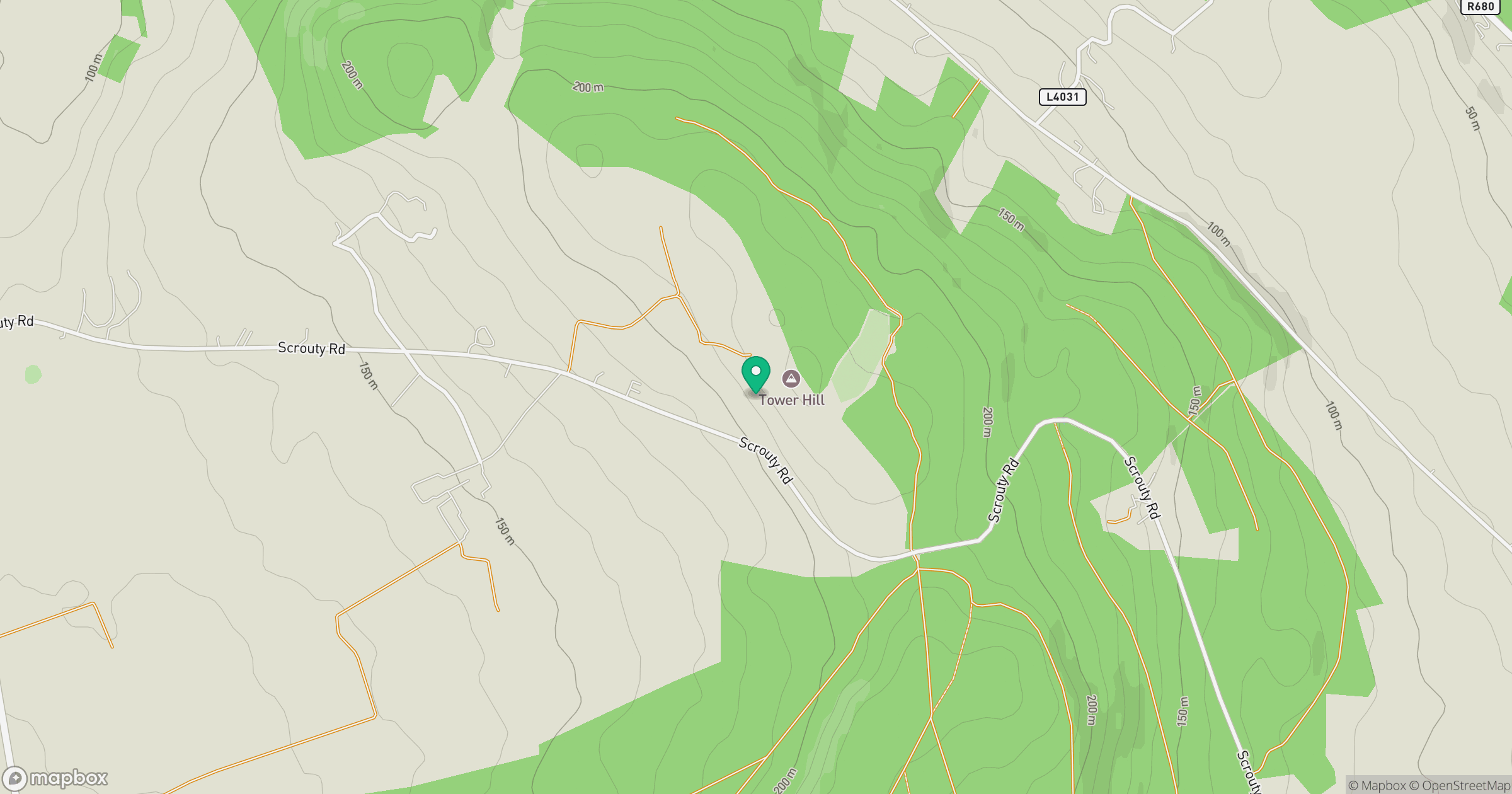
Grid reference: S443188
View on OpenStreetMapOpens a map in a new tab, centred on the hill.
Hills within 30 km
Straight-line distance, not a walking route or confirmation of access.
No comments yet. Be the first.