
Tievenanass
Good walks are even better shared.
Overview
Tievenanass: A Hidden Gem of the Southern Uplands
Tievenanass stands proudly at 580 meters, offering an inviting challenge to hikers eager to explore the rugged beauty of the Southern Uplands. As a Marilyn, it boasts enough elevation to warrant respect, yet its moderate trails make it accessible to a wide range of adventurers.
Geology
The hill is primarily built from granite and schist, providing not just durability but also dramatic landscapes that will take your breath away. The contrasting textures of the rocks add interest to the hike and keep the inquisitive geologist in you entertained.
Routes
The most popular hike is the Tievenanass Circular. Spanning approximately 8.5 km, this route takes about 3.5 hours to complete, depending on how often you stop to admire the views (and trust me, you will!).
Summit Features
At the top, a sizeable cairn awaits your arrival, joyfully marking your conquest. Don’t forget to snap a picture to show your mates that you actually did climb a mountain!
Terrain Type
The terrain mainly consists of grassy slopes, intermingled with rocky outcrops that provide a delightful challenge. Be cautious of the boggy patches, especially after a rain shower—wellies might not be a bad idea!
Views
On a clear day, the views from Tievenanass are top-notch. The Galloway Hills can be seen in the distance, rewarding you with a picturesque panorama of the verdant valleys below. For the best sights, aim for late spring or autumn; nothing beats the blooming heather!
Hazards
As always, be prepared for the unpredictable Scottish weather. Dressing in layers is wise, and those currant sandwiches won’t do you any good if you trip over wet rocks, so keep your wits about you!
Nearby Summits
If you're feeling adventurous, combine your trip with a visit to nearby peaks such as Benedict's Hill and Cairnsmore of Carsphairn. Each offers its own unique scenery and challenges.
Access
Getting there is straightforward. The nearest parking area is conveniently located on the A745, just a short jaunt from the trailhead. If you prefer public transport, hop on a bus from Dumfries to Moniaive, but anticipate a nice stroll (or taxi) to reach the trails.
Facilities
Moniaive, the sweet little village nearby, offers a café perfect for refuelling after a day in the hills. Pop in for a slice of cake aimed to fuel your adventure!
History
The intriguing name Tievenanass hints at a rich heritage, stemming from Scottish Gaelic. This hill has long been a contextual landmark, linking local farmers with the land’s traditional routes.
So lace up those hiking boots and get yourself to Tievenanass; the hills are calling and you must go!
Explore routes near Tievenanass
Public walks starting within 80 km of this hill. Nearby does not mean a route reaches the summit; check its map and access before setting out.
Florence Court: Riverside and Forest Circuit, County Fermanagh
View route
Scarva to Poyntzpass: Newry Canal and Lough Shark Return
View route
Peatlands Park Red Trail: Annagarriff Wood and Derryadd Lough
View route
Portadown to Knock Bridge: Bann Boulevard and Moneypenny’s Lock
View route
Route planning notes
These notes describe possible approaches, not verified navigable routes or permission to cross land. Check current paths, local access rules and conditions before setting out.
Tievenanass Circular
A delightful circular route starting from the nearest parking area, weaving through heather moorland and taking in the stunning views of the surrounding landscape.
Make a day of it, together
Find someone to share the walk with, or organise a day out along a route you like.
Hill facts and local notes
Classifications
Elevation
261m
856 ft
Prominence
104m
Coordinates
53.9893, -7.1135
H582048
OS Map
35
At the Summit
The summit features a prominent cairn, which is a popular spot for photographs and a friendly reminder that you’ve made it to the top.
Terrain & Geology
Tievenanass is primarily composed of granite and schist, providing a rugged and resilient landscape. The distinctive rock formations contribute to the hill's unique visual character.
Views & Scenery
From the summit, you'll enjoy sweeping vistas of the Southern Uplands, with views stretching to the Galloway Hills and across the lush valleys below.
History & Heritage
Name Origin
The name Tievenanass derives from the Scottish Gaelic 'Tighean an Ais,' meaning 'house of the ash tree.'
Historical Significance
The mountain has been a silent witness to local history, serving as a landmark for local farmers and as a gathering point for various outdoor activities.
Getting There & Facilities
Check current local access restrictions, parking rules and transport timetables before travelling. These notes do not confirm public access to the summit.
Parking
There is off-road parking on the A745, approximately 1 km from the starting point. Please park responsibly to avoid blocking access.
Public Transport
The nearest bus service runs from Dumfries to Moniaive, but you’ll need a taxi or a pleasant walk to get closer to the trailhead.
Nearby Facilities
While there are no facilities directly on the mountain, Moniaive features a café and a small shop for supplies, including that all-important chocolate bar.
Safety Information
Known Hazards
- Weather can change rapidly; keep an eye on the sky. Also, beware of slippery rocks, especially after rain.
General Safety Tips
- Check weather conditions before setting out
- Carry appropriate clothing and equipment
- Let someone know your planned route
- Take a map, compass, and GPS device
- Carry emergency supplies: food, water, first aid kit, torch
Hills
Some common questions about the hills answered
Are there group walks up Tievenanass?
Many walkers use Walkmates to join or organise walks with others. You can check for group walks around Tievenanass through the maps
Are there other walkers around Tievenanass?
Activity varies by location and time, but Walkmates lets you see whether others have shared walks or shown interest in this area. Find other people through the walking friends search walking friends for Tievenanass search or of course create your own walk for Tievenanass
Can I organise a walk to Tievenanass?
Yes. If there aren’t any walks listed already, you can create a walk and make it available for others to join.
If you're signed up to Walkmates, you can create a walk to Tievenanass.
How do I find a walk up this hill?
There are often multiple ways to walk this hill, depending on experience and route preference. Walkmates helps you explore walks and routes that others have shared.
Can I suggest a new route up Tievenanass?
Yes. You can suggest or create routes to share with others. Walkmates focuses on the social side of walking, so routes are used to help people organise walks and explore areas together, rather than as detailed navigation tools or route libraries.
Other uses really appreciate knowledgeable walkers sharing their routes. Share your favourite route to Tievenanass here
The is an error or something incorrect about this hill. How do I let you know?
We always strive to keep the information on Walkmates as accurate as possible. If you find an error, please let us know through the contact form and we'll aim to correct it as quickly as possible
Community Discussion
Comments
Location
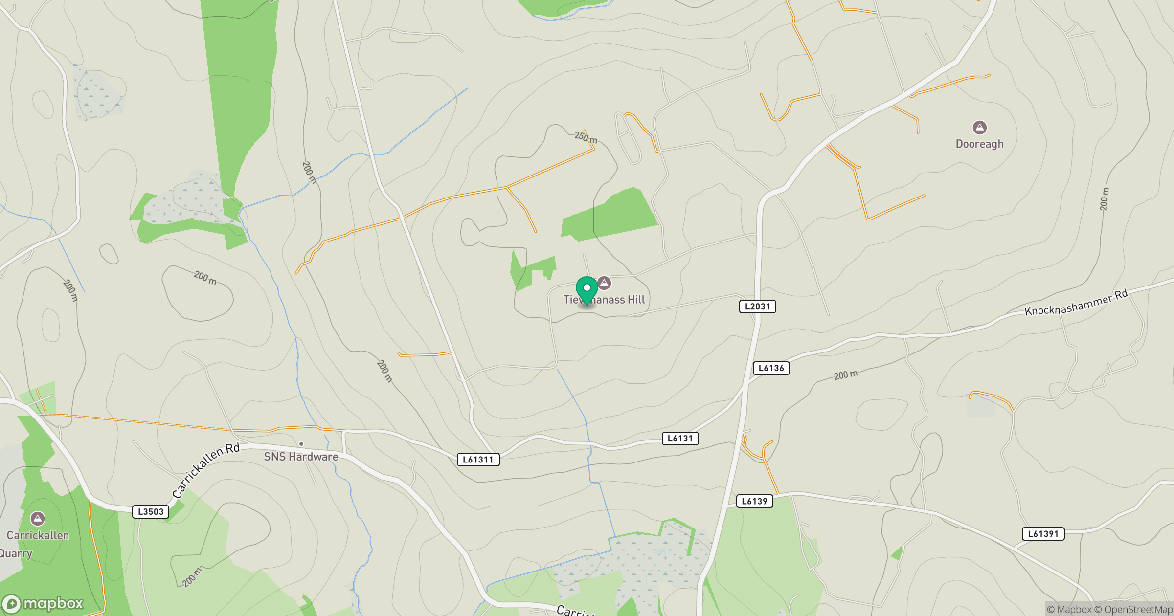
Grid reference: H582048
View on OpenStreetMapOpens a map in a new tab, centred on the hill.
Hills within 30 km
Straight-line distance, not a walking route or confirmation of access.
No comments yet. Be the first.