

St Michael's Mount
Good walks are even better shared.
SW5129 : St. Michael's Mount - Looking up at the north face of the house
Chris Gorringe Photo source
Overview
St Michael's Mount: A Jewel of Cornwall
Overview
St Michael's Mount, an iconic tidal island located just off the coast of Cornwall, offers both history and stunning natural beauty. Rising to 80 meters, it may not make you breathless with elevation, but it certainly captures the imagination with its charm and views.
Geology
Primarily granite, the rock formations of St Michael's Mount are not just there for show; they tell tales of volcanic activity millions of years ago. You'll find boulders, weathered stones, and even the occasional sea creature trying to get you to join their ranks.
Routes
Causeway Walk
Distance: 1.5 km
Time: 0.5 hours
Difficulty: Easy
A leisurely stroll along the causeway during low tide gives one a sense of adventure without breaking a sweat. Just keep an eye on the tide; nobody fancies a surprise dip!
Summit Trail
Distance: 1.0 km
Time: 1 hour
Difficulty: Moderate
The path from the causeway to the summit is a delightful trod with some cobblestones, leading adventurers to the castle and its gardens.
Summit Features
Upon reaching the summit, expect to find the iconic castle, beautiful terraced gardens, and a chapel dedicated to St Michael. On a clear day, these sites are more than just pretty; they’re steeped in history.
Terrain Type
The terrain consists of rocky paths leading up to more grassy areas, making it suitable for various adventures rather than just strolls.
Views
From the top, you’re treated to sweeping vistas of the surrounding coastline, Marazion village, and possibly even the Isles of Scilly on a clear day. Make sure to bring your camera, or at least an enthusiastic Instagram filter!
Hazards
One of the biggest hazards here is the tide! Check tide times to avoid being stranded, as the causeway is only visible when the sea allows.
Access
- Nearest Parking: Marazion Car Park is just a hop, skip, and jump away.
- Public Transport: Penzance buses have regular routes to Marazion.
- Nearest Town: Marazion, a charming village bursting with character.
Facilities
You won’t be caught short – there are cafés and restrooms available both in Marazion and on the island during service hours.
History
The name St Michael's Mount signifies its historical ties to the Cathedral of St Michael, reflecting its long-standing significance as a spiritual and strategic site through centuries.
Whether you visit for the history, the walk, or the picture-perfect views, St Michael's Mount is a destination that combines the best of Cornwall’s heritage and natural beauty. Remember, if you leave a piece of your heart there, you may have to wait for the tide to bring it back!
Explore routes near St Michael's Mount
Walks starting near this hill. Open a route to check its map, distance and full itinerary.
Penzance Walk with Men Walking & Talking
View route
Helston to southern Loe Pool: Penrose lakeside woodland walk
View route
Porthcurno and the Minack Theatre
View route
Tehidy lakes, Kennels Hill and North Cliffs woodland circuit
View route
Route planning notes
These notes describe possible approaches. Check a route's map and access information when planning your walk.
Causeway Walk
Starting from the Marazion car park, this route leads along the iconic tidal causeway to St Michael's Mount. Accessible only during low tide, the walk offers breathtaking views of the surrounding coastline and the Mount itself. Return via the same route before the tide rises.
Marazion Beach to St Michael's Mount via Boat
Begin at Marazion Beach and take a scenic boat ride to St Michael's Mount during high tide. Once on the Mount, explore its pathways, gardens, and historic castle. Return by boat to complete this short but rewarding journey.
Marazion to Perranuthnoe Circular Walk
This picturesque circular route starts from Marazion and follows the South West Coast Path towards Perranuthnoe. Pass through charming coastal landscapes and return via inland paths with stunning views of St Michael's Mount throughout the walk.
St Michael's Mount and Mount's Bay Loop
Starting from Marazion, this longer loop takes you along Mount's Bay, offering spectacular views of the Mount and surrounding waters. The route incorporates sections of the South West Coast Path and returns via a mix of scenic coastal and inland trails.
Goldsithney to St Michael's Mount Linear Walk
Starting from the village of Goldsithney, this linear walk passes through quiet country lanes and fields before reaching Marazion and St Michael's Mount. A great option for those wanting a peaceful approach to the Mount.
Make a day of it, together
Find someone to share the walk with, or organise a day out along a route you like.
Photo Gallery
View all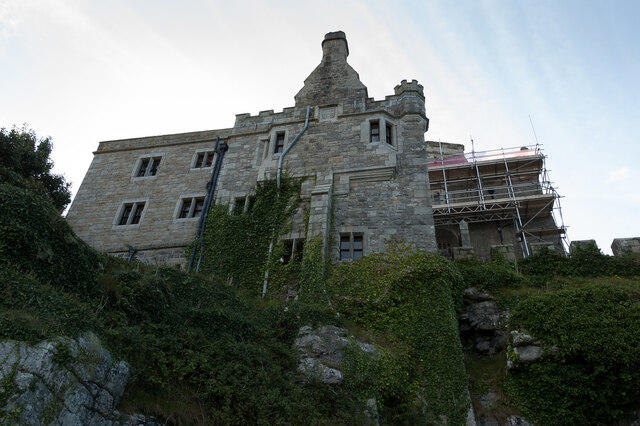 Photo could not load
SW5129 : St. Michael's Mount - Looking up at the north face of the house
Chris Gorringe
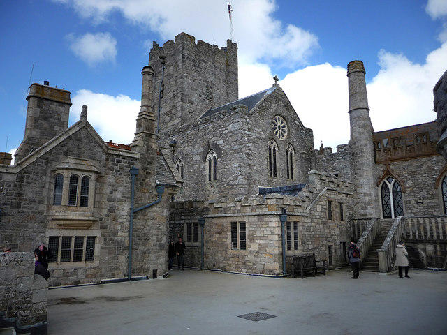 Photo could not load
SW5129 : St Michael's Mount
Chris Gunns
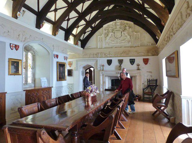 Photo could not load
SW5129 : Dining Hall, Saint Michael's Mount, Cornwall
Derek Voller
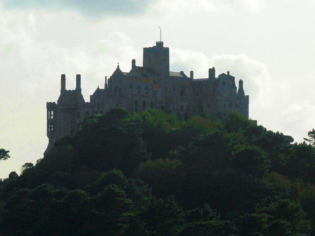 Photo could not load
SW5129 : Priory Castle of St Michael's Mount
Rob Farrow
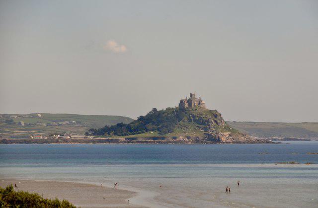 Photo could not load
SW5129 : Marazion : St Michael's Mount
Lewis Clarke
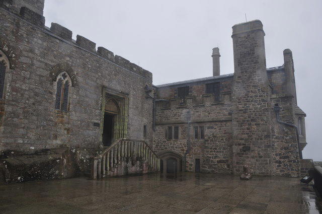 Photo could not load
SW5129 : Marazion : St Michael's Mount Chapel Entrance
Lewis Clarke
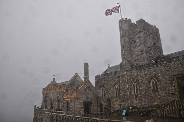 Photo could not load
SW5129 : Marazion : St Michael's Mount Chapel
Lewis Clarke
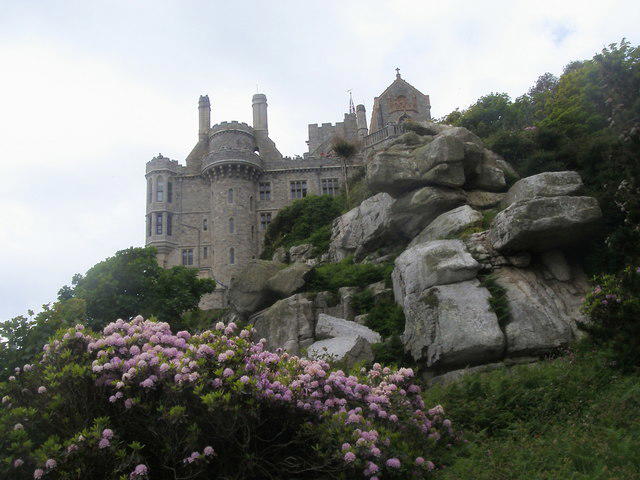 Photo could not load
SW5129 : St Michael's Mount
Shaun Ferguson
 Photo could not load
SW5129 : Marazion : St Michael's Mount
Lewis Clarke
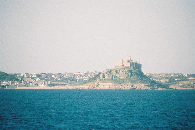
SW5129 : St. Michael’s Mount: view from at sea
Chris Downer
Hill facts and local notes
Classifications
Elevation
61m
200 ft
Prominence
61m
Coordinates
50.1161, -5.4789
SW514298
OS Map
203
Explorer: 102
At the Summit
The summit features a historic castle, beautiful gardens, and a stunning chapel dedicated to St Michael, providing a unique blend of history and nature.
Terrain & Geology
Primarily composed of granite, St Michael's Mount features a stunning array of rock formations and coastal geology that contribute to its breathtaking scenery.
Views & Scenery
Stunning views of the surrounding coastline, the village of Marazion, and, on a clear day, the craggy peaks of the Isles of Scilly.
History & Heritage
Name Origin
The name 'St Michael's Mount' refers to the patron saint of soldiers, indicating its historical significance as a defensive position.
Historical Significance
The site has been a place of pilgrimage and a strategic fortification for centuries, reflecting its deep cultural and historical roots.
Getting There & Facilities
Parking
Marazion Car Park, located a short walk from the causeway.
Public Transport
Regular bus services operate from Penzance to Marazion.
Nearby Facilities
Cafés and restrooms are available in Marazion and on the island during visitor hours.
Safety Information
Known Hazards
- The causeway can be submerged at high tide; check tide times before your visit to avoid being cut off.
General Safety Tips
- Check weather conditions before setting out
- Carry appropriate clothing and equipment
- Let someone know your planned route
- Take a map, compass, and GPS device
- Carry emergency supplies: food, water, first aid kit, torch
Hills
Some common questions about the hills answered
Are there group walks up St Michael's Mount?
Many walkers use Walkmates to join or organise walks with others. You can check for group walks around St Michael's Mount through the maps
Are there other walkers around St Michael's Mount?
Activity varies by location and time, but Walkmates lets you see whether others have shared walks or shown interest in this area. Find other people through the walking friends search walking friends for St Michael's Mount search or of course create your own walk for St Michael's Mount
Can I organise a walk to St Michael's Mount?
Yes. If there aren’t any walks listed already, you can create a walk and make it available for others to join.
If you're signed up to Walkmates, you can create a walk to St Michael's Mount.
How do I find a walk up this hill?
There are often multiple ways to walk this hill, depending on experience and route preference. Walkmates helps you explore walks and routes that others have shared.
Can I suggest a new route up St Michael's Mount?
Yes. You can suggest or create routes to share with others. Walkmates focuses on the social side of walking, so routes are used to help people organise walks and explore areas together, rather than as detailed navigation tools or route libraries.
Other uses really appreciate knowledgeable walkers sharing their routes. Share your favourite route to St Michael's Mount here
The is an error or something incorrect about this hill. How do I let you know?
We always strive to keep the information on Walkmates as accurate as possible. If you find an error, please let us know through the contact form and we'll aim to correct it as quickly as possible
Community Discussion
Comments
Location
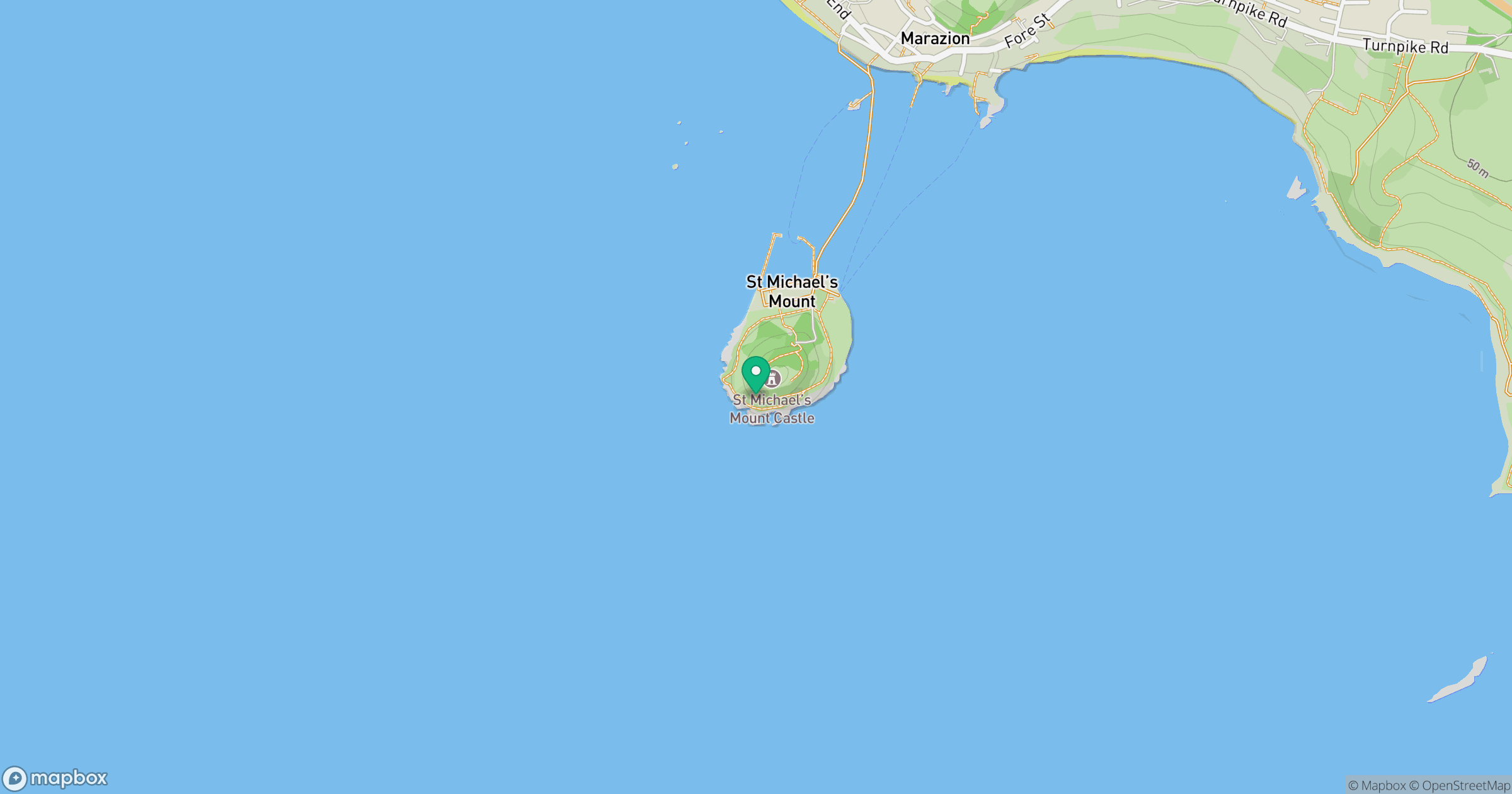
Grid reference: SW514298
View on OpenStreetMapOpens a map in a new tab, centred on the hill.


No comments yet. Be the first.