
Sron ri Gaoith
Good walks are even better shared.
Overview
Sron ri Gaoith: The Nose of the Wind
Sron ri Gaoith, towering at 812 meters, is a splendid Munro located in the heart of the Scottish Highlands. Known for its dramatic granite cliffs and rugged beauty, this mountain is a favourite among hikers seeking both challenge and stunning views.
Geology
The mountain is primarily composed of ancient granitic rock formations. These durable rocks have endured the test of time, standing resilient against weathering and erosion. The landscape here has been sculpted into vertical cliffs and steep slopes, offering both beauty and adventure.
Routes
There are several routes up Sron ri Gaoith, each providing a unique perspective on this majestic peak.
- Glen Feshie Route: This moderate route is approximately 12 km long and takes around 5 hours to complete. It begins from the picturesque Glen Feshie, winding through lush valleys before ascending the mountain.
- Coire na Ciste Route: A more challenging route, this 10 km path can be tackled in about 4.5 hours and involves steeper climbs, making it ideal for those looking for a bit of a workout.
Summit Features
The summit is adorned with a sizeable stone cairn, which serves as a waypoint for weary hikers. The views from the top are absolutely breathtaking, showcasing the vastness of the Scottish Highlands. Don't forget to bring your camera!
Terrain
Expect rocky paths intertwined with grassy slopes and patches of heather. The variety of terrain keeps the hike interesting, but watch your step—what goes up must come down, and not just in comedy!
Views
From the summit, one can feast their eyes on the majestic Cairngorms and the expansive Monadhliath, making it a true treasure for nature lovers and photographers alike. For the best experience, plan your hike in spring or autumn for vibrant landscapes, or try an early morning ascent for a glorious sunrise.
Hazards
Staying safe is paramount! Keep an eye on the swiftly changing weather; winds can pick up dramatically, especially at the summit. The rocky terrain can also become quite slippery when it rains, so proper footwear is a must.
Nearby Summits
For those looking to extend their adventure, nearby peaks include:
- Carn na Caim at 1044 meters
- Geal Charn at 900 meters
Access
The nearest car park is conveniently located at the end of the Glen Feshie road, roughly 4 km from the trailhead. Aviemore is the nearest town, providing access to amenities like cafes and toilets for tired hikers.
Facilities
Although Sron ri Gaoith itself lacks facilities, there are ample options in Aviemore for a good meal and a bit of relaxation after your adventure.
History
The mountain's name means 'nose of the wind', a fitting title for a peak often subject to brisk mountain breezes. It's also steeped in Scottish folklore, with tales woven into the fabric of the local culture.
Conclusion
In summary, Sron ri Gaoith is not just a hike; it’s an experience that gets under your skin—preferably not in a biting way. Whether you’re an experienced Munro bagger or a new adventurer, this mountain promises lovely views and a memorable day out.
Explore routes near Sron ri Gaoith
Public walks starting within 80 km of this hill. Nearby does not mean a route reaches the summit; check its map and access before setting out.
Beautiful private beach walk Isle of Harris
View route
Berneray Community Hall to the beautiful beach
View route
Route planning notes
These notes describe possible approaches, not verified navigable routes or permission to cross land. Check current paths, local access rules and conditions before setting out.
Glen Feshie Route
A scenic approach from Glen Feshie that winds through green valleys and offers beautiful views of the surrounding mountains.
Coire na Ciste Route
A steeper route starting from the south-east, providing direct access to the summit with a few challenging sections.
Make a day of it, together
Find someone to share the walk with, or organise a day out along a route you like.
Hill facts and local notes
Classifications
Elevation
253m
830 ft
Prominence
124m
Coordinates
58.1539, -6.9740
NB075291
OS Map
13
Explorer: 458
At the Summit
The summit features a substantial stone cairn, which serves as a delightful spot for a group photo or a moment of reflection. The panoramic views from this height really take the biscuit!
Terrain & Geology
Sron ri Gaoith is primarily composed of ancient granitic rocks, which are part of the rugged geological composition of the Scottish Highlands. The erosion process has sculpted dramatic cliffs and steep slopes that provide a stunning landscape for adventurers.
Views & Scenery
From the summit, one can enjoy views of the Cairngorms, the dramatic peaks of the Monadhliath, and the vast expanse of the Scottish wilderness. On a clear day, you might even spot Loch Ness in the distance!
History & Heritage
Name Origin
The name 'Sron ri Gaoith' translates to 'nose of the wind', reflecting the often blustery conditions at the summit. A fitting name for a mountain that likes to make its presence known!
Historical Significance
Historically, the mountain has been a feature in Scottish folklore, often associated with stories of mythology and ancient battles between clans.
Getting There & Facilities
Check current local access restrictions, parking rules and transport timetables before travelling. These notes do not confirm public access to the summit.
Parking
There is a car park at the end of the Glen Feshie road, approximately 4 km from the trailhead. The car park can accommodate several vehicles and is free to use.
Public Transport
Public transport options are limited, but can be accessed via local bus services that operate from Aviemore to nearby villages during the summer months.
Nearby Facilities
While there are no facilities directly on the mountain, Aviemore offers cafes, restaurants, and toilets to cater to the needs of hikers before and after the climb.
Safety Information
Known Hazards
- The main hazards include rapidly changing weather conditions, particularly high winds at the summit, and rocky terrain that can become slippery in wet conditions.
General Safety Tips
- Check weather conditions before setting out
- Carry appropriate clothing and equipment
- Let someone know your planned route
- Take a map, compass, and GPS device
- Carry emergency supplies: food, water, first aid kit, torch
Hills
Some common questions about the hills answered
Are there group walks up Sron ri Gaoith?
Many walkers use Walkmates to join or organise walks with others. You can check for group walks around Sron ri Gaoith through the maps
Are there other walkers around Sron ri Gaoith?
Activity varies by location and time, but Walkmates lets you see whether others have shared walks or shown interest in this area. Find other people through the walking friends search walking friends for Sron ri Gaoith search or of course create your own walk for Sron ri Gaoith
Can I organise a walk to Sron ri Gaoith?
Yes. If there aren’t any walks listed already, you can create a walk and make it available for others to join.
If you're signed up to Walkmates, you can create a walk to Sron ri Gaoith.
How do I find a walk up this hill?
There are often multiple ways to walk this hill, depending on experience and route preference. Walkmates helps you explore walks and routes that others have shared.
Can I suggest a new route up Sron ri Gaoith?
Yes. You can suggest or create routes to share with others. Walkmates focuses on the social side of walking, so routes are used to help people organise walks and explore areas together, rather than as detailed navigation tools or route libraries.
Other uses really appreciate knowledgeable walkers sharing their routes. Share your favourite route to Sron ri Gaoith here
The is an error or something incorrect about this hill. How do I let you know?
We always strive to keep the information on Walkmates as accurate as possible. If you find an error, please let us know through the contact form and we'll aim to correct it as quickly as possible
Community Discussion
Comments
Location
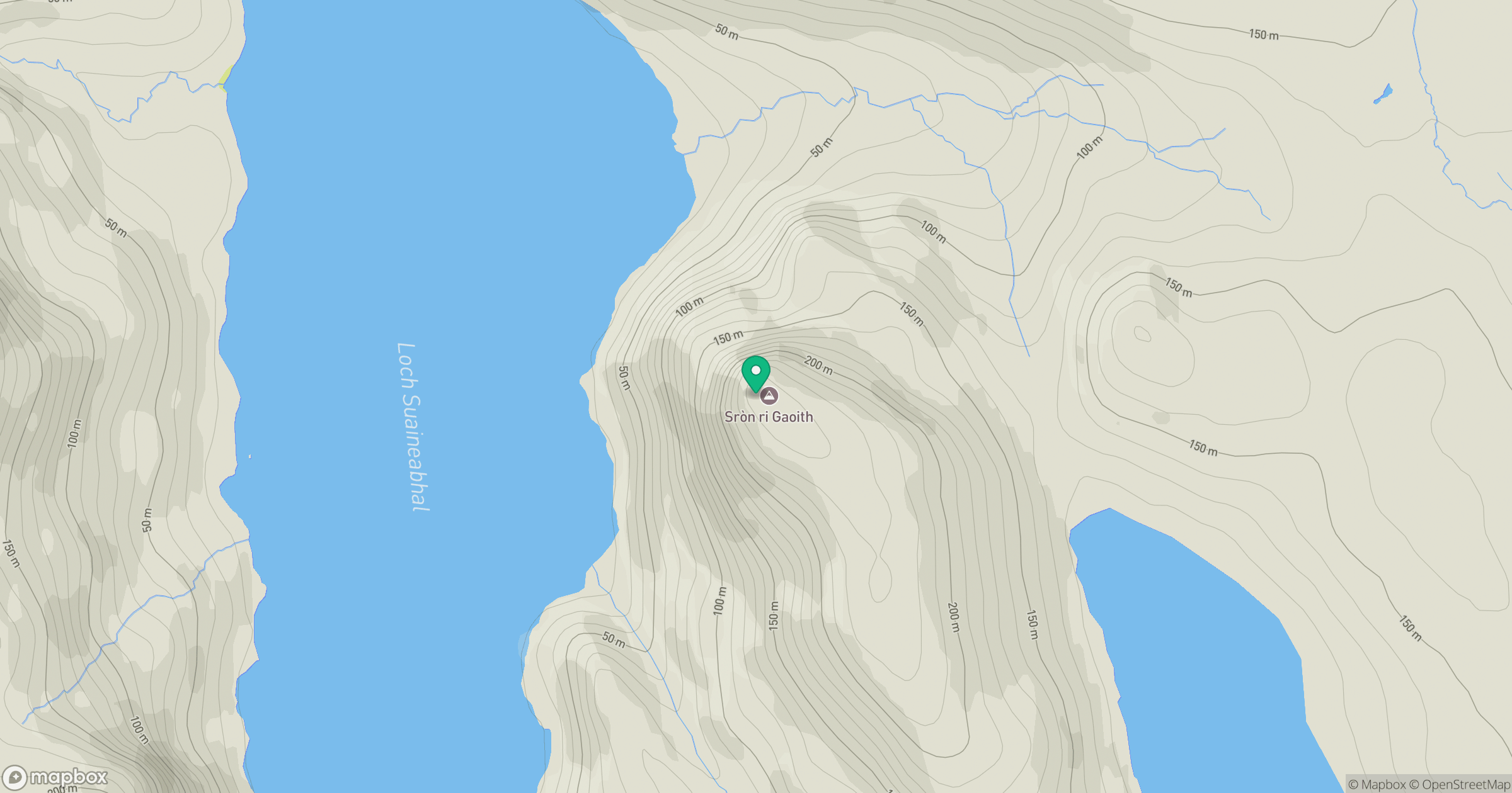
Grid reference: NB075291
View on OpenStreetMapOpens a map in a new tab, centred on the hill.
Hills within 30 km
Straight-line distance, not a walking route or confirmation of access.
An Cliseam [Clisham]
800m
Suaineabhal [Suainaval]
428m
Tarain Mor [Tarain]
411m
Beinn Mheadhanach [Beinn Mheadhonach]
397m
Niosa Mhor [Nisa Mhor]
136m
No comments yet. Be the first.