

Sneathabhal Mor
Good walks are even better shared.
Overview
Sneathabhal Mor
Nestled in the heart of the Scottish Highlands, Sneathabhal Mor beckons adventurous souls looking for a rewarding hike with magnificent views. Standing at 404 meters, it's not the highest peak in the region, but its approachable charm is undeniable.
Geology
Sneathabhal Mor is primarily made of granite, which gives the landscape its characteristic ruggedness. The glacially eroded valleys surrounding the peak illustrate the earth's weathered history, making it a delightful excursion for geology enthusiasts.
Routes
The most popular route is the Sneathabhal Mor Path. Beginning at the B8013, this path is easy to navigate and well-marked. You'll meander through vibrant heather and grasslands for approximately 5 km, culminating in a well-earned workout at the summit. Expect to spend around 3 hours on this moderate trek.
Summit Features
Upon reaching the summit, hikers are greeted by a substantial cairn, a hallmark of Scottish peaks. It makes for the perfect place to enjoy a packed lunch while admiring the breathtaking scenery. Remember, nothing says ‘I conquered this mountain’ quite like a mountain-top selfie!
Terrain Type
The terrain varies from grassy slopes to rocky outcrops, allowing hikers to experience the terrain's full character. A sturdy pair of boots will serve you well here.
Views
The summit offers panoramic views showcasing the majestic landscapes of the Outer Hebrides. The vistas are particularly stunning in late spring and early autumn when the skies are clear and colours vibrant. Keep your camera ready; you won't want to miss capturing these views.
Hazards
As with many Scottish hikes, be prepared for rapidly changing weather. Visibility can drop quickly in mist, reminding adventurers to always come prepared with a map and compass—just in case GPS decides to quit on you!
Nearby Summits
If you're feeling ambitious, nearby summits like Ben Griam Mor and Ben Griam Beg offer further challenges and stunning scenic beauty. Why not tackle more than one mountain while you're in the neighbourhood?
Access
Nearest Parking
You can park conveniently along the B8013, where you'll find ample space suitable for a number of vehicles.
Public Transport
For those relying on public transport, buses from Inverness can drop you near Altnaharra, from which a quick taxi ride will take you to the trailhead.
Nearest Town
The closest town is Altnaharra, a quaint village perfect for a pint after a long day on the hills.
Facilities
Altnaharra also offers a small shop and a charming café to refuel once you've tackled Sneathabhal Mor, allowing you to indulge in post-hike indulgence.
History
The name ‘Sneathabhal Mor’ means ‘the big peak of tin,’ referencing the area's mining past. This mountain has seen many adventures over the years, making it a significant symbol for the local clans.
In summary, Sneathabhal Mor invites you to take a break from the hustle and bustle of life and enjoy the simple pleasures of nature. Pack your gear, brace for a bit of a climb, and take in the natural beauty that the Scottish Highlands have to offer!
Happy hiking!
Explore routes near Sneathabhal Mor
Public walks starting within 80 km of this hill. Nearby does not mean a route reaches the summit; check its map and access before setting out.
Beautiful private beach walk Isle of Harris
View route
Berneray Community Hall to the beautiful beach
View route
Route planning notes
These notes describe possible approaches, not verified navigable routes or permission to cross land. Check current paths, local access rules and conditions before setting out.
Sneathabhal Mor Path
A well-marked path starting from the B8013, winding through heather and grassland to the summit.
Make a day of it, together
Find someone to share the walk with, or organise a day out along a route you like.
Photo Gallery
View all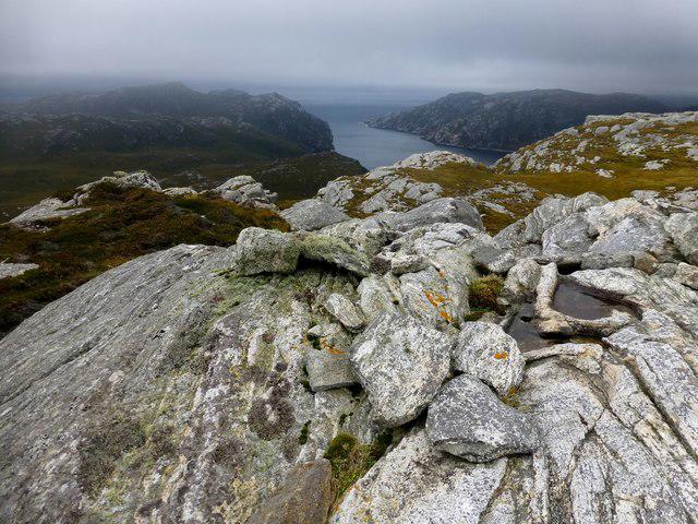 Photo could not load
NB0417 : Sneathabhal Mor
Rude Health
Hill facts and local notes
Classifications
Elevation
175m
574 ft
Prominence
114m
Coordinates
58.0497, -7.0129
NB043177
OS Map
13
Explorer: 456
At the Summit
The summit features a large cairn, offering a perfect spot for a well-deserved snack and photo opportunities.
Terrain & Geology
The area is primarily composed of granite, which forms the rugged peaks of the Highlands. The varied topography includes glacially carved features, adding to the scenic allure of the region.
Views & Scenery
From the summit, one can spot the stunning vistas of the Outer Hebrides and the rugged landscape of the surrounding mountains.
History & Heritage
Name Origin
The name 'Sneathabhal Mor' translates to 'the big peak of tin,' referencing historical mining activity in the area.
Historical Significance
The mountain holds cultural significance to the local clans, and its landscape has been used for many outdoor activities over the years.
Getting There & Facilities
Check current local access restrictions, parking rules and transport timetables before travelling. These notes do not confirm public access to the summit.
Parking
Parking is available on the verge of the B8013 road, approximately 2 km from the start of the path.
Public Transport
Buses operate from Inverness to the nearest village of Altnaharra, with a short taxi ride to the starting point.
Nearby Facilities
The nearest facilities can be found in Altnaharra, which includes a small shop and a café for refreshments after your hike.
Safety Information
Known Hazards
- Be wary of sudden weather changes common in the Highlands. Low visibility can occur, especially in misty conditions.
General Safety Tips
- Check weather conditions before setting out
- Carry appropriate clothing and equipment
- Let someone know your planned route
- Take a map, compass, and GPS device
- Carry emergency supplies: food, water, first aid kit, torch
Hills
Some common questions about the hills answered
Are there group walks up Sneathabhal Mor?
Many walkers use Walkmates to join or organise walks with others. You can check for group walks around Sneathabhal Mor through the maps
Are there other walkers around Sneathabhal Mor?
Activity varies by location and time, but Walkmates lets you see whether others have shared walks or shown interest in this area. Find other people through the walking friends search walking friends for Sneathabhal Mor search or of course create your own walk for Sneathabhal Mor
Can I organise a walk to Sneathabhal Mor?
Yes. If there aren’t any walks listed already, you can create a walk and make it available for others to join.
If you're signed up to Walkmates, you can create a walk to Sneathabhal Mor.
How do I find a walk up this hill?
There are often multiple ways to walk this hill, depending on experience and route preference. Walkmates helps you explore walks and routes that others have shared.
Can I suggest a new route up Sneathabhal Mor?
Yes. You can suggest or create routes to share with others. Walkmates focuses on the social side of walking, so routes are used to help people organise walks and explore areas together, rather than as detailed navigation tools or route libraries.
Other uses really appreciate knowledgeable walkers sharing their routes. Share your favourite route to Sneathabhal Mor here
The is an error or something incorrect about this hill. How do I let you know?
We always strive to keep the information on Walkmates as accurate as possible. If you find an error, please let us know through the contact form and we'll aim to correct it as quickly as possible
Community Discussion
Comments
Location
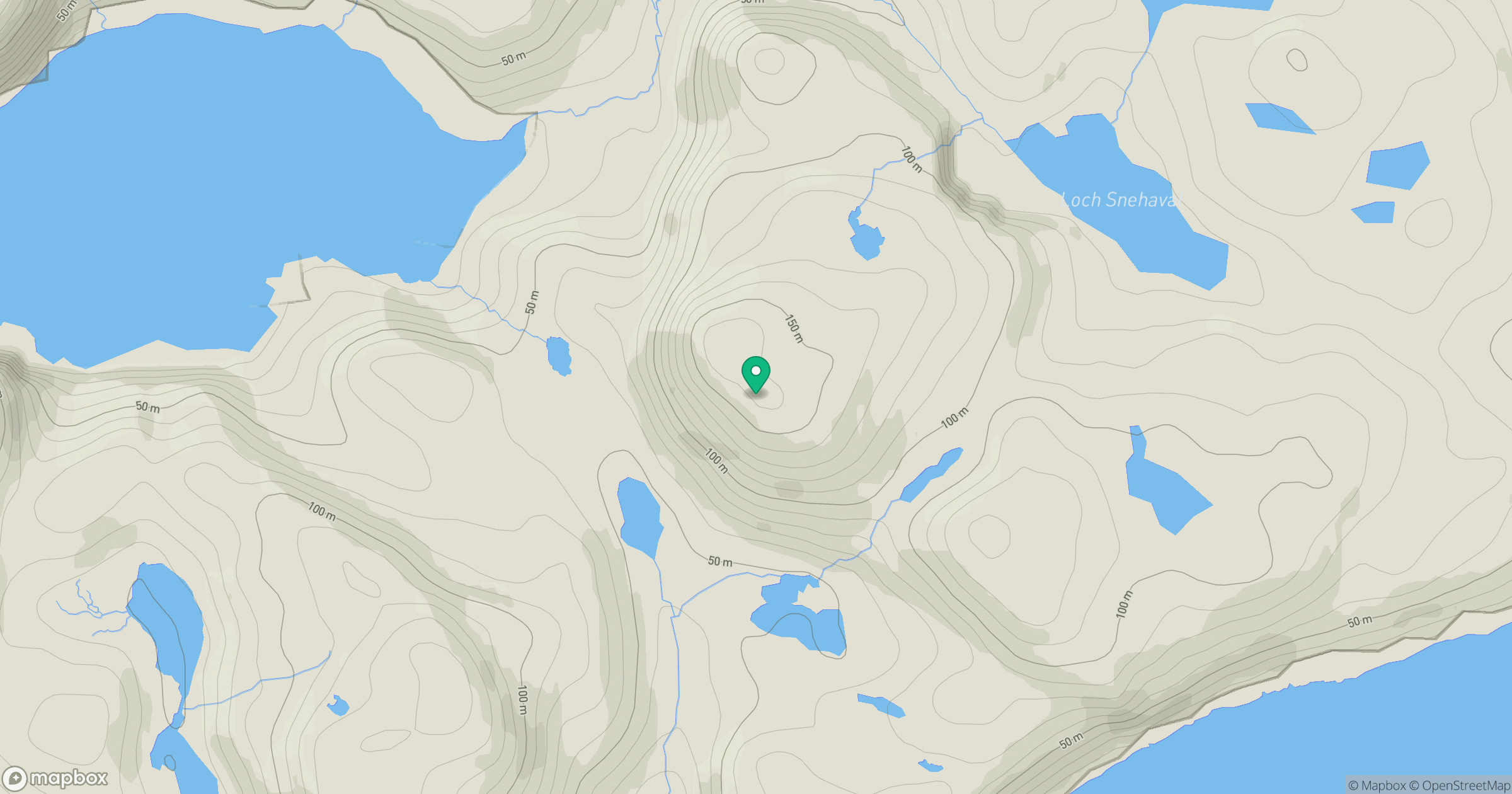
Grid reference: NB043177
View on OpenStreetMapOpens a map in a new tab, centred on the hill.
Hills within 30 km
Straight-line distance, not a walking route or confirmation of access.
No comments yet. Be the first.