

Coduinn
Good walks are even better shared.
Overview
Coduinn: An Explorer's Guide
Overview
Coduinn, nestled within the picturesque Western Uplands, stands proudly at 419 meters. This Marilyn offers not just a climb, but an adventure steeped in geological wonders and stunning scenery. Perfect for both seasoned hikers and those just looking to enjoy a leisurely walk in the hills.
Geology
The rocks are primarily Silurian sandstone and mudstone, providing a rich narrative of Earth's history. Hikers might find fossilized remnants—though I wouldn’t recommend trying to start a rock collection for fear of your backpack collapsing under the weight!
Route Details
The Coduinn Loop Trail is the most popular route, featuring a distance of 10.5 km that can typically be tackled in about 3.5 hours. Expect a moderate difficulty rating that may make you feel as accomplished as a cat that successfully caught a mouse. The trail leads through charming woodlands, with a steady incline to the summit.
Summit Features
The summit is marked by a small stone cairn. Enjoy a well-deserved rest here, with views that might leave you speechless—just don’t forget to take a photo or two, as your friends need proof of your mountain conquests.
Terrain and Views
The terrain is predominantly grassy with a dash of rocky outcrops, and the occasional boggy patch—where wearing the right footwear becomes particularly important. From the top, the views will captivate your heart; you can see the shimmering Loch Cnuic and embrace the grandeur of the Mourne Mountains in the distance.
Access and Facilities
Access is straightforward. Park your car in Corgar, just a short distance from the trailhead. You can hop on a local bus from bigger towns; just keep an eye on the schedules. While there are no facilities on the mountain, don’t worry—Corgar has a lovely café ready to provide you that essential post-hike treat.
History and Reminders
The name 'Coduinn' hints at the rich history of ancient settlements. Please remember, fellow hikers, nature is meant to be respected. Keep the trails clean and enjoy the unique stories that every mountain has to tell.
Happy hiking, and may your feet find solid ground!
Explore routes near Coduinn
Public walks starting within 80 km of this hill. Nearby does not mean a route reaches the summit; check its map and access before setting out.
Beautiful private beach walk Isle of Harris
View route
Berneray Community Hall to the beautiful beach
View route
Route planning notes
These notes describe possible approaches, not verified navigable routes or permission to cross land. Check current paths, local access rules and conditions before setting out.
Coduinn Loop Trail
A delightful circular route starting from the nearby village, leading through scenic woodlands and open moorland to the summit.
Make a day of it, together
Find someone to share the walk with, or organise a day out along a route you like.
Photo Gallery
View all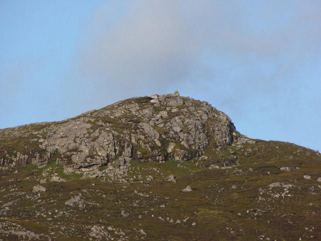 Photo could not load
NB1223 : The Cairn on top of Coduinn
John Tustin
Hill facts and local notes
Classifications
Elevation
241m
791 ft
Prominence
102m
Coordinates
58.1044, -6.8891
NB120232
OS Map
13 14
Explorer: 458
At the Summit
At the summit, you'll find a small stone cairn marking the highest point, alongside a lovely view of the rolling hills and nearby lochs.
Terrain & Geology
Coduinn features a mix of Silurian sandstone and mudstone, offering insight into the Earth’s geological history from over 400 million years ago. The rock formations provide a lovely contrast against the lush greenery of the surrounding areas, perfect for geological enthusiasts.
Views & Scenery
From the summit, enjoy stunning panoramic views of the Western Uplands, including the shimmering waters of Loch Cnuic and the distant peaks of the Mourne Mountains.
History & Heritage
Name Origin
The name 'Coduinn' is believed to derive from the Gaelic 'Cnocdhun', meaning 'hill of the fort', possibly indicating an ancient settlement in the area.
Historical Significance
Coduinn is steeped in local folklore, often associated with ancient Scottish clans that roamed the hills, making it a cultural treasure for history buffs.
Getting There & Facilities
Check current local access restrictions, parking rules and transport timetables before travelling. These notes do not confirm public access to the summit.
Parking
There is parking available in the village of Corgar, approximately 3 km from the trailhead. Make sure to arrive early on weekends, as spots can fill up quickly.
Public Transport
Regular bus services operate from nearby towns, with connections to Corgar. Check local schedules as they may vary.
Nearby Facilities
While there are no facilities directly on the mountain itself, the village of Corgar offers a charming café and public toilets, perfect for that pre-hike caffeine fix.
Safety Information
Known Hazards
- Be cautious of slippery paths, especially in wet conditions, and the occasional encounter with low-hanging branches – they can be surprisingly cheeky.
General Safety Tips
- Check weather conditions before setting out
- Carry appropriate clothing and equipment
- Let someone know your planned route
- Take a map, compass, and GPS device
- Carry emergency supplies: food, water, first aid kit, torch
Hills
Some common questions about the hills answered
Are there group walks up Coduinn?
Many walkers use Walkmates to join or organise walks with others. You can check for group walks around Coduinn through the maps
Are there other walkers around Coduinn?
Activity varies by location and time, but Walkmates lets you see whether others have shared walks or shown interest in this area. Find other people through the walking friends search walking friends for Coduinn search or of course create your own walk for Coduinn
Can I organise a walk to Coduinn?
Yes. If there aren’t any walks listed already, you can create a walk and make it available for others to join.
If you're signed up to Walkmates, you can create a walk to Coduinn.
How do I find a walk up this hill?
There are often multiple ways to walk this hill, depending on experience and route preference. Walkmates helps you explore walks and routes that others have shared.
Can I suggest a new route up Coduinn?
Yes. You can suggest or create routes to share with others. Walkmates focuses on the social side of walking, so routes are used to help people organise walks and explore areas together, rather than as detailed navigation tools or route libraries.
Other uses really appreciate knowledgeable walkers sharing their routes. Share your favourite route to Coduinn here
The is an error or something incorrect about this hill. How do I let you know?
We always strive to keep the information on Walkmates as accurate as possible. If you find an error, please let us know through the contact form and we'll aim to correct it as quickly as possible
Community Discussion
Comments
Location
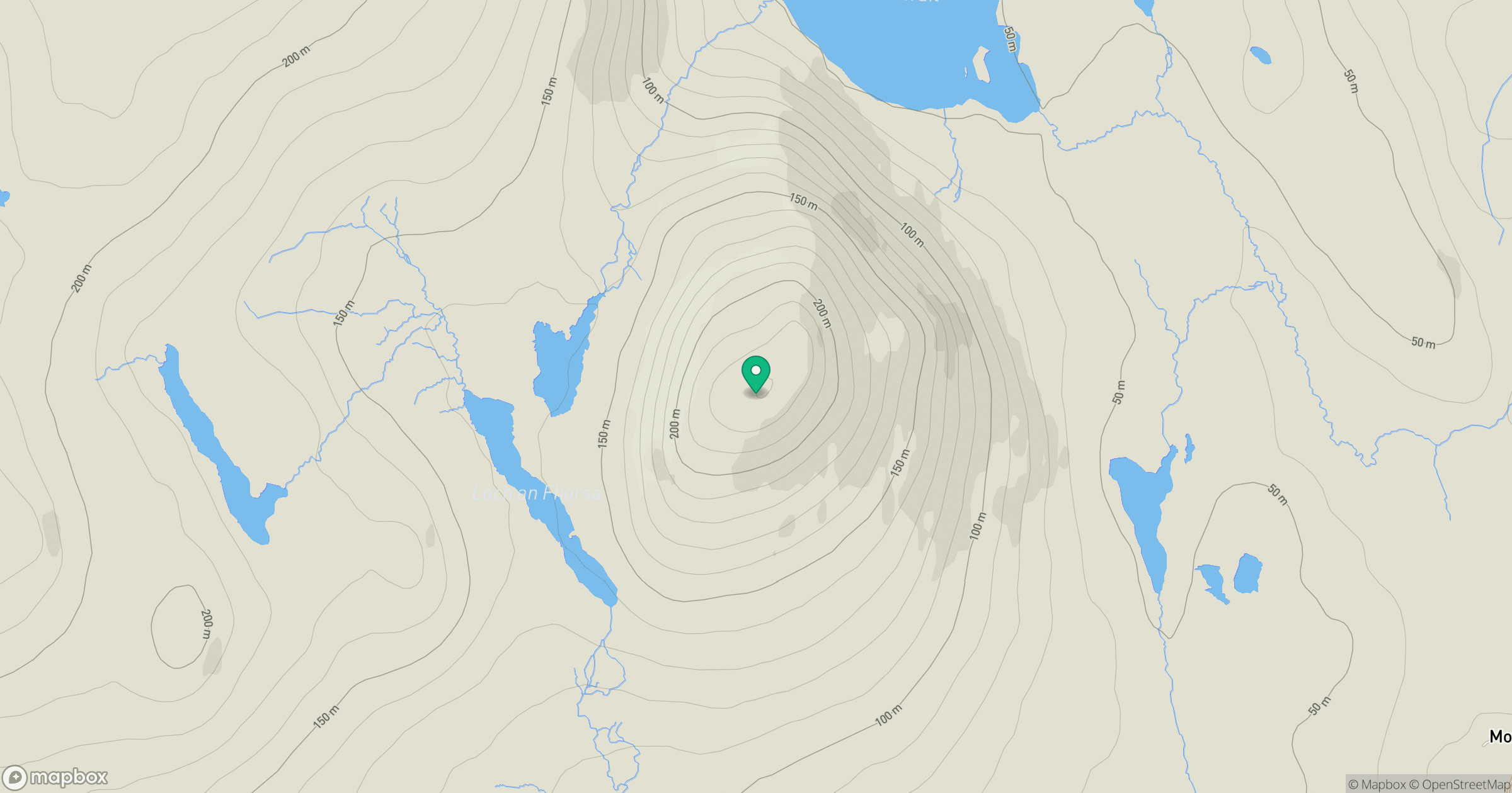
Grid reference: NB120232
View on OpenStreetMapOpens a map in a new tab, centred on the hill.
Hills within 30 km
Straight-line distance, not a walking route or confirmation of access.
An Cliseam [Clisham]
800m
Sgalabhal [Scalaval] [Scalabhal]
260m
Beinn Mheadhanach [Beinn Mheadhonach]
397m
Beinisbhal [Benisval]
190m
Beinn a' Charnain
215m
No comments yet. Be the first.