

Silver How
Good walks are even better shared.
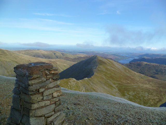
NY3206 : On Silver How
Michael Graham Photo source
Overview
Silver How
Silver How stands proud at 482 meters, a gem in the Lake District that boasts both beauty and accessibility. Located just a stone's throw from Grasmere, this hill offers hikers a splendid experience without making you feel like you've taken up mountaineering as a full-time profession.
Geology
The mountain is predominantly made from the area’s distinctive slate, shaped over millennia. When you’re wandering around, don't forget to look at the ground; those twinkling slate pieces can be as dazzling as a diamond ring, albeit a bit less expensive.
Routes
There are several ways to reach the top:
- Grasmere to Silver How: This 3.5 km trail is moderately challenging and takes about 1.5 hours. Not only will you enjoy stunning views, but you'll also get a good workout without needing to visit the gym later.
- Dale Head Path: For those who fancy a bit of a challenge, this 4 km route winds more dramatically up the slope—perfect for those looking to impress friends with their hiking prowess!
Summit Features
Upon reaching the summit, you’ll be greeted by a small cairn that sits proudly on the rocky outcrop. A great photo opportunity awaits as you stand there, arms wide, basking in the glory of your achievement—and the views!
Terrain
Expect a delightful variety of terrains—from rocky paths (watch your step!) to lush grassy meadows where sheep might look at you with mild disdain for intruding on their grazing.
Views
From the top, the sights are nothing short of breathtaking. Gaze upon Grasmere Lake, the quaint village, and the formidable peaks surrounding you. The best views are during spring and early summer when the blooms pop and the skies are bluer than a very blue thing.
Hazards
Caution is advised due to uneven terrain and slippery conditions after rain. Good boots are your best mates here!
Nearby Summits
You won’t be short of neighbours—Helm Crag and Fairfield are just a couple of the many peaks beckoning for your attention.
Access
Grasmere, being the nearest town, is well-equipped with parking and public transport options from Windermere. So no need to drag your gear for miles! Just remember to free your car up from the tourists who might be dreaming of that same gingerbread you’ve been salivating over.
Facilities
You’ll find a host of facilities in Grasmere including charming cafés and public toilets. And let’s not forget Sarah Nelson's Gingerbread, which is a must-visit. It's just the thing to reward yourself after a vigorous hike!
History
The name ‘Silver How’ evokes imagery of the sparkling landscapes that surround it. Locals have long revered this hill, making it a significant attraction for both new hikers and seasoned pros.
With all this in tow, Silver How invites you to lace up your boots and embrace the wild. It's not just a hike; it’s an adventure infused with the beauty and charm that only the Lake District can offer.
This journey is simply waiting for you to explore it.
Happy hiking!
Explore routes near Silver How
Walks starting near this hill. Open a route to check its map, distance and full itinerary.
Bow Fell from Langdale
View route
Great Carrs Halifax Wreckage from Wrynose Pass
View route
Tarn Hows Fast Route
View route
Coniston to Tarn Hows: Monk Coniston Gardens and Woodland Circuit
View route
Route planning notes
These notes describe possible approaches. Check a route's map and access information when planning your walk.
Grasmere to Silver How
A scenic route starting from the picturesque village of Grasmere, leading you through charming woodlands and providing sweeping views along the climb.
Dale Head Path
A more challenging route that takes you over varied terrains including bracken and rocky paths, providing excellent scenic rewards.
Make a day of it, together
Find someone to share the walk with, or organise a day out along a route you like.
Photo Gallery
View all Photo could not load
NY3206 : On Silver How
Michael Graham
 Photo could not load
NY3206 : East from Silver How
Karl and Ali
 Photo could not load
NY3206 : On Silver How
Michael Graham
 Photo could not load
NY3206 : Scree gully below Silver How
Anthony Foster
 Photo could not load
NY3206 : Descent from Silver How
Bill Boaden
 Photo could not load
NY3206 : Summit of Silver How
Shaun Ferguson
 Photo could not load
NY3206 : Sunlight on Silver How
Michael Graham
 Photo could not load
NY3206 : West side of Silver How
DS Pugh
 Photo could not load
NY3206 : Summit Cairn, Silver How
Michael Graham

NY3206 : Silver How and Grasmere
David Purchase
Hill facts and local notes
Classifications
Elevation
394m
1,292 ft
Prominence
30m
Coordinates
54.4507, -3.0429
NY324066
OS Map
90
Explorer: OL7N
At the Summit
The summit features a prominent rocky outcrop with a small cairn, offering a perfect vantage point for a well-deserved photo opportunity.
Terrain & Geology
Silver How is primarily composed of slate, typical of the Lakeland region, contributing to its rugged charm and stunning scenery.
Views & Scenery
Views of the stunning Grasmere Lake, Helm Crag, and the majestic peaks surrounding the area such as Fairfield and St. Sunday Crag.
History & Heritage
Name Origin
The name 'Silver How' could be translated to reflect its shimmering appearance in the sunlight or the silvery hues of the surrounding lakes.
Historical Significance
Silver How is revered for its stunning vistas and is a popular route for walkers and hikers visiting the Lake District.
Getting There & Facilities
Parking
Grasmere village has several car parks; the main one is at the southern end near the church which provides access to popular hiking trails.
Public Transport
Regular bus services from Windermere and Ambleside connect to Grasmere.
Nearby Facilities
Cafés and shops in Grasmere, including the famous Sarah Nelson's Gingerbread shop. Public toilets are available in the village.
Safety Information
Known Hazards
- Uneven terrain with some rocky outcrops, potential for slippery paths in wet conditions.
General Safety Tips
- Check weather conditions before setting out
- Carry appropriate clothing and equipment
- Let someone know your planned route
- Take a map, compass, and GPS device
- Carry emergency supplies: food, water, first aid kit, torch
Hills
Some common questions about the hills answered
Are there group walks up Silver How?
Many walkers use Walkmates to join or organise walks with others. You can check for group walks around Silver How through the maps
Are there other walkers around Silver How?
Activity varies by location and time, but Walkmates lets you see whether others have shared walks or shown interest in this area. Find other people through the walking friends search walking friends for Silver How search or of course create your own walk for Silver How
Can I organise a walk to Silver How?
Yes. If there aren’t any walks listed already, you can create a walk and make it available for others to join.
If you're signed up to Walkmates, you can create a walk to Silver How.
How do I find a walk up this hill?
There are often multiple ways to walk this hill, depending on experience and route preference. Walkmates helps you explore walks and routes that others have shared.
Can I suggest a new route up Silver How?
Yes. You can suggest or create routes to share with others. Walkmates focuses on the social side of walking, so routes are used to help people organise walks and explore areas together, rather than as detailed navigation tools or route libraries.
Other uses really appreciate knowledgeable walkers sharing their routes. Share your favourite route to Silver How here
The is an error or something incorrect about this hill. How do I let you know?
We always strive to keep the information on Walkmates as accurate as possible. If you find an error, please let us know through the contact form and we'll aim to correct it as quickly as possible
Community Discussion
Comments
Location
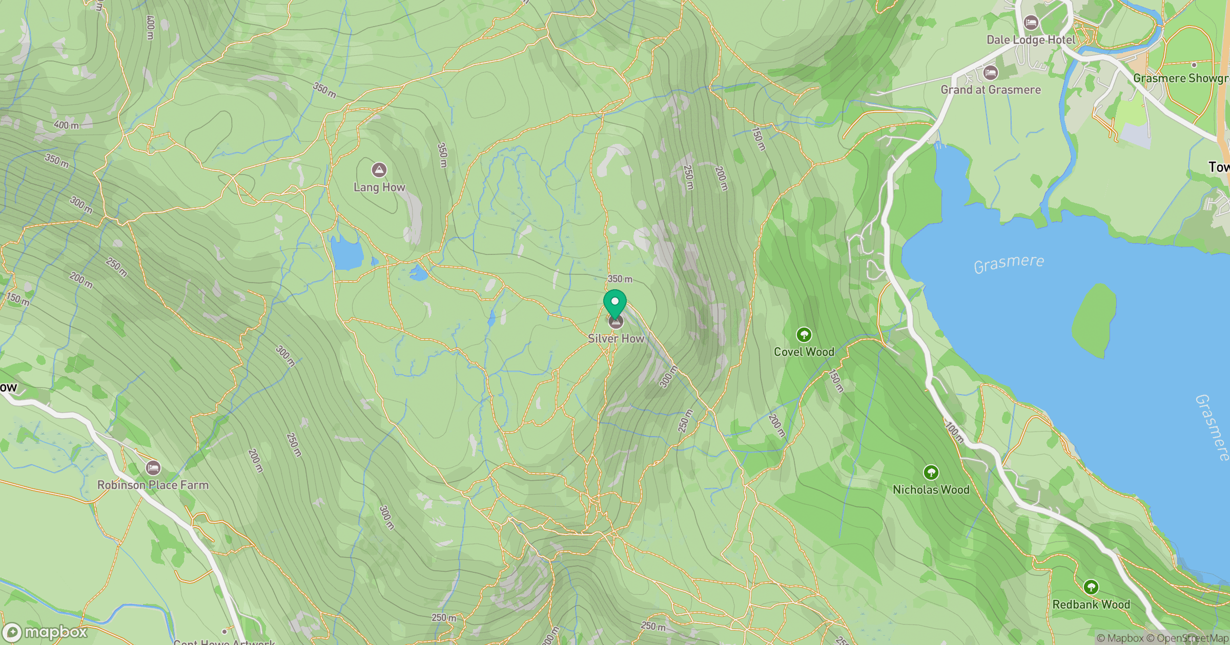
Grid reference: NY324066
View on OpenStreetMapOpens a map in a new tab, centred on the hill.
No comments yet. Be the first.