

Shaftoe Crags
Good walks are even better shared.
NZ0581 : Rocks at Shaftoe Crags
Andrew Curtis Photo source
Overview
Shaftoe Crags are sandstone outcrops in Northumberland. The mapped Bolam Lake and Shaftoe Crags walk links the lake with the crags on an 11.1 km circular route; check its map and access notes before setting off.
Sandstone country
Shaftoe Crags rise above the farmland of rural Northumberland, with exposed rock, grassy ground and open views. The crags are a destination in their own right, while the mapped Bolam Lake circuit combines them with a lakeside walk. These are different outings: a short stroll beside the lake should not be confused with the longer route to the crags.
Geology and rock formations
The rocks are sandstone, known geologically as the Shaftoe Grits. They formed from sand deposited by ancient river systems. The British Geological Survey describes coarse grains, locally pebbly layers and cross-bedding, the inclined layers left by moving sediment. Weathering has helped give the outcrops their distinctive shapes.
Named formations in the crags include the Piper’s Chair and Punch Bowl. The BGS also records a large fallen sandstone block called the Tailor and his Man below the escarpment. These names describe features across the crags; they are not a promise that every mapped walking route visits each one. See the BGS account of the Morpeth district for the geological background.
Walking from Bolam Lake
The Bolam Lake and Shaftoe Crags circular walk is approximately 11.1 km (6.9 miles), with an estimated walking time of three and a half hours before longer stops. Its map links woodland and lakeside paths with lanes, tracks and open ground. Road sections are part of the outing, so allow for traffic as well as the climb towards the rocks.
Use the route’s own map and starting-point directions when planning this circuit. The hill’s location marker identifies the hill, not a parking space or a complete set of walking directions. Route length and time apply to that particular circuit, rather than every possible visit to Shaftoe Crags.
Parking, facilities and access
For the mapped circuit, check Northumberland County Council’s Bolam Lake visitor information. The park has three car parks, with opening hours and charges to check before travelling. Gates close at dusk; leave enough time to return before the closure time shown on the signs.
The café and toilets are at Boathouse Wood, by the lake, rather than at the crags. Check their opening times separately. The council lists no direct public transport to the park, so any bus-based trip needs a separately planned connection to the start.
The accessible circuit around Bolam Lake is about one mile long. Its wheelchair and pushchair access does not extend automatically to the longer Shaftoe Crags route. Keep dogs under control around wildlife and livestock.
Archaeology in the wider landscape
At Salters Nick, north-east of Shaftoe Grange, a scheduled monument preserves a Romano-British settlement and evidence interpreted as a possible earlier Iron Age settlement. Historic England describes an enclosure using the crag edge for natural defence, with remains of stone-founded circular houses inside. The remains offer evidence of how people occupied and adapted this landscape.
The Historic England record gives the monument’s location and archaeological description. Its presence in the wider area does not mean that it is a stop on the Bolam Lake circuit, or establish permission to leave public paths. Respect archaeological remains and local access signs.
Conditions and preparation
Expect uneven rock and open ground as well as the easier paths around the lake. Wear suitable footwear, check the weather and take a map you can use away from a mobile signal. Keep back from exposed edges, particularly in wet or windy conditions. Views depend on visibility, and a low hill can still feel exposed in poor weather.
Plan for the full distance, daylight and the car park’s closing time. For a group outing, agree the route and pace in advance; the longer circular walk requires more time and effort than a lakeside stroll.
Explore routes near Shaftoe Crags
Walks starting near this hill. Open a route to check its map, distance and full itinerary.
Bolam Lake Lakeside Circuit
View route
Bolam Lake and Shaftoe Crags Walk: Circular Route
View route
Wallington - National Trust via kids playground
View route
Wallington River and Woodland Walk
View route
Route planning notes
These notes describe possible approaches. Check a route's map and access information when planning your walk.
Bolam Lake and Shaftoe Crags Walk
The existing mapped circular route links Bolam Lake with Shaftoe Crags using woodland paths, lanes and tracks. There is road walking as well as open ground; use the route map for the full circuit.
Make a day of it, together
Find someone to share the walk with, or organise a day out along a route you like.
Photo Gallery
View all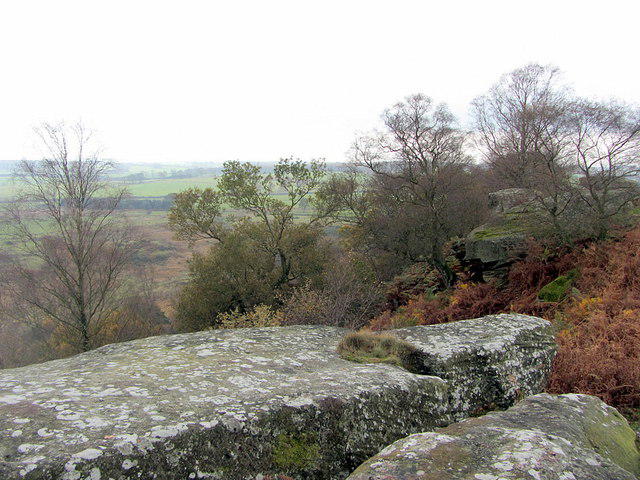 Photo could not load
NZ0581 : Rocks at Shaftoe Crags
Andrew Curtis
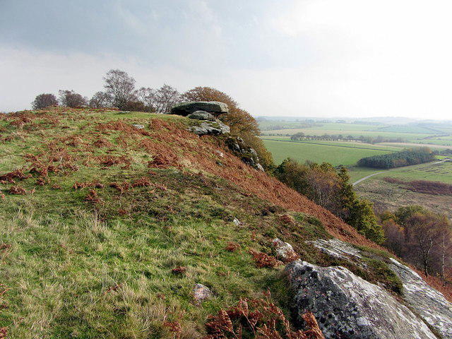 Photo could not load
NZ0581 : Piper's Chair from the west
Andrew Curtis
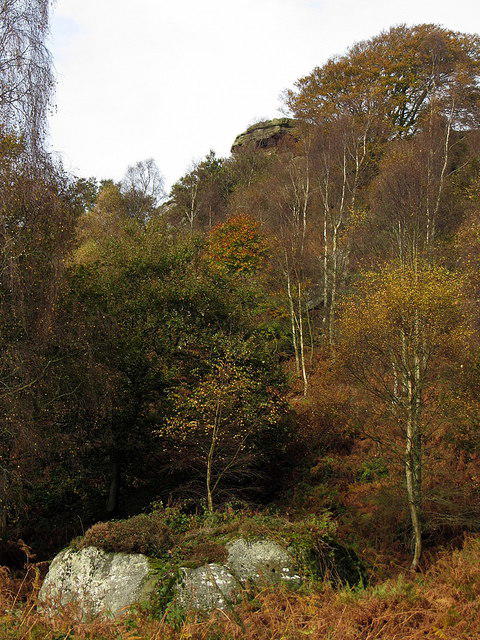 Photo could not load
NZ0581 : Shaftoe Crags from below
Andrew Curtis
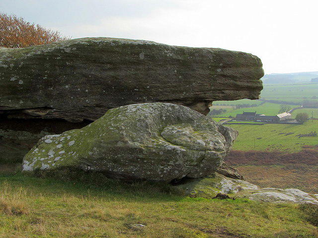 Photo could not load
NZ0581 : Piper's Chair & The Punch Bowl above Shaftoe Crags
Andrew Curtis
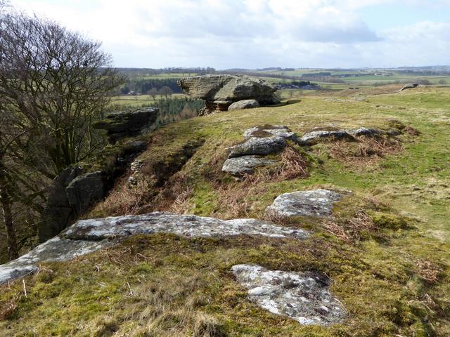 Photo could not load
NZ0581 : Piper's Chair and the Devil's Punchbowl
Oliver Dixon
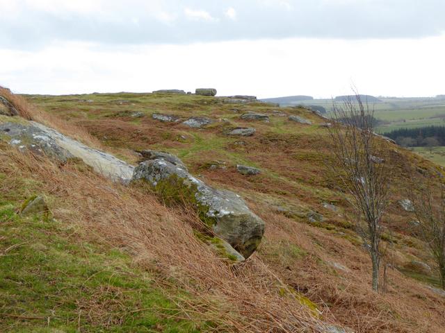 Photo could not load
NZ0581 : Moorland near the Piper's Chair
Oliver Dixon
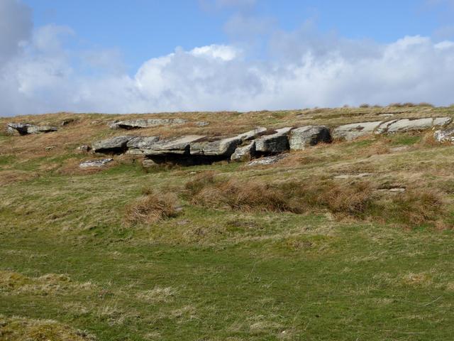 Photo could not load
NZ0581 : Overhanging rocks at Shaftoe Crags
Oliver Dixon
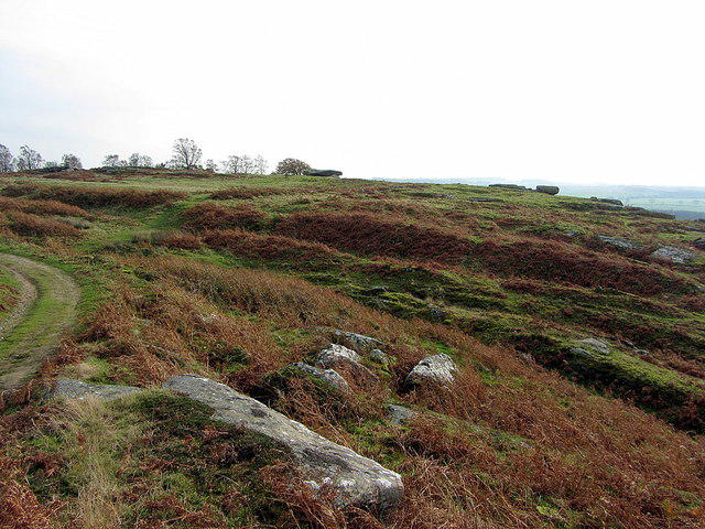 Photo could not load
NZ0581 : Iron Age Defended Settlement, Shaftoe Crags
Andrew Curtis
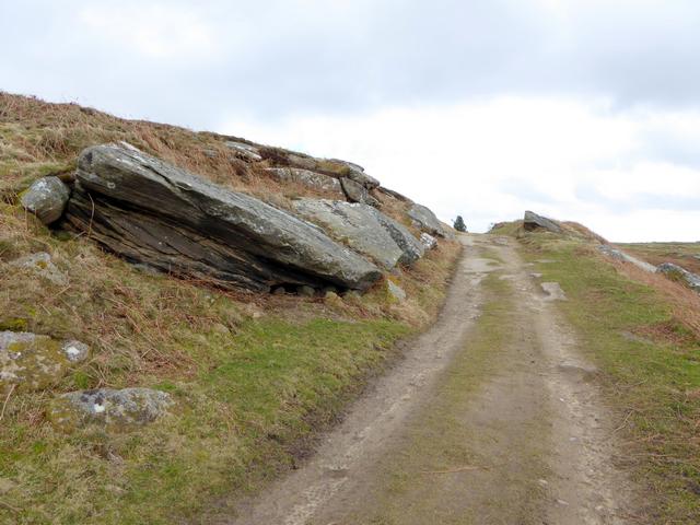 Photo could not load
NZ0581 : Track on Shaftoe Crags
Oliver Dixon
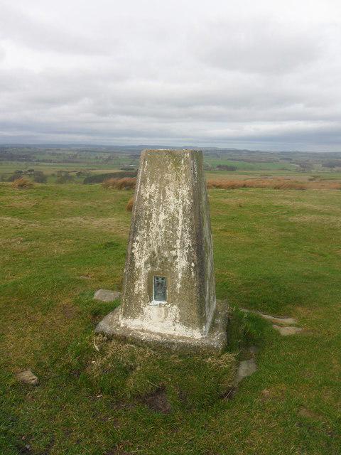 Photo could not load
NZ0581 : Shaftoe Crags Triangulation Pillar
Anthony Foster
Hill facts and local notes
Classifications
Elevation
213m
699 ft
Prominence
48m
Coordinates
55.1313, -1.9215
NZ051818
OS Map
81
Explorer: OL42E
At the Summit
The summit is marked by an impressive rocky outcrop, a few sparse grass tufts, and panoramic views that can easily make you forget the climb.
Terrain & Geology
The crags are formed from sandstone of the Shaftoe Grits. The British Geological Survey describes these sandstone beds in its geology of the Morpeth district; the outcrops are not volcanic dolerite.
Views & Scenery
The crags offer views across the surrounding Northumberland countryside. Visibility and the character of the outing depend on the weather; take care around exposed rock and uneven ground.
History & Heritage
Historical Significance
The wider Shaftoe area includes a scheduled Iron Age defended settlement and Romano-British settlement at Salters Nick, north-east of Shaftoe Grange. Historic England records this archaeology; it does not establish that the monument is a stop on the mapped Bolam Lake route.
Getting There & Facilities
Parking
For the mapped Bolam Lake and Shaftoe Crags route, use the Bolam Lake Country Park parking arrangements. The council lists three car parks, with charges and closing times shown on signs. They are locked at dusk, so allow time to return before closing.
Public Transport
The council lists no direct public transport to Bolam Lake Country Park. If using a bus to a nearby settlement, check the current timetable and plan the complete connection to the mapped start; do not assume a bus reaches the park or crags.
Nearby Facilities
Toilets and a cafe are at Boathouse Wood in Bolam Lake Country Park. Check their current opening before depending on them. They are at the lake, rather than facilities on the crags.
Safety Information
Known Hazards
- Watch out for loose rocks, especially during wet weather. Muddier patches may also surprise you if you're not paying attention.
General Safety Tips
- Check weather conditions before setting out
- Carry appropriate clothing and equipment
- Let someone know your planned route
- Take a map, compass, and GPS device
- Carry emergency supplies: food, water, first aid kit, torch
Hills
Some common questions about the hills answered
Are there group walks up Shaftoe Crags?
Many walkers use Walkmates to join or organise walks with others. You can check for group walks around Shaftoe Crags through the maps
Are there other walkers around Shaftoe Crags?
Activity varies by location and time, but Walkmates lets you see whether others have shared walks or shown interest in this area. Find other people through the walking friends search walking friends for Shaftoe Crags search or of course create your own walk for Shaftoe Crags
Can I organise a walk to Shaftoe Crags?
Yes. If there aren’t any walks listed already, you can create a walk and make it available for others to join.
If you're signed up to Walkmates, you can create a walk to Shaftoe Crags.
How do I find a walk up this hill?
There are often multiple ways to walk this hill, depending on experience and route preference. Walkmates helps you explore walks and routes that others have shared.
Can I suggest a new route up Shaftoe Crags?
Yes. You can suggest or create routes to share with others. Walkmates focuses on the social side of walking, so routes are used to help people organise walks and explore areas together, rather than as detailed navigation tools or route libraries.
Other uses really appreciate knowledgeable walkers sharing their routes. Share your favourite route to Shaftoe Crags here
The is an error or something incorrect about this hill. How do I let you know?
We always strive to keep the information on Walkmates as accurate as possible. If you find an error, please let us know through the contact form and we'll aim to correct it as quickly as possible
Community Discussion
Comments
Location
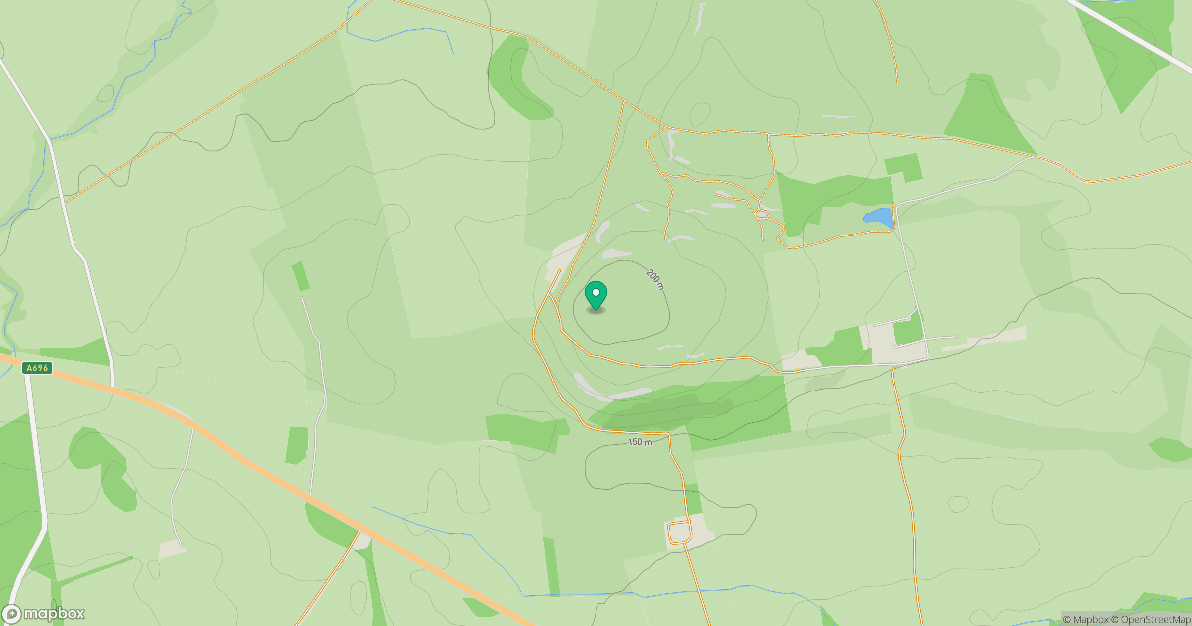
Grid reference: NZ051818
View on OpenStreetMapOpens a map in a new tab, centred on the hill.


No comments yet. Be the first.