

Sedgley Beacon (boundary)
Good walks are even better shared.
SO9294 : Two Masts and a Tower
Gordon Griffiths Photo source
Overview
Sedgley Beacon (boundary)
Overview
Sedgley Beacon stands proudly in the West Midlands, reaching an elevation of 168 meters. It is classified as a Marilyn due to its relative height and prominence, making it a favourite destination for casual hikers and nature lovers alike.
Geology
The mountain’s geology consists primarily of sandstone. The terrain features rolling hills and lush greenery, typical of the West Midlands region. When wet, the clayey soil can feel a tad squelchy underfoot, so do wear sturdy footwear unless you'd like a spontaneous mud facial.
Routes
The most popular route to the summit is the Sedgley Beacon Circular Walk, which spans about 4 kilometers and takes approximately 1.5 hours to complete. This easy trail is perfect for families and offers a chance to soak in the stunning scenery without breaking much of a sweat.
Summit Features
At the peak, hikers are greeted by a trig point, which serves as an excellent landmark for those needing to mark their territory...or simply take a group photo. The viewpoint is particularly picturesque, allowing for memorable snaps.
Terrain
The terrain around Sedgley Beacon is primarily grassy with some rocky patches, making it accessible for all fitness levels. Well-marked paths guide you straight to the top, along with a few cheeky hills to keep your heart pumping.
Views
Once at the summit, prepare to be captivated by the breathtaking views of the Black Country and—on clear days—the far-off Birmingham skyline. To catch the best sights, aim for spring or autumn, when the visibility is at its best.
Hazards
Though not treacherous, hikers should be wary of muddy spots, especially after a downpour. You wouldn’t want to end up with muddy socks—unless you're into that sort of thing!
Access
For those driving, parking is easily found at the Sedgley Park Visitor Centre. If public transport is more your style, regular bus services connect Sedgley with Wolverhampton and Dudley.
Facilities
Before or after your adventure, take advantage of local facilities at Sedgley Park—grab a coffee or use the public toilets to ensure you’re all set for your journey.
History
The name 'Sedgley' has its roots in Old English, referring to ‘sedge land’, which hints at the marshy areas of yesteryears. Historically, this beacon has played a role in local defence during the English Civil War, a significant piece of regional history that resonates with many locals.
Conclusion
Sedgley Beacon is a gem of the West Midlands, offering an accessible adventure with rich history and stunning views. Whether you’re a seasoned hiker or just looking for a peaceful stroll, Sedgley has something to offer everyone. Just don't forget to pack a camera!
Explore routes near Sedgley Beacon (boundary)
Walks starting near this hill. Open a route to check its map, distance and full itinerary.
Baggeridge Country Park: Bag Pool, Wishing Pools and woodland circuit
View route
Wombourne to Castlecroft: South Staffordshire Railway Walk
View route
Clent Hills: Buzzard Trail and Four Stones
View route
Kinver Edge: Centenary woodland and hillfort circuit
View route
Route planning notes
These notes describe possible approaches. Check a route's map and access information when planning your walk.
Sedgley Beacon Circular Walk
A circular walk starting from Sedgley with scenic views and an easy elevation gain, suitable for all abilities.
Make a day of it, together
Find someone to share the walk with, or organise a day out along a route you like.
Photo Gallery
View all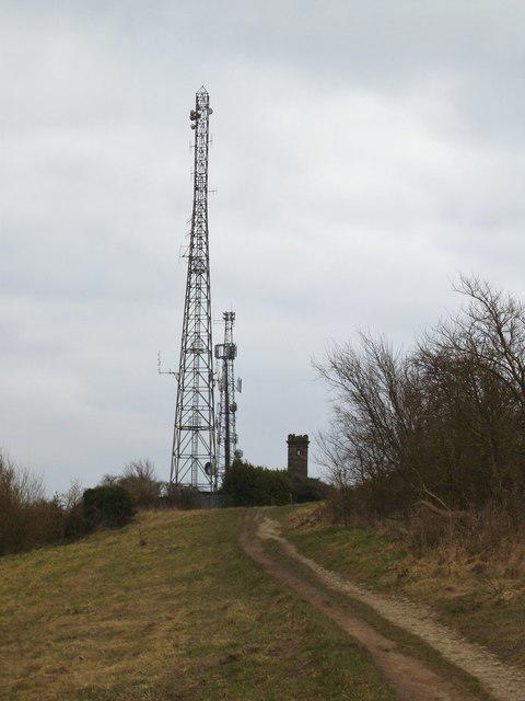 Photo could not load
SO9294 : Two Masts and a Tower
Gordon Griffiths
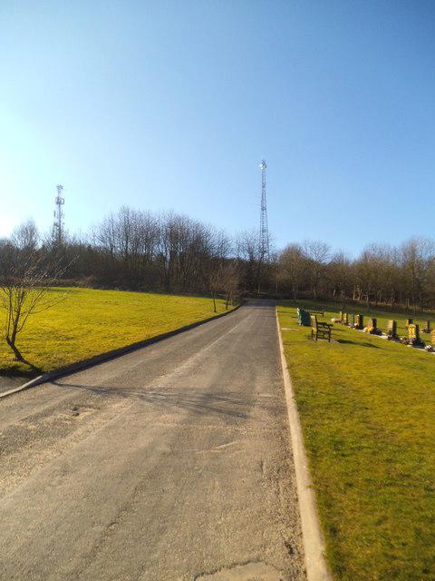 Photo could not load
SO9294 : Cemetery Path
Gordon Griffiths
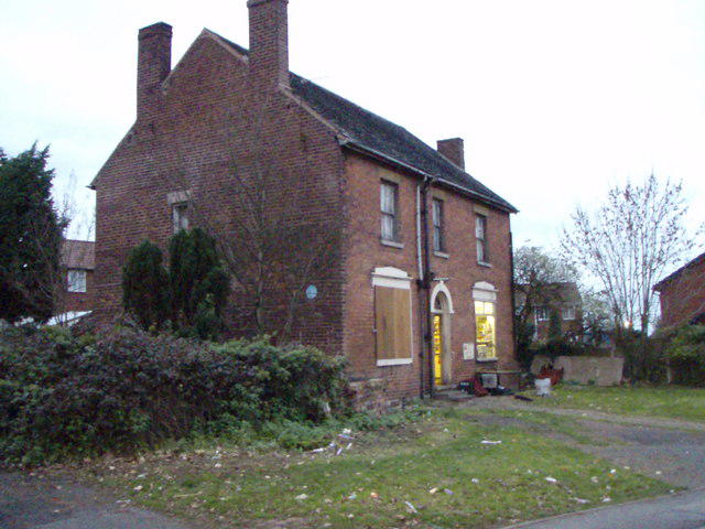 Photo could not load
SO9294 : Old shop in Bath St, Sedgley
David Bowen
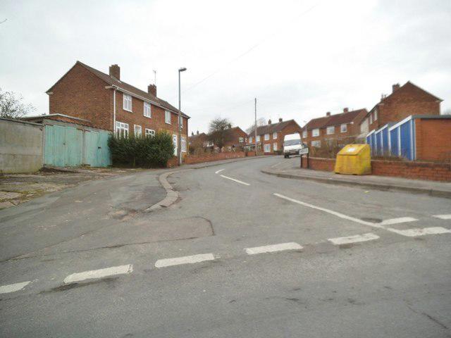 Photo could not load
SO9294 : Lyndon Close
Gordon Griffiths
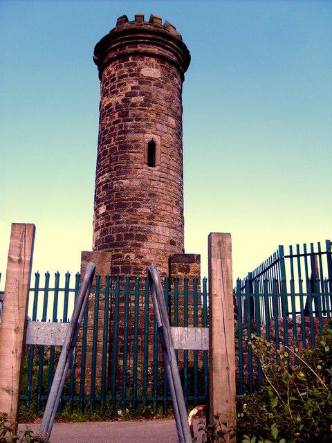 Photo could not load
SO9294 : Sedgley Tower
Gordon Griffiths
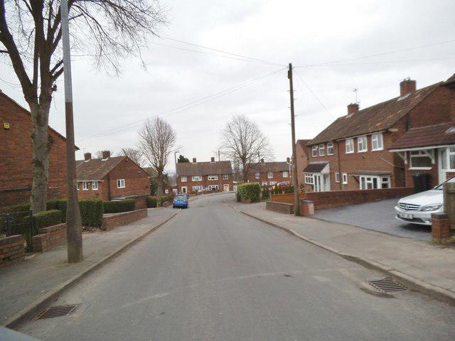 Photo could not load
SO9294 : Monument Lane Scene
Gordon Griffiths
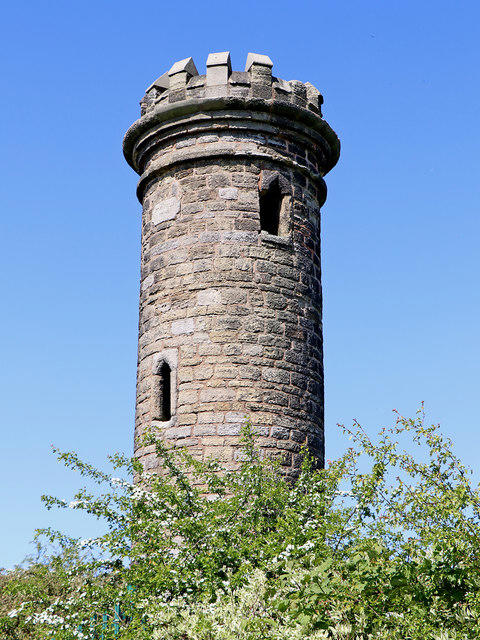 Photo could not load
SO9294 : Tower on Beacon Hill near Sedgley, Dudley
Roger D Kidd
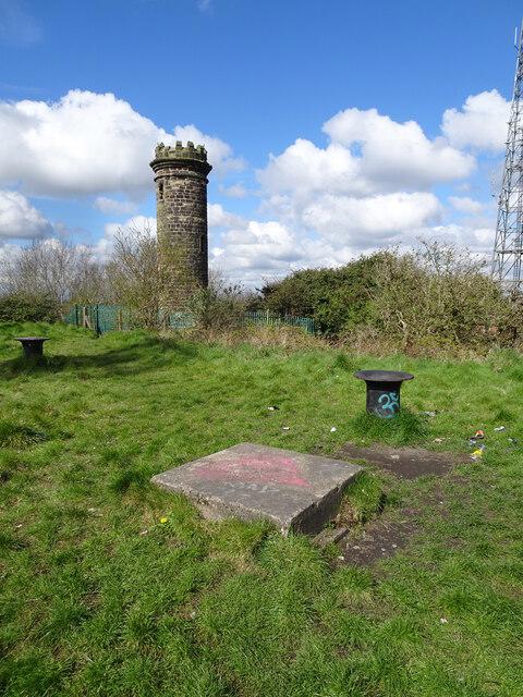 Photo could not load
SO9294 : Beacon Folly
Gordon Griffiths
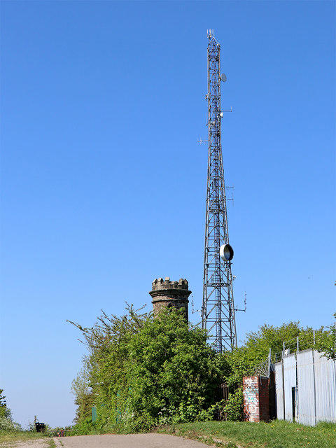 Photo could not load
SO9294 : Tower and mast on Beacon Hill near Sedgley, Dudley
Roger D Kidd
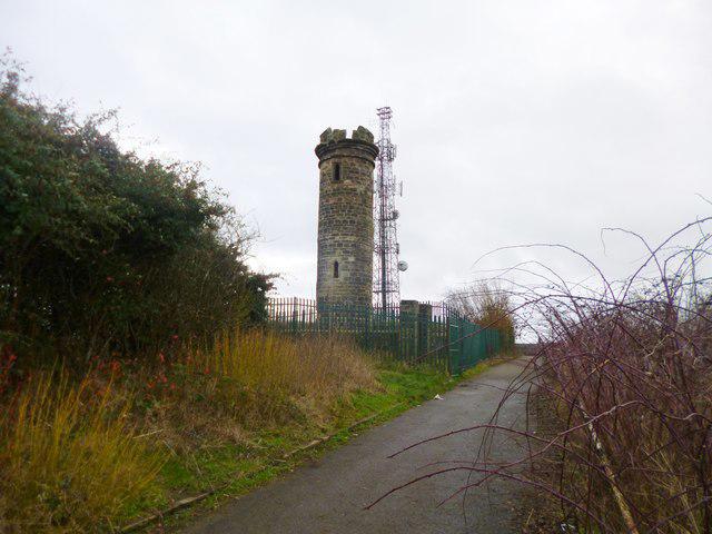
SO9294 : Sedgley, tower
Mike Faherty
Hill facts and local notes
Classifications
Elevation
232m
761 ft
Prominence
0m
Coordinates
52.5473, -2.1145
SO923943
OS Map
139
Explorer: 219N
At the Summit
The summit features a prominent trig point, which offers a perfect photo opportunity for both seasoned hikers and social media enthusiasts alike.
Terrain & Geology
The area is primarily underlain by sandstone, giving rise to relatively stable but slightly undulating terrain. The soil is primarily clayey loam, leading to lush greenery during the rainy seasons.
Views & Scenery
From the summit, visitors can enjoy stunning views of the surrounding Black Country, with distant glimpses of the Birmingham skyline and the Clent Hills.
History & Heritage
Name Origin
The name 'Sedgley' derives from the Old English 'saege', meaning 'sedge land', indicating the marshy conditions that would have existed in the area more than a millennium ago.
Historical Significance
Sedgley Beacon is a historical site with a rich heritage, once part of the defence system during the English Civil War and a notable landmark for locals.
Getting There & Facilities
Parking
Free parking available at Sedgley Park Visitor Centre, located just a short walk from the trailhead.
Public Transport
Regular bus services from Wolverhampton and Dudley make getting to Sedgley easy. Check local timetables for the latest routes.
Nearby Facilities
Cafes and public toilets are available at Sedgley Park; ideal for a pre-hike coffee stop!
Safety Information
Known Hazards
- Watch out for muddy patches on rainy days; it's not a high mountain, but you may still find yourself sinking into the earth as if it were a welcoming hug!
General Safety Tips
- Check weather conditions before setting out
- Carry appropriate clothing and equipment
- Let someone know your planned route
- Take a map, compass, and GPS device
- Carry emergency supplies: food, water, first aid kit, torch
Hills
Some common questions about the hills answered
Are there group walks up Sedgley Beacon (boundary)?
Many walkers use Walkmates to join or organise walks with others. You can check for group walks around Sedgley Beacon (boundary) through the maps
Are there other walkers around Sedgley Beacon (boundary)?
Activity varies by location and time, but Walkmates lets you see whether others have shared walks or shown interest in this area. Find other people through the walking friends search walking friends for Sedgley Beacon (boundary) search or of course create your own walk for Sedgley Beacon (boundary)
Can I organise a walk to Sedgley Beacon (boundary)?
Yes. If there aren’t any walks listed already, you can create a walk and make it available for others to join.
If you're signed up to Walkmates, you can create a walk to Sedgley Beacon (boundary).
How do I find a walk up this hill?
There are often multiple ways to walk this hill, depending on experience and route preference. Walkmates helps you explore walks and routes that others have shared.
Can I suggest a new route up Sedgley Beacon (boundary)?
Yes. You can suggest or create routes to share with others. Walkmates focuses on the social side of walking, so routes are used to help people organise walks and explore areas together, rather than as detailed navigation tools or route libraries.
Other uses really appreciate knowledgeable walkers sharing their routes. Share your favourite route to Sedgley Beacon (boundary) here
The is an error or something incorrect about this hill. How do I let you know?
We always strive to keep the information on Walkmates as accurate as possible. If you find an error, please let us know through the contact form and we'll aim to correct it as quickly as possible
Community Discussion
Comments
Location
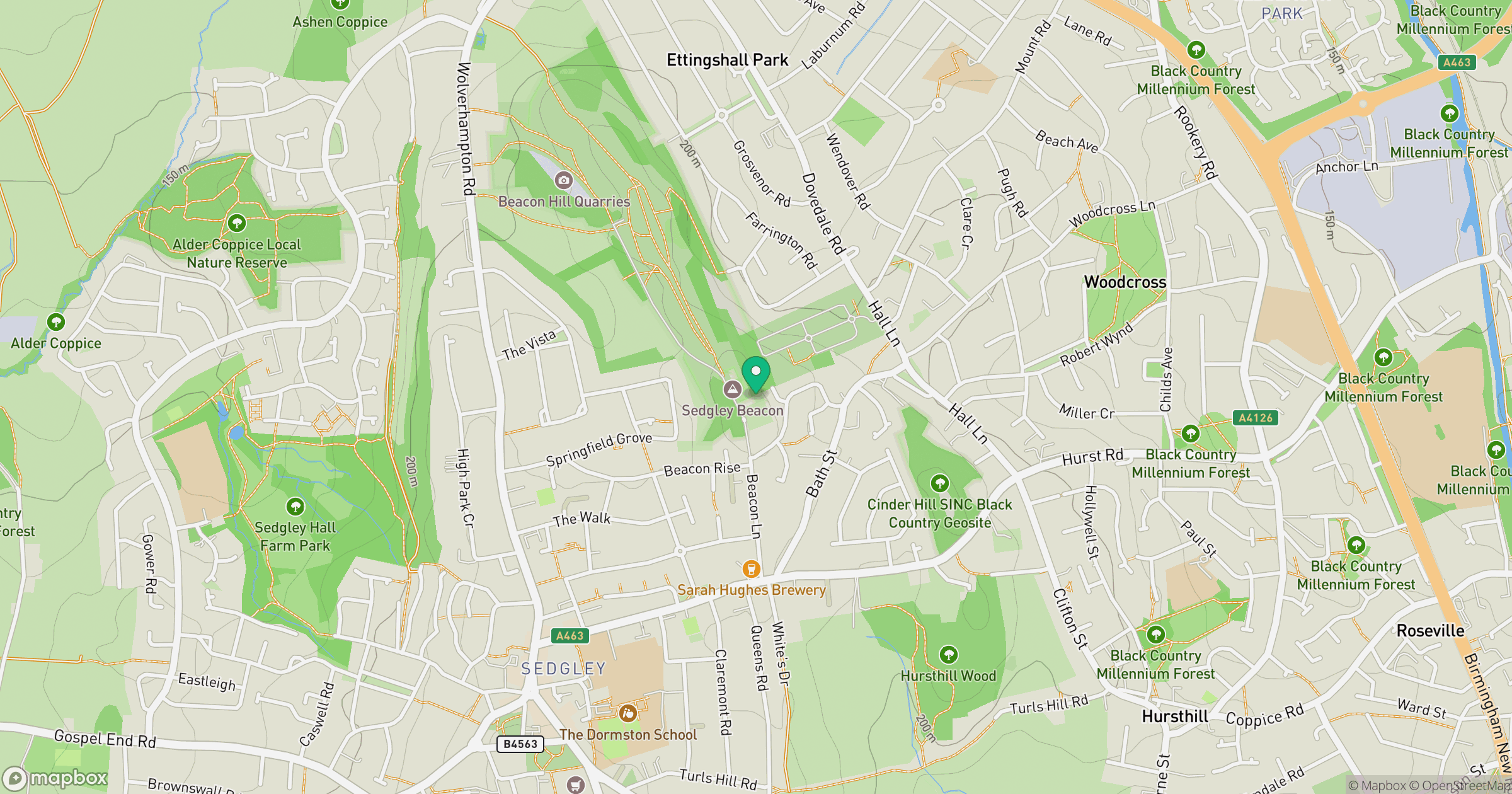
Grid reference: SO923943
View on OpenStreetMapOpens a map in a new tab, centred on the hill.
Nearby Hills

The Wrekin
407m
Worcestershire Beacon
425m
Titterstone Clee Hill
533m
The Roaches
505m
Long Mynd - Pole Bank
517m
No comments yet. Be the first.