

Sand Field
Good walks are even better shared.
Overview
Sand Field: An Overview
Nestled in the beautiful Southern Uplands, Sand Field is a delightful spot for those seeking a moderate hike with stunning vistas. Standing at an elevation of 267 meters, it’s a perfect challenge for both novice and seasoned hikers alike.
Geology
The underlying geology of Sand Field consists mainly of sedimentary sandstone. This rock type has shaped the landscape significantly, creating soft rolling hills that are inviting but can pose some muddy challenges, especially after the rain. Keeping your footing is paramount.
Routes
The recommended route is the Hare Hill Circuit, a loop that begins at a small layby on the B7078. This moderate hike spans about 5.6 km and typically takes around 2.5 hours to complete. Don’t forget your snacks – a summit break is the cherry on top!
Summit Features
Upon reaching the summit, you’ll be greeted by a quaint stone cairn. Don’t miss the photo opportunity—after all, if it’s not on social media, did you really climb it? The view stretches across the Southern Uplands and even glimpses into the Lake District on the horizon.
Terrain Type
Expect grassy trails, interspersed with rocky areas and the occasional bog that tests your balance. Suitable footwear is a must—pick your steps wisely!
Views
From the top, gaze upon the rolling hills and verdant valleys. The best seasons for these sights are during Spring and Autumn when nature’s palette is at its most striking.
Hazards
Watch for slippery patches post-rain and the elusive sheep that may dart out from nowhere. They have a sixth sense about hikers, it seems.
Nearby Summits
For those keen on extending their adventure, nearby summits like Hare Hill (380m) and Black Hill (560m) offer additional hikes that can quench your thirst for altitude.
Access
The nearest parking is a small layby along the B7078, and public transport is somewhat limited to regional buses stopping in Abington, the closest town. Prepare for a scenic and rustic day out!
Facilities
Once you’ve conquered Sand Field, make your way back to Abington for a warm cup of tea and maybe a scone or two. Public toilets are available here as well.
History
The name 'Sand Field' eloquently reflects the local geology. While it may not be at the forefront of British history, it's woven into the rural tapestry that showcases Scotland’s pastoral beauty.
So lace up those hiking boots, grab a friend (you know, for morale), and set out to conquer Sand Field. It'll be a day well spent on the hills!
Explore routes near Sand Field
Public walks starting within 80 km of this hill. Nearby does not mean a route reaches the summit; check its map and access before setting out.
No public routes are currently listed within 80 km of Sand Field on Walkmates. This does not mean there are no paths here. Explore the map and check local access information before planning a walk.
Route planning notes
These notes describe possible approaches, not verified navigable routes or permission to cross land. Check current paths, local access rules and conditions before setting out.
Hare Hill Circuit
A scenic loop that starts at a nearby base and takes you around the contours of Sand Field, offering diverse landscapes and local wildlife.
Make a day of it, together
Find someone to share the walk with, or organise a day out along a route you like.
Photo Gallery
View all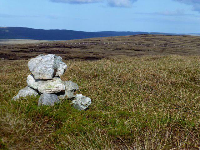 Photo could not load
HU3148 : Sand Field
Rude Health
Hill facts and local notes
Classifications
Elevation
136m
446 ft
Prominence
117m
Coordinates
60.2197, -1.4359
HU313485
OS Map
3
Explorer: 467W
At the Summit
The summit boasts a modest stone cairn, perfect for that quintessential 'I made it!' photo-op. On a clear day, the view can really take the breath away—just remember to breathe again after your triumphant summit pose.
Terrain & Geology
The region features sedimentary rock formations, with layers of sandstone that have eroded to create the gentle slopes of Sand Field. The geology is both interesting and significant, giving insight into the ancient sea that once covered this area.
Views & Scenery
From the summit, you can enjoy panoramic views of the rolling hills of the Southern Uplands and, on a clear day, catch sight of the distant peaks of the Lake District.
History & Heritage
Name Origin
The name 'Sand Field' is derived from the local geology, as sandy soil underlies many areas here.
Historical Significance
While not historically significant in a grand sense, the area has seen local agricultural development and is part of pastoral landscapes.
Getting There & Facilities
Check current local access restrictions, parking rules and transport timetables before travelling. These notes do not confirm public access to the summit.
Parking
There is a small layby on the B7078 road about 1 km from the start of the trail with room for a few cars.
Public Transport
The nearest bus stop is in the village of Abington, about 4 km away, serviced by regional buses.
Nearby Facilities
There are no facilities at the summit, but Abington offers a cafe and some public toilets for pre-hike refreshments.
Safety Information
Known Hazards
- Muddy paths can be tricky after rain, and the occasional sheep can surprise you if you’re not paying attention.
General Safety Tips
- Check weather conditions before setting out
- Carry appropriate clothing and equipment
- Let someone know your planned route
- Take a map, compass, and GPS device
- Carry emergency supplies: food, water, first aid kit, torch
Hills
Some common questions about the hills answered
Are there group walks up Sand Field?
Many walkers use Walkmates to join or organise walks with others. You can check for group walks around Sand Field through the maps
Are there other walkers around Sand Field?
Activity varies by location and time, but Walkmates lets you see whether others have shared walks or shown interest in this area. Find other people through the walking friends search walking friends for Sand Field search or of course create your own walk for Sand Field
Can I organise a walk to Sand Field?
Yes. If there aren’t any walks listed already, you can create a walk and make it available for others to join.
If you're signed up to Walkmates, you can create a walk to Sand Field.
How do I find a walk up this hill?
There are often multiple ways to walk this hill, depending on experience and route preference. Walkmates helps you explore walks and routes that others have shared.
Can I suggest a new route up Sand Field?
Yes. You can suggest or create routes to share with others. Walkmates focuses on the social side of walking, so routes are used to help people organise walks and explore areas together, rather than as detailed navigation tools or route libraries.
Other uses really appreciate knowledgeable walkers sharing their routes. Share your favourite route to Sand Field here
The is an error or something incorrect about this hill. How do I let you know?
We always strive to keep the information on Walkmates as accurate as possible. If you find an error, please let us know through the contact form and we'll aim to correct it as quickly as possible
Community Discussion
Comments
Location
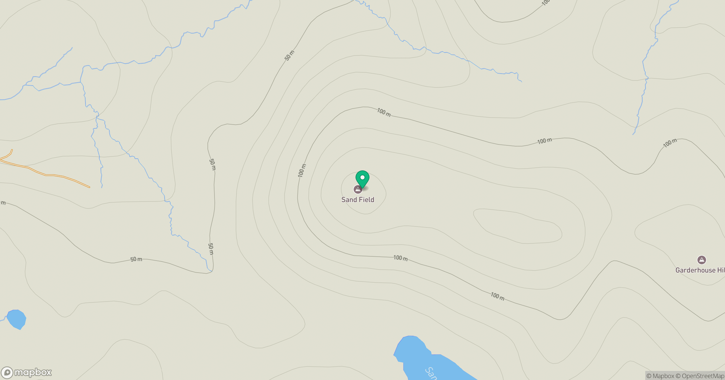
Grid reference: HU313485
View on OpenStreetMapOpens a map in a new tab, centred on the hill.
Hills within 30 km
Straight-line distance, not a walking route or confirmation of access.
Weisdale Hill
260m
Hill of Moustoft
176m
Hill of Hamarsland
158m
Sandness Hill
249m
Ward of Bressay
226m
No comments yet. Be the first.