

Pilot Hill
Good walks are even better shared.
SU3960 : Downland, East Woodhay
Andrew Smith Photo source
Overview
Pilot Hill: A Gentle Giant of the South Downs
Nestled within the breathtaking South Downs National Park, Pilot Hill stands proudly as one of the region's notable hills, reaching an elevation of 295 meters. If hills could talk, Pilot Hill would likely boast of its rich geology, composed mainly of chalk; a true testament to the natural history of Southern England.
Access and Routes
Easily accessible from the village of Weston, the most popular route is a classic ascent that meanders through charming countryside, ideal for young families and seasoned hikers alike. With a distance of approximately 4.5 km and an estimated time of 1.5 hours, it’s perfect for a leisurely afternoon excursion! Remember: No matter how briskly you go, this isn’t a race; the best things in life are savoured slowly.
Summit Features
Upon reaching the summit, hikers are greeted by a trig point. It stands there like a friendly sentinel, nodding along as you catch your breath and sip some well-deserved water. The views are nothing short of spectacular!
Stunning Views and Terrain
From the summit, sweeping vistas of the rolling hills of the South Downs greet you. On a clear day, the sea's vastitude can tempt you to grab a paddle... only to remember you’re not at the beach! The terrain varies from grassy slopes to chalky paths, making it suitable for a range of abilities. Just beware of those slippery patches after a rain shower – we wouldn’t want someone performing an impromptu slide!
Best Seasons for Views
The best time to appreciate the panoramic beauty is late spring, when blooming wildflowers sprinkle the hillsides, or in autumn, as the leaves don their vibrant cloaks of red and gold. A hill's truly glamorous transformation!
Nearby Summits
Adventurous hikers might consider exploring other nearby summits such as Beacon Hill and Butser Hill for an extended day of hill-hopping and some extra exercise to offset those tasty café treats.
Hazards to Consider
While seeking the beauty that Pilot Hill has to offer, do keep an eye on the weather, as it can change quicker than a cup of tea can brew. Also, the edge of the hill can be steep, so make sure to maintain a safe distance – it won’t be a laughing matter if you take a tumble!
Facilities
For a post-hike snack, the café in Weston is quaint, though availability may vary, hope springs eternal! For a more robust meal, the nearest town, Petersfield, offers a variety of eateries and shops to restock your supplies.
Pilot Hill is more than just a height; it's a community landmark that has been cherished by walkers for generations. So lace up those boots and make your way up – you won’t regret a minute spent on its paths.
Last Updated
Stay tuned; this write-up was last updated on 2023-10-08.
Source
Information gathered from the Ordnance Survey and local hiking guides.
Explore routes near Pilot Hill
Walks starting near this hill. Open a route to check its map, distance and full itinerary.
Newbury to Donnington Castle: Lambourn Valley Way via Speen and Bagnor
View route
Thatcham short birding stroll
View route
Thatcham short birding stroll
View route
Chiseldon to Barbury Shooting School Circular Walk
View route
Route planning notes
These notes describe possible approaches. Check a route's map and access information when planning your walk.
The Classic Ascent from the Village of Weston
A gentle ascent through picturesque countryside, this route offers lovely views as you make your way up to the summit.
Make a day of it, together
Find someone to share the walk with, or organise a day out along a route you like.
Photo Gallery
View all Photo could not load
SU3960 : Downland, East Woodhay
Andrew Smith
 Photo could not load
SU3960 : Trig Point 5548 Pilot
Damon Knight
Hill facts and local notes
Classifications
Elevation
286m
938 ft
Prominence
45m
Coordinates
51.3394, -1.4301
SU397601
OS Map
174
Explorer: 158
At the Summit
The summit is adorned with a trig point, a fine spot for a photo-op or a rest while taking in the scenery.
Terrain & Geology
Pilot Hill is primarily composed of chalk, characteristic of the South Downs, which is fun for geological enthusiasts. The exposed chalk faces are a testament to millions of years of natural history.
Views & Scenery
On a clear day, you can see the rolling hills of the South Downs stretching out before you, with views across to the sea in the distance.
History & Heritage
Name Origin
The name 'Pilot' may derive from its historical use as a navigational point for aircraft, given its prominence in the area.
Historical Significance
Pilot Hill has been a key site for local walkers and nature enthusiasts, playing a part in the area’s cultural landscape.
Getting There & Facilities
Parking
There’s a small car park located near the village of Weston, but be mindful of parking restrictions along the lanes.
Public Transport
Catch a bus to the village of Petersfield, then it's about a 15-minute taxi ride to the start of the trail.
Nearby Facilities
The village of Weston has a few facilities, including a small café and public toilets. Better facilities can be found in Petersfield.
Safety Information
Known Hazards
- Slippery when wet, and care should be taken near steep edges. Be wary of sudden weather changes typical of the British countryside.
General Safety Tips
- Check weather conditions before setting out
- Carry appropriate clothing and equipment
- Let someone know your planned route
- Take a map, compass, and GPS device
- Carry emergency supplies: food, water, first aid kit, torch
Hills
Some common questions about the hills answered
Are there group walks up Pilot Hill?
Many walkers use Walkmates to join or organise walks with others. You can check for group walks around Pilot Hill through the maps
Are there other walkers around Pilot Hill?
Activity varies by location and time, but Walkmates lets you see whether others have shared walks or shown interest in this area. Find other people through the walking friends search walking friends for Pilot Hill search or of course create your own walk for Pilot Hill
Can I organise a walk to Pilot Hill?
Yes. If there aren’t any walks listed already, you can create a walk and make it available for others to join.
If you're signed up to Walkmates, you can create a walk to Pilot Hill.
How do I find a walk up this hill?
There are often multiple ways to walk this hill, depending on experience and route preference. Walkmates helps you explore walks and routes that others have shared.
Can I suggest a new route up Pilot Hill?
Yes. You can suggest or create routes to share with others. Walkmates focuses on the social side of walking, so routes are used to help people organise walks and explore areas together, rather than as detailed navigation tools or route libraries.
Other uses really appreciate knowledgeable walkers sharing their routes. Share your favourite route to Pilot Hill here
The is an error or something incorrect about this hill. How do I let you know?
We always strive to keep the information on Walkmates as accurate as possible. If you find an error, please let us know through the contact form and we'll aim to correct it as quickly as possible
Community Discussion
Comments
Location
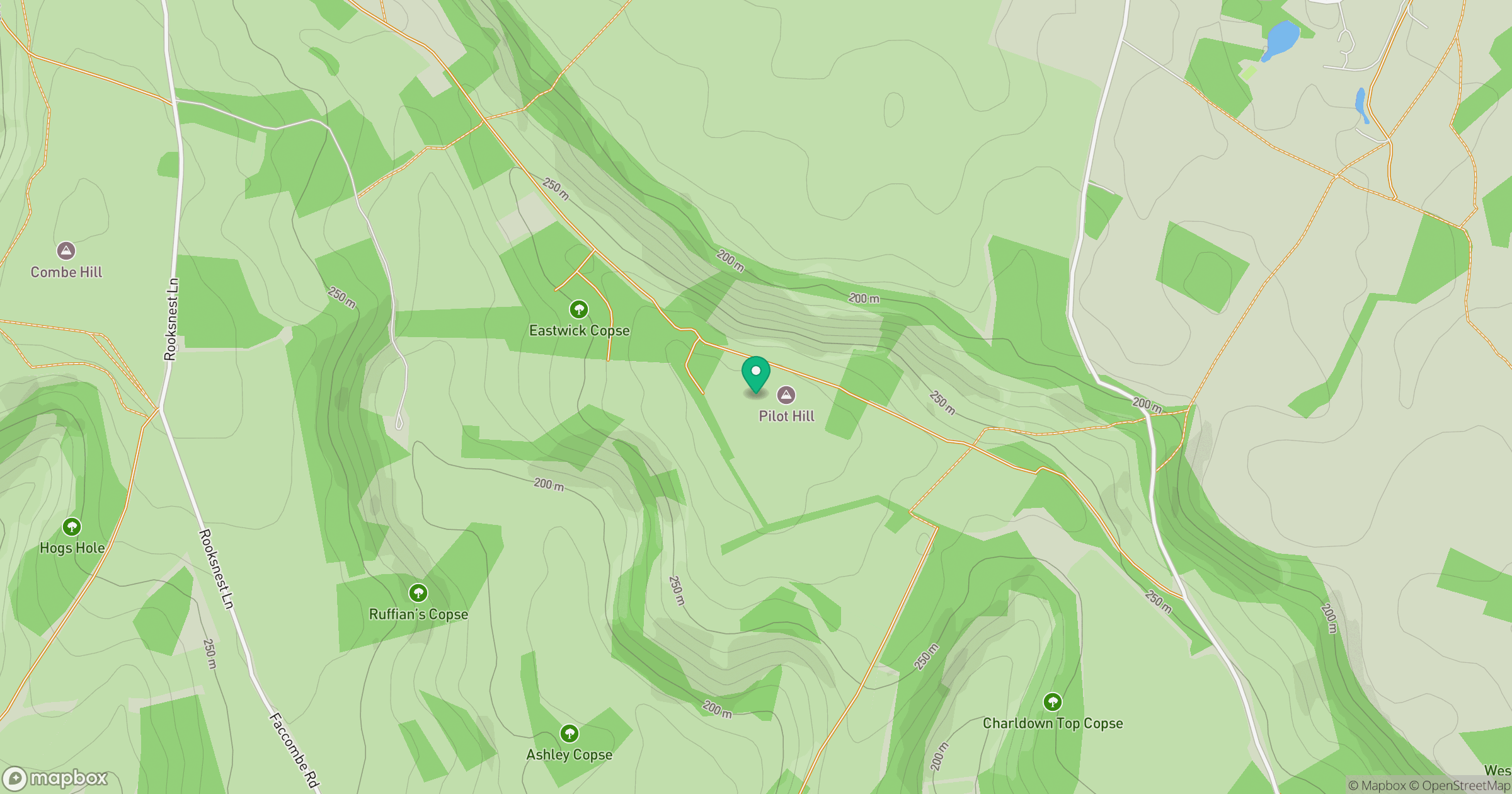
Grid reference: SU397601
View on OpenStreetMapOpens a map in a new tab, centred on the hill.
Nearby Hills
Leith Hill
294m
Worcestershire Beacon
425m
Glastonbury Tor
158m
Ditchling Beacon
248m
Titterstone Clee Hill
533m
No comments yet. Be the first.