

Penshaw Hill
Good walks are even better shared.
NZ3354 : Penshaw Monument
Alexander P Kapp Photo source
Overview
Penshaw Hill (136 m) is a limestone hill above Penshaw village in the City of Sunderland, Tyne and Wear. Grade I-listed Penshaw Monument stands at its summit, overlooking the Wear Valley. Steep steps lead up from Chester Road, with a longer woodland and riverside circuit on the National Trust’s Lambton Worm walk.
Penshaw Hill
Overview
Penshaw Hill rises to 136 m above Penshaw village in the City of Sunderland, Tyne and Wear. The roofless, Greek-style Penshaw Monument stands at the summit. The recorded high point is ground 4 m south of the monument's southwest corner.
Walking
For a direct summit visit, climb the steep steps from the foot of the hill beside Chester Road (A183), then return down the same steps. The National Trust also describes a gentler approach through the gate to the left of the main entrance.
The National Trust's Lambton Worm walk is a separate 4.16 km circuit, graded moderate, with a published duration of 1.5 hours. It visits the summit, woodland, fields and the River Wear, returning through Cox Green and uphill to the monument before descending to its starting point. The route includes stiles and road sections.
Walking to the hill summit does not include access to the monument's upper walkway. Visits to the top of the monument are separately booked guided events when offered; use the National Trust's event listings for available dates.
Terrain and safety
The main hill steps are steep and uneven and have no handrail. The circuit includes a road crossing, road walking and a riverside path. Keep dogs on a lead where livestock are grazing.
Landscape
The hill is part of the Durham Magnesian Limestone escarpment. Raisby Formation limestone and dolomite are exposed in the old quarry. Views take in the Wear Valley and Herrington Country Park; the Cheviot Hills and Durham Cathedral may be visible in clear weather. Wildflowers grow on the hill and quarry slopes in spring and summer, and Penshaw Wood has bluebells, wood anemones and wild garlic.
Access and facilities
Limited free roadside parking is available off Chester Road at the foot of the hill. Herrington Country Park offers additional parking across the A183 and has toilets. Penshaw Tea Room is near the hill's base, and Love Lily is in the country park. Go North East services 2 and 78 call at Chester Road-Penshaw Monument; consult the operator's timetable for your travel date.
History and name
The monument commemorates John George Lambton, 1st Earl of Durham. John and Benjamin Green designed it, and its foundation stone was laid on 28 August 1844. It is Grade I listed. Local folklore associates the hill with the Lambton Worm.
Penshaw is probably a Brittonic name. The first element means hill or summit; the second has been interpreted as rock. Early spellings such as Pencher do not support the familiar explanation of a hill by a wood.
Explore routes near Penshaw Hill
Walks starting near this hill. Open a route to check its map, distance and full itinerary.
Chester-le-Street Riverside and Town
View route
Seaham Upper Promenade to Tommy
View route
Ouseburn walk with Men Walking & Talking
View route
Collingwood history walk: Bridge Hotel to Discovery Museum
View route
Route planning notes
These notes describe possible approaches. Check a route's map and access information when planning your walk.
Penshaw Monument's Lambton Worm walk
Start and finish at the foot of Penshaw Hill beside the A183. Climb the main steps to the monument, go left around its base, then descend the woodland steps. Turn left, pass the gate, ignore the first right-hand woodland gate and use the later right-hand stile into the fields. Cross the road and follow the yellow-marked field-edge path via the gate and stile. Beyond the next gate, turn right past the barn, keep left at the woodland fork, then go left downhill to the Wear. Follow the river rightwards through Cox Green. After the small wooden footbridge, turn right up the woodland steps. Bear left through Woodhouse Livery's yard and up the road beside the golf course. At the left bend, take the right-hand footpath gate across the field into woods. Pass the first left-hand steps, use the next set, and follow the middle path towards the monument. Descend the main hill steps to the original starting point. The National Trust gives 4.16 km and 1.5 hours for this complete circuit.
Make a day of it, together
Find someone to share the walk with, or organise a day out along a route you like.
Photo Gallery
View all Photo could not load
NZ3354 : Penshaw Monument
Alexander P Kapp
 Photo could not load
NZ3354 : Penshaw Monument And Sign
Keith Evans
 Photo could not load
NZ3354 : Penshaw Monument (Earl of Durham's Monument)
G Laird
 Photo could not load
NZ3354 : Penshaw Monument (Earl of Durham's Monument)
G Laird
 Photo could not load
NZ3354 : Penshaw Monument
Malc McDonald
 Photo could not load
NZ3354 : Penshaw Monument
Andrew Curtis
 Photo could not load
NZ3354 : Penshaw Monument
Alexander P Kapp
 Photo could not load
NZ3354 : Penshaw Monument
Richard Cooke
 Photo could not load
NZ3354 : Penshaw Monument interior
Graham Hogg

NZ3354 : Penshaw Monument
Alexander P Kapp
Hill facts and local notes
Classifications
Elevation
136m
446 ft
Prominence
52m
Coordinates
54.8830, -1.4812
NZ333543
OS Map
88
Explorer: 308
At the Summit
Penshaw Monument is a roofless, Greek-style memorial on the summit. The recorded high point is ground 4 m south of its southwest corner. Walking to the hilltop does not include access to the monument’s upper walkway, which is a separate booked guided-tour activity when offered.
Terrain & Geology
Penshaw Hill forms part of the Durham Magnesian Limestone escarpment. Permian limestone and dolomite of the Raisby Formation are exposed in the disused Penshaw Hill Quarry.
Views & Scenery
Views over the Wear Valley and Herrington Country Park; in clear conditions the Cheviot Hills and Durham Cathedral may be visible.
Best Seasons
Spring and summer bring wildflowers to the hill and quarry slopes. Penshaw Wood has bluebells, wood anemones and wild garlic.
History & Heritage
Name Origin
Penshaw is probably Brittonic: pen means hill or summit, and the second element has been interpreted as carr, rock. Early forms include Pencher. The common explanation of a hill by a wood does not fit those early spellings.
Historical Significance
Penshaw Monument commemorates John George Lambton, 1st Earl of Durham. Designed by John and Benjamin Green in the Greek Revival style, its foundation stone was laid on 28 August 1844. The monument has been Grade I listed since 1950.
Getting There & Facilities
Parking
Limited free roadside parking is available off Chester Road (A183) at the foot of Penshaw Hill. There is additional parking at Herrington Country Park across the A183.
Public Transport
Go North East services 2 and 78 stop at Chester Road-Penshaw Monument. Service 2 links Sunderland and Washington; service 78 links Sunderland, Chester-le-Street and Consett. Check the operator’s timetable for your travel date.
Nearby Facilities
Toilets are available at nearby Herrington Country Park, across the A183. Refreshments are available at Penshaw Tea Room near the hill’s base and at Love Lily in the country park.
Safety Information
Known Hazards
- The direct summit climb has steep, uneven steps without a handrail.
- The Lambton Worm circuit includes stiles, a road crossing, road walking and paths beside the River Wear.
- Keep dogs on a lead where livestock are grazing.
General Safety Tips
- Check weather conditions before setting out
- Carry appropriate clothing and equipment
- Let someone know your planned route
- Take a map, compass, and GPS device
- Carry emergency supplies: food, water, first aid kit, torch
Hills
Some common questions about the hills answered
Are there group walks up Penshaw Hill?
Many walkers use Walkmates to join or organise walks with others. You can check for group walks around Penshaw Hill through the maps
Are there other walkers around Penshaw Hill?
Activity varies by location and time, but Walkmates lets you see whether others have shared walks or shown interest in this area. Find other people through the walking friends search walking friends for Penshaw Hill search or of course create your own walk for Penshaw Hill
Can I organise a walk to Penshaw Hill?
Yes. If there aren’t any walks listed already, you can create a walk and make it available for others to join.
If you're signed up to Walkmates, you can create a walk to Penshaw Hill.
How do I find a walk up this hill?
There are often multiple ways to walk this hill, depending on experience and route preference. Walkmates helps you explore walks and routes that others have shared.
Can I suggest a new route up Penshaw Hill?
Yes. You can suggest or create routes to share with others. Walkmates focuses on the social side of walking, so routes are used to help people organise walks and explore areas together, rather than as detailed navigation tools or route libraries.
Other uses really appreciate knowledgeable walkers sharing their routes. Share your favourite route to Penshaw Hill here
The is an error or something incorrect about this hill. How do I let you know?
We always strive to keep the information on Walkmates as accurate as possible. If you find an error, please let us know through the contact form and we'll aim to correct it as quickly as possible
Community Discussion
Comments
Location
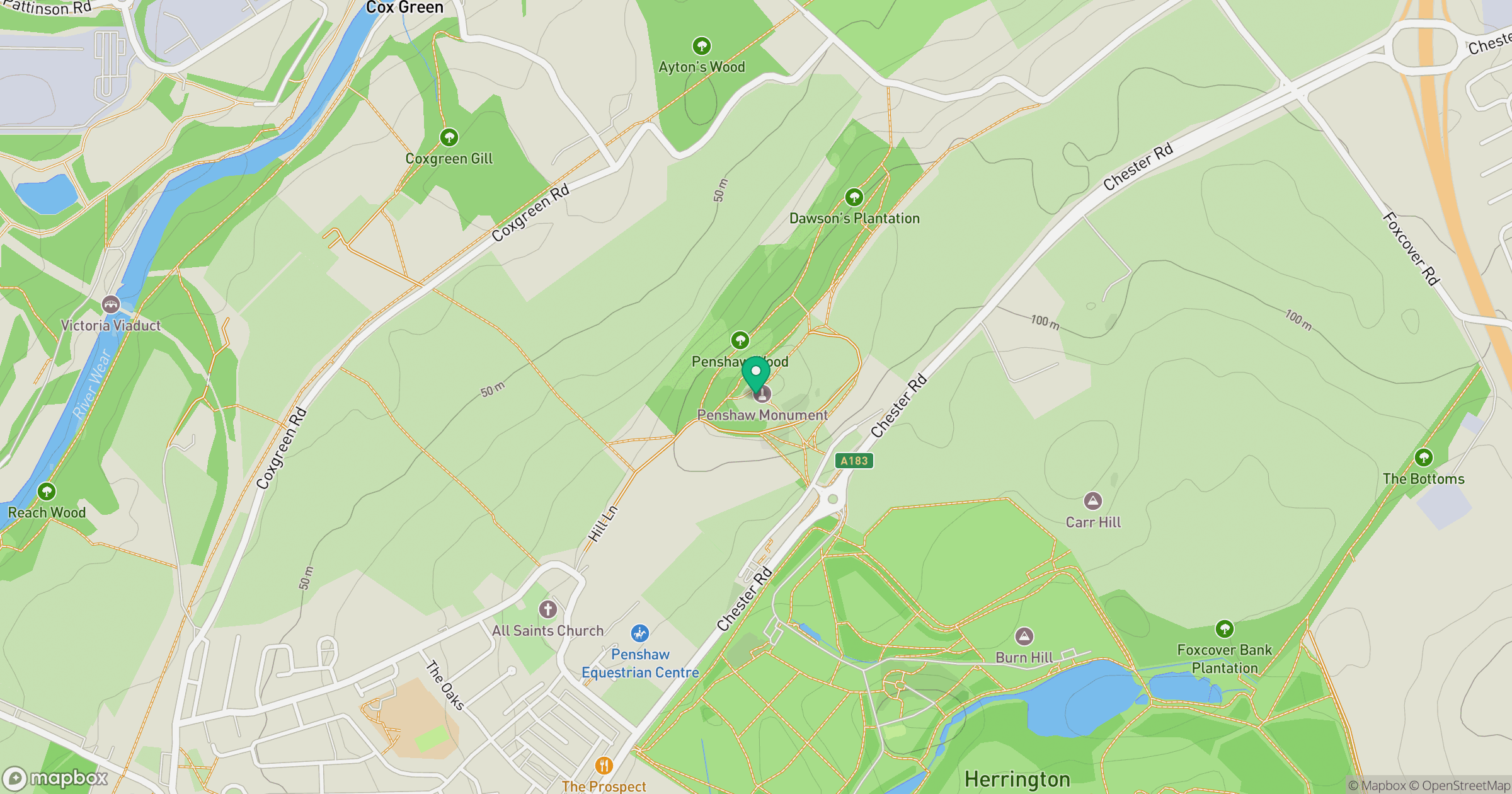
Grid reference: NZ333543
View on OpenStreetMapOpens a map in a new tab, centred on the hill.
Nearby Hills
Buckden Pike
702m
The Cheviot
816m
Nine Standards Rigg
662m
Cross Fell
893m
Rombalds Moor [Ilkley Moor]
402m
No comments yet. Be the first.