

Mullion Island
Good walks are even better shared.
SW6617 : Mullion Island from Higher Predannack Cliff
David Smith Photo source
Overview
Mullion Island
Mullion Island, nestled off the southern coast of Cornwall, is a marine sanctuary brimming with natural beauty and a hint of adventure. Standing proud (or rather, somewhat low, considering its elevation of zero meters), the island beckons outdoor enthusiasts with its scenic routes and rich history.
Geology
Mullion Island is primarily composed of granite, which has weathered gracefully over the centuries. The island features intriguing coastal erosion formations, such as rugged cliffs and curious sea stacks, sculpted by the relentless crashing of waves.
Routes
The most popular route to Mullion Island starts from Mullion Cove. This 3.5 km walk is classified as moderate, taking roughly 1.5 hours. As you stroll along the coastline, be prepared for breathtaking views, coastal wildlife, and the occasional curious seal popping its head above the water. Remember to pack your sense of adventure and maybe a sandwich or two!
Summit Features
While there's no towering summit here, the island’s rocky outcrops provide plenty of opportunities for exploration. Keep an eye out for remnants of shipwrecks around the island’s sandy shores – perfect for those who love a smidgen of historical storytelling!
Terrain
The terrain is predominantly rocky, so proper footwear is essential. The coastal path can be slippery at times, particularly after rainfall, but the views are well worth the careful steps.
Views
From Mullion Island, you’ll be treated to striking panoramas of the Cornwall coastline, with Lizard Point glistening in the distance. The best seasons for experiencing this beauty are spring and early summer when nature paints the island in vibrant hues and wildlife comes alive. Don't forget your binoculars – you might spot dolphins playing in the waves!
Hazards
Adventure does come with its risks, however. Be aware of strong currents, particularly around the island, and watch your footing on the slippery rocks. Sudden weather changes can also occur, so it’s wise to keep an eye on the forecast before setting out.
Access
Nearest Parking
You can find ample parking at Mullion Cove, though be prepared for a small charge. This convenient starting point allows you to set off with ease.
Public Transport
If you prefer to rely on public transport, there are regular bus services from Helston to Mullion. This way, you can enjoy picturesque views from the bus without the hassle of parking!
Nearest Town
Mullion, a quaint village, is your closest haven for food, drink, and friendly faces ready to share stories of the great outdoors.
Facilities
After your adventure, you can refresh yourself with a visit to one of the local cafes or restaurants in Mullion. Public toilets are also available, ensuring you’re not caught short!
History
Name Meaning
The name 'Mullion' is believed to stem from the Cornish word for 'mule', hinting at its agricultural past.
Significance
Historically, Mullion Island has served as a lookout point and has witnessed countless shipwrecks. Its maritime lore adds a layer of intrigue for every visitor, inviting you to imagine the tales of yore.
In summary, Mullion Island is a delightful destination for nature lovers and history buffs alike. Pack your walking boots and get ready for an adventure that combines stunning scenery with a sprinkle of history. Enjoy your trip!
Explore routes near Mullion Island
Walks starting near this hill. Open a route to check its map, distance and full itinerary.
Lizard to Kynance Cove Out and Back
View route
Helston to southern Loe Pool: Penrose lakeside woodland walk
View route
Stithians Lake circular walk: dam, woodland and Penmarth
View route
Falmouth Walk with Men Walking & Talking
View route
Route planning notes
These notes describe possible approaches. Check a route's map and access information when planning your walk.
Mullion Cove to Mullion Island
A scenic coastal walk from Mullion Cove to Mullion Island, offering stunning views and a chance to see local wildlife.
Make a day of it, together
Find someone to share the walk with, or organise a day out along a route you like.
Photo Gallery
View all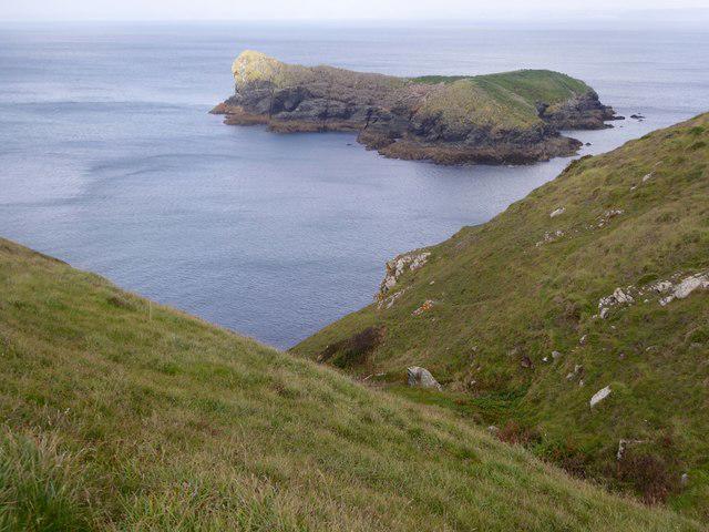 Photo could not load
SW6617 : Mullion Island from Higher Predannack Cliff
David Smith
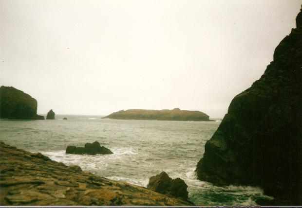 Photo could not load
SW6617 : Mullion Island from below the cliffs
Michael Murray
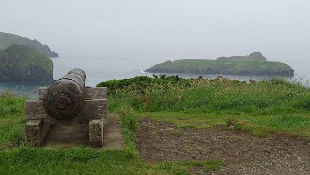 Photo could not load
SW6617 : Mullion Island seen from South West Coast Path near The Mullion Cove Hotel
habiloid
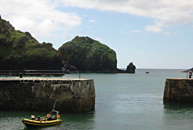 Photo could not load
SW6617 : Harbour Entrance
Tony Atkin
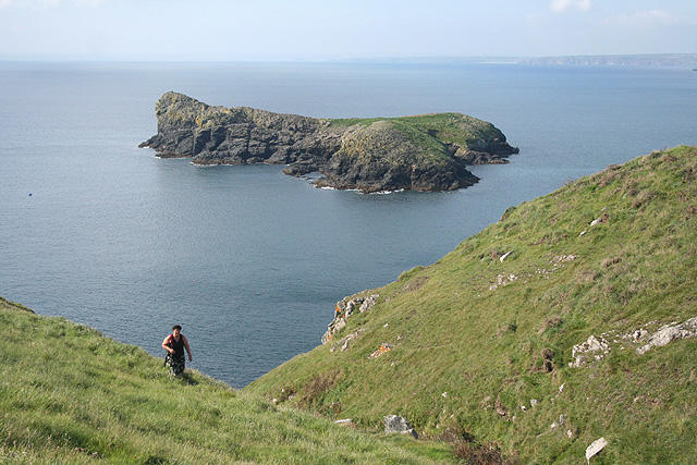 Photo could not load
SW6617 : Mullion: Mullion Island
Martin Bodman
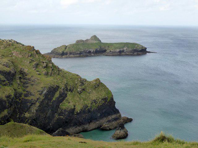 Photo could not load
SW6617 : Mullion Island and the cliff at Laden Ceyn
David Smith
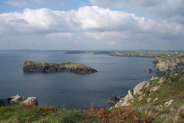 Photo could not load
SW6617 : Mullion: Mullion Island 2
Martin Bodman
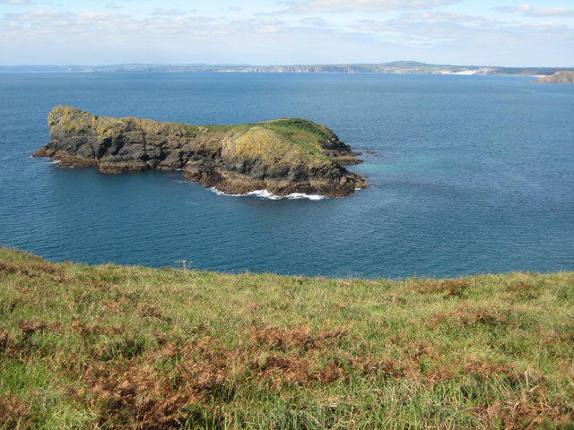 Photo could not load
SW6617 : Mullion Island
Philip Halling
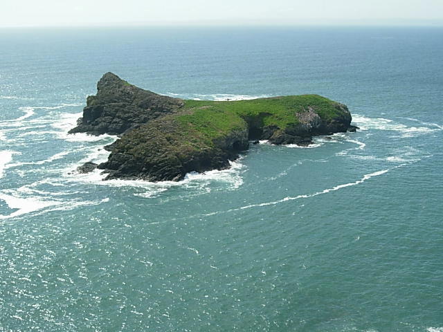 Photo could not load
SW6517 : Mullion Island
John Garfoot
Hill facts and local notes
Classifications
Elevation
33m
107 ft
Prominence
33m
Coordinates
50.0120, -5.2686
SW659175
OS Map
203
Explorer: 103
At the Summit
The island features rocky outcrops and a few scattered grasses, with the remnants of old shipwrecks in the waters surrounding it; perfect for a seafaring tale or two.
Terrain & Geology
Mullion Island is primarily composed of granite, with interesting coastal erosion features including cliffs and sea stacks, a testament to the relentless forces of nature.
Views & Scenery
From the island, you can spot the dramatic coastline of Cornwall, the distant Lizard Point, and if you squint hard enough, you may even see a dolphin or two frolicking in the waters.
History & Heritage
Name Origin
The name 'Mullion' is believed to derive from the Cornish word for 'mule', reflecting its historical agricultural connections.
Historical Significance
Historically used as a lookout point, the island has witnessed countless shipwrecks and is steeped in maritime lore.
Getting There & Facilities
Parking
There is parking available at Mullion Cove with a small charge; it makes for an easy start to your adventure.
Public Transport
Regular bus services operate from Helston to Mullion, so leave the car behind and enjoy the ride.
Nearby Facilities
Mullion has several cafes, restaurants, and public toilets, perfect for a post-hike treat or a loo break before you head back.
Safety Information
Known Hazards
- Strong currents around the island, slippery rocks, and the possibility of sudden weather changes.
General Safety Tips
- Check weather conditions before setting out
- Carry appropriate clothing and equipment
- Let someone know your planned route
- Take a map, compass, and GPS device
- Carry emergency supplies: food, water, first aid kit, torch
Hills
Some common questions about the hills answered
Are there group walks up Mullion Island?
Many walkers use Walkmates to join or organise walks with others. You can check for group walks around Mullion Island through the maps
Are there other walkers around Mullion Island?
Activity varies by location and time, but Walkmates lets you see whether others have shared walks or shown interest in this area. Find other people through the walking friends search walking friends for Mullion Island search or of course create your own walk for Mullion Island
Can I organise a walk to Mullion Island?
Yes. If there aren’t any walks listed already, you can create a walk and make it available for others to join.
If you're signed up to Walkmates, you can create a walk to Mullion Island.
How do I find a walk up this hill?
There are often multiple ways to walk this hill, depending on experience and route preference. Walkmates helps you explore walks and routes that others have shared.
Can I suggest a new route up Mullion Island?
Yes. You can suggest or create routes to share with others. Walkmates focuses on the social side of walking, so routes are used to help people organise walks and explore areas together, rather than as detailed navigation tools or route libraries.
Other uses really appreciate knowledgeable walkers sharing their routes. Share your favourite route to Mullion Island here
The is an error or something incorrect about this hill. How do I let you know?
We always strive to keep the information on Walkmates as accurate as possible. If you find an error, please let us know through the contact form and we'll aim to correct it as quickly as possible
Community Discussion
Comments
Location
View the hill's mapped position and surrounding paths.
Grid reference: SW659175
View on OpenStreetMapOpens a map in a new tab, centred on the hill.
Nearby Hills
Brown Willy
420m

Brent Tor
334m

High Willhays
622m
Rhossili Down - The Beacon
193m

Dunkery Beacon
520m
No comments yet. Be the first.