

Mulfra Hill
Good walks are even better shared.
SW4535 : Mulfra Quoit
Malcolm Kewn Photo source
Overview
Mulfra Hill: A Glimpse of Cornwall's Beauty
Introduction
Nestled in the enchanting landscapes of Cornwall, Mulfra Hill is a moderately challenging yet rewarding hike for outdoor enthusiasts. Standing at 199 meters, it offers stunning vistas that are well worth the effort.
Geology
Mulfra Hill showcases the classic granite formations that are emblematic of the region’s geology. Over millions of years, weathering has sculpted these rocks into fascinating shapes, making the terrain both picturesque and intriguing.
Routes
Mulfra Hill Circular Walk
A popular choice for hikers, this route is approximately 5.5 km and takes about 2 hours to complete. The loop starts in Mulfra village and allows you to enjoy a variety of landscapes, including coastal paths and moorland trails. The scenery alone is enough to keep your spirits high, so don’t forget to bring your camera!
Summit Features
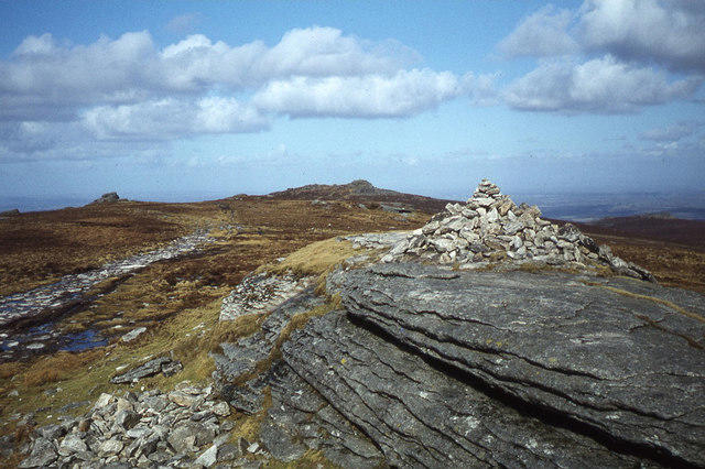
Upon reaching the summit, one is greeted with a modest rock cairn which adds charm to the peak. It may not be the biggest monument, but it’s perfect for a group picture - after all, what are summits for if not to showcase your hiking prowess?
Terrain Type
The terrain on Mulfra Hill consists of grassy inclines intertwined with rocky outcrops. Keep your wits about you when navigating the occasional boggy patch, as your footwear choice will surely be tested!
Views
Highlights
From the peak, gaze upon the sweeping views of the Atlantic and the stunning Cornish coastline. On a clear day, the sights are truly mesmerising and stretch all the way to the Lizard Peninsula.
Best Seasons
Spring and early autumn are ideal for trekking up Mulfra Hill. The flora bursts into colour during spring, while autumn offers a picturesque golden palette.
Hazards
As with any height, the main risks include slippery rocks—especially after rain—and rapid shifts in weather. Keep your eyes peeled and your preparations ready, because the ground isn’t the only thing that can be unpredictable!
Nearby Summits
If you fancy a bit of peak bagging, consider nearby summits such as Carn Brea and Godolphin Hill. Both add depth to your hiking adventure and can easily be incorporated into your itinerary.
Access
Nearest Parking
A small parking area can be found close to Mulfra village, ideal for those eager to hit the trails early. Arriving early is highly recommended.
Public Transport
While public transport is available, a taxi may save you some legwork from Penzance.
Nearest Town
Penzance is your best bet for supplies, with its charming cafes and shops providing the perfect fuel for your adventure.
Facilities
Although facilities are scarce, Penzance offers all the amenities you may require, including cafes and public toilets.
History
Name Meaning
Mulfra's name reflects the wild beauty of the hill, its derivation steeped in the local Cornish language.
Significance
Beyond its physical beauty, Mulfra Hill holds cultural significance in local folklore, representing a connection to the past that many hike to experience.
Conclusion
Mulfra Hill is a lovely foray into the heart of Cornwall's natural splendour. Whether you're a seasoned hiker or just in it for the views, this peak promises a delightful day out. Remember to bring water, and perhaps a Cornish pasty for that unbeatable energy boost!
Explore routes near Mulfra Hill
Walks starting near this hill. Open a route to check its map, distance and full itinerary.
Penzance Walk with Men Walking & Talking
View route
Porthcurno and the Minack Theatre
View route
Tehidy lakes, Kennels Hill and North Cliffs woodland circuit
View route
Helston to southern Loe Pool: Penrose lakeside woodland walk
View route
Route planning notes
These notes describe possible approaches. Check a route's map and access information when planning your walk.
Mulfra Hill Circular Walk
A scenic loop starting from the nearby village of Mulfra and incorporating coastal paths and moorland trails.
Make a day of it, together
Find someone to share the walk with, or organise a day out along a route you like.
Photo Gallery
View all Photo could not load
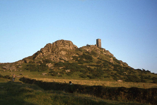
SW4535 : Mulfra Quoit
Malcolm Kewn
 Photo could not load
SW4535 : Mulfra Quoit
Andrew Curtis
 Photo could not load
SW4535 : Mulfra Quoit
Brian Deegan
 Photo could not load
SW4535 : Bracken & gorse on Mulfra Hill
David Medcalf
 Photo could not load
SW4535 : Mulfra Quoit
Kieran Campbell
 Photo could not load
SW4535 : Mulfra Quoit
Chris Andrews
 Photo could not load
SW4535 : Mulfra Quoit
Malcolm Kewn
 Photo could not load
SW4535 : Footpath on Mulfra Hill
David Medcalf
 Photo could not load
SW4535 : Mulfra Hill
Rude Health
Hill facts and local notes
Classifications
Elevation
221m
725 ft
Prominence
33m
Coordinates
50.1641, -5.5709
SW450354
OS Map
203
Explorer: 102
At the Summit
At the summit, hikers are greeted with a modest but notable rock cairn that offers a perfect photo opportunity; not quite a castle, but it boasts better views!
Terrain & Geology
Mulfra Hill is primarily composed of granite, characteristic of the Cornish landscape, which has eroded over millennia to create interesting rock formations and outcrops.
Views & Scenery
From the top, you can enjoy breathtaking views of the Atlantic Ocean, the Lizard Peninsula, and the rugged Cornish coastline.
History & Heritage
Name Origin
The name Mulfra is derived from the Cornish words meaning 'hill' and 'wild breast', reflecting the area's natural beauty.
Historical Significance
Mulfra Hill is not only a peak for hiking enthusiasts but also steeped in local folklore and history, often regarded as a place of ancient rituals.
Getting There & Facilities
Parking
There is a small parking area near the village of Mulfra, suitable for a handful of vehicles. Arrive early to avoid disappointment!
Public Transport
The nearest bus service operates from Penzance, though a bit of a walk from the bus stop is required. Consider a taxi for convenience.
Nearby Facilities
While there are limited facilities on-site, nearby Penzance provides plenty of cafes, restaurants, and public toilets.
Safety Information
Known Hazards
- Beware of the slippery rocks, especially in wet weather. Also, keep an eye out for sudden changes in weather, as conditions can shift rapidly in Cornwall.
General Safety Tips
- Check weather conditions before setting out
- Carry appropriate clothing and equipment
- Let someone know your planned route
- Take a map, compass, and GPS device
- Carry emergency supplies: food, water, first aid kit, torch
Hills
Some common questions about the hills answered
Are there group walks up Mulfra Hill?
Many walkers use Walkmates to join or organise walks with others. You can check for group walks around Mulfra Hill through the maps
Are there other walkers around Mulfra Hill?
Activity varies by location and time, but Walkmates lets you see whether others have shared walks or shown interest in this area. Find other people through the walking friends search walking friends for Mulfra Hill search or of course create your own walk for Mulfra Hill
Can I organise a walk to Mulfra Hill?
Yes. If there aren’t any walks listed already, you can create a walk and make it available for others to join.
If you're signed up to Walkmates, you can create a walk to Mulfra Hill.
How do I find a walk up this hill?
There are often multiple ways to walk this hill, depending on experience and route preference. Walkmates helps you explore walks and routes that others have shared.
Can I suggest a new route up Mulfra Hill?
Yes. You can suggest or create routes to share with others. Walkmates focuses on the social side of walking, so routes are used to help people organise walks and explore areas together, rather than as detailed navigation tools or route libraries.
Other uses really appreciate knowledgeable walkers sharing their routes. Share your favourite route to Mulfra Hill here
The is an error or something incorrect about this hill. How do I let you know?
We always strive to keep the information on Walkmates as accurate as possible. If you find an error, please let us know through the contact form and we'll aim to correct it as quickly as possible
Community Discussion
Comments
Location
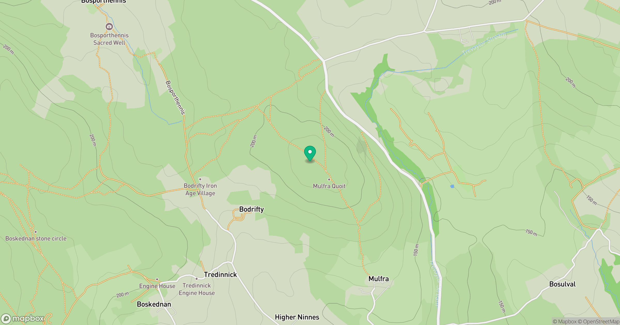
Grid reference: SW450354
View on OpenStreetMapOpens a map in a new tab, centred on the hill.
No comments yet. Be the first.