

Loudoun Hill
Good walks are even better shared.
NS6038 : Loudoun Hill from the north
Iain Russell Photo source
Overview
Loudoun Hill
Nestled in West Ayrshire, Loudoun Hill rises majestically to an elevation of 351 meters and is celebrated as a Marilyn, a term used for hills in the UK that are over 150 meters of prominence. Its volcanic origins provide a fascinating glimpse into the Earth’s geological past, with the remnants of ancient lava flows adding character to the landscape.
Route Overview
One of the most popular paths leading to Loudoun Hill is the Loudoun Hill Circular Route. This 5.5 km journey is perfect for moderately experienced hikers and offers a wonderful blend of natural beauty and engaging terrain. Starting from Kilmaurs, the path meanders through charming countryside, gradually leading you to the summit. Expect muddy conditions if rain is in the forecast—don’t forget your wellies!
Summit Features
Upon reaching the summit, an imposing trig point greets you, along with historical fortifications that whisper tales from centuries past. There's also a modest cairn, a nod to the walkers who’ve braved the climb before you.
Views
The views from the top are nothing short of spectacular. On a clear day, you might just see the rugged peaks of Arran and the sparkling Firth of Clyde, a sight that will leave you feeling as though you've conquered the world. The best seasons for view-seeking are undoubtedly spring and autumn when the landscape bursts with colour and clarity.
Hazards
Keep your wits about you as you navigate the unpredictable terrain. Should you visit after a deluge, be prepared for muddy trails, and watch your step around the rocky outcrop near the summit—nobody wants to play hopscotch with loose stones!
Access
Accessing Loudoun Hill is relatively straightforward. The nearest parking is located in Kilmaurs, about a kilometre from the hiking trail's start. If you prefer public transport, Kilmarnock has a good bus service that connects to Kilmaurs, making this natural gem accessible to all.
Facilities
While the village of Kilmaurs offers basic facilities, Kilmarnock is a short distance away and will provide you with all manner of refreshments to revive yourself post-hike. Whether you fancy a cup of tea or a more substantial meal, you’re in luck!
History
The name 'Loudoun' is derived from Gaelic, meaning 'mound' or 'hill', which, let’s be honest, is fitting for this elevated landmark. Historically, it is famed for the Battle of Loudoun Hill, which took place in 1307 during the Wars of Scottish Independence. A place not only for breathtaking vistas but also steeped in rich Scottish heritage.
So there you have it! Loudoun Hill isn’t just a hike; it’s an adventure through time and nature. Happy hiking!
Explore routes near Loudoun Hill
Walks starting near this hill. Open a route to check its map, distance and full itinerary.
Motherwell: Strathclyde Loch full shoreline circuit
View route
Cambuslang Walk with Men Walking & Talking
View route
Paisley Walk with Men Walking & Talking
View route
Kirkintilloch to Twechar Bridge: Forth and Clyde Canal Return
View route
Route planning notes
These notes describe possible approaches. Check a route's map and access information when planning your walk.
Loudoun Hill Circular Route
A delightful circular trek beginning at Kilmaurs, winding through beautiful countryside with a steady ascent to the summit.
Make a day of it, together
Find someone to share the walk with, or organise a day out along a route you like.
Photo Gallery
View all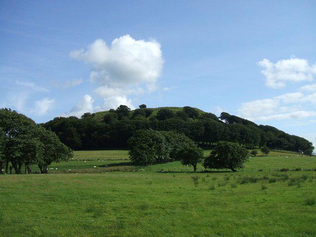 Photo could not load
NS6038 : Loudoun Hill from the north
Iain Russell
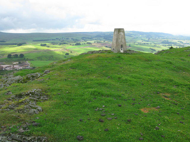 Photo could not load
NS6037 : Trig Point on Loudoun Hill
G Laird
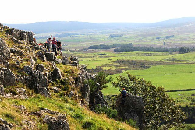 Photo could not load
NS6037 : Climbers on Loudoun Hill
Alan Reid
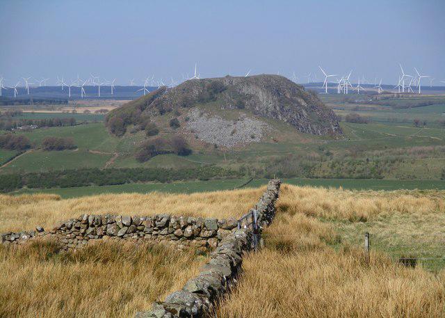 Photo could not load
NS6037 : Loudoun Hill viewed from Cairnsaigh Hill
Alan O'Dowd
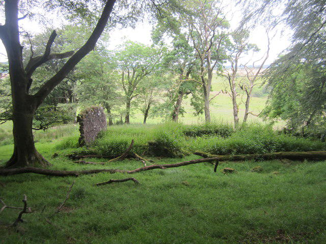 Photo could not load
NS6038 : The ruin in the woods
David Medcalf
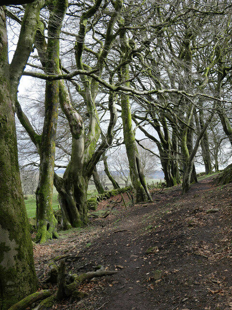 Photo could not load
NS6038 : A muddy track through the woods at Loudoun Hill
James T M Towill
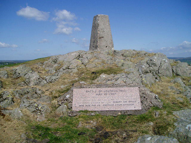 Photo could not load
NS6037 : Trig Point and Battle Plaque
Alan Pitkethley
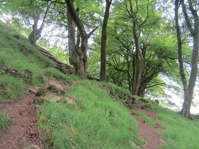 Photo could not load
NS6038 : Path by the derelict house
David Medcalf
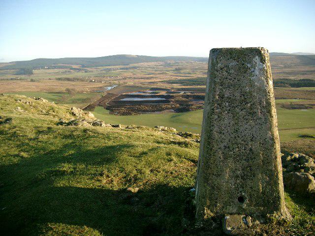 Photo could not load
NS6037 : Trig point on Loudoun Hill
Gordon Brown
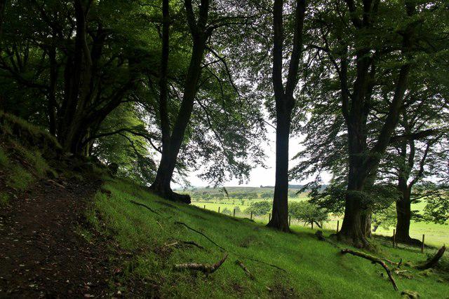
NS6038 : Shady woods on the north side of Loudon Hill
Alan Reid
Hill facts and local notes
Classifications
Elevation
316m
1,037 ft
Prominence
76m
Coordinates
55.6147, -4.2105
NS608379
OS Map
71
Explorer: 334
At the Summit
The summit proudly boasts a prominent trig point, alongside remnants of ancient fortifications. A small cairn pays homage to those who have trekked this hill before.
Terrain & Geology
Loudoun Hill is primarily composed of volcanic rock, making it a fascinating site for geology enthusiasts. The underlying basalt indicates a rich volcanic history, further evidenced by features such as columnar jointing that can be found around the summit.
Views & Scenery
From the summit, enjoy sweeping views of the surrounding Ayrshire countryside, including the distant Arran and the picturesque waters of the Firth of Clyde.
History & Heritage
Name Origin
Loudoun is derived from the Gaelic 'Lodainn', meaning 'mound' or 'hill', quite apt for this elevated site.
Historical Significance
Historically, the hill served as a stronghold during the Wars of Scottish Independence. It is also associated with the legendary 'Battle of Loudoun Hill' in 1307.
Getting There & Facilities
Parking
There is a small parking area near the village of Kilmaurs, approximately 1 km from the start of the hiking trail.
Public Transport
Buses run regularly from Kilmarnock to Kilmaurs, making it accessible for those without a car.
Nearby Facilities
The village of Kilmaurs offers basic amenities, including a few cafés and local shops. For more extensive facilities, Kilmarnock has numerous options.
Safety Information
Known Hazards
- Watch out for muddy sections after rain, and be cautious of loose rocks near the summit.
General Safety Tips
- Check weather conditions before setting out
- Carry appropriate clothing and equipment
- Let someone know your planned route
- Take a map, compass, and GPS device
- Carry emergency supplies: food, water, first aid kit, torch
Hills
Some common questions about the hills answered
Are there group walks up Loudoun Hill?
Many walkers use Walkmates to join or organise walks with others. You can check for group walks around Loudoun Hill through the maps
Are there other walkers around Loudoun Hill?
Activity varies by location and time, but Walkmates lets you see whether others have shared walks or shown interest in this area. Find other people through the walking friends search walking friends for Loudoun Hill search or of course create your own walk for Loudoun Hill
Can I organise a walk to Loudoun Hill?
Yes. If there aren’t any walks listed already, you can create a walk and make it available for others to join.
If you're signed up to Walkmates, you can create a walk to Loudoun Hill.
How do I find a walk up this hill?
There are often multiple ways to walk this hill, depending on experience and route preference. Walkmates helps you explore walks and routes that others have shared.
Can I suggest a new route up Loudoun Hill?
Yes. You can suggest or create routes to share with others. Walkmates focuses on the social side of walking, so routes are used to help people organise walks and explore areas together, rather than as detailed navigation tools or route libraries.
Other uses really appreciate knowledgeable walkers sharing their routes. Share your favourite route to Loudoun Hill here
The is an error or something incorrect about this hill. How do I let you know?
We always strive to keep the information on Walkmates as accurate as possible. If you find an error, please let us know through the contact form and we'll aim to correct it as quickly as possible
Community Discussion
Comments
Location
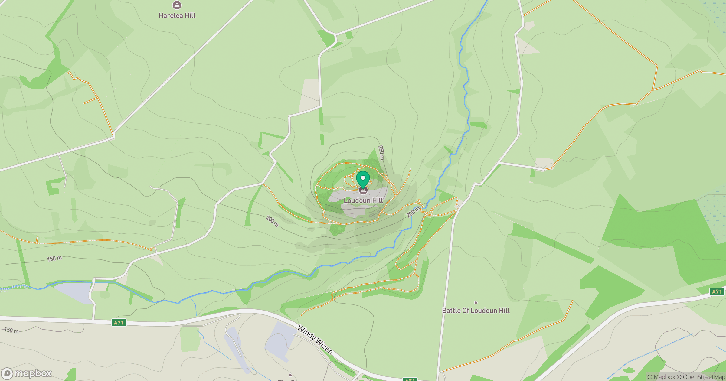
Grid reference: NS608379
View on OpenStreetMapOpens a map in a new tab, centred on the hill.

No comments yet. Be the first.