

Lawel Hill
Good walks are even better shared.
Overview
Lawel Hill
Nestled in the heart of Snowdonia National Park, Lawel Hill is a delightful destination for both seasoned hikers and casual stroll-seekers alike. With an elevation of 300 meters, this Marilyn may not be the highest peak in the region, but it certainly packs a punch when it comes to stunning views and varied terrain.
Geology
The underlying geology of Lawel Hill is primarily characterized by granite and schist. This ancient rock formation lends itself to a rugged landscape that’s been magnificently shaped by the forces of glacial activity over millennia. Those with a keen eye for geology will find the contrasting textures and colours of the rocks fascinating.
Routes
One of the most popular routes to the summit is via the Coed y Brenin Trail. This route offers a moderate challenge, set against the backdrop of towering pines and the gentle sounds of the forest. Covering a distance of 5.5 km, most hikers find they can conquer it in about 2.5 hours, depending on stops for selfies and admiring the scenery, of course!
Summit Features
As you reach the top, you'll be greeted by a robust trig point—which makes for a perfect photo opportunity! Depending on the time of year, the summit can be decorated with a variety of wildflowers, adding splashes of colour to the rocky outcrops.
Terrain
The terrain here is primarily grassy but punctuated by rocky outcrops and occasional boggy areas. Be prepared for uneven footing, especially if the weather has been wet, as the last thing you want is a muddy surprise!
Views
From the summit of Lawel Hill, the panoramic views are nothing short of spectacular. Highlights include the majestic Myndd Mawr and, on a clear day, the far-off pinnacles of Snowdon. The best seasons to enjoy these vistas are Spring and early Summer when the air is crisp, and the landscape is alive with colour.
Hazards
As with many outdoor adventures, one should be mindful of the elements. Weather conditions in Snowdonia are notorious for changing faster than you can say 'What a lovely day!' It's wise to check forecasts and carry appropriate clothing.
Access
For those driving, the nearest parking is available at the Coed y Brenin Visitor Centre, which offers plenty of space and facilities to cater for your needs. If public transport is more your style, local buses frequently connect from Dolgellau to the visitor centre, making it quite accessible.
Facilities
After your hike, a stop at the Coed y Brenin café is a must! Treat yourself to a well-deserved slice of cake and a cup of tea while reliving your hike. Toilets are also available here.
History
In terms of history, the name 'Lawel' relates to the Welsh word for 'slope'—a fitting descriptor for this picturesque hill. While it may not be steeped in monumental tales, it does hold a place in the hearts of locals and is often featured in hiking directories.
In conclusion, Lawel Hill may not be the tallest or most challenging hill, but it offers a delightful outing for those seeking a taste of Wales' natural beauty without losing the sense of adventure.
So grab your hiking boots and enjoy all that Lawel Hill has to offer! Happy hiking!
Explore routes near Lawel Hill
Public walks starting within 80 km of this hill. Nearby does not mean a route reaches the summit; check its map and access before setting out.
Formartine and Buchan Way: Dyce to Udny Station
View route
Walk Aberdeen – Dyce easy social walk
View route
Formartine and Buchan Way: Ellon to Auchnagatt
View route
Walk Aberdeen – Kingswells easy social walk
View route
Route planning notes
These notes describe possible approaches, not verified navigable routes or permission to cross land. Check current paths, local access rules and conditions before setting out.
Coed y Brenin Trail
Starting from the popular Coed y Brenin visitor centre, this trail offers a gentle ascent through lush forestry before leading up to the hill.
Make a day of it, together
Find someone to share the walk with, or organise a day out along a route you like.
Photo Gallery
View all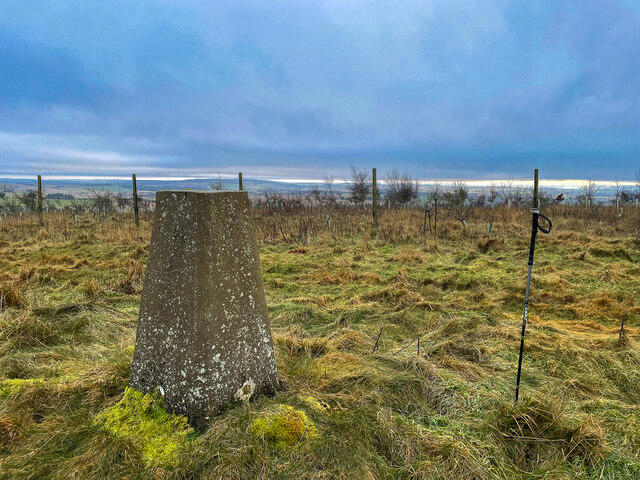 Photo could not load
NJ8024 : Lawel Hill trig point
Ralph Greig
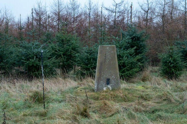 Photo could not load
NJ8024 : Lawel Hill Summit
Ralph Greig
Hill facts and local notes
Classifications
Elevation
236m
774 ft
Prominence
119m
Coordinates
57.3069, -2.3193
NJ808240
OS Map
38
Explorer: 421W
At the Summit
The summit features a sturdy trig point and is often adorned with vibrant wildflowers, depending on the season.
Terrain & Geology
Granite and schist dominate the area's geology, providing a rugged terrain shaped by glacial activity.
Views & Scenery
From the summit, one can enjoy sweeping views of the Myndd Mawr and the distant peaks of Snowdon.
History & Heritage
Name Origin
The name 'Lawel' is believed to derive from the Welsh word for 'slope'.
Historical Significance
Lawel Hill holds significance for local walkers and is often featured in regional hiking guides.
Getting There & Facilities
Check current local access restrictions, parking rules and transport timetables before travelling. These notes do not confirm public access to the summit.
Parking
Parking is available at the Coed y Brenin Visitor Centre, with ample space and facilities.
Public Transport
Buses run regularly from nearby towns such as Dolgellau to the visitor centre.
Nearby Facilities
The Coed y Brenin Visitor Centre has a café, toilets, and a bike hire service - perfect for post-hike refreshments.
Safety Information
Known Hazards
- Beware of sudden weather changes; conditions can shift quicker than a squirrel up a tree.
General Safety Tips
- Check weather conditions before setting out
- Carry appropriate clothing and equipment
- Let someone know your planned route
- Take a map, compass, and GPS device
- Carry emergency supplies: food, water, first aid kit, torch
Hills
Some common questions about the hills answered
Are there group walks up Lawel Hill?
Many walkers use Walkmates to join or organise walks with others. You can check for group walks around Lawel Hill through the maps
Are there other walkers around Lawel Hill?
Activity varies by location and time, but Walkmates lets you see whether others have shared walks or shown interest in this area. Find other people through the walking friends search walking friends for Lawel Hill search or of course create your own walk for Lawel Hill
Can I organise a walk to Lawel Hill?
Yes. If there aren’t any walks listed already, you can create a walk and make it available for others to join.
If you're signed up to Walkmates, you can create a walk to Lawel Hill.
How do I find a walk up this hill?
There are often multiple ways to walk this hill, depending on experience and route preference. Walkmates helps you explore walks and routes that others have shared.
Can I suggest a new route up Lawel Hill?
Yes. You can suggest or create routes to share with others. Walkmates focuses on the social side of walking, so routes are used to help people organise walks and explore areas together, rather than as detailed navigation tools or route libraries.
Other uses really appreciate knowledgeable walkers sharing their routes. Share your favourite route to Lawel Hill here
The is an error or something incorrect about this hill. How do I let you know?
We always strive to keep the information on Walkmates as accurate as possible. If you find an error, please let us know through the contact form and we'll aim to correct it as quickly as possible
Community Discussion
Comments
Location
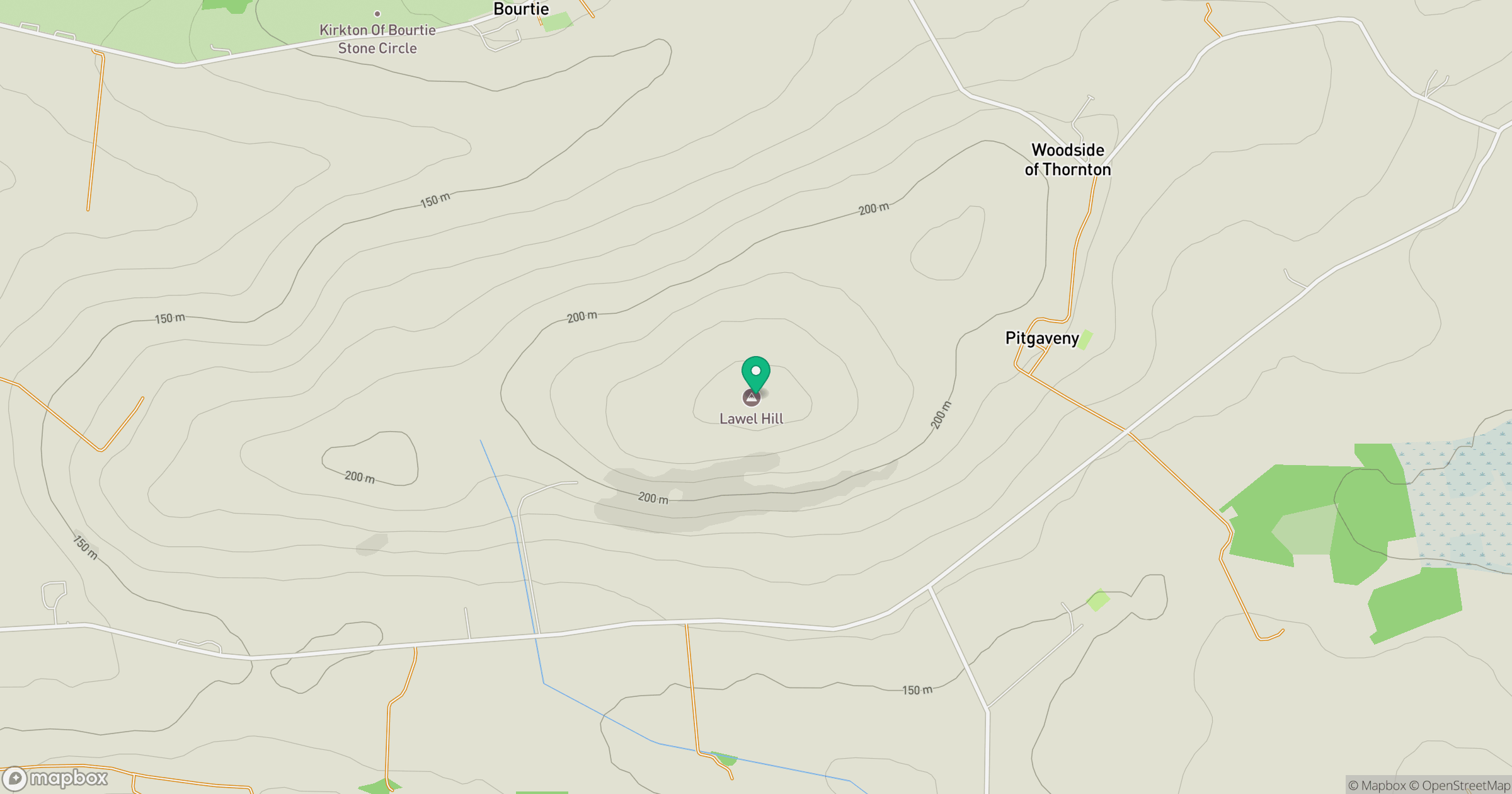
Grid reference: NJ808240
View on OpenStreetMapOpens a map in a new tab, centred on the hill.
Hills within 30 km
Straight-line distance, not a walking route or confirmation of access.
Bennachie - Oxen Craig
529m
Tyrebagger Hill
250m
Brimmond Hill
266m
Millstone Hill
409m
Cairn William
448m
No comments yet. Be the first.