

Lanchestoo
Good walks are even better shared.
Overview
Lanchestoo: A Hidden Gem in the South Pennines
Overview
Lanchestoo, perched at an elevation of 384 meters, is one of the delightful Marilyns nestled in the picturesque South Pennines region of the UK. This hill, while perhaps overshadowed by its larger neighbours, offers equally rewarding views and a sense of serenity that hikers seek.
Geology
Composed mainly of gritstone, Lanchestoo's geology is typical of this rugged region, featuring impressive rocky outcrops that serve as homes for local wildlife. Keep your eyes peeled for birds and even the occasional deer!
Routes
The Lanchestoo Circular Route is a popular choice for walkers. At 7.5 km, it’s a moderate trek that brings you full circle back to where you started, all whilst taking in the stunning views that the hill has to offer.
Summit Features
Upon reaching the summit, adventurers are greeted by a simple but noteworthy stone cairn. Be warned, however; it appears to be a favourite resting spot for local sheep, so don’t be surprised if you have to share your moment of zen with a few woolly visitors!
Terrain Type
Expect a varied terrain that mixes rocky paths with lush grassy slopes. Watch out for the boggy patches—adventurers often view these as opportunities to test out their boot waterproofing.
Views
One of the highlights from the summit is the beautiful panoramic vista overlooking the Peak District, alongside charming local farmsteads dotting the landscape. The best time to soak all this in is during spring and autumn when the air is clear, and the colours are at their most vibrant.
Hazards
As with any outdoor adventure, it’s essential to be cautious of the unpredictable UK weather. Slippery paths can catch you off guard, not to mention those enthusiastic sheep that sometimes seem to think they're more important than you!
Nearby Summits
Lanchestoo’s companions include the towering Blackstone Edge and the serene Ladybower Reservoir, making it a perfect area for a day of exploration.
Access
The nearest car park is located on Oldham Road, accommodating around 10 cars—so arrive early! For those relying on public transport, regular bus services from nearby towns lead you close to the trailhead.
Facilities
After a satisfying hike, head into Uppermill for a comforting pub meal or a sweet treat at a local café. Public toilets are conveniently located in the village centre for your convenience.
History
The name 'Lanchestoo' itself means 'hill of the land of the people', reflecting its enduring place in the local community. Historically, it has served as a meeting point for locals, embodying the spirit of togetherness.
In conclusion, Lanchestoo may not be the highest mountain on the block, but it captures the hearts of all those who choose to scale its charming slopes. Dust off those walking boots, grab a friend, and make it a day to remember!
Enjoy your adventure,
Lanchestoo awaits!
Explore routes near Lanchestoo
Public walks starting within 80 km of this hill. Nearby does not mean a route reaches the summit; check its map and access before setting out.
No public routes are currently listed within 80 km of Lanchestoo on Walkmates. This does not mean there are no paths here. Explore the map and check local access information before planning a walk.
Route planning notes
These notes describe possible approaches, not verified navigable routes or permission to cross land. Check current paths, local access rules and conditions before setting out.
Lanchestoo Circular Route
A scenic circular route that begins at the foot of the hill and provides stunning views of the surrounding countryside.
Make a day of it, together
Find someone to share the walk with, or organise a day out along a route you like.
Photo Gallery
View all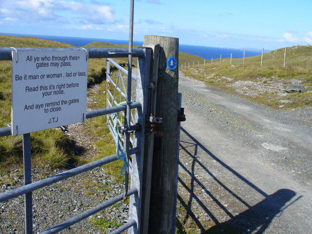 Photo could not load
HU3791 : J.T.J.'s Ode
Colin Smith
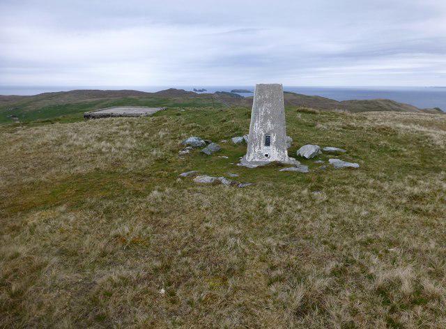 Photo could not load
HU3791 : Lanchestoo Trig
Rude Health
Hill facts and local notes
Classifications
Elevation
130m
427 ft
Prominence
122m
Coordinates
60.6062, -1.3166
HU375916
OS Map
1 2
Explorer: 469N
At the Summit
The summit boasts a simple stone cairn, which seems to attract a fair number of sheep who have decided it’s the perfect spot for a snooze.
Terrain & Geology
Lanchestoo is primarily comprised of gritstone, typical of the South Pennines, with rocky outcrops that provide a unique habitat for wildlife and interesting geological features.
Views & Scenery
From the top, you can enjoy panoramic views of the surrounding hills, including the distant Peak District and charming local farmsteads.
History & Heritage
Name Origin
The name Lanchestoo is derived from Old English, meaning 'hill of the land of the people', which is rather fitting considering all the folks who like to clamber up it.
Historical Significance
The hill has been part of local folklore and has served as a meeting place for generations, embodying the community spirit.
Getting There & Facilities
Check current local access restrictions, parking rules and transport timetables before travelling. These notes do not confirm public access to the summit.
Parking
There is a small car park at the trailhead on Oldham Road, which can accommodate about 10 vehicles. Arrive early to nab a spot!
Public Transport
Buses run frequently from nearby towns, including Saddleworth and Huddersfield, with a 15-minute walk to the trailhead.
Nearby Facilities
Uppermill has several cafes and pubs, perfect for a post-hike pint or a slice of cake, and public toilets can be found near the village centre.
Safety Information
Known Hazards
- Variable weather conditions can make paths slippery, so always check the forecast; also, be wary of the occasional enthusiastic sheep!
General Safety Tips
- Check weather conditions before setting out
- Carry appropriate clothing and equipment
- Let someone know your planned route
- Take a map, compass, and GPS device
- Carry emergency supplies: food, water, first aid kit, torch
Hills
Some common questions about the hills answered
Are there group walks up Lanchestoo?
Many walkers use Walkmates to join or organise walks with others. You can check for group walks around Lanchestoo through the maps
Are there other walkers around Lanchestoo?
Activity varies by location and time, but Walkmates lets you see whether others have shared walks or shown interest in this area. Find other people through the walking friends search walking friends for Lanchestoo search or of course create your own walk for Lanchestoo
Can I organise a walk to Lanchestoo?
Yes. If there aren’t any walks listed already, you can create a walk and make it available for others to join.
If you're signed up to Walkmates, you can create a walk to Lanchestoo.
How do I find a walk up this hill?
There are often multiple ways to walk this hill, depending on experience and route preference. Walkmates helps you explore walks and routes that others have shared.
Can I suggest a new route up Lanchestoo?
Yes. You can suggest or create routes to share with others. Walkmates focuses on the social side of walking, so routes are used to help people organise walks and explore areas together, rather than as detailed navigation tools or route libraries.
Other uses really appreciate knowledgeable walkers sharing their routes. Share your favourite route to Lanchestoo here
The is an error or something incorrect about this hill. How do I let you know?
We always strive to keep the information on Walkmates as accurate as possible. If you find an error, please let us know through the contact form and we'll aim to correct it as quickly as possible
Community Discussion
Comments
Location
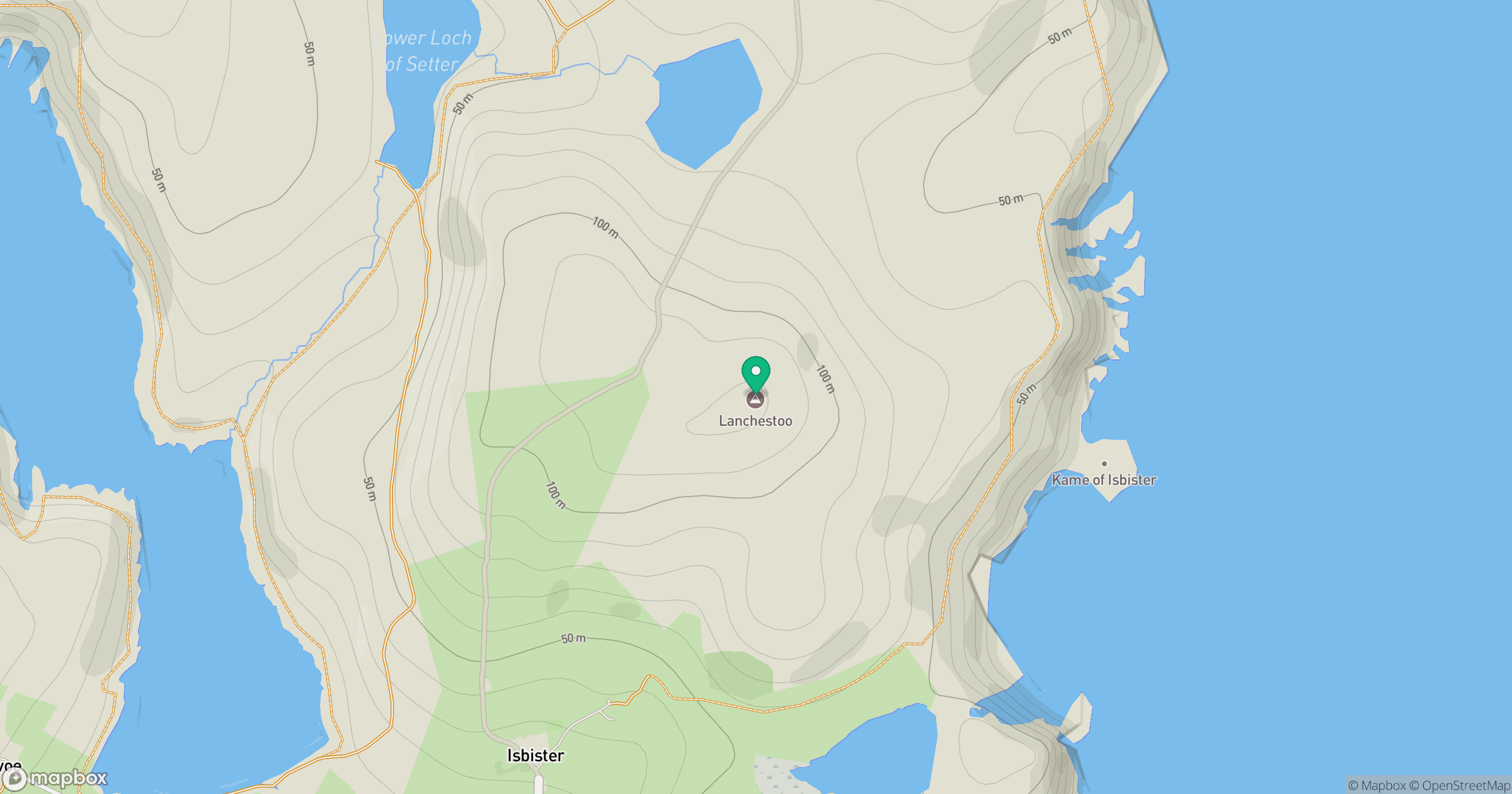
Grid reference: HU375916
View on OpenStreetMapOpens a map in a new tab, centred on the hill.
Hills within 30 km
Straight-line distance, not a walking route or confirmation of access.
No comments yet. Be the first.