

Knocknanask
Good walks are even better shared.
Overview
Knocknanask
Overview
Nestled in the scenic Cork and Kerry Mountains, Knocknanask offers a delightful hiking experience while holding its own amidst its more famous neighbours. At an elevation of 400 meters, this charming hill presents a moderate challenge for walkers and is particularly noted for its spectacular views over Bantry Bay.
Geology
The rugged beauty of Knocknanask is crafted from resilient granite rock, shaped by millennia of glacial activity. Glacial erosion has sculpted its landscape into dramatic slopes, making it a fascinating site for geology enthusiasts and casual hikers alike.
Routes
The popular route to Knocknanask is the Knocknanask Circuit, beginning from Glengarriff. This circuit spans approximately 7.5 km and typically takes around 2.5 hours to complete. Be prepared for some delightful woodland paths that eventually open up into panoramic views as you ascend! Remember, walking is a fine balance of enjoying the scenery and trying not to trip over your own feet.
Summit Features
Upon reaching the summit, you'll be greeted by a sturdy stone cairn, a testament to countless adventures that have taken place in this beautiful location. It’s a fantastic spot for a well-deserved breather and a photo op. Don’t be shy – strike a pose while showing off that ‘I just hiked a mountain’ glow!
Terrain Type
The terrain is a mix of grassy slopes interspersed with rocky outcrops, making it essential to wear sturdy hiking boots. The varying landscape might challenge you in places, but it’s all part of the fun!
Views
Highlights: From the summit, the sweeping vistas include Bantry Bay to the south and the captivating Boggeragh Mountains to the north. A sight that makes the heart soar.
Best Seasons: Autumn is particularly rewarding, where vibrant fall colours carpet the landscape. Spring is equally tempting with nature coming into bloom.
Hazards
Watch out for those pesky wet areas along the trails, especially after a refreshing Irish shower! As with all mountain hikes, stay vigilant for changing weather conditions. Layers are your friend!
Access
Nearest Parking
The Glengarriff Nature Reserve offers convenient parking (S052031). Ample spaces mean no need to jockey for a good spot – a rarity these days!
Public Transport
If you fancy leaving the car behind, the 226 bus takes you from Cork City to Glengarriff. Not too shabby!
Nearest Town
Glengarriff is your closest town, providing all the amenities you might need post-hike.
Facilities
After your trek, treat yourself to a café or shop in Glengarriff. There are also public toilets available at the Nature Reserve, because, let’s be honest, everyone needs a quick pit stop.
History
Name Meaning: The name 'Knocknanask' is thought to refer to 'hill of the waterfalls,' perfectly illustrating the natural beauty surrounding this hill.
Significance: Enviably popular, Knocknanask is revered among locals and visitors alike, standing as a symbol of County Cork's remarkable landscapes.
In conclusion, whether you’re a seasoned hiker or a leisurely walker, Knocknanask has something for everyone. Just remember to practice your best summit smile for the camera!
Explore routes near Knocknanask
Public walks starting within 80 km of this hill. Nearby does not mean a route reaches the summit; check its map and access before setting out.
No public routes are currently listed within 80 km of Knocknanask on Walkmates. This does not mean there are no paths here. Explore the map and check local access information before planning a walk.
Route planning notes
These notes describe possible approaches, not verified navigable routes or permission to cross land. Check current paths, local access rules and conditions before setting out.
Knocknanask Circuit
A scenic circuit starting from the nearby village of Glengarriff, this route takes you through lush woodlands before ascending the gentle slopes of Knocknanask.
Make a day of it, together
Find someone to share the walk with, or organise a day out along a route you like.
Photo Gallery
View all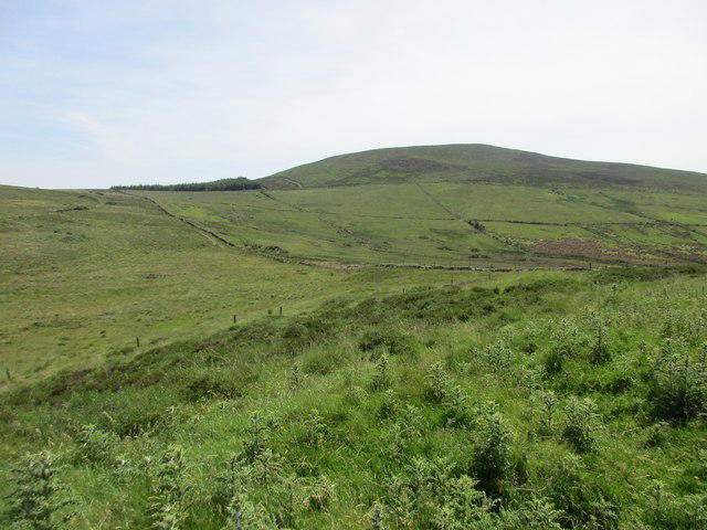 Photo could not load
S1107 : View towards Knocknanask
Jonathan Thacker
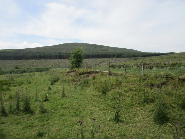 Photo could not load
S1107 : View towards Knocknanask
Jonathan Thacker
Hill facts and local notes
Classifications
Elevation
486m
1,594 ft
Prominence
130m
Coordinates
52.2169, -7.8310
S116072
OS Map
74
At the Summit
The summit of Knocknanask features a substantial stone cairn, offering a perfect spot for a well-earned rest and photo opportunity. On a clear day, you can spot the distant peaks of the Caha Mountains.
Terrain & Geology
The predominant rock on Knocknanask is granite, which creates rugged features and adds to the mountain's dramatic appearance. The glacial history of the region has also contributed to its unique topography, showcasing classic U-shaped valleys and rocky outcrops.
Views & Scenery
From the summit, hikers can enjoy expansive views across Bantry Bay, and on the other side, the rolling hills of the Boggeragh Mountains are a sight to behold.
History & Heritage
Name Origin
The name 'Knocknanask' possibly derives from the Irish Gaelic 'Cnoc na nEas’ which translates to 'hill of the waterfalls', a nod to the region's picturesque streams and water flows.
Historical Significance
This mountain is a popular hiking destination for both locals and tourists, symbolising the natural beauty of County Cork.
Getting There & Facilities
Check current local access restrictions, parking rules and transport timetables before travelling. These notes do not confirm public access to the summit.
Parking
Parking is available at the Glengarriff Nature Reserve (S052031) which has ample space for vehicles. Please park responsibly.
Public Transport
The 226 bus service from Cork City to Glengarriff stops within walking distance of the trailhead.
Nearby Facilities
Cafes and shops in Glengarriff offer refreshments, with public toilets available at the Nature Reserve.
Safety Information
Known Hazards
- Wet and slippery patches, particularly in shaded areas. Be mindful of sudden weather changes common in the Irish mountains.
General Safety Tips
- Check weather conditions before setting out
- Carry appropriate clothing and equipment
- Let someone know your planned route
- Take a map, compass, and GPS device
- Carry emergency supplies: food, water, first aid kit, torch
Hills
Some common questions about the hills answered
Are there group walks up Knocknanask?
Many walkers use Walkmates to join or organise walks with others. You can check for group walks around Knocknanask through the maps
Are there other walkers around Knocknanask?
Activity varies by location and time, but Walkmates lets you see whether others have shared walks or shown interest in this area. Find other people through the walking friends search walking friends for Knocknanask search or of course create your own walk for Knocknanask
Can I organise a walk to Knocknanask?
Yes. If there aren’t any walks listed already, you can create a walk and make it available for others to join.
If you're signed up to Walkmates, you can create a walk to Knocknanask.
How do I find a walk up this hill?
There are often multiple ways to walk this hill, depending on experience and route preference. Walkmates helps you explore walks and routes that others have shared.
Can I suggest a new route up Knocknanask?
Yes. You can suggest or create routes to share with others. Walkmates focuses on the social side of walking, so routes are used to help people organise walks and explore areas together, rather than as detailed navigation tools or route libraries.
Other uses really appreciate knowledgeable walkers sharing their routes. Share your favourite route to Knocknanask here
The is an error or something incorrect about this hill. How do I let you know?
We always strive to keep the information on Walkmates as accurate as possible. If you find an error, please let us know through the contact form and we'll aim to correct it as quickly as possible
Community Discussion
Comments
Location
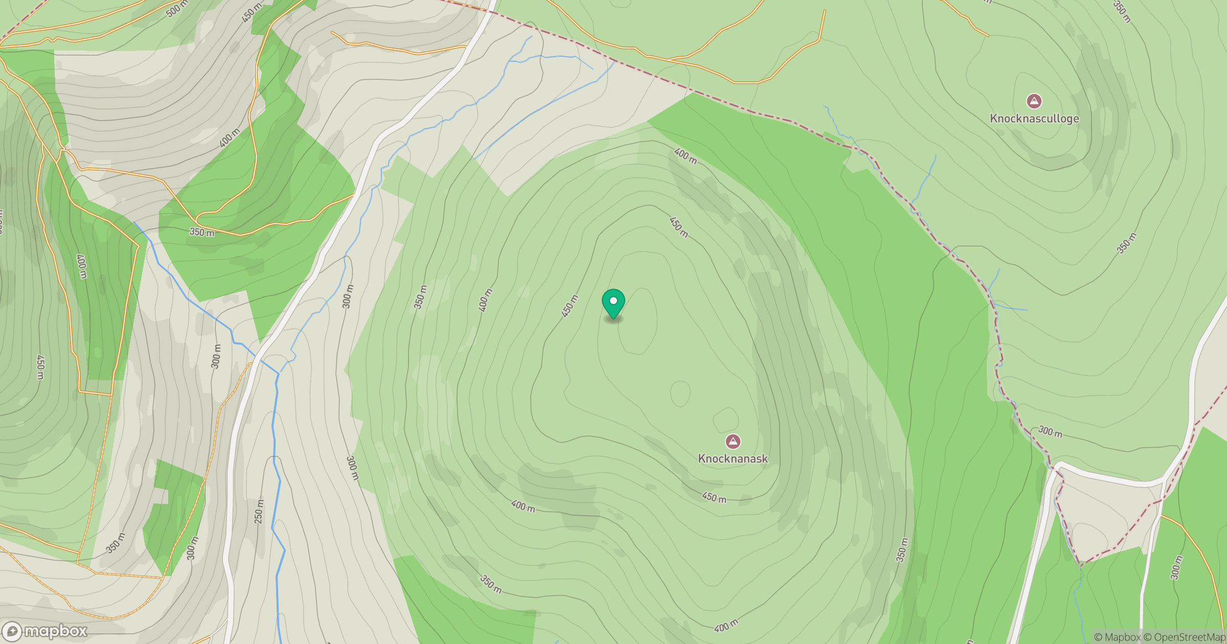
Grid reference: S116072
View on OpenStreetMapOpens a map in a new tab, centred on the hill.
Hills within 30 km
Straight-line distance, not a walking route or confirmation of access.
No comments yet. Be the first.