

Lacken Hill
Good walks are even better shared.
Overview
Lacken Hill: A Hidden Gem in the Malvern Hills
Nestled within the scenic Malvern Hills, Lacken Hill stands modestly at 367 meters. While it may not be the tallest, it certainly holds its own, boasting stunning views and a rich geological history that will capture the imagination of hikers and nature-lovers alike.
Geology
Formed predominantly from Old Red Sandstone, Lacken Hill's geology tells a tale of ancient rivers and shifting landforms. The distinctive reddish hue of the rocks can be attributed to iron oxide, providing a unique landscape that contrasts beautifully with the lush greenery of the surrounding fields. As you trek through the undulating terrain, take a moment to appreciate the layers of history beneath your feet.
Routes
The most popular route is the Lacken Hill Circular. Spanning 6.5 kilometers, this moderate trail starts in the picturesque village of Colwall. As you weave through forests and open pastures, the stunning views will leave you grinning like a Cheshire cat. This route typically takes about 2.5 hours to complete, perfect for an afternoon jaunt.
Summit Features
At the summit, you'll find a humble trig point and a rocky outcrop, ideal for that Instagram snap. Don’t be surprised if you encounter a few hardy shrubs claiming their place in this rough environment; they add character to the already striking landscape.
Terrain and Views
Expect a mixture of grassy slopes and rocky outcrops, with patches of woodland thrown in for good measure. The views from the summit are nothing short of breathtaking. To the east, the sweeping landscapes of Herefordshire unfold, while to the west, the rugged beauty of the Welsh mountains peeks through the horizon. For the best experience, spring and autumn are your allies, offering mild weather and vibrant colours.
Hazards
As with any outdoor adventure, be vigilant. Muddy trails can be slippery, especially after a downpour, and some rocks may be a little immovable – best to watch your footing. Also, keep an ear open for sudden weather changes; the hills have a knack for unpredictable shifts!
Nearby Summits
For those looking to extend their experience, nearby summits include British Camp and Worcester Beacon, both towering at 425 meters. They provide excellent company for Lacken Hill and offer even more stunning vistas.
Access
Reaching Lacken Hill is a piece of cake. The nearest parking is at Colwall Village Hall Car Park, where you can park for free, though it fills up in a jiffy, especially on sunny weekends. Public transport options are also available, with regular bus services dropping you off in the charming village of Colwall, the closest town.
Facilities
Colwall boasts a handful of delightful cafes and pubs perfect for quenching your thirst or having a cheeky slice of cake post-hike. You'll also find public toilets near the village hall, an essential feature of any hiking adventure.
History
The name 'Lacken' likely stems from the Old English word for 'brook', giving a nod to the area's watery past. The Malvern Hills hold significant cultural heritage, being a site of spiritual retreats for centuries, and it remains a beautiful refuge for those seeking solace in nature.
In summary, Lacken Hill may be modest in stature, but it more than makes up for it with charm, stunning landscapes, and a route that promises a lovely day out. So pack your boots, bring your sense of adventure, and get ready to explore this hidden gem!
Explore routes near Lacken Hill
Public walks starting within 80 km of this hill. Nearby does not mean a route reaches the summit; check its map and access before setting out.
No public routes are currently listed within 80 km of Lacken Hill on Walkmates. This does not mean there are no paths here. Explore the map and check local access information before planning a walk.
Route planning notes
These notes describe possible approaches, not verified navigable routes or permission to cross land. Check current paths, local access rules and conditions before setting out.
Lacken Hill Circular
A scenic circuit starting from the village of Colwall, offering stunning views and a pleasant blend of forest and open fields.
Make a day of it, together
Find someone to share the walk with, or organise a day out along a route you like.
Photo Gallery
View all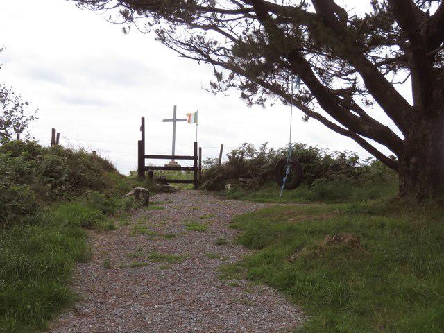 Photo could not load
S7628 : Lacken Hill 1798 monument
Hywel Williams
Hill facts and local notes
Classifications
Elevation
193m
633 ft
Prominence
107m
Coordinates
52.3996, -6.8856
S759281
OS Map
76
At the Summit
The summit features a small stone outcrop and a weathered trig point that serves as a perfect photo opportunity. A few hardy shrubs cling to life on the rocky summit, adding a touch of green to the otherwise stark landscape.
Terrain & Geology
Lacken Hill is primarily composed of Old Red Sandstone, characterised by its reddish hue and layers formed during the Devonian period. The geology here provides fascinating insights into the earth's history, with sedimentary rocks that hint at ancient river systems.
Views & Scenery
Panoramic views of the Malvern Hills and the surrounding countryside, including the picturesque Herefordshire plains and distant views of the Welsh mountains.
History & Heritage
Name Origin
The name 'Lacken' is believed to derive from the Old English term meaning 'to brook or stream', reflecting the area's past when water bodies were abundant.
Historical Significance
Historically, the Malvern Hills have had spiritual significance, and they have long been a gathering place for those seeking natural beauty and tranquillity.
Getting There & Facilities
Check current local access restrictions, parking rules and transport timetables before travelling. These notes do not confirm public access to the summit.
Parking
The nearest parking is available at the Colwall Village Hall Car Park, which offers free parking but can often fill up quickly, so arrive early.
Public Transport
Regular bus services from Hereford and Malvern stop in Colwall, making it accessible for those opting out of a driving adventure.
Nearby Facilities
There are local cafes and pubs in Colwall for a post-hike refuel, as well as public toilets situated near the village hall.
Safety Information
Known Hazards
- Watch out for muddy sections after rain, as well as hidden rocks that might trip you up. Also, be cautious of sudden weather changes typical in the Malvern Hills.
General Safety Tips
- Check weather conditions before setting out
- Carry appropriate clothing and equipment
- Let someone know your planned route
- Take a map, compass, and GPS device
- Carry emergency supplies: food, water, first aid kit, torch
Hills
Some common questions about the hills answered
Are there group walks up Lacken Hill?
Many walkers use Walkmates to join or organise walks with others. You can check for group walks around Lacken Hill through the maps
Are there other walkers around Lacken Hill?
Activity varies by location and time, but Walkmates lets you see whether others have shared walks or shown interest in this area. Find other people through the walking friends search walking friends for Lacken Hill search or of course create your own walk for Lacken Hill
Can I organise a walk to Lacken Hill?
Yes. If there aren’t any walks listed already, you can create a walk and make it available for others to join.
If you're signed up to Walkmates, you can create a walk to Lacken Hill.
How do I find a walk up this hill?
There are often multiple ways to walk this hill, depending on experience and route preference. Walkmates helps you explore walks and routes that others have shared.
Can I suggest a new route up Lacken Hill?
Yes. You can suggest or create routes to share with others. Walkmates focuses on the social side of walking, so routes are used to help people organise walks and explore areas together, rather than as detailed navigation tools or route libraries.
Other uses really appreciate knowledgeable walkers sharing their routes. Share your favourite route to Lacken Hill here
The is an error or something incorrect about this hill. How do I let you know?
We always strive to keep the information on Walkmates as accurate as possible. If you find an error, please let us know through the contact form and we'll aim to correct it as quickly as possible
Community Discussion
Comments
Location
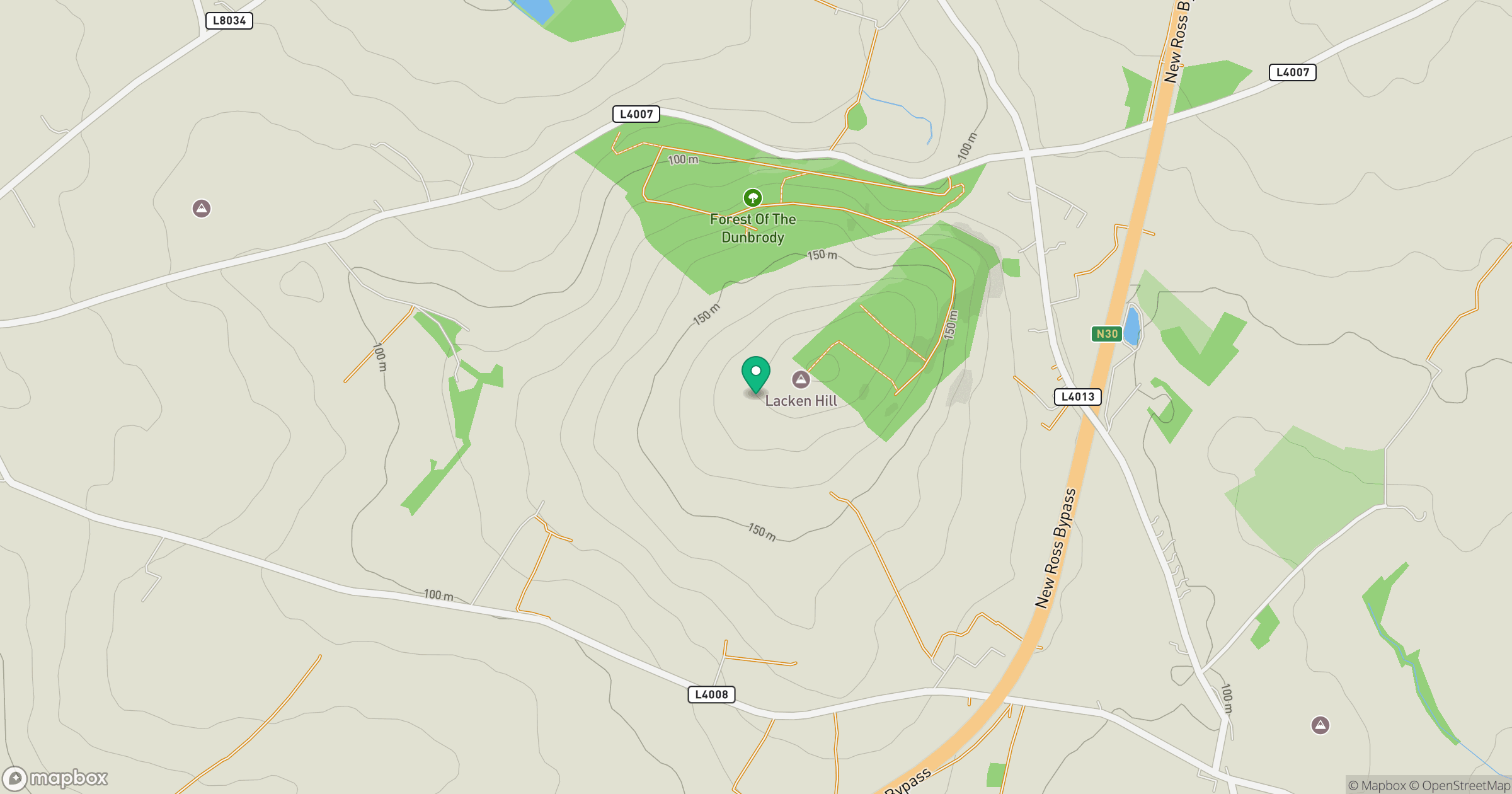
Grid reference: S759281
View on OpenStreetMapOpens a map in a new tab, centred on the hill.
Hills within 30 km
Straight-line distance, not a walking route or confirmation of access.
No comments yet. Be the first.