
Knockadullaun
Good walks are even better shared.
Overview
Knockadullaun
Nestled in the stunning landscape of Connemara in County Galway, Knockadullaun is a gem of a hill perfect for those looking to stretch their legs and catch a whiff of fresh Irish air. With an elevation of 292 meters, it's not the tallest mountain in Ireland, but what it lacks in stature, it more than makes up for in magnificent views and charm.
Geology
The mountain primarily boasts a granite composition interspersed with slate layers. This rugged geology is a reminder of Ireland's fiery past—yes, this place used to be a hotbed of volcanic activity! Talk about a hot topic!
The Routes
Ballynahinch Castle Hotel Route
This scenic circular route begins at the historic Ballynahinch Castle. Expect picturesque woodlands and tranquil lakes on the way to the summit. The 7.5 km hike offers a moderate challenge, and you’ll likely feel like you’re wandering through a fairy tale.
- Distance: 7.5 km
- Estimated Time: 3 hours
- Difficulty: Moderate
Summit Features
Once you reach the top, you’ll be greeted by a modest stone cairn—nothing too fancy, but it certainly does the job! Don’t forget to grab a few selfies against the panoramic backdrop. Your friends will be green with envy.
Terrain
The terrain is mainly grassy with periodic rocky spots, making the hike enjoyable but requiring a bit of care, especially near the summit. Good hiking boots are a must unless you fancy the idea of slipping and sliding.
Views
From the peak, you’ll be able to gaze at the breathtaking Twelve Bens mountain range to the north and the stunning Atlantic Ocean to the west. It’s prime selfie territory, especially in spring and autumn when visibility is best—a must for any Instagram enthusiast!
Hazards
Keep an eye out for loose stones along the path, and remember: Irish weather can change quicker than you can say 'I need my raincoat'. Be prepared for anything, and always check the forecast before you head out.
Nearby Summits
For the more adventurous souls, nearby peaks include:
- Bencorr Mountain (1014 meters)
- Mweelrea (814 meters)
Access
- Nearest Parking: You can find parking at the Ballynahinch Castle Hotel, conveniently located near the trailhead.
- Public Transport: Buses run from Galway City to Roundstone, with a quick taxi ride to kick off your hiking adventure.
- Nearest Town: Roundstone, a quaint village with a beautiful harbour.
Facilities
After your hike, indulge in a meal at the Ballynahinch Castle or visit one of the cozy cafes in Roundstone to replenish those calories.
History
The name 'Knockadullaun' translates to 'Hill of the Little Oak' in Irish, connecting this lovely mountain to its ancient roots. The landscape is steeped in local legends, making it a culturally significant spot for hikers and history buffs alike.
So, why not lace up those boots and take a jaunt up Knockadullaun? Fresh air and stunning views await, and who knows—you might even discover a bit of your own adventure along the way!
Explore routes near Knockadullaun
Public walks starting within 80 km of this hill. Nearby does not mean a route reaches the summit; check its map and access before setting out.
No public routes are currently listed within 80 km of Knockadullaun on Walkmates. This does not mean there are no paths here. Explore the map and check local access information before planning a walk.
Route planning notes
These notes describe possible approaches, not verified navigable routes or permission to cross land. Check current paths, local access rules and conditions before setting out.
Ballynahinch Castle Hotel Route
A scenic circular route starting from the Ballynahinch Castle, this trail leads you through lush woodlands and stunning lakes before ascending to the summit.
Make a day of it, together
Find someone to share the walk with, or organise a day out along a route you like.
Hill facts and local notes
Classifications
Elevation
352m
1,156 ft
Prominence
124m
Coordinates
52.1889, -8.0452
R969040
OS Map
74
At the Summit
The summit is marked by a small stone cairn and offers plenty of space for a well-earned rest while enjoying the breathtaking views.
Terrain & Geology
Primarily composed of granite with some slate formations, giving it a rugged appearance worthy of a postcard. The unique geological features are a result of ancient volcanic activity.
Views & Scenery
From the summit, you can enjoy sweeping views of the Twelve Bens to the north and the Atlantic Ocean to the west.
History & Heritage
Name Origin
The name 'Knockadullaun' derives from the Irish 'Cnoc Duileann' which translates to 'Hill of the Little Oak'.
Historical Significance
The area is rich in folklore and history, often associated with local legends and the ancient Gaelic culture.
Getting There & Facilities
Check current local access restrictions, parking rules and transport timetables before travelling. These notes do not confirm public access to the summit.
Parking
There is parking available at Ballynahinch Castle Hotel, which is a short walk from the trailhead.
Public Transport
Bus services run from Galway City to Roundstone, with a short taxi ride to the trailhead.
Nearby Facilities
Ballynahinch Castle Hotel offers dining facilities and restrooms, and there are cafes in Roundstone for post-hike refreshments.
Safety Information
Known Hazards
- Watch out for loose stones and sudden changes in weather, as the Irish love to keep you on your toes with unpredictable rain and wind.
General Safety Tips
- Check weather conditions before setting out
- Carry appropriate clothing and equipment
- Let someone know your planned route
- Take a map, compass, and GPS device
- Carry emergency supplies: food, water, first aid kit, torch
Hills
Some common questions about the hills answered
Are there group walks up Knockadullaun?
Many walkers use Walkmates to join or organise walks with others. You can check for group walks around Knockadullaun through the maps
Are there other walkers around Knockadullaun?
Activity varies by location and time, but Walkmates lets you see whether others have shared walks or shown interest in this area. Find other people through the walking friends search walking friends for Knockadullaun search or of course create your own walk for Knockadullaun
Can I organise a walk to Knockadullaun?
Yes. If there aren’t any walks listed already, you can create a walk and make it available for others to join.
If you're signed up to Walkmates, you can create a walk to Knockadullaun.
How do I find a walk up this hill?
There are often multiple ways to walk this hill, depending on experience and route preference. Walkmates helps you explore walks and routes that others have shared.
Can I suggest a new route up Knockadullaun?
Yes. You can suggest or create routes to share with others. Walkmates focuses on the social side of walking, so routes are used to help people organise walks and explore areas together, rather than as detailed navigation tools or route libraries.
Other uses really appreciate knowledgeable walkers sharing their routes. Share your favourite route to Knockadullaun here
The is an error or something incorrect about this hill. How do I let you know?
We always strive to keep the information on Walkmates as accurate as possible. If you find an error, please let us know through the contact form and we'll aim to correct it as quickly as possible
Community Discussion
Comments
Location
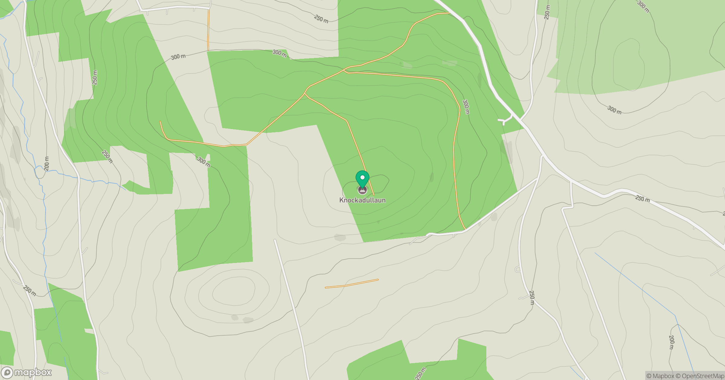
Grid reference: R969040
View on OpenStreetMapOpens a map in a new tab, centred on the hill.
Hills within 30 km
Straight-line distance, not a walking route or confirmation of access.
Galtymore [Cnoc Mor na nGaibhlte]
918m
Knockshanahullion
653m
Sugarloaf Hill
663m
Knockmealdown [Cnoc Mhaoldomhnaigh]
792m
Knockakeo
238m
No comments yet. Be the first.