

Knocknacloghoge
Good walks are even better shared.
Overview
Knocknacloghoge: A Gem in the Mourne Mountains
Nestled within the beloved Mourne Mountains, Knocknacloghoge stands at an elevation of 585 meters, offering a lovely escape for hikers seeking stunning views and a touch of adventure. Whether you are a seasoned peak-bagger or a casual walker, this mountain is accessible and rewarding.
Geology
The geological composition of Knocknacloghoge primarily features granite, which lends the mountain its rugged character. Beyond its beauty, granite is known for its resistance to erosion, making these rocky outcrops a true testament to nature's artistry. As you hike, be sure to admire the curious shapes that weathering has sculpted over the years.
Routes
One popular route begins at the Hen Mountain car park. This moderate trail extends about 4.5 km and typically takes around 2.5 hours to complete. It is steep in part, but the effort is well worth the journey as the landscape unfolds before you.
Summit Features
Reaching the summit, you'll be greeted by a small cairn, perfect for a photo op or simply a place to rest and catch your breath—while taking in the magnificent views!
Terrain
The terrain varies from rocky sections to grassy areas, along with the occasional boggy patch that may remind you of a surprise mud bath. Proper footwear is recommended to navigate this delightful yet unpredictable ground.
Views
From the summit, expect panoramic vistas showcasing the rolling hills of the Mournes, the blue shimmer of the Irish Sea, and the proud silhouette of Slieve Donard. The best times to experience these views are in spring and autumn, when the colours are simply breathtaking, and the air is fresh.
Hazards
While majestic, Knocknacloghoge is not without its challenges. Hikers should be cautious of slippery rocks—especially following rain. Those boggy patches may also require some careful footwork to avoid an unexpected splash!
Nearby Summits
Don’t miss the chance to explore nearby mountains like Slieve Donard, the highest peak in the Mourne area at 850 meters, or Hen Mountain at 562 meters. Each offers its unique trails and breath-taking vistas.
Access
For access, head to Newcastle, where you can find parking at the Hen Mountain car park. Public transport to the area is a bit scarce, so it's best to have your own set of wheels for this adventure.
Facilities
Before or after your hike, Newcastle has all the amenities you might need, including quaint cafes and public toilets to refresh you.
History
The name Knocknacloghoge refers to 'the hill of the clay', hinting at its rich historical context. The mountain, like many in its range, carries tales of ancient Ulster kings and local lore, adding a dash of intrigue to your hike.
In conclusion, Knocknacloghoge is not just a hike; it’s an experience filled with natural beauty, history, and a bit of fun along the way. Pack your gear, lace up your hiking boots, and embrace the wanderlust!
Happy hiking!
Explore routes near Knocknacloghoge
Public walks starting within 80 km of this hill. Nearby does not mean a route reaches the summit; check its map and access before setting out.
No public routes are currently listed within 80 km of Knocknacloghoge on Walkmates. This does not mean there are no paths here. Explore the map and check local access information before planning a walk.
Route planning notes
These notes describe possible approaches, not verified navigable routes or permission to cross land. Check current paths, local access rules and conditions before setting out.
Hen Mountain Route
Starting from the Hen Mountain car park, this route offers a steep ascent towards the summit of Knocknacloghoge.
Make a day of it, together
Find someone to share the walk with, or organise a day out along a route you like.
Photo Gallery
View all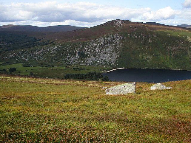 Photo could not load
O1405 : Lough Dan
kevin higgins
Hill facts and local notes
Classifications
Elevation
532m
1,747 ft
Prominence
133m
Coordinates
53.0876, -6.2940
O143054
OS Map
56
At the Summit
At the summit, you will find a distinctive small cairn which offers a lovely spot to take in the views and maybe contemplate the meaning of life or just how on Earth you lost your snack.
Terrain & Geology
The core of Knocknacloghoge is primarily composed of granite, providing a rugged and resilient surface. The weathering of this granite has created fascinating rock formations that intrigue both geologists and hikers alike.
Views & Scenery
From the summit, enjoy panoramic views of the surrounding Mourne Mountains, the Irish Sea, and the expansive green valleys. On a clear day, the sight of Slieve Donard is particularly breathtaking.
History & Heritage
Name Origin
The name Knocknacloghoge derives from the Irish 'Cnoc na Clocaire', which translates to 'the hill of the clay'.
Historical Significance
This mountain, like many in the Mourne range, is deeply rooted in local folklore and history, often linked to the ancient kings of Ulster.
Getting There & Facilities
Check current local access restrictions, parking rules and transport timetables before travelling. These notes do not confirm public access to the summit.
Parking
There is a small car park located at the base of Hen Mountain, approximately 3 km away from the nearest road access.
Public Transport
Public transport options are limited; best accessed via car, but there are bus services from nearby towns on select days.
Nearby Facilities
In Newcastle, you'll find cafes, restaurants, and public toilets to prepare you for your hiking adventure.
Safety Information
Known Hazards
- Be wary of slippery rocks, particularly after rain. Some boggy areas can be deceptively tricky!
General Safety Tips
- Check weather conditions before setting out
- Carry appropriate clothing and equipment
- Let someone know your planned route
- Take a map, compass, and GPS device
- Carry emergency supplies: food, water, first aid kit, torch
Hills
Some common questions about the hills answered
Are there group walks up Knocknacloghoge?
Many walkers use Walkmates to join or organise walks with others. You can check for group walks around Knocknacloghoge through the maps
Are there other walkers around Knocknacloghoge?
Activity varies by location and time, but Walkmates lets you see whether others have shared walks or shown interest in this area. Find other people through the walking friends search walking friends for Knocknacloghoge search or of course create your own walk for Knocknacloghoge
Can I organise a walk to Knocknacloghoge?
Yes. If there aren’t any walks listed already, you can create a walk and make it available for others to join.
If you're signed up to Walkmates, you can create a walk to Knocknacloghoge.
How do I find a walk up this hill?
There are often multiple ways to walk this hill, depending on experience and route preference. Walkmates helps you explore walks and routes that others have shared.
Can I suggest a new route up Knocknacloghoge?
Yes. You can suggest or create routes to share with others. Walkmates focuses on the social side of walking, so routes are used to help people organise walks and explore areas together, rather than as detailed navigation tools or route libraries.
Other uses really appreciate knowledgeable walkers sharing their routes. Share your favourite route to Knocknacloghoge here
The is an error or something incorrect about this hill. How do I let you know?
We always strive to keep the information on Walkmates as accurate as possible. If you find an error, please let us know through the contact form and we'll aim to correct it as quickly as possible
Community Discussion
Comments
Location
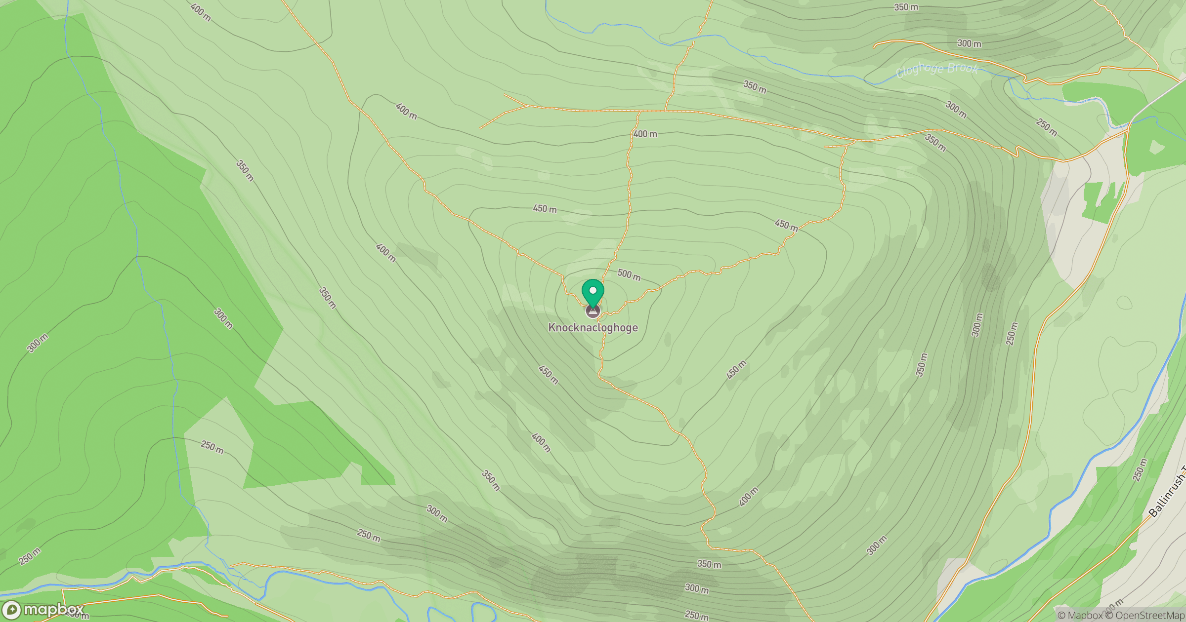
Grid reference: O143054
View on OpenStreetMapOpens a map in a new tab, centred on the hill.
Hills within 30 km
Straight-line distance, not a walking route or confirmation of access.
Mullaghcleevaun
847m
Lugnaquilla [Log na Coille]
925m
Luggala [Fancy Mountain] [Log an La]
593m
Scarr
640m
Djouce
726m
No comments yet. Be the first.