
Kilmacomma Hill
Good walks are even better shared.
Overview
Kilmacomma Hill: An Adventure Awaits
Nestled in the stunning Slieve Bloom Mountains, Kilmacomma Hill stands proud at 234 meters, offering hikers both a physical challenge and an abundance of natural beauty. With its relatively approachable elevation, it attracts walkers of all skill levels, proving that getting outside doesn’t require reaching 'the sky'.
Geology
The hill showcases fascinating geological formations primarily comprised of limestone and sandstone. As you trek along, take a moment to appreciate the ancient history written in the rocks beneath your feet—each stone a chapter from eons past.
Routes
One popular route is the Kilmacomma Circular Walk, beginning at the quaint village of Kinnity. This moderate circular walk spans 9 km and typically takes around 3.5 hours to complete, allowing ample opportunity to soak in the views or, perhaps, paint a tree if you’re feeling particularly inspired!
Summit Features
At the summit, adventurers will find a solid stone cairn, a symbol of accomplishment, and a perfect resting place to enjoy your homemade sandwiches—because you know they taste better with a view! The scenery from Kilmacomma will certainly make you reach for your camera, so don’t forget to capture the moment.
Terrain Type
The terrain is primarily grassy with some rocky areas, so while it’s not a scramble, it's best to wear sturdy footwear to navigate those sneaky patches of heather.
Views
The views from Kilmacomma Hill are nothing short of spectacular! You can feast your eyes on the rolling hills of County Offaly and, on a clear day, catch a glimpse of the mighty River Shannon snaking its way through the lush landscape. The best seasons for these views? Spring and autumn, when nature’s palette is a feast for the eyes!
Hazards
As with any outdoor adventure, be wary of the elements. The paths can get muddy after a good rain and sudden weather changes may catch you off-guard. Make sure your footwear can handle a bit of slush, and it’s always wise to check the forecast before heading out—don’t forget to pack those extra socks!
Access
Nearest Parking: You’ll find ample parking at Kinnity Castle Hotel, just 2 km from the trailhead. It's generally used by non-guests, so pop by without hesitation!
Public Transport: Local buses serve Kinnity from larger towns like Tullamore, but services are infrequent, so be sure to check the timetable.
Nearest Town: Kinnity possesses charm and warmth, with locals eager to share tales of history and maybe offer a few recommendations for that well-deserved post-hike bite.
Facilities
In Kinnity, you'll find friendly cafés, local shops, and even toilet facilities for those ‘emergencies’—a must for any adventurer!
History
Kilmacomma Hill is steeped in history. Its name suggests a link to St. Comman, possibly indicating its historical role as a religious site. Local folklore often finds its way into conversations here, so feel free to ask the locals for a good story or two!
In conclusion, Kilmacomma Hill is not just a hike; it’s an experience wrapped in history, beauty, and a touch of adventure. Pack your bag, grab your walking stick, and head for the hills—it’s time to create your own memories on Kilmacomma!
Last Updated
2023-10-05
Source
OpenStreetMap
Explore routes near Kilmacomma Hill
Public walks starting within 80 km of this hill. Nearby does not mean a route reaches the summit; check its map and access before setting out.
No public routes are currently listed within 80 km of Kilmacomma Hill on Walkmates. This does not mean there are no paths here. Explore the map and check local access information before planning a walk.
Route planning notes
These notes describe possible approaches, not verified navigable routes or permission to cross land. Check current paths, local access rules and conditions before setting out.
Kilmacomma Circular Walk
A scenic loop starting from the nearby village of Kinnity, taking you through lush forests and open moorland with a gradual ascent to the summit.
Make a day of it, together
Find someone to share the walk with, or organise a day out along a route you like.
Hill facts and local notes
Classifications
Elevation
213m
699 ft
Prominence
146m
Coordinates
52.3345, -7.7381
S179203
OS Map
74
At the Summit
At the summit, hikers will find a modest stone cairn and a stunning view of the surrounding countryside. It's a popular place for a well-earned rest and a snack!
Terrain & Geology
Kilmacomma Hill is primarily composed of limestone and sandstone, offering interesting rocky outcrops and fertile valleys. The processes that shaped these hills can be traced back millions of years, giving hikers a glimpse into the Earth's geological history.
Views & Scenery
From the top, enjoy breathtaking views of the Slieve Bloom Mountains, the rolling hills of County Offaly, and on a clear day, the distant outline of the River Shannon.
History & Heritage
Name Origin
The name 'Kilmacomma' is thought to derive from Gaelic, meaning 'the Church of St. Comman', pointing to its historical significance as a religious site.
Historical Significance
The area is steeped in local folklore, and Kilmacomma Hill has been a place of gathering for centuries, often used for local festivals and events.
Getting There & Facilities
Check current local access restrictions, parking rules and transport timetables before travelling. These notes do not confirm public access to the summit.
Parking
Parking is available at the Kinnity Castle Hotel, approximately 2 km from the trailhead, where non-guests are generally welcome to park.
Public Transport
Buses run from larger towns like Tullamore to Kinnity, but service may be infrequent. Check local timetables for details.
Nearby Facilities
Kinnity offers a small selection of cafés and amenities. Toilets are available at Kinnity Castle, which is a short distance from the route.
Safety Information
Known Hazards
- Occasional steep sections and muddy paths after rain, so good footwear is essential.
- Beware of sudden weather changes, as the weather can turn quicker than a cat on a hot tin roof.
General Safety Tips
- Check weather conditions before setting out
- Carry appropriate clothing and equipment
- Let someone know your planned route
- Take a map, compass, and GPS device
- Carry emergency supplies: food, water, first aid kit, torch
Hills
Some common questions about the hills answered
Are there group walks up Kilmacomma Hill?
Many walkers use Walkmates to join or organise walks with others. You can check for group walks around Kilmacomma Hill through the maps
Are there other walkers around Kilmacomma Hill?
Activity varies by location and time, but Walkmates lets you see whether others have shared walks or shown interest in this area. Find other people through the walking friends search walking friends for Kilmacomma Hill search or of course create your own walk for Kilmacomma Hill
Can I organise a walk to Kilmacomma Hill?
Yes. If there aren’t any walks listed already, you can create a walk and make it available for others to join.
If you're signed up to Walkmates, you can create a walk to Kilmacomma Hill.
How do I find a walk up this hill?
There are often multiple ways to walk this hill, depending on experience and route preference. Walkmates helps you explore walks and routes that others have shared.
Can I suggest a new route up Kilmacomma Hill?
Yes. You can suggest or create routes to share with others. Walkmates focuses on the social side of walking, so routes are used to help people organise walks and explore areas together, rather than as detailed navigation tools or route libraries.
Other uses really appreciate knowledgeable walkers sharing their routes. Share your favourite route to Kilmacomma Hill here
The is an error or something incorrect about this hill. How do I let you know?
We always strive to keep the information on Walkmates as accurate as possible. If you find an error, please let us know through the contact form and we'll aim to correct it as quickly as possible
Community Discussion
Comments
Location
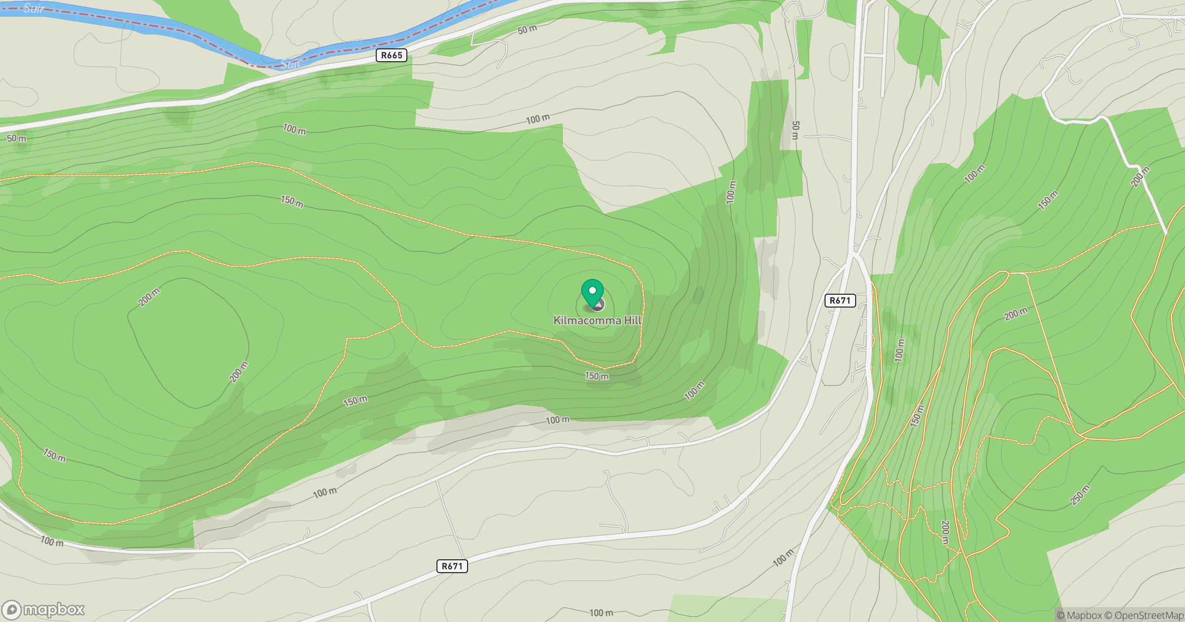
Grid reference: S179203
View on OpenStreetMapOpens a map in a new tab, centred on the hill.
Hills within 30 km
Straight-line distance, not a walking route or confirmation of access.
Laghtnafrankee
518m
Knocknanask
486m
Knockanaffrin [Cnoc an Aifrinn]
755m
Slievenamon [Sliabh na mBan]
720m
Knockmealdown [Cnoc Mhaoldomhnaigh]
792m
No comments yet. Be the first.