

Inisheer
Good walks are even better shared.
L9702 : Boreen - Inis Oírr
louise price Photo source
Overview
Inisheer: The Eastern Gem of the Aran Islands
Nestled in the heart of Galway Bay, Inisheer, or East Island, boasts a unique charm blending stunning landscapes and historical richness. Though it may not reach lofty elevations, at sea level, its allure lies in its coastal beauty and cultural heritage.
Geology
Inisheer is primarily composed of limestone formed during the Carboniferous period. This geologically rich environment supports an array of fossils and marine remnants, making it a fun spot for amateur paleontologists. Don’t forget to take a closer look at the ground—you might uncover a piece of history!
Routes
Exploring Inisheer is a delight, particularly for those who fancy a brisk stroll along the coast or a leisurely hike through history.
Coastal Walk: A scenic coast-hugging trail that offers beautiful vistas of the ocean and chances to spot wildlife.
- Distance: 5.5 km
- Time: Approx. 2 hours
- Difficulty: Easy
Inisheer Loop Trail: This charming route encompasses historical landmarks including forts and ancient ruins.
- Distance: 8.0 km
- Time: Approx. 3 hours
- Difficulty: Moderate
Summit Features
While you won’t find a traditional summit, the rolling hills of Inisheer host several fascinating features, including the remains of the 12th-century St. Caomhnóg church. Here, history mingles with grasslands, creating an atmosphere of serenity mixed with a dash of the ancient.
Terrain
Prepare for gentle hills and rocky paths with plenty of grass underfoot. A good pair of shoes will keep you steady as you explore these picturesque landscapes.
Views
On a clear day, the vistas from various points on Inisheer are nothing short of breathtaking. Look out for Inis Meain and the majestic Cliffs of Moher to the north. Spring and early autumn are the prime seasons to soak in these views—perfect weather for sightseers!
Hazards
As with many coastal areas, be aware of strong winds and slippery rocks. Just because the scenery is dazzling doesn’t mean the geology won’t keep you on your toes!
Access
Getting to Inisheer is a breeze with ferry services running regularly from Doolin, County Clare. There’s some parking at the ferry terminal for those driving from afar. Availability of public transport may be limited, so do check schedules in advance.
Facilities
The island offers small cafés where you can grab a bite, alongside public toilets close to the ferry landing for your convenience.
History
Inisheer’s name means 'East Island' in Irish—apt considering its location! Historically, it holds significance with old Christian settlements steeped in Gaelic culture that are worth exploring.
In conclusion, whether you're a history buff or a nature lover, Inisheer promises a delightful escape. Just remember to check the weather before you head out—after all, the Irish weather has a way of keeping hikers on their toes!
Happy Hiking!
Explore routes near Inisheer
Walks starting near this hill. Open a route to check its map, distance and full itinerary.
Route planning notes
These notes describe possible approaches. Check a route's map and access information when planning your walk.
Coastal Walk
A scenic coastal walk circling the island offering stunning views of the Atlantic and occasional encounters with wildlife.
Inisheer Loop Trail
A pleasant loop that takes hikers through historical sites including old forts and ancient ruins.
Make a day of it, together
Find someone to share the walk with, or organise a day out along a route you like.
Photo Gallery
View all Photo could not load
L9702 : Boreen - Inis Oírr
louise price
 Photo could not load
L9702 : Spring well - Inis Oírr
louise price
 Photo could not load
L9701 : Inis Oírr - tractor ride
louise price
 Photo could not load
L9701 : Feidin wall on Inis Oírr
louise price
Hill facts and local notes
Classifications
Elevation
57m
187 ft
Prominence
57m
Coordinates
53.0582, -9.5265
L977019
OS Map
51
At the Summit
The island does not have a peak per se but features remarkable grasslands and ruins, including the 12th-century church of St. Caomhnóg with its ancient graveyard.
Terrain & Geology
Inisheer is primarily composed of limestone, part of the Carboniferous era, which plays host to an array of interesting fossils and marine life remnants. The island's flat landscape contrasts sharply with the rugged cliffs that surround it.
Views & Scenery
Inis Meain and Inis Meain to the north, the Cliffs of Moher on the mainland, and panoramic views of the Atlantic Ocean.
History & Heritage
Name Origin
Inisheer translates to 'East Island' in Irish, reflecting its geographic position relative to the other Aran Islands.
Historical Significance
Historically, Inisheer is known for its rich history of early Christian settlements and its role in the Gaelic revival.
Getting There & Facilities
Parking
Parking is available at the ferry terminal in Doolin, County Clare, where boat services to Inisheer operate.
Public Transport
Regular ferry service from Doolin and the mainland; limited flights may be available from Galway.
Nearby Facilities
Small cafés and shops are present on the island, along with public toilets near the ferry landing.
Safety Information
Known Hazards
- Strong winds, slippery coastal paths, and sudden weather changes can pose challenges for walkers.
General Safety Tips
- Check weather conditions before setting out
- Carry appropriate clothing and equipment
- Let someone know your planned route
- Take a map, compass, and GPS device
- Carry emergency supplies: food, water, first aid kit, torch
Hills
Some common questions about the hills answered
Are there group walks up Inisheer?
Many walkers use Walkmates to join or organise walks with others. You can check for group walks around Inisheer through the maps
Are there other walkers around Inisheer?
Activity varies by location and time, but Walkmates lets you see whether others have shared walks or shown interest in this area. Find other people through the walking friends search walking friends for Inisheer search or of course create your own walk for Inisheer
Can I organise a walk to Inisheer?
Yes. If there aren’t any walks listed already, you can create a walk and make it available for others to join.
If you're signed up to Walkmates, you can create a walk to Inisheer.
How do I find a walk up this hill?
There are often multiple ways to walk this hill, depending on experience and route preference. Walkmates helps you explore walks and routes that others have shared.
Can I suggest a new route up Inisheer?
Yes. You can suggest or create routes to share with others. Walkmates focuses on the social side of walking, so routes are used to help people organise walks and explore areas together, rather than as detailed navigation tools or route libraries.
Other uses really appreciate knowledgeable walkers sharing their routes. Share your favourite route to Inisheer here
The is an error or something incorrect about this hill. How do I let you know?
We always strive to keep the information on Walkmates as accurate as possible. If you find an error, please let us know through the contact form and we'll aim to correct it as quickly as possible
Community Discussion
Comments
Location
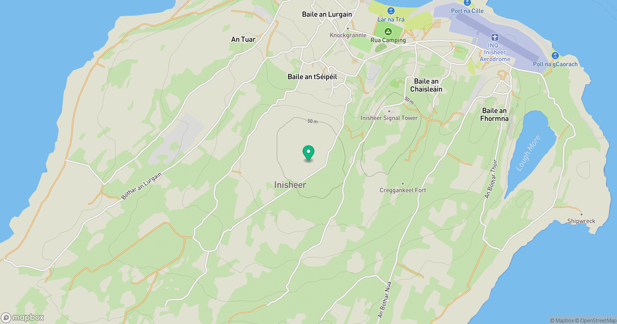
Grid reference: L977019
View on OpenStreetMapOpens a map in a new tab, centred on the hill.
No comments yet. Be the first.