
Inishbofin
Good walks are even better shared.
Overview
Inishbofin: A Hidden Gem
Nestled off the coast of Connemara in County Galway, Inishbofin is a mesmerising island that offers adventure seekers a beautiful blend of rugged landscape and rich history. With an elevation of 145 meters, this Marilyn may not be the highest peak, but it certainly offers some of the most breathtaking views.
Geology
Inishbofin’s geological features tell a tale of time. The limestone and sedimentary rocks reveal the island’s ancient origins. Exploring the rugged cliffs and coastal ranges can feel like stepping back in time, where you can almost hear the whispers of the past.
Hiking Routes
Coastal Route
A must-do! The Coastal Route navigates along the edges of the island and stretches around 8.5 km. This moderate trek offers unmatched views of the Atlantic crashing against the rocky shores. Allow about 3.5 hours for this one—don't forget your camera!
Inland Trail
For a more leisurely stroll, the Inland Trail takes you across grassy fields and peaceful country paths, covering approximately 5 km in about 2 hours. It's an ideal spot for those wishing to soak in the tranquillity of the island away from the hustle and bustle.
Summit Features
Upon reaching the summit, you’ll be greeted by a jolly stone cairn. It stands proudly as a reminder of the many adventurers who have walked these paths. Snap a picture, but be careful of those gusty winds!
Views
The vistas from the summit are simply stunning. Gaze out over the shimmering Atlantic, catch a glimpse of the Aran Islands, and marvel at the rugged beauty of Connemara. Spring and early summer offer the clearest skies, making it the perfect time for photo enthusiasts.
Hazards
Though Inishbofin is a beautiful island, keep an eye out for those slippery rocks, especially after rain. And just as the locals would say, always check the weather before you step out; the Irish weather is as unpredictable as a cat on a hot tin roof!
Access
Inishbofin is accessible via a ferry from Cleggan, which is the nearest town. There’s some parking available at the ferry terminal, so it might be wise to arrive early.
Facilities
The island has a lovely pub and a tiny shop for any essentials or post-hike refreshments. Toilets can be found at the ferry terminal as well.
History
The name Inishbofin, meaning 'Island of the White Cow', hints at its colourful folkloric past. Historically, it has served as a retreat for rebels, drawing in those seeking solace from conflict.
Inishbofin is not just a hike; it's an experience bundled with nature, history, and breathtaking views. Whether you’re a seasoned hiker or a casual stroller, this island is sure to leave a lasting memory.
Happy hiking!
Explore routes near Inishbofin
Walks starting near this hill. Open a route to check its map, distance and full itinerary.
Route planning notes
These notes describe possible approaches. Check a route's map and access information when planning your walk.
Coastal Route
This scenic route follows the coastline, offering stunning views of the Atlantic Ocean and the surrounding islands.
Inland Trail
A lovely walk through the rolling hills and fields of Inishbofin, perfect for a peaceful hike away from more tourist-trodden paths.
Make a day of it, together
Find someone to share the walk with, or organise a day out along a route you like.
Hill facts and local notes
Classifications
Elevation
89m
292 ft
Prominence
89m
Coordinates
53.6184, -10.2479
L513655
OS Map
37
At the Summit
At the summit, you’ll find a charming stone cairn, a perfect spot for a snapshot to impress your friends back home. Just don’t drop your camera down the cliffs!
Terrain & Geology
Inishbofin is primarily composed of limestone and other sedimentary rocks, a testament to the area's rich geological history. The rugged cliffs and karst landscapes are a result of millennia of erosion and weathering.
Views & Scenery
From the summit, hikers can enjoy panoramic views of the Atlantic Ocean, the Aran Islands, and the majestic Connemara landscape.
History & Heritage
Name Origin
Inishbofin translates to 'Island of the White Cow' in Irish, steeped in tales of folklore and myth.
Historical Significance
The island has historical significance as it was once a refuge for the Irish rebels during the 1650s.
Getting There & Facilities
Parking
There is limited parking available at the ferry terminal in Inishturk. Arrive early during peak season to secure a spot.
Public Transport
The nearest public transport option is a bus service from Westport to the ferry terminal. Check local timetables for more details.
Nearby Facilities
Inishbofin offers a pub and a small shop, perfect for a post-hike pint or snack. Toilet facilities are available at the ferry terminal.
Safety Information
Known Hazards
- Be wary of slippery rocks, particularly after rainfall. Check the weather before heading out, and be prepared for coastal winds!
General Safety Tips
- Check weather conditions before setting out
- Carry appropriate clothing and equipment
- Let someone know your planned route
- Take a map, compass, and GPS device
- Carry emergency supplies: food, water, first aid kit, torch
Hills
Some common questions about the hills answered
Are there group walks up Inishbofin?
Many walkers use Walkmates to join or organise walks with others. You can check for group walks around Inishbofin through the maps
Are there other walkers around Inishbofin?
Activity varies by location and time, but Walkmates lets you see whether others have shared walks or shown interest in this area. Find other people through the walking friends search walking friends for Inishbofin search or of course create your own walk for Inishbofin
Can I organise a walk to Inishbofin?
Yes. If there aren’t any walks listed already, you can create a walk and make it available for others to join.
If you're signed up to Walkmates, you can create a walk to Inishbofin.
How do I find a walk up this hill?
There are often multiple ways to walk this hill, depending on experience and route preference. Walkmates helps you explore walks and routes that others have shared.
Can I suggest a new route up Inishbofin?
Yes. You can suggest or create routes to share with others. Walkmates focuses on the social side of walking, so routes are used to help people organise walks and explore areas together, rather than as detailed navigation tools or route libraries.
Other uses really appreciate knowledgeable walkers sharing their routes. Share your favourite route to Inishbofin here
The is an error or something incorrect about this hill. How do I let you know?
We always strive to keep the information on Walkmates as accurate as possible. If you find an error, please let us know through the contact form and we'll aim to correct it as quickly as possible
Community Discussion
Comments
Location
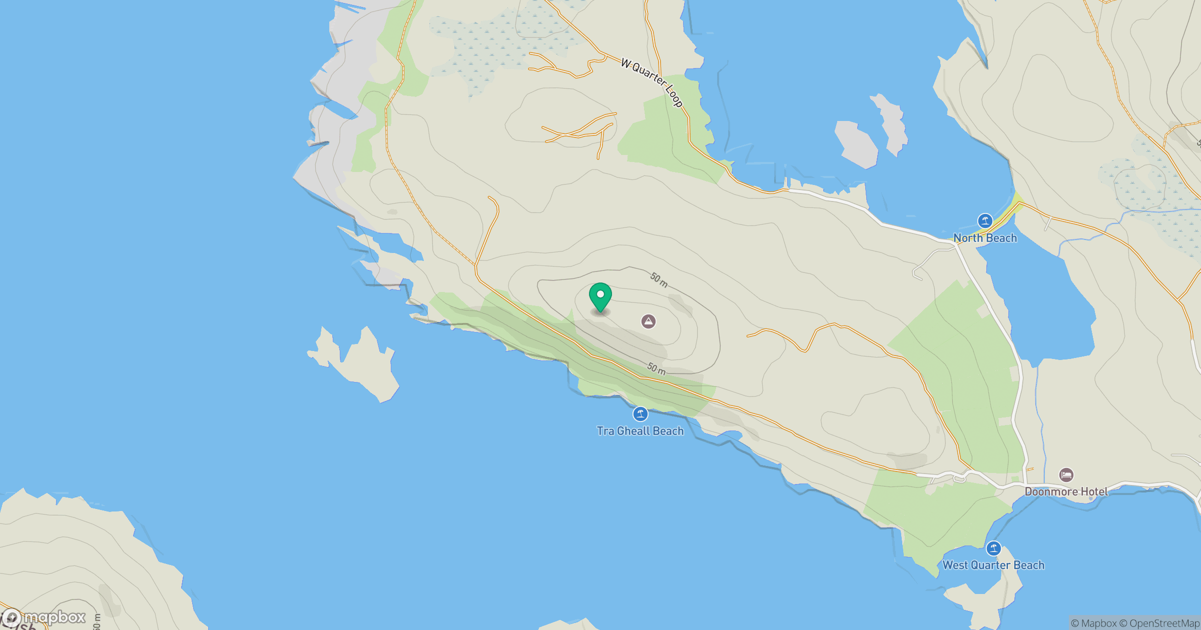
Grid reference: L513655
View on OpenStreetMapOpens a map in a new tab, centred on the hill.
No comments yet. Be the first.