
Knocknaveen
Good walks are even better shared.
Overview
Knocknaveen: A Hidden Gem in the Sperrins
Knocknaveen, standing proud at 510 meters, offers an escape for those wishing to embrace nature without the tourist hustle. This Marilyn mountain may not be the highest in the Sperrin range, but it makes up for it with its charming views and welcoming trails.
Geology
The rocky heart of Knocknaveen is forged from granite and schist, providing a window into the Earth’s ancient past. As you traverse its slopes, take a moment to marvel at the natural artistry that’s been shaped over millions of years.
Routes
Carpark to Summit
The most popular hike starts from the gravel layby at L688852. Covering approximately 4.2 km, this trek will have you navigating through fragrant heather before rewarding you with panoramic views at the summit. Allow about 2 hours to leisurely make your way, snapping photos and enjoying the scenery along the way.
Summit Features
As you reach the summit, you’ll be greeted by a lovely stone cairn, the perfect place to catch your breath and enjoy the well-deserved views. It’s also a good spot to declare your victory over the mountain!
Terrain
Expect a delightful mix of grassy hillsides, rocky outcrops, and a few boggy patches to test your navigational skills. Wellies might not be necessary, but waterproof boots will go a long way!
Views
From the summit, your eyes can feast upon the stunning landscapes of the Sperrins. On a clear day, you can see neighbouring peaks and unspoilt valleys stretching as far as the eye can wander. For the best experiences, try visiting in late spring or early autumn, when the weather is mild and the skies clearer than your average cup of tea.
Hazards
Be wary of sudden weather changes typical of the region. Muddy and slippery conditions can catch you off guard, so tread carefully, especially when you are on the rocky sections.
Access
The nearest parking area offers a quaint spot to leave your car, but watch out for other hikers claiming a space! If you’re relying on public transport, best bring a friend with a vehicle unless you're in for a long trek. Draperstown is your go-to for amenities like cafes and toilets before you hit the trails.
Facilities
Nothing beats a post-hike bite! Head to Draperstown after your hike for a well-earned treat. Stock up on snacks and water before embarking on your adventure as facilities are scarce on route.
History
The etymology of Knocknaveen reflects its charm, translating to 'hill of the little peak'. The mountain’s significance goes beyond its physical presence, featuring in local folklore and rich culture that enriches the spiritual connection many hold with this stunning landscape.
Final Thoughts
Knocknaveen may be small in stature, but it is colossal in beauty and charm. Whether you are an experienced hiker or just fancy a gentle ramble, this hidden gem awaits your footsteps. So, grab your gear, lace up those boots, and prepare to discover the wonders that Knocknaveen has to offer!
Happy hiking!
Explore routes near Knocknaveen
Public walks starting within 80 km of this hill. Nearby does not mean a route reaches the summit; check its map and access before setting out.
No public routes are currently listed within 80 km of Knocknaveen on Walkmates. This does not mean there are no paths here. Explore the map and check local access information before planning a walk.
Route planning notes
These notes describe possible approaches, not verified navigable routes or permission to cross land. Check current paths, local access rules and conditions before setting out.
Carpark to Summit
Starting from the nearest car park, this route winds through heather and grassland before steepening towards the summit.
Make a day of it, together
Find someone to share the walk with, or organise a day out along a route you like.
Hill facts and local notes
Classifications
Elevation
222m
728 ft
Prominence
119m
Coordinates
53.8020, -9.9769
L698854
OS Map
30
At the Summit
The summit features a prominent cairn, which makes for a perfect photo-op, showcasing the effort it took to reach this lovely peak.
Terrain & Geology
Knocknaveen is primarily composed of granite and schist, typical of the region. The rock formations tell tales of ancient geological activity, making it a fascinating study for geology enthusiasts.
Views & Scenery
From the summit, you can see the panoramic vistas of the lush Sperrins, along with glimpses of the sweeping valleys and the distant outline of other peaks.
History & Heritage
Name Origin
The name 'Knocknaveen' comes from the Irish 'Cnoc na mBínn', which translates to 'hill of the little peak'.
Historical Significance
Knocknaveen is part of the rich cultural landscape of the Sperrins, with local folklore and stories woven into the fabric of the mountain's identity.
Getting There & Facilities
Check current local access restrictions, parking rules and transport timetables before travelling. These notes do not confirm public access to the summit.
Parking
A small gravel layby at L688852 provides ample space for parking. Make sure you arrive early on weekends or bank holidays!
Public Transport
Limited public transport options are available; a car is recommended to reach the starting point.
Nearby Facilities
Basic facilities can be found in Draperstown, including cafes and toilets. Carry sufficient water and snacks to keep your energy up on the trail.
Safety Information
Known Hazards
- Watch out for sudden weather changes and potential slippery conditions on rocky sections. The boggy areas can be particularly treacherous after rains.
General Safety Tips
- Check weather conditions before setting out
- Carry appropriate clothing and equipment
- Let someone know your planned route
- Take a map, compass, and GPS device
- Carry emergency supplies: food, water, first aid kit, torch
Hills
Some common questions about the hills answered
Are there group walks up Knocknaveen?
Many walkers use Walkmates to join or organise walks with others. You can check for group walks around Knocknaveen through the maps
Are there other walkers around Knocknaveen?
Activity varies by location and time, but Walkmates lets you see whether others have shared walks or shown interest in this area. Find other people through the walking friends search walking friends for Knocknaveen search or of course create your own walk for Knocknaveen
Can I organise a walk to Knocknaveen?
Yes. If there aren’t any walks listed already, you can create a walk and make it available for others to join.
If you're signed up to Walkmates, you can create a walk to Knocknaveen.
How do I find a walk up this hill?
There are often multiple ways to walk this hill, depending on experience and route preference. Walkmates helps you explore walks and routes that others have shared.
Can I suggest a new route up Knocknaveen?
Yes. You can suggest or create routes to share with others. Walkmates focuses on the social side of walking, so routes are used to help people organise walks and explore areas together, rather than as detailed navigation tools or route libraries.
Other uses really appreciate knowledgeable walkers sharing their routes. Share your favourite route to Knocknaveen here
The is an error or something incorrect about this hill. How do I let you know?
We always strive to keep the information on Walkmates as accurate as possible. If you find an error, please let us know through the contact form and we'll aim to correct it as quickly as possible
Community Discussion
Comments
Location
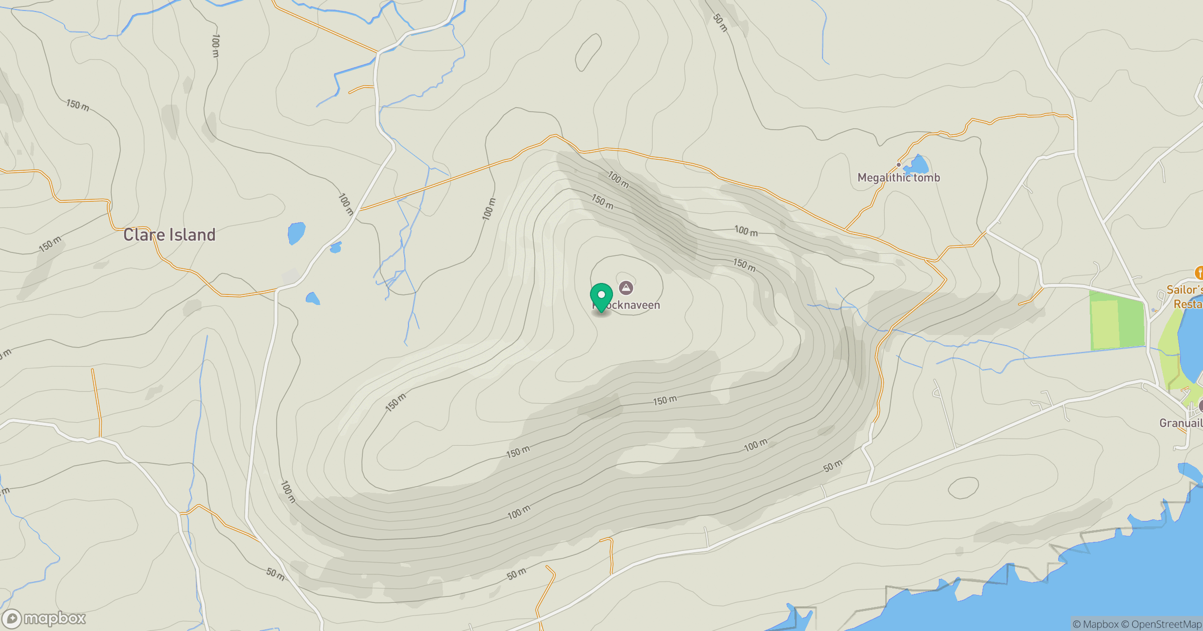
Grid reference: L698854
View on OpenStreetMapOpens a map in a new tab, centred on the hill.
Hills within 30 km
Straight-line distance, not a walking route or confirmation of access.
No comments yet. Be the first.