

Cregg
Good walks are even better shared.
Overview
Exploring Cregg: A Gem in County Antrim
Overview
Cregg is a delightful peak located in County Antrim, not far from the bustling town of Newcastle. While it may not be the highest hill in Northern Ireland, its charm and the rewarding views from the summit make it a must-visit for hikers and outdoor enthusiasts alike.
Geology
Cregg comes alive with ancient volcanic rock, giving the terrain a unique characteristic. The interplay between grassy slopes and rocky outcrops creates a tapestry of colours and textures that shift with the changing light.
Routes
The Cregg Summit Trail is recommended for those looking to treat themselves to a lovely day outdoors. Spanning around 6.5 km, the route takes about 2.5 hours to complete, depending on your pace and the amount of time you spend soaking in the views at the summit. The trail is moderate in difficulty, making it suitable for most hikers. Just remember to wear appropriate footwear—no flip-flops on this trek!
Summit Features
Upon reaching the summit, you'll find a quaint cairn that’s perfect for a quick selfie (don’t forget to tag #Cregg!). The views are what truly steal the show, revealing a panorama that sweeps over the countryside.
Terrain Type
Prepare for a mix of grassy slopes and rocky outcrops. The lower sections can get a bit boggy, especially after a spell of rain, so it's wise to stick to the paths.
Views
From the pinnacle of Cregg, you can admire the majestic Mourne Mountains to the south, while on clear days, the outline of Scotland lingers on the horizon, beckoning adventurers across the sea.
Best Seasons
The ideal times to visit are during spring and autumn, when the colours are vivid, and the weather tends to cooperate more than during winter. Early mornings can be particularly enchanting!
Hazards
While Cregg isn’t a treacherous climb, there are certainly risks to keep in mind. Wet patches can become slippery, and fog can turn a sunny day into a game of 'where did I put my path?' Be prepared and stay aware of your surroundings.
Access
For those traveling by car, you’ll find parking available along the L715 road, just a short distance from the trailhead. Newcastle is the nearest hub for public transport, ensuring you can make your way here without having to hitch a ride from the mountain goats!
Nearby Amenities
After your trek, why not reward yourself with a visit to one of Newcastle's delightful cafes? They've got everything from a hearty breakfast to a well-deserved slice of cake.
In summary, Cregg is well worth a visit whether you're a seasoned hiker or a casual walker. So lace up those hiking boots, pack a snack, and set off for a memorable day in the great outdoors!
Explore routes near Cregg
Public walks starting within 80 km of this hill. Nearby does not mean a route reaches the summit; check its map and access before setting out.
No public routes are currently listed within 80 km of Cregg on Walkmates. This does not mean there are no paths here. Explore the map and check local access information before planning a walk.
Route planning notes
These notes describe possible approaches, not verified navigable routes or permission to cross land. Check current paths, local access rules and conditions before setting out.
Cregg Summit Trail
A well-marked trail that takes you through lush woodland, ascending steadily to the summit of Cregg. Breathe in the fresh air as you enjoy the beautiful scenery along the way.
Make a day of it, together
Find someone to share the walk with, or organise a day out along a route you like.
Photo Gallery
View all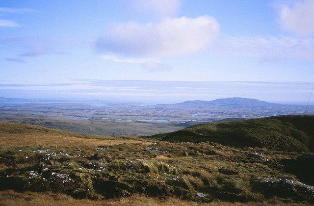 Photo could not load
L7152 : An Chreig (Cregg Hill)
Nigel Cox
Hill facts and local notes
Classifications
Elevation
297m
974 ft
Prominence
144m
Coordinates
53.5061, -9.9375
L715524
OS Map
37
At the Summit
The summit features a modest cairn, which offers a great photo opportunity. Nearby, you'll find stunning vistas that stretch across the surrounding countryside.
Terrain & Geology
Cregg comprises primarily of basalt, shaped by ancient volcanic activity which has left it with a rich, rugged terrain. The unique geology provides a plethora of flora and fauna, making the slopes teem with life.
Views & Scenery
From the summit, gaze upon the stunning Mourne Mountains to the south and the expansive landscape of County Antrim. On a clear day, you might even spy the distant outlines of Scotland across the sea!
History & Heritage
Name Origin
The name 'Cregg' derives from the Irish 'Craobh', meaning 'branch' or 'twig', perhaps referencing the lush greenery surrounding the mountain.
Historical Significance
Cregg has been a revered spot for local hikers and nature lovers for generations, often considered a hidden gem in County Antrim.
Getting There & Facilities
Check current local access restrictions, parking rules and transport timetables before travelling. These notes do not confirm public access to the summit.
Parking
There is a small car park alongside the L715 road, roughly 2 km from the start of the trail. Be mindful of local parking regulations.
Public Transport
Buses operate from Belfast to the nearest village of Newcastle, which is about 7 km away from the trailhead.
Nearby Facilities
In Newcastle, you will find cafes, restaurants, and public toilets. It's advisable to fuel up before your hike!
Safety Information
Known Hazards
- Wet and muddy patches can be slippery, especially after rain. Pay attention to weather conditions, as fog can roll in unexpectedly.
General Safety Tips
- Check weather conditions before setting out
- Carry appropriate clothing and equipment
- Let someone know your planned route
- Take a map, compass, and GPS device
- Carry emergency supplies: food, water, first aid kit, torch
Hills
Some common questions about the hills answered
Are there group walks up Cregg?
Many walkers use Walkmates to join or organise walks with others. You can check for group walks around Cregg through the maps
Are there other walkers around Cregg?
Activity varies by location and time, but Walkmates lets you see whether others have shared walks or shown interest in this area. Find other people through the walking friends search walking friends for Cregg search or of course create your own walk for Cregg
Can I organise a walk to Cregg?
Yes. If there aren’t any walks listed already, you can create a walk and make it available for others to join.
If you're signed up to Walkmates, you can create a walk to Cregg.
How do I find a walk up this hill?
There are often multiple ways to walk this hill, depending on experience and route preference. Walkmates helps you explore walks and routes that others have shared.
Can I suggest a new route up Cregg?
Yes. You can suggest or create routes to share with others. Walkmates focuses on the social side of walking, so routes are used to help people organise walks and explore areas together, rather than as detailed navigation tools or route libraries.
Other uses really appreciate knowledgeable walkers sharing their routes. Share your favourite route to Cregg here
The is an error or something incorrect about this hill. How do I let you know?
We always strive to keep the information on Walkmates as accurate as possible. If you find an error, please let us know through the contact form and we'll aim to correct it as quickly as possible
Community Discussion
Comments
Location
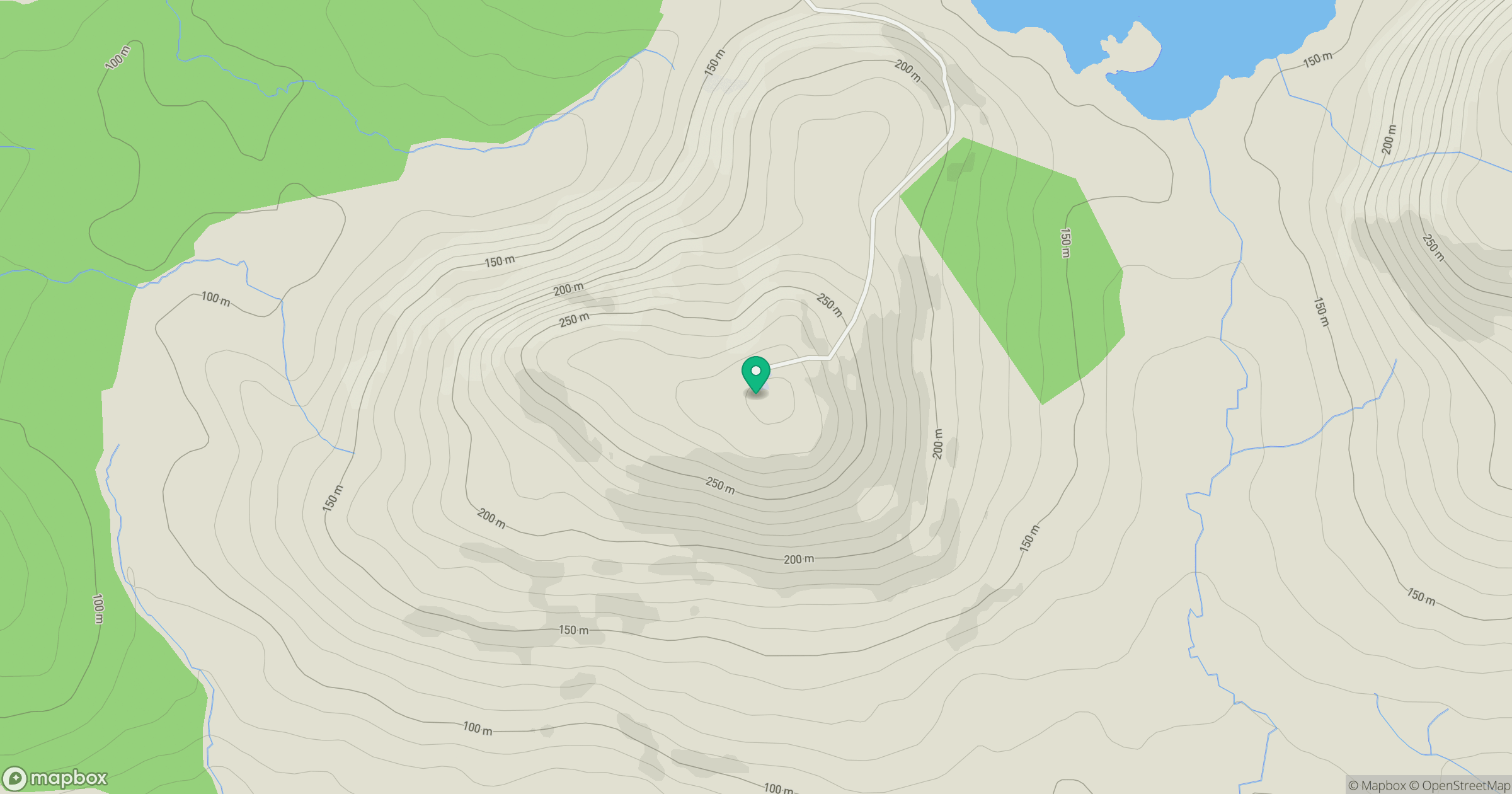
Grid reference: L715524
View on OpenStreetMapOpens a map in a new tab, centred on the hill.
Hills within 30 km
Straight-line distance, not a walking route or confirmation of access.
Mweelrea
814m
Diamond Hill [Bengooria]
443m
An Chailleach [Bencullagh]
634m
Currywongaun [Corr Ui Mhongain]
272m
Mucanacht [Meacanacht] [Muckanaght]
655m
No comments yet. Be the first.