
Inishark Island
Good walks are even better shared.
Overview
Inishark Island: A Hidden Gem in Connemara
Inishark Island is a captivating isle located off the coast of Connemara, County Galway. While it may not boast a towering elevation, its stunning landscapes and historical significance make it a worthwhile destination for outdoor enthusiasts.
Geology
The island's intriguing geology is primarily limestone, creating remarkable karst formations that tell the story of erosion over time. The rocky coastal terrain and cliffs are evidence of nature's artistic touch, and fossil enthusiasts may also find remnants from ancient marine life scattered about.
Routes
A popular route around the island, known as the "Island Walk," offers hikers a delightful 5 km loop that showcases the best of Inishark's coastal beauty. This easy walk will leave you breathless from the views—though fortunately, not from the exertion!
Summit Features
Though Inishark does not feature a traditional summit, its coastal cliffs provide some stunning vantage points for panorama-loving hikers. Bring your camera, as the views of the Atlantic Ocean and the Twelve Bens will certainly take your breath away, especially if you forget to breathe while snapping photos!
Terrain Type
Expect a mix of rocky coastal paths, sandy patches, and the odd patch of limestone. Good sturdy shoes are recommended, as the terrain can be uneven.
Views
From its cliffs, Inishark offers a fantastic vista that includes the Atlantic stretching to the horizon and the majestic Twelve Bens mountains rising in the distance. The best time to soak in these views is in the spring and summer months when wildflowers dot the landscape and the weather is more forgiving.
Hazards
While exploring, keep an eye on the tides; the beautiful, inviting waters can swiftly turn. It’s a case of loving nature but giving it a healthy respect!
Nearby Summits
Inishark is a gateway to many nearby peaks. Consider taking a trek to Benbaun (711m) or Mam Tom (802m) for a more elevated challenge post-Inishark.
Access
To access Inishark Island, park in Cleggan Village where a ferry service offers a delightful jaunt across the waters. While the island itself offers limited facilities, Cleggan is home to charming cafes and shops for pre-walk supplies and post-walk snacks.
Facilities
While conveniences on the island are scant, the nearby village offers a range of facilities, including public toilets, ensuring you’re not caught short!
History
The name 'Inishark' translates to 'Island of the Deer,' and its historical significance is palpable. Inishark was once a bustling community, now a serene remnant of its past, abandoned in the 1960s. The echoes of history still linger in the air, adding a layer of depth to your visit.
In conclusion, Inishark Island is a treasure trove of natural beauty and historical intrigue waiting to be explored. Whether you're wandering its rocky coastal paths or contemplating the layers of time etched in stone, there's no denying that Inishark beckons adventurers with open arms.
Happy hiking!
Explore routes near Inishark Island
Walks starting near this hill. Open a route to check its map, distance and full itinerary.
Route planning notes
These notes describe possible approaches. Check a route's map and access information when planning your walk.
Island Walk
A captivating walk around the island's perimeter taking in the coastal beauty.
Make a day of it, together
Find someone to share the walk with, or organise a day out along a route you like.
Hill facts and local notes
Classifications
Elevation
97m
317 ft
Prominence
97m
Coordinates
53.6127, -10.2879
L486649
OS Map
37
At the Summit
The island doesn't feature a traditional summit but is adorned with stunning coastal cliffs and rugged terrain, making for dramatic views.
Terrain & Geology
Inishark Island is primarily composed of limestone, showcasing intriguing karst formations. The erosion processes have produced fascinating cliff structures, drawing geology enthusiasts to its rugged shores.
Views & Scenery
Panoramic views of the Atlantic Ocean, the Twelve Bens mountain range, and the neighbouring Inis Meain.
History & Heritage
Name Origin
The name 'Inishark' is derived from the Irish 'Inis Airc', meaning 'Island of the Deer'.
Historical Significance
Inishark was once home to a vibrant community before being abandoned in the 1960s.
Getting There & Facilities
Parking
Parking is available at Cleggan Village, with a ferry service to Inishark.
Public Transport
Bus services run to Cleggan from Clifden, connecting with the ferry.
Nearby Facilities
Limited facilities on the island; however, Cleggan has cafes and shops for supplies, as well as public toilets.
Safety Information
Known Hazards
- Strong tides and rocky shores can pose risks; navigate carefully!
General Safety Tips
- Check weather conditions before setting out
- Carry appropriate clothing and equipment
- Let someone know your planned route
- Take a map, compass, and GPS device
- Carry emergency supplies: food, water, first aid kit, torch
Hills
Some common questions about the hills answered
Are there group walks up Inishark Island?
Many walkers use Walkmates to join or organise walks with others. You can check for group walks around Inishark Island through the maps
Are there other walkers around Inishark Island?
Activity varies by location and time, but Walkmates lets you see whether others have shared walks or shown interest in this area. Find other people through the walking friends search walking friends for Inishark Island search or of course create your own walk for Inishark Island
Can I organise a walk to Inishark Island?
Yes. If there aren’t any walks listed already, you can create a walk and make it available for others to join.
If you're signed up to Walkmates, you can create a walk to Inishark Island.
How do I find a walk up this hill?
There are often multiple ways to walk this hill, depending on experience and route preference. Walkmates helps you explore walks and routes that others have shared.
Can I suggest a new route up Inishark Island?
Yes. You can suggest or create routes to share with others. Walkmates focuses on the social side of walking, so routes are used to help people organise walks and explore areas together, rather than as detailed navigation tools or route libraries.
Other uses really appreciate knowledgeable walkers sharing their routes. Share your favourite route to Inishark Island here
The is an error or something incorrect about this hill. How do I let you know?
We always strive to keep the information on Walkmates as accurate as possible. If you find an error, please let us know through the contact form and we'll aim to correct it as quickly as possible
Community Discussion
Comments
Location
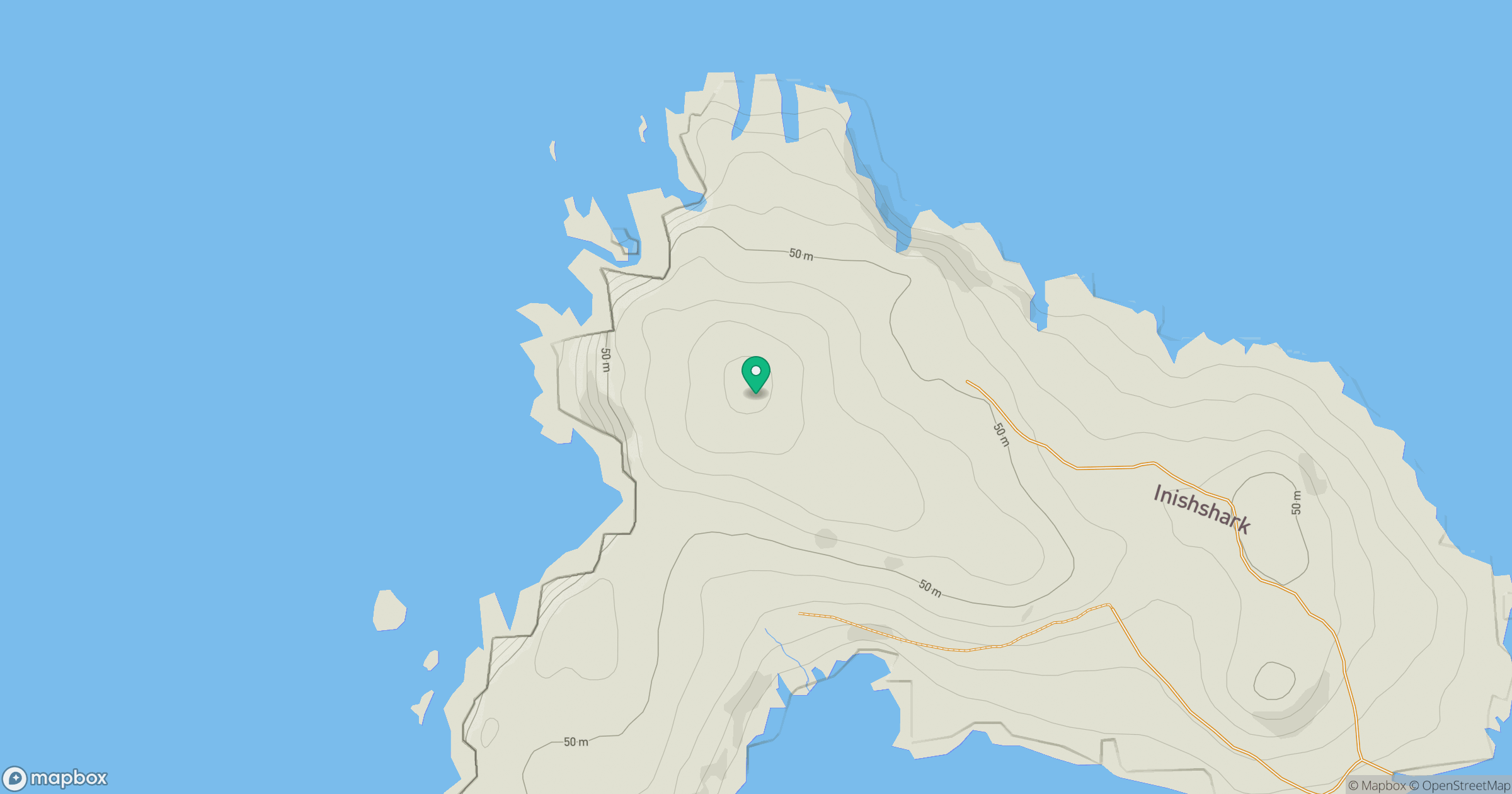
Grid reference: L486649
View on OpenStreetMapOpens a map in a new tab, centred on the hill.
No comments yet. Be the first.