

Holm Field
Good walks are even better shared.
Overview
Welcome to Holm Field
Holm Field, standing at a modest 130 meters, is a delightful Marilyn nestled in the Lincolnshire Wolds, ideal for a Sunday stroll or a family outing. While it may lack the towering heights of some of its Highland cousins, Holm Field more than compensates with its tranquil atmosphere and stunning scenery.
Geology
The landscape is predominantly shaped by Jurassic limestone, which not only contributes to the unique topography but also supports a diverse range of local wildlife. Fun fact: this limestone was once part of ancient seabeds! So, who knows? Perhaps you will find a prehistoric sea creature's fossil—if lucky enough!
Routes
There are a couple of lovely routes to explore:
Holm Field Circular Walk
- Distance: 5.2 km
- Time: 2.5 hours
- Difficulty: Moderate
A circular jaunt through the countryside, expect stunning views and plenty of friendly sheep along the way. Remember to stop at the summit for that Instagram-worthy snap!
Bridleway Approach
- Distance: 3.8 km
- Time: 1.5 hours
- Difficulty: Easy
This route is a delightful stroll; just keep an eye out for any cows who have decided they want to ‘moo-ve’ into your path!
Summit Features
At the top, you’ll find a quaint stone cairn, a great spot to catch your breath. Next to it is a bench perfect for a picnic—don’t mind the view; it’ll take your breath away!
Terrain Type
Prepare for grassy fields with patches of limestone, which ensures you're not just walking on flat ground all the time—just be wary of muddy spots post-rain. Soggy socks are nobody’s idea of fun!
Views
Once you’ve reached the summit, the panoramic views will replace any weariness you may feel. You’ll be able to spot fellow peaks, rolling hills, and, on particularly clear days, the North Sea teasing in the distance. The best seasons for these views are late spring and early autumn; think vibrant colours and clear blue skies.
Hazards
As with all outings, it's crucial to be mindful of your surroundings. The paths can get slippery with mud after rainfall, and do keep an eye out for farm vehicles in the fields!
Access
Accessing Holm Field is straightforward:
- Nearest Parking: Village hall in Thornham
- Public Transport: Local bus service includes a stop in Thornham
- Nearest Town: The lovely Thornham village is nearby!
Facilities
Thornham offers a quaint café with delicious treats to refuel after your trek, as well as essential public toilets.
History
The origin of the name 'Holm Field' roots back to Old English, linking to flat, island-like landforms. This area has a rich history, tied to local folklore, ensuring that your hike is not only physically engaging but also rich with stories!
Whether you’re an avid hiker or a casual stroll seeker, Holm Field offers a perfect slice of Lincolnshire’s natural beauty, healthy hiking, and a generous sprinkle of charm. Pack your lunch, grab your boots—adventure awaits!
Happy hiking!
Last Updated: 2023-10-15
Explore routes near Holm Field
Public walks starting within 80 km of this hill. Nearby does not mean a route reaches the summit; check its map and access before setting out.
No public routes are currently listed within 80 km of Holm Field on Walkmates. This does not mean there are no paths here. Explore the map and check local access information before planning a walk.
Route planning notes
These notes describe possible approaches, not verified navigable routes or permission to cross land. Check current paths, local access rules and conditions before setting out.
Holm Field Circular Walk
A scenic route starting from the nearby village that offers visitors a chance to enjoy the varied wildlife of the area as well as stunning views across the Wolds.
Bridleway Approach
This route follows a bridleway through picturesque farmland, perfect for both walkers and cyclists. Watch out for the farm animals that may want to join your trek!
Make a day of it, together
Find someone to share the walk with, or organise a day out along a route you like.
Photo Gallery
View all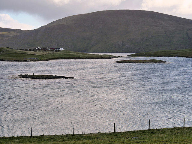 Photo could not load
HU3930 : View towards Clift Hill
David Dixon
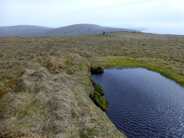 Photo could not load
HU3930 : Holm Field
Rude Health
Hill facts and local notes
Classifications
Elevation
290m
951 ft
Prominence
104m
Coordinates
60.0590, -1.2921
HU395306
OS Map
4
Explorer: 466N
At the Summit
The summit is marked by a small stone cairn, which has become a popular photo opportunity amongst hikers and their pets alike. There's also a lovely bench for those wanting to take a breather and enjoy the surroundings.
Terrain & Geology
Holm Field is predominantly composed of Jurassic limestone, resulting in well-drained soils which further provides ideal conditions for a variety of flora and fauna. This limestone is a remnant of ancient seabeds, lending fascinating insights into the Earth's geological past.
Views & Scenery
From the summit, you can see the heart of the Lincolnshire Wolds, including rolling hills, patchwork fields, and, on clear days, even the distant coast of the North Sea.
History & Heritage
Name Origin
The name 'Holm Field' likely derives from the Old English word 'holm', meaning an island or piece of flat land, which ties well with the landscape topology of the Wolds.
Historical Significance
Historically, Holm Field was part of larger estates and is steeped in local folklore—rumour has it that there are ghostly figures seen around the cairn at twilight!
Getting There & Facilities
Check current local access restrictions, parking rules and transport timetables before travelling. These notes do not confirm public access to the summit.
Parking
There is ample parking available at the village hall in Thornham. Be sure to respect local signs regarding parking regulations.
Public Transport
The nearest bus stop is located in Thornham, serviced by local routes connecting to larger towns.
Nearby Facilities
The nearest facilities include a small café in Thornham serving refreshments and homemade cakes, as well as public toilets.
Safety Information
Known Hazards
- Beware of potentially muddy paths after rainy weather which can make footing tricky.
- Watch for farm machinery if walking through fields.
General Safety Tips
- Check weather conditions before setting out
- Carry appropriate clothing and equipment
- Let someone know your planned route
- Take a map, compass, and GPS device
- Carry emergency supplies: food, water, first aid kit, torch
Hills
Some common questions about the hills answered
Are there group walks up Holm Field?
Many walkers use Walkmates to join or organise walks with others. You can check for group walks around Holm Field through the maps
Are there other walkers around Holm Field?
Activity varies by location and time, but Walkmates lets you see whether others have shared walks or shown interest in this area. Find other people through the walking friends search walking friends for Holm Field search or of course create your own walk for Holm Field
Can I organise a walk to Holm Field?
Yes. If there aren’t any walks listed already, you can create a walk and make it available for others to join.
If you're signed up to Walkmates, you can create a walk to Holm Field.
How do I find a walk up this hill?
There are often multiple ways to walk this hill, depending on experience and route preference. Walkmates helps you explore walks and routes that others have shared.
Can I suggest a new route up Holm Field?
Yes. You can suggest or create routes to share with others. Walkmates focuses on the social side of walking, so routes are used to help people organise walks and explore areas together, rather than as detailed navigation tools or route libraries.
Other uses really appreciate knowledgeable walkers sharing their routes. Share your favourite route to Holm Field here
The is an error or something incorrect about this hill. How do I let you know?
We always strive to keep the information on Walkmates as accurate as possible. If you find an error, please let us know through the contact form and we'll aim to correct it as quickly as possible
Community Discussion
Comments
Location
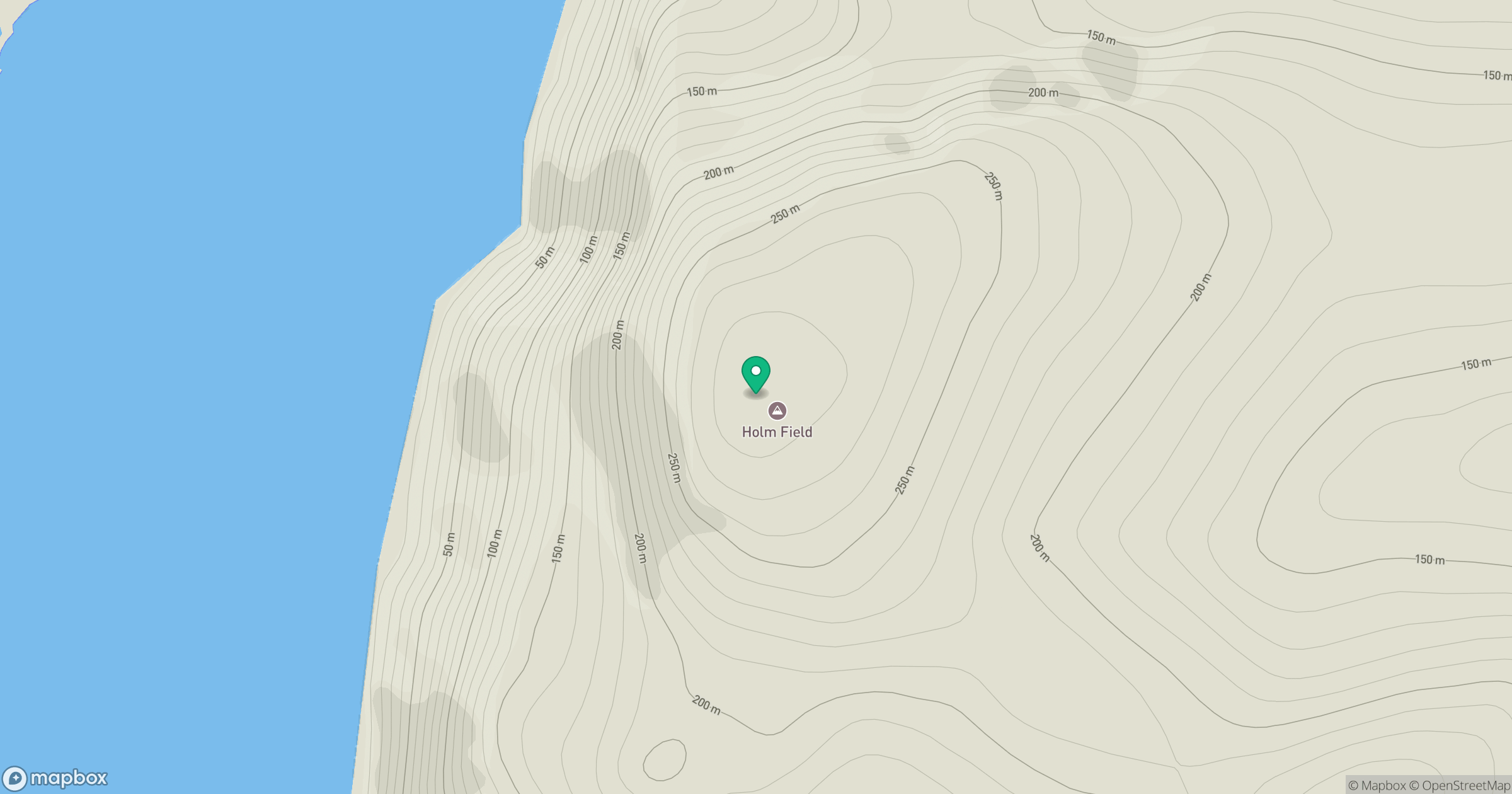
Grid reference: HU395306
View on OpenStreetMapOpens a map in a new tab, centred on the hill.
Hills within 30 km
Straight-line distance, not a walking route or confirmation of access.
Ward of Scousburgh
263m
Hill of Hamarsland
158m
Fitful Head
283m
Hill of Moustoft
176m
Weisdale Hill
260m
No comments yet. Be the first.