

Highgate
Good walks are even better shared.
TQ2887 : Highgate School chapel, North London
Jim Osley Photo source
Overview
Highgate: A Hidden Gem in London
Highgate, perched in North London, stands at an elevation of 130 meters, making it a delightful hill for both casual walkers and serious hikers alike. Despite being surrounded by urban sprawl, Highgate offers a surprising respite from city life with its lush greenery and charming woods.
Geology
The geology of Highgate is quite typical for the area, with a mixture of London Clay and chalk. This unique composition not only supports a rich variety of plant life but also provides interesting cliff faces worth exploring for geology enthusiasts.
Routes
One of the most popular routes begins at Highgate Woods. This scenic trail leads you through serene woodlands before ascending to Highgate Hill, offering an enjoyable hike suitable for the family. It's about 2.5 km long and should take around an hour and a half.
Summit Features
At the summit, you'll find a pleasant little grassy knoll with benches inviting weary walkers to take a load off and enjoy the views. It’s an ideal spot for picnicking or just kicking back with a good book.
Terrain Type
The terrain is predominantly grassy with some well-marked pathways. It’s generally easy to navigate, making it accessible for walkers of all fitness levels. Suitable instructions abound, so no need to take a GPS, unless you feel adventurous!
Views
The summit provides stunning views of London, allowing you to spot famous landmarks like The Shard and the winding Thames. The best seasons for panoramic views are spring and summer, but don’t dismiss the vibrant hues of autumn! Just watch for fog; visibility can take a nosedive.
Hazards
While the paths are relatively safe, do take care on rainy days as they can become slippery. Also, be mindful of cyclists, as the woods can get a bit busy with them zooming past!
Nearby Summits
If you’re looking to stretch your legs further, Parliament Hill and Muswell Hill are nearby and offer more elevation, great for those wanting to explore a bit more.
Access
Highgate is easily accessible by public transport, with the nearest station just a short walk away. Limited parking is available for those who prefer to drive, with the main car park located at the end of Highgate Hill.
Facilities
After your hike, indulge yourself in one of the local cafes or pubs. Highgate Woods also provides toilet facilities, so you can refresh yourself before the journey home.
History
As for the name, 'Highgate' harks back to a gate on the Roman road where tolls used to be collected. The hill is steeped in history and was once home to notable figures like Karl Marx, giving it a cultural vibe that’s like none other.
In conclusion, Highgate may not top the charts for elevation, but it certainly offers a quintessentially British outdoor experience - ideal for a leisurely day hike or a family outing. Don’t forget your camera and that packed lunch; the views and the atmosphere are well worth it!
Happy hiking!
Explore routes near Highgate
Walks starting near this hill. Open a route to check its map, distance and full itinerary.
Hampstead Heath: Parliament Hill, Highgate Ponds and the Tumulus
View route
Regent's Canal and Regent's Park
View route
Regent's Park Boating Lake and Broad Walk Circuit
View route
Paddington Little Venice Canalside Walk
View route
Route planning notes
These notes describe possible approaches. Check a route's map and access information when planning your walk.
Highgate Woods to Highgate Hill
A scenic route starting from the serene Highgate Woods, leading up to the summit of Highgate Hill, where you'll be rewarded with breathtaking views over London.
Make a day of it, together
Find someone to share the walk with, or organise a day out along a route you like.
Photo Gallery
View all Photo could not load
TQ2887 : Highgate School chapel, North London
Jim Osley
 Photo could not load
TQ2887 : Highgate School
Philip Halling
 Photo could not load
TQ2887 : Highgate West Hill
Martin Addison
 Photo could not load
TQ2887 : Highgate
Peter Trimming
 Photo could not load
TQ2887 : Highgate High Street at the junction of Southwood Lane
David Howard
 Photo could not load
TQ2887 : Highgate School on North Road
David Howard
 Photo could not load
TQ2887 : Ordnance Survey Cut Mark
Adrian Dust
 Photo could not load
TQ2887 : Highgate School, Benchmark
Cipollini
 Photo could not load
TQ2887 : Highgate School, North Road N6
Robin Sones

TQ2887 : Southwood Lane, Highgate
Derek Harper
Hill facts and local notes
Classifications
Elevation
129m
423 ft
Prominence
23m
Coordinates
51.5716, -0.1499
TQ283874
OS Map
176
Explorer: 173
At the Summit
The summit features a small grassy knoll adorned with benches, perfect for a relaxing break, along with a delightful woodland area nearby.
Terrain & Geology
Highgate is primarily composed of London Clay and some chalk, typical of the geology found in the North London area. This allows for interesting exposures along the slopes and a rich biodiversity in flora and fauna.
Views & Scenery
From the summit, one can see iconic landmarks such as The Shard and the Thames winding through the city. On a clear day, the panorama stretches for miles.
History & Heritage
Name Origin
The name 'Highgate' derives from a gate on the ancient Roman road, which served as a toll point during the Middle Ages.
Historical Significance
Highgate is rich in history, having been home to famous figures such as Karl Marx. The area also features beautiful Victorian architecture.
Getting There & Facilities
Parking
Limited street parking is available near Highgate Woods. The nearest car park can be found at the end of Highgate Hill, providing easy access to the trail.
Public Transport
Highgate Tube Station is nearby with good connections to Central London, and several bus routes serve the area.
Nearby Facilities
Highgate has excellent facilities including quaint cafes, pubs, and toilets within Highgate Woods, ideal for a post-walk refreshment.
Safety Information
Known Hazards
- Watch out for slippery paths during the rainy season and be cautious of cyclists sharing the narrow trails in the woods.
- Limited visibility during foggy weather can make navigation tricky.
General Safety Tips
- Check weather conditions before setting out
- Carry appropriate clothing and equipment
- Let someone know your planned route
- Take a map, compass, and GPS device
- Carry emergency supplies: food, water, first aid kit, torch
Hills
Some common questions about the hills answered
Are there group walks up Highgate?
Many walkers use Walkmates to join or organise walks with others. You can check for group walks around Highgate through the maps
Are there other walkers around Highgate?
Activity varies by location and time, but Walkmates lets you see whether others have shared walks or shown interest in this area. Find other people through the walking friends search walking friends for Highgate search or of course create your own walk for Highgate
Can I organise a walk to Highgate?
Yes. If there aren’t any walks listed already, you can create a walk and make it available for others to join.
If you're signed up to Walkmates, you can create a walk to Highgate.
How do I find a walk up this hill?
There are often multiple ways to walk this hill, depending on experience and route preference. Walkmates helps you explore walks and routes that others have shared.
Can I suggest a new route up Highgate?
Yes. You can suggest or create routes to share with others. Walkmates focuses on the social side of walking, so routes are used to help people organise walks and explore areas together, rather than as detailed navigation tools or route libraries.
Other uses really appreciate knowledgeable walkers sharing their routes. Share your favourite route to Highgate here
The is an error or something incorrect about this hill. How do I let you know?
We always strive to keep the information on Walkmates as accurate as possible. If you find an error, please let us know through the contact form and we'll aim to correct it as quickly as possible
Community Discussion
Comments
Location
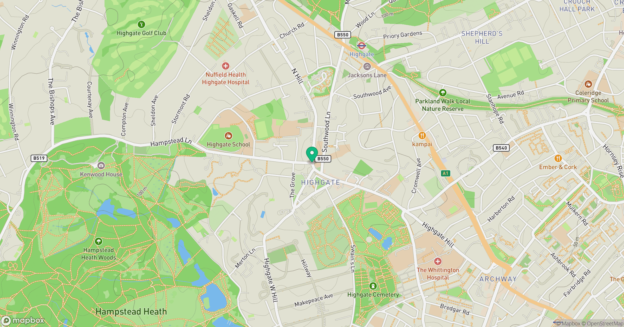
Grid reference: TQ283874
View on OpenStreetMapOpens a map in a new tab, centred on the hill.
No comments yet. Be the first.