
High Hunsley Wold
Good walks are even better shared.
Overview
High Hunsley Wold
High Hunsley Wold reigns majestically over the rolling hills of the East Riding of Yorkshire at an elevation of 216 meters. This Marilyn may not be the most towering peak in the UK, but what it lacks in height, it makes up for in charm and panoramic views.
Geology
The geological composition of High Hunsley Wold primarily comprises chalk and limestone, dating back to the Cretaceous period. The porous chalk lends itself to a distinct ecosystem that supports diverse flora and fauna. Whether it’s the vibrant wildflowers in spring or the autumn leaves, there’s always something to catch the eye.
Route Options
The Hunsley Hill Circular Route is highly recommended for its scenic beauty and manageable difficulty. Stretching approximately 5.5 km, this moderate trek sets off from South Cave village. Be prepared to soak in the sights of nature and perhaps even catch a glimpse of a grazing sheep or two, blissfully unaware of the hiker's plight for a perfect Instagram shot.
Summit Features
Reaching the summit, you will encounter a notable trig point, standing sentinel over the landscape. The flat area surrounding it serves as a delightful spot for a picnic, provided you don’t mind sharing it with the local wildlife.
Terrain
The terrain at High Hunsley Wold is predominantly grassy, but do not underestimate its unevenness; watch where you tread to avoid surprise encounters with a muddy puddle after a rainy spell.
Views
The views from the summit are nothing short of spectacular. On a clear day, the panorama includes the Yorkshire Wolds and beyond – potentially even the distant silhouette of Hull’s spires! Spring and autumn are the best seasons for hiking here, with vibrant colours and clearer skies enhancing the beauty.
Hazards
Though generally safe, hikers should remain aware of muddy paths during wet weather and the occasional presence of cattle grazing peacefully in the fields.
Access
For those driving, parking is conveniently located in South Cave village, just a short stroll from the hiking routes. Public transport options include regular bus services from nearby towns, such as Brough and Hull, making it easily accessible for all.
Facilities
After your adventures, why not reward yourself with a treat? South Cave has quaint cafés and a local pub that serve up tasty options, along with public toilets to freshen up!
History
The name 'Hunsley' originates from Old Norse, meaning 'Huns' clearing, with signifiers of early settlement in this idyllic area. Rich in natural beauty and historical significance, High Hunsley Wold has stood the test of time, witnessing everything from local agriculture to modern-day outdoor escapades.
In summary, High Hunsley Wold may be a modest hill, but its inviting trails and stunning views ensure that it remains a beloved spot for locals and visitors alike. Grab your hiking boots, pack a snack, and enjoy everything this charming wold has to offer!
Explore routes near High Hunsley Wold
Public walks starting within 80 km of this hill. Nearby does not mean a route reaches the summit; check its map and access before setting out.
Drewton Wold
View route
Drewton Dale and Drewton Wold Circular
View route
Pocklington Canal, Canal Head to Melbourne Arm
View route
Wheldrake Woods Woodland Circuit
View route
Route planning notes
These notes describe possible approaches, not verified navigable routes or permission to cross land. Check current paths, local access rules and conditions before setting out.
Hunsley Hill Circular Route
A scenic circular route starting from the village of South Cave, offering panoramic views and opportunities to spot local wildlife.
Make a day of it, together
Find someone to share the walk with, or organise a day out along a route you like.
Hill facts and local notes
Classifications
Elevation
164m
538 ft
Prominence
114m
Coordinates
53.8025, -0.5694
SE943349
OS Map
106
Explorer: 293
At the Summit
The summit features a distinctive trig point and a small flat area with views of the surrounding countryside, making it a lovely picnic spot if the weather permits.
Terrain & Geology
High Hunsley Wold is composed of chalk and limestone, primarily formed during the Cretaceous period. The soil is predominantly clayey, supporting a variety of flora typical of chalky landscapes.
Views & Scenery
From the summit, one can enjoy views of the Yorkshire Wolds, expansive fields, and nearby woodlands. On clear days, the distant spires of Hull can be spotted.
History & Heritage
Name Origin
The name 'Hunsley' is derived from Old Norse, meaning 'Huns' clearing, referencing early settlements in the area.
Historical Significance
High Hunsley Wold has been noted for its natural beauty and distinct landscape, contributing to the historical agricultural practices in the Yorkshire Wolds.
Getting There & Facilities
Check current local access restrictions, parking rules and transport timetables before travelling. These notes do not confirm public access to the summit.
Parking
Parking is available at the South Cave village car park, approximately 1 km from the starting point of the route.
Public Transport
Regular bus services operate from nearby towns, including Brough and Hull, with stops at South Cave.
Nearby Facilities
South Cave offers a couple of charming cafés and a pub for post-hike refreshments. There are also public toilets available in the village.
Safety Information
Known Hazards
- Be cautious of muddy paths during wet weather, and watch for cattle in the fields.
General Safety Tips
- Check weather conditions before setting out
- Carry appropriate clothing and equipment
- Let someone know your planned route
- Take a map, compass, and GPS device
- Carry emergency supplies: food, water, first aid kit, torch
Hills
Some common questions about the hills answered
Are there group walks up High Hunsley Wold?
Many walkers use Walkmates to join or organise walks with others. You can check for group walks around High Hunsley Wold through the maps
Are there other walkers around High Hunsley Wold?
Activity varies by location and time, but Walkmates lets you see whether others have shared walks or shown interest in this area. Find other people through the walking friends search walking friends for High Hunsley Wold search or of course create your own walk for High Hunsley Wold
Can I organise a walk to High Hunsley Wold?
Yes. If there aren’t any walks listed already, you can create a walk and make it available for others to join.
If you're signed up to Walkmates, you can create a walk to High Hunsley Wold.
How do I find a walk up this hill?
There are often multiple ways to walk this hill, depending on experience and route preference. Walkmates helps you explore walks and routes that others have shared.
Can I suggest a new route up High Hunsley Wold?
Yes. You can suggest or create routes to share with others. Walkmates focuses on the social side of walking, so routes are used to help people organise walks and explore areas together, rather than as detailed navigation tools or route libraries.
Other uses really appreciate knowledgeable walkers sharing their routes. Share your favourite route to High Hunsley Wold here
The is an error or something incorrect about this hill. How do I let you know?
We always strive to keep the information on Walkmates as accurate as possible. If you find an error, please let us know through the contact form and we'll aim to correct it as quickly as possible
Community Discussion
Comments
Location
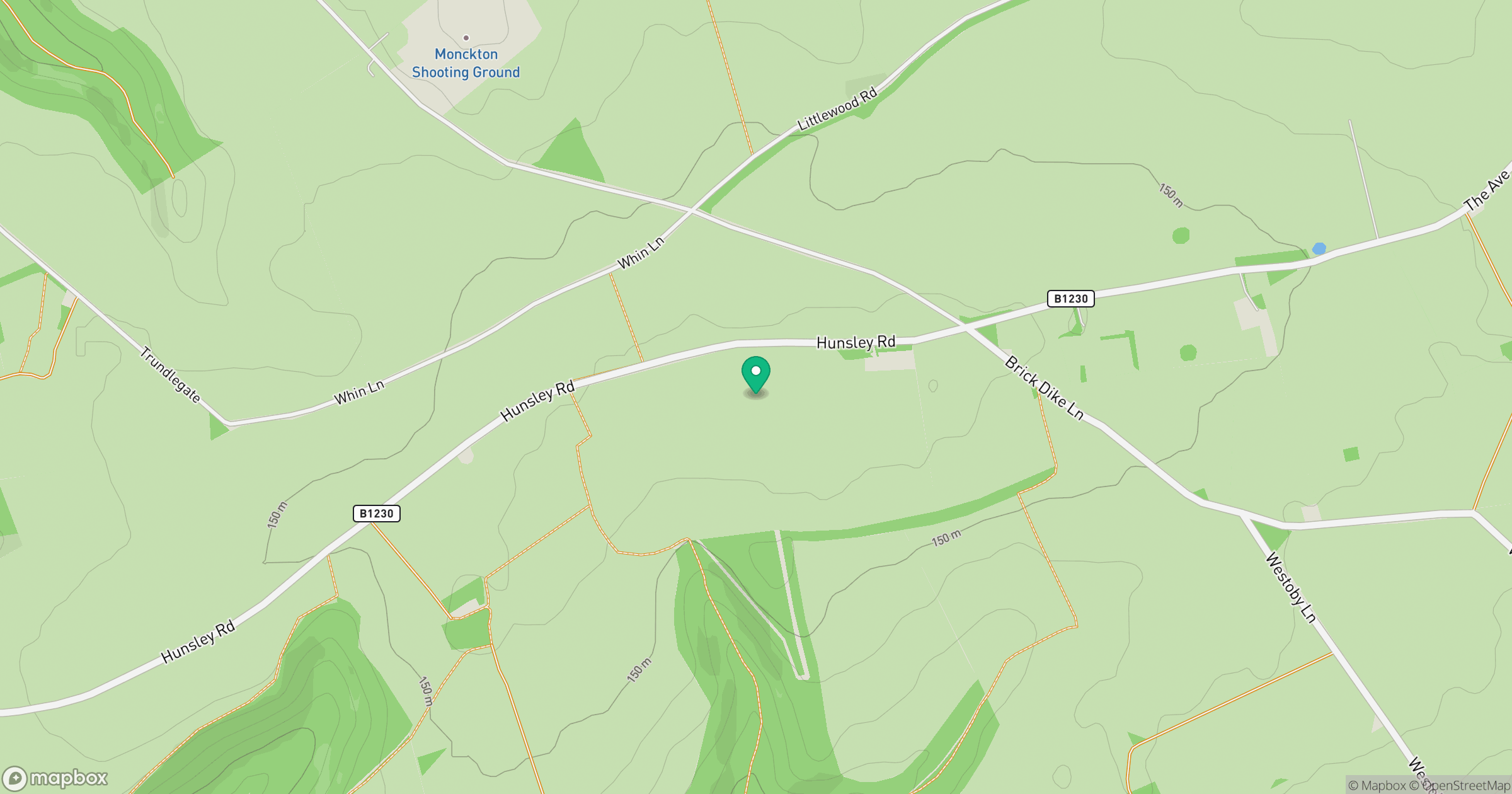
Grid reference: SE943349
View on OpenStreetMapOpens a map in a new tab, centred on the hill.
Hills within 30 km
Straight-line distance, not a walking route or confirmation of access.
No comments yet. Be the first.