

Helm Crag
Good walks are even better shared.
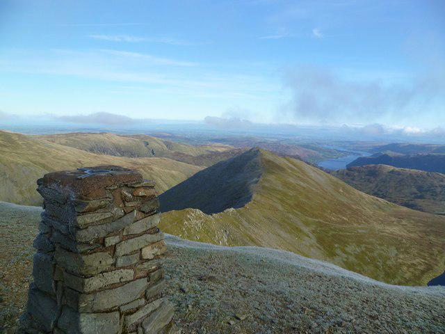
NY3209 : The Howitzer
Shaun Ferguson Photo source
Overview
Helm Crag is a 405 m Wainwright above Grasmere in the Lake District's Central Fells. A steep path leads to a broken rocky ridge and views across Grasmere and the surrounding fells. The familiar Lion and the Lamb rocks are at its south-east end; the highest point is the separate Howitzer tor to the north-west. Reaching the top of that rock requires an exposed scramble, which is optional for a visit to the ridge.
Helm Crag
Helm Crag rises to 405 m above Grasmere in the Lake District's Central Fells. It is a Wainwright with 72 m of prominence. Its compact rocky ridge gives a rewarding half-day outing, but the highest rock demands more than ordinary hillwalking.
The summit rocks
The traditional Lion and the Lamb stand at the south-east end of the ridge. The highest point is the separate Howitzer tor to the north-west, at NY326093. Walking to its base does not put you on the true summit. Climbing the Howitzer is an exposed hands-on scramble with serious drops and a difficult descent for anyone lacking experience. Enjoying the ridge does not require climbing either outcrop.
Walking from Grasmere
The out-and-back from the centre of Grasmere is 6.4 km in the Lakelovers route guide. Follow Easedale Road past Goody Bridge to the signed Helm Crag approach, then climb the steep, partly stone-pitched path above Easedale. Rocky steps lead onto the ridge. Return by the route of ascent. The distance covers the complete walk back to Grasmere.
Gibson Knott (420.1 m) and Calf Crag (537 m) lie farther along the ridge. Continuing over them and returning through Far Easedale makes a substantially longer walk. The descent from Bracken Hause towards Stythwaite Steps is included in Fix the Fells' 2026 repair programme: follow any site instructions and check Lake District National Park path notices before using that alternative.
Terrain and safety
Expect steep paths, uneven rock and gaps among the summit outcrops. Damp rock can be slippery. Snow, ice or strong winds make the ridge and rock climbs more serious; leave the Howitzer alone in icy conditions. Carry navigation equipment you can use, warm and waterproof layers, food, water and a torch. Check the mountain forecast and allow daylight for the descent. For a mountain emergency, call 999 or 112 and ask for Police, then Mountain Rescue.
Views and geology
In clear weather the outlook includes Grasmere, Easedale, Seat Sandal, Fairfield, Helvellyn, the Langdale Pikes and the Coniston fells. Helm Crag belongs to the Borrowdale Volcanic Group; volcanic beds and weathering contribute to its distinctive crags and ridges.
Getting there
Grasmere is the walking base. Broadgate Meadow and Stock Lane offer paid village parking; Stock Lane has public toilets. Shops, cafes and pubs are in the village. Stagecoach 555 and 599 serve Grasmere, with links through Ambleside and Windermere; the 555 also connects with Keswick. Check your date-specific timetable and the return bus before setting out.
Literary connection
Wordsworth names Helm Crag and its rock figures in The Waggoner, composed in 1805 and published in 1819. The familiar Lion and the Lamb name comes from the southern rocks' outline when seen from Grasmere.
Explore routes near Helm Crag
Walks starting near this hill. Open a route to check its map, distance and full itinerary.
Bow Fell from Langdale
View route
Great Carrs Halifax Wreckage from Wrynose Pass
View route
Tarn Hows Fast Route
View route
Scafell Pike from Seathwaite via the Corridor Route
View route
Route planning notes
These notes describe possible approaches. Check a route's map and access information when planning your walk.
Helm Crag from Grasmere (out and back)
Start in the centre of Grasmere and follow Easedale Road past Goody Bridge to the signed Helm Crag lane. Take the signed fell path up engineered steps and zigzags to the rocky summit ridge. Return by the route of ascent. Lakelovers gives 6.4 km for this out-and-back. Its walking directions do not describe climbing the Howitzer: that is a separate exposed scramble. Continuing over Gibson Knott and Calf Crag is a different, longer outing.
Make a day of it, together
Find someone to share the walk with, or organise a day out along a route you like.
Photo Gallery
View all Photo could not load
NY3209 : The Howitzer
Shaun Ferguson
 Photo could not load
NY3209 : Approach to Helm Crag from Gibson Knott
Robert Struthers
 Photo could not load
NY3209 : Summit rocks Helm Crag
Tom Richardson
 Photo could not load
NY3209 : Helm Crag
Steven Brown
 Photo could not load
NY3209 : Helm Crag Summit
Michael Graham
 Photo could not load
NY3209 : Helm Crag
David Brown
 Photo could not load
NY3209 : Helm Crag with Bracken Hause
Trevor Littlewood
 Photo could not load
NY3209 : The "Howitzer" on the summit of Helm Crag
Phil Catterall
 Photo could not load
NY3209 : The Cannon Helm Crag in winter
Robert Skipworth

NY3209 : Looking back to Helm Crag
Chris Holifield
Hill facts and local notes
Classifications
Elevation
405m
1,329 ft
Prominence
72m
Coordinates
54.4750, -3.0408
NY326093
OS Map
90
Explorer: OL5S OL7N
At the Summit
The highest point is the top of the Howitzer, a rock tor at the north-west end of the summit ridge. The traditional Lion and the Lamb rocks, seen from Grasmere, are at the south-east end. Walking onto the ridge does not reach the top of the Howitzer: that requires an exposed hands-on climb and a careful descent. It can be left unclimbed.
Terrain & Geology
Helm Crag lies in the Borrowdale Volcanic Group. Its broken outcrops and parallel summit ridges reflect the structure and weathering of volcanic rocks, including tuffs.
Views & Scenery
Views take in Grasmere and Easedale, Seat Sandal and Fairfield, with the Langdale Pikes, Coniston fells and Helvellyn visible in clear conditions.
History & Heritage
Name Origin
The alternative name 'Lion and the Lamb' describes the outline of the southern summit rocks as seen from Grasmere.
Historical Significance
William Wordsworth refers to Helm Crag and its distinctive rock figures in The Waggoner, composed in 1805 and published in 1819. The fell is also included in Alfred Wainwright's Central Fells.
Getting There & Facilities
Parking
Use paid village parking in Grasmere, such as Broadgate Meadow or Stock Lane, then walk to Easedale Road. Follow the car park's displayed conditions and keep narrow lanes and farm entrances clear.
Public Transport
Stagecoach 555 serves Grasmere from Windermere, Ambleside and Keswick; 599 links Grasmere with Ambleside, Windermere and Bowness. Check the operator's timetable for your travel date and return journey, especially around seasonal changes.
Nearby Facilities
Grasmere has shops, cafes and pubs, with public toilets at Stock Lane car park. Carry the food, water and hillwalking equipment you need before leaving the village.
Safety Information
Known Hazards
- The Howitzer is an exposed rock climb/scramble above serious drops. The walking route reaches its base; only attempt the top if you have the skills and conditions for both ascent and descent.
- The approach has steep stone-pitched sections and rocky steps. Damp rock is slippery; take care around summit gaps and crag edges.
- Mist can obscure the ridge and route junctions. Carry a map and compass and know how to use them; do not rely on mobile reception.
Seasonal Hazards
Snow, ice and strong winds make the rocky ridge and summit climbs more serious. Leave the Howitzer alone in icy conditions. Check a mountain forecast, carry warm and waterproof layers and a torch, and allow enough daylight for the descent.
General Safety Tips
- Check weather conditions before setting out
- Carry appropriate clothing and equipment
- Let someone know your planned route
- Take a map, compass, and GPS device
- Carry emergency supplies: food, water, first aid kit, torch
Hills
Some common questions about the hills answered
Are there group walks up Helm Crag?
Many walkers use Walkmates to join or organise walks with others. You can check for group walks around Helm Crag through the maps
Are there other walkers around Helm Crag?
Activity varies by location and time, but Walkmates lets you see whether others have shared walks or shown interest in this area. Find other people through the walking friends search walking friends for Helm Crag search or of course create your own walk for Helm Crag
Can I organise a walk to Helm Crag?
Yes. If there aren’t any walks listed already, you can create a walk and make it available for others to join.
If you're signed up to Walkmates, you can create a walk to Helm Crag.
How do I find a walk up this hill?
There are often multiple ways to walk this hill, depending on experience and route preference. Walkmates helps you explore walks and routes that others have shared.
Can I suggest a new route up Helm Crag?
Yes. You can suggest or create routes to share with others. Walkmates focuses on the social side of walking, so routes are used to help people organise walks and explore areas together, rather than as detailed navigation tools or route libraries.
Other uses really appreciate knowledgeable walkers sharing their routes. Share your favourite route to Helm Crag here
The is an error or something incorrect about this hill. How do I let you know?
We always strive to keep the information on Walkmates as accurate as possible. If you find an error, please let us know through the contact form and we'll aim to correct it as quickly as possible
Community Discussion
Comments
Location
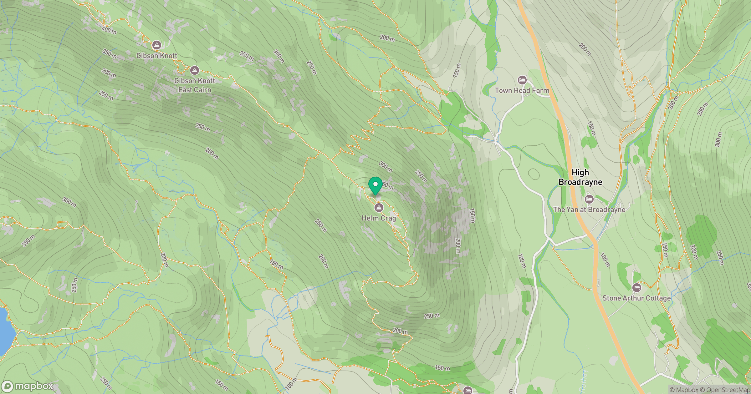
Grid reference: NY326093
View on OpenStreetMapOpens a map in a new tab, centred on the hill.
No comments yet. Be the first.