

Havering Atte Bower church
Good walks are even better shared.
TQ5193 : St John the Evangelist, Havering atte Bower - West end
John Salmon Photo source
Overview
Overview
Havering Atte Bower church, sitting lovely within the lush greenery of the London Borough of Havering, is not just a place of worship but a delightful spot for a casual hike. The scenic route around the church allows you to stretch your legs while soaking in the rich history and charming ambiance.
Geology
The area is characterised by London Clay and gravel deposits, lending the terrain a rather forgiving nature for walking. So kick off your boots and enjoy the scenery without worrying about rocky outcrops.
Routes
Havering Atte Bower Church Circuit
This route is a gentle loop measuring approximately 2.5 km and should take about 1 hour. Perfect for families or anyone who wants a bit of fresh air without the sweat!
Summit Features
While it's not a peak, the highlight here is undoubtedly the church itself. This quaint building provides a picturesque focal point and a lovely backdrop for photos. Don't forget to snap a selfie with the church!
Terrain Type
Expect a grassy parkland that’s great for picnics after a walk. The paths are well-maintained, meaning your shoes can stay relatively mud-free unless there’s been a downpour!
Views
From its vicinity, you can enjoy delightful views of the parklands and the surrounding neighbourhood. The best time to enjoy these is during spring and summer, when the local flora is bursting with colour and life.
Hazards
It’s a straightforward stroll, but do watch out for the occasional slippery spot, especially after rain. Remember, nobody wants a muddy backside on their trip!
Nearby Summits
Just down the road, you’ll find St Mary’s Church, equally lovely and worth a visit if you still have energy left.
Access
Parking options are available at Bower Park Academy, only a mile away, and the area is conveniently linked by the 296 bus route, making it easy to hop on and off when needed. The nearest town is Romford, where you can grab some snacks after your outing.
Facilities
You'll find plenty of quaint cafes and shops in the village centre nearby, perfect for a post-hike treat. Their tea and scones could rival any hilltop picnic!
History
The name Havering means riverbank clearing, and Atte Bower hints at its manor origins. This church, dating back to the 12th century, is a gem of historical significance, showcasing classic English architecture. Surely a visit here is worth its weight in gold!
Conclusion
Whether you’re here for the history, the scenery, or just a nice day out, Havering Atte Bower church has something for everyone, proving that you don’t need mountains to enjoy a bit of nature’s beauty. Just don’t forget your camera!
Explore routes near Havering Atte Bower church
Walks starting near this hill. Open a route to check its map, distance and full itinerary.
Weald Country Park: Chestnut Avenue and lakes
View route
Thorndon Country Park: Jury Hill, woodland and Old Hall Pond
View route
Wanstead Park Chestnut Trail
View route
Epping Forest Holly Trail from Chingford Plain
View route
Route planning notes
These notes describe possible approaches. Check a route's map and access information when planning your walk.
Havering Atte Bower Church Circuit
A leisurely circuit encompassing the picturesque church and surrounding parkland, ideal for families and casual walkers.
Make a day of it, together
Find someone to share the walk with, or organise a day out along a route you like.
Photo Gallery
View all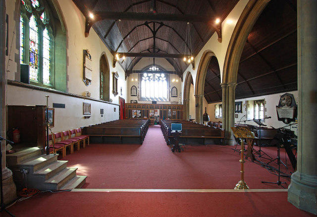 Photo could not load
TQ5193 : St John the Evangelist, Havering atte Bower - West end
John Salmon
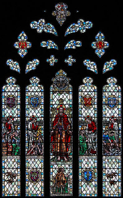 Photo could not load
TQ5193 : St John the Evangelist, Havering atte Bower - Stained glass window
John Salmon
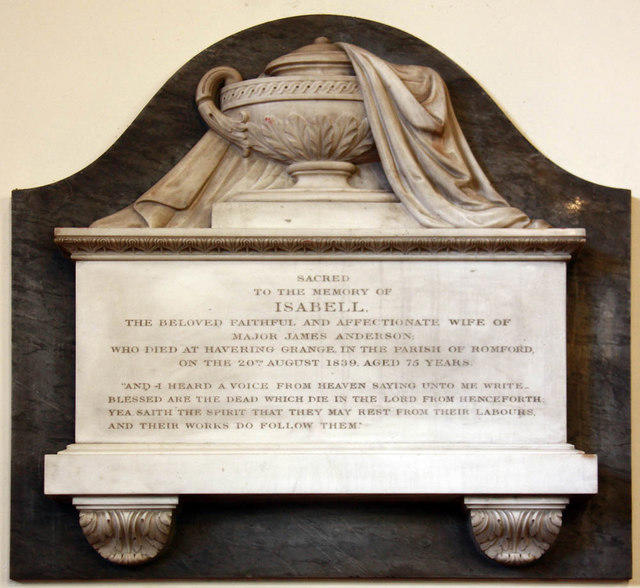 Photo could not load
TQ5193 : St John the Evangelist, Havering atte Bower - Wall monument
John Salmon
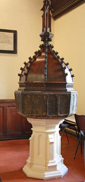 Photo could not load
TQ5193 : St John the Evangelist, Havering atte Bower - Font
John Salmon
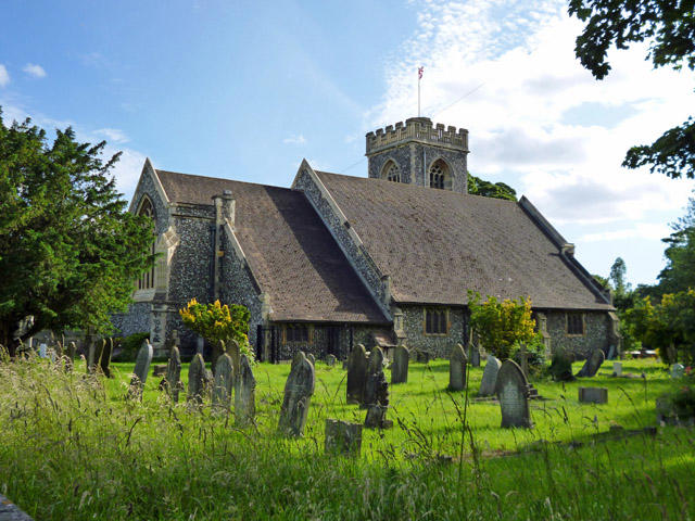 Photo could not load
TQ5193 : Havering-atte-Bower church
Robin Webster
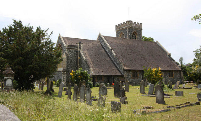 Photo could not load
TQ5193 : St John the Evangelist, Havering atte Bower
John Salmon
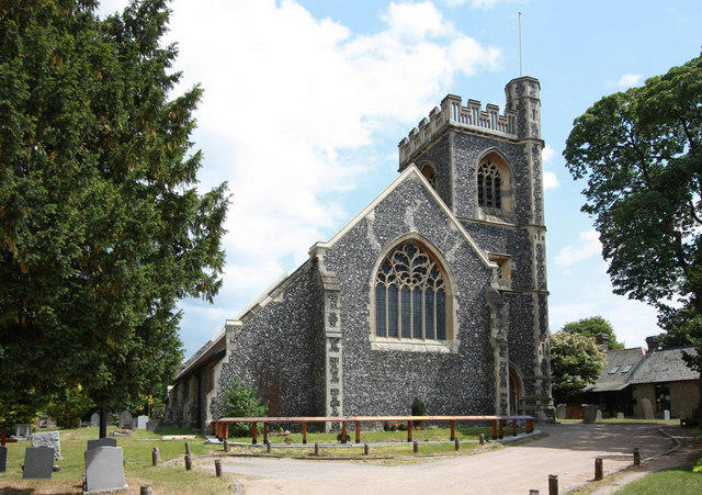 Photo could not load
TQ5193 : St John the Evangelist, Havering atte Bower
John Salmon
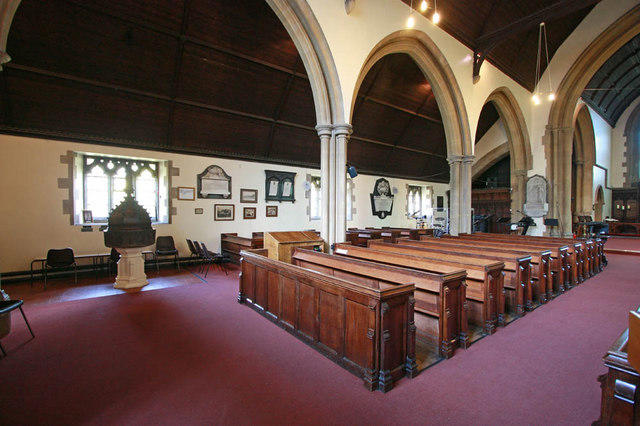 Photo could not load
TQ5193 : St John the Evangelist, Havering atte Bower - North arcade
John Salmon
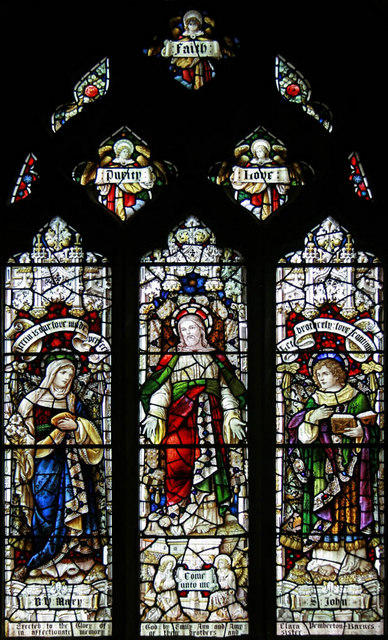 Photo could not load
TQ5193 : St John the Evangelist, Havering atte Bower - Stained glass window
John Salmon
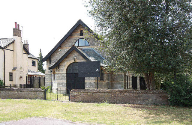
TQ5193 : Village Hall
John Salmon
Hill facts and local notes
Classifications
Elevation
106m
348 ft
Prominence
3m
Coordinates
51.6160, 0.1827
TQ512930
OS Map
177
Explorer: 175W
At the Summit
The church itself, a historic building, offers a quaint backdrop amongst lush surroundings.
Terrain & Geology
The area mainly consists of London Clay and gravel deposits, giving it a soft composition suitable for easy walks.
Views & Scenery
Stunning views of the surrounding parklands and the historic architecture of the church itself.
History & Heritage
Name Origin
The name 'Havering' derives from the Old English 'Haforan,' meaning 'riverbank clearing,' while 'Atte Bower' refers to someone who was a dwelling or a manor.
Historical Significance
The church dates back to the 12th century and is a key historical site in the area, showcasing typical English architecture of its time.
Getting There & Facilities
Parking
Parking is available at the nearby Bower Park Academy, located less than a mile away.
Public Transport
Easily accessible via the 296 bus route that stops close to the church.
Nearby Facilities
There are several cafes and shops within a short walking distance in the village centre of Havering Atte Bower.
Safety Information
Known Hazards
- Occasional slippery spots after rain; watch where you step!
General Safety Tips
- Check weather conditions before setting out
- Carry appropriate clothing and equipment
- Let someone know your planned route
- Take a map, compass, and GPS device
- Carry emergency supplies: food, water, first aid kit, torch
Hills
Some common questions about the hills answered
Are there group walks up Havering Atte Bower church?
Many walkers use Walkmates to join or organise walks with others. You can check for group walks around Havering Atte Bower church through the maps
Are there other walkers around Havering Atte Bower church?
Activity varies by location and time, but Walkmates lets you see whether others have shared walks or shown interest in this area. Find other people through the walking friends search walking friends for Havering Atte Bower church search or of course create your own walk for Havering Atte Bower church
Can I organise a walk to Havering Atte Bower church?
Yes. If there aren’t any walks listed already, you can create a walk and make it available for others to join.
If you're signed up to Walkmates, you can create a walk to Havering Atte Bower church.
How do I find a walk up this hill?
There are often multiple ways to walk this hill, depending on experience and route preference. Walkmates helps you explore walks and routes that others have shared.
Can I suggest a new route up Havering Atte Bower church?
Yes. You can suggest or create routes to share with others. Walkmates focuses on the social side of walking, so routes are used to help people organise walks and explore areas together, rather than as detailed navigation tools or route libraries.
Other uses really appreciate knowledgeable walkers sharing their routes. Share your favourite route to Havering Atte Bower church here
The is an error or something incorrect about this hill. How do I let you know?
We always strive to keep the information on Walkmates as accurate as possible. If you find an error, please let us know through the contact form and we'll aim to correct it as quickly as possible
Community Discussion
Comments
Location
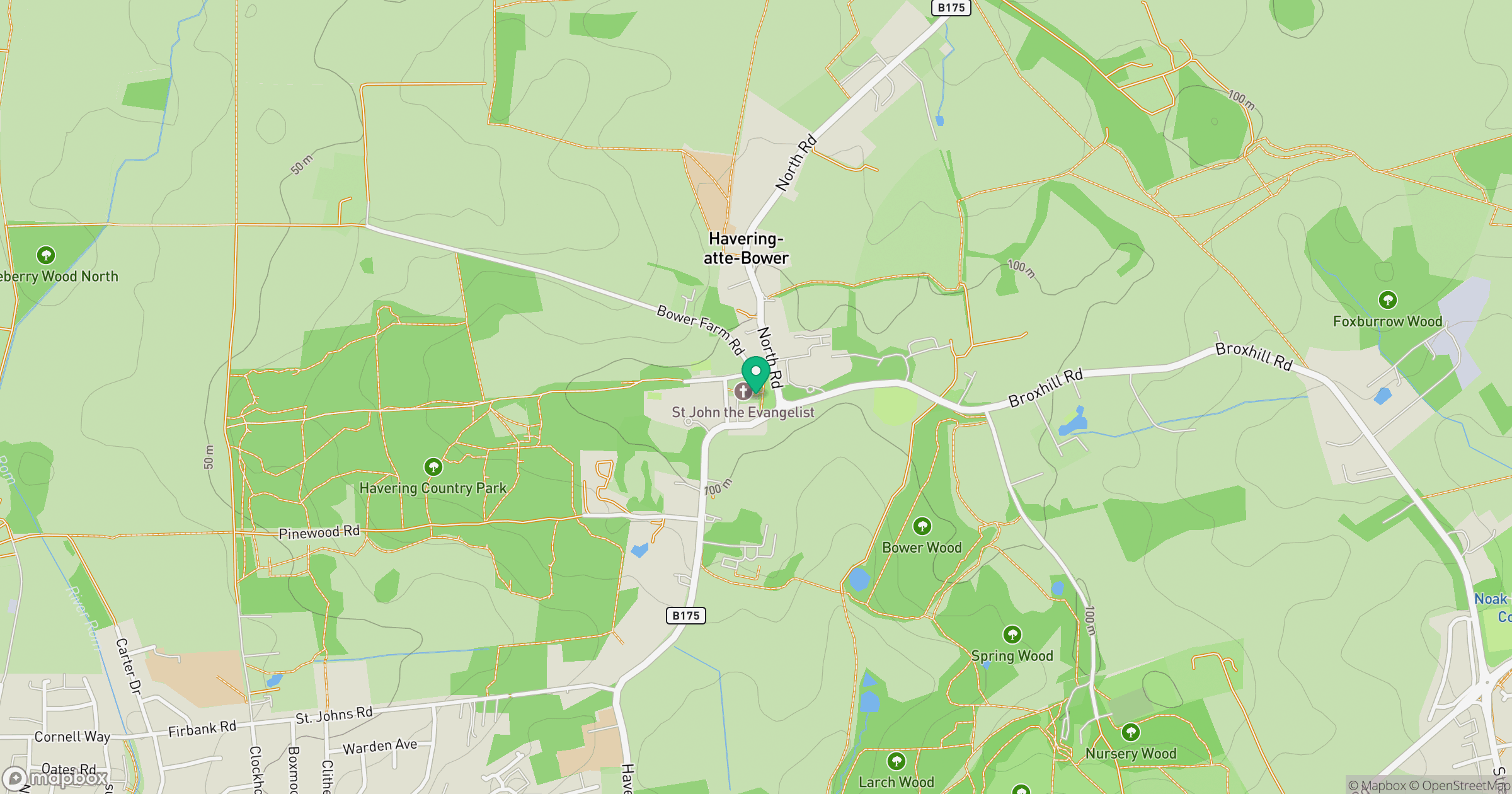
Grid reference: TQ512930
View on OpenStreetMapOpens a map in a new tab, centred on the hill.

No comments yet. Be the first.