

Graven Hill
Good walks are even better shared.
SP5820 : By Wood Crescent
Shaun Ferguson Photo source
Overview
Graven Hill
Nestled in the rolling hills of North Oxfordshire, Graven Hill is a delightful destination for hikers and outdoor enthusiasts alike. Standing at an elevation of 235 meters, it’s not the highest mountain but it packs a punch with its stunning views and charming routes.
Geology
Graven Hill is primarily composed of Jurassic limestone, adding a unique feature to its landscape. The surrounding area, with its rich clay soils, creates a vibrant environment, particularly noticeable in the lush greenery of spring and summer.
Routes
There are two popular routes to consider:
- Graven Hill Circular Walk - This picturesque circular route is about 5.5 km long and typically takes 1.5 hours to complete. It offers moderate difficulty, making it accessible for families and casual hikers.
- Direct Ascent from the North - For those seeking a bit more of a challenge, this 2.7 km route is a direct path to the summit and can be completed in around an hour.
Summit Features
At the top, hikers are greeted by a trig point, which is not only a marker but also a great spot for a photo—especially if you manage to get a sheep in the frame!
Terrain Type
The terrain consists of gentle slopes interspersed with grassy patches and rocky outcrops, making it an enjoyable hike for those who prefer to take their time absorbing the surroundings.
Views
On a clear day, you can admire vast panoramas, including the iconic spires of Oxford and the picturesque Cotswolds. The best seasons to visit for these scenic vistas are undoubtedly spring and autumn; just watch out for the crowds as they flock to enjoy the colours!
Hazards
Nevertheless, it's not all roses; be cautious of slippery areas, especially during or right after rain. Livestock might also be around, so keep an eye out for any wandering sheep!
Nearby Summits
If you're looking to mix it up, consider visiting the nearby Taihills and Feldon Hill, both providing their own unique views and hiking experiences.
Access
Getting there is relatively simple. The nearest parking is in Ashbury village, where you'll find plenty of spots. Public transport options are available from Wantage and Faringdon, though it will require a bit of walking to reach the trails.
Facilities
Don't forget to reward yourself after your hike! Ashbury boasts a charming café, perfect for a post-hike treat.
History
The name 'Graven' has its roots in Old English, potentially referring to a historical burial site, which adds a layer of intrigue for history buffs. The hill also features archaeological finds dating back to the Bronze Age, making it a notable site for those interested in the past.
Whether you're passing through or planning a day out, Graven Hill offers a delightful blend of natural beauty, rich history, and plenty of fresh air. Remember, a day outdoors is a day well spent!
Explore routes near Graven Hill
Walks starting near this hill. Open a route to check its map, distance and full itinerary.
Shotover Country Park Circular
View route
Aylesbury Walk with Men Walking & Talking
View route
Cowleaze Wood Halifax Crash Memorial Circuit
View route
Coombe Hill Monument and Ridgeway Circuit
View route
Route planning notes
These notes describe possible approaches. Check a route's map and access information when planning your walk.
Graven Hill Circular Walk
A picturesque circular route that allows you to ascend the hill and enjoy the scenic countryside.
Direct Ascent from the North
A more challenging but direct route from the north that takes you straight up to the summit.
Make a day of it, together
Find someone to share the walk with, or organise a day out along a route you like.
Photo Gallery
View all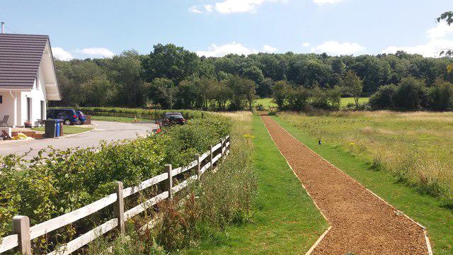 Photo could not load
SP5820 : By Wood Crescent
Shaun Ferguson
Hill facts and local notes
Classifications
Elevation
115m
377 ft
Prominence
48m
Coordinates
51.8791, -1.1462
SP588204
OS Map
164
Explorer: 191E
At the Summit
The summit boasts a prominent trig point, which serves as a perfect photo op (if you can squeeze through the local sheep!).
Terrain & Geology
Graven Hill is largely composed of Jurassic limestone, which gives it a unique character. The surrounding area features fertile clay soils, contributing to the region's lush greenery.
Views & Scenery
From the summit, one can see the rolling hills of the Cotswolds and Oxfordshire plain, with the spires of Oxford visible on a clear day.
History & Heritage
Name Origin
The name 'Graven' is thought to come from the Old English term 'græfen', meaning 'grave' or 'a place of graves', suggesting historical significance.
Historical Significance
The hill has historical significance due to its archaeological finds, including Bronze Age barrows, hinting at its long-standing importance in the region.
Getting There & Facilities
Parking
The nearest parking is available at the village of Ashbury, which provides ample space for visitors.
Public Transport
Regular bus services run from nearby towns like Wantage and Faringdon, though a short walk will be necessary to reach the trailheads.
Nearby Facilities
Although there are no facilities at the summit, nearby Ashbury has a lovely café that offers a welcome cuppa and a bite to eat.
Safety Information
Known Hazards
- Watch out for slippery patches, particularly in wet weather. The area may also have livestock.
General Safety Tips
- Check weather conditions before setting out
- Carry appropriate clothing and equipment
- Let someone know your planned route
- Take a map, compass, and GPS device
- Carry emergency supplies: food, water, first aid kit, torch
Hills
Some common questions about the hills answered
Are there group walks up Graven Hill?
Many walkers use Walkmates to join or organise walks with others. You can check for group walks around Graven Hill through the maps
Are there other walkers around Graven Hill?
Activity varies by location and time, but Walkmates lets you see whether others have shared walks or shown interest in this area. Find other people through the walking friends search walking friends for Graven Hill search or of course create your own walk for Graven Hill
Can I organise a walk to Graven Hill?
Yes. If there aren’t any walks listed already, you can create a walk and make it available for others to join.
If you're signed up to Walkmates, you can create a walk to Graven Hill.
How do I find a walk up this hill?
There are often multiple ways to walk this hill, depending on experience and route preference. Walkmates helps you explore walks and routes that others have shared.
Can I suggest a new route up Graven Hill?
Yes. You can suggest or create routes to share with others. Walkmates focuses on the social side of walking, so routes are used to help people organise walks and explore areas together, rather than as detailed navigation tools or route libraries.
Other uses really appreciate knowledgeable walkers sharing their routes. Share your favourite route to Graven Hill here
The is an error or something incorrect about this hill. How do I let you know?
We always strive to keep the information on Walkmates as accurate as possible. If you find an error, please let us know through the contact form and we'll aim to correct it as quickly as possible
Community Discussion
Comments
Location
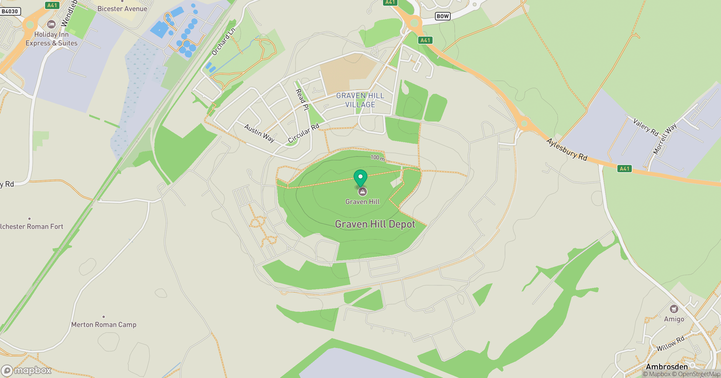
Grid reference: SP588204
View on OpenStreetMapOpens a map in a new tab, centred on the hill.
Nearby Hills
Leith Hill
294m
Worcestershire Beacon
425m
Ditchling Beacon
248m
Titterstone Clee Hill
533m
The Roaches
505m
No comments yet. Be the first.