

Goonhilly Down
Good walks are even better shared.
SW7221 : Goonhilly Earth Station At Sunset
James T M Towill Photo source
Overview
Goonhilly Down: A Cornish Gem
Nestled in the heart of Cornwall, Goonhilly Down might not tower like some of the other peaks in the UK, but what it lacks in height, it makes up for in charm and views. At 62 meters, this Marilyn qualifies as a must-visit for hikers, local explorers, and those simply after a bit of fresh air.
Geology
Goonhilly Down showcases the fascinating geology of Cornwall, predominantly featuring granite with a combination of volcanic remnants. This means that as you hike, you'll be treading on grounds that have seen thousands of years of geological history.
Routes
Access to the summit is quite simple via the Goonhilly Satellite Earth Station Access Road. This easy 2.5 km route takes about 1.5 hours, perfect for a family outing. Along the path, you'll likely meet some friendly locals (both human and sheep!) and witness stunning scenery.
Summit Features
Upon reaching the summit, you'll find the trig point, standing as a silent witness to the ebb and flow of time. Make sure to capture the moment, as the backdrop of the iconic satellite dishes serves as an unusual yet captivating contrast to the rolling hills of Cornwall.
Terrain
The terrain is primarily grassy with some rocky outcrops, providing just the right amount of uneven ground to keep you on your toes but not so much that it requires climbing gear. Hiking boots will suffice!
Views
The views from the top are nothing short of breathtaking. The Lizard Peninsula stretches out before you, and on a clear day, the Isles of Scilly appear like jewels in the ocean. The best time for these views is during spring or autumn, when the skies are usually clear and the air crisp.
Hazards
While wandering around, keep an eye out for any livestock that may be grazing along the paths. While they're generally friendly and inquisitive, it's best to maintain a respectful distance.
Access and Facilities
Getting to Goonhilly Down is fairly straightforward, with ample parking available at the Earth Station’s visitor car park. Public transport options are also available, albeit limited, so check the schedules before heading out. After your hike, treat yourself to a slice of cake at the Earth Station café, or perhaps just a refreshing cup of tea to celebrate your conquest!
Conclusion
Goonhilly Down may not be the tallest mountain, but it is a delightful destination that combines natural beauty with fascinating history. So lace up those hiking boots and take a stroll in this charming corner of Cornwall—who knows what new adventures await you!
Last Updated: 2023-10-01
Explore routes near Goonhilly Down
Walks starting near this hill. Open a route to check its map, distance and full itinerary.
Helston to southern Loe Pool: Penrose lakeside woodland walk
View route
Lizard to Kynance Cove Out and Back
View route
Falmouth Walk with Men Walking & Talking
View route
Stithians Lake circular walk: dam, woodland and Penmarth
View route
Route planning notes
These notes describe possible approaches. Check a route's map and access information when planning your walk.
Goonhilly Satellite Earth Station Access Road
A scenic route starting from the Earth Station car park, this pathway leads gently uphill through terrain rich in local flora and fauna, ideal for a leisurely stroll or a brisk hike.
Make a day of it, together
Find someone to share the walk with, or organise a day out along a route you like.
Photo Gallery
View all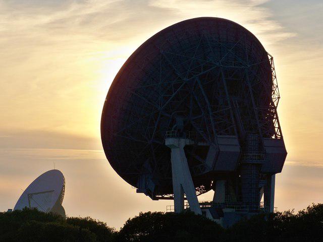 Photo could not load
SW7221 : Goonhilly Earth Station At Sunset
James T M Towill
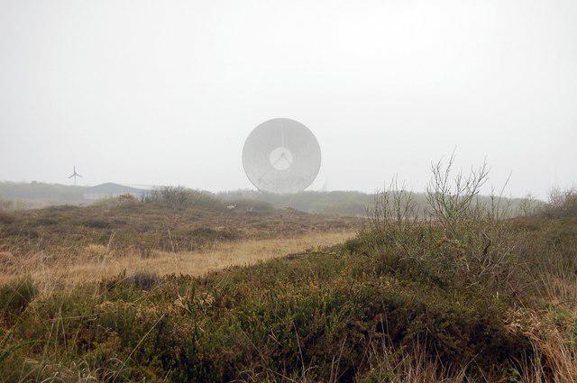 Photo could not load
SW7221 : Ancient and Modern on Goonhilly Down
Trevor Harris
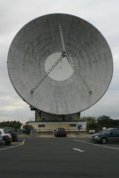 Photo could not load
SW7221 : "Arthur" at Goonhilly Earth Station
Paul Loft
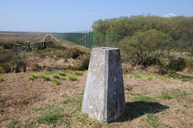 Photo could not load
SW7221 : Trig point on Goonhilly Down
Philip Halling
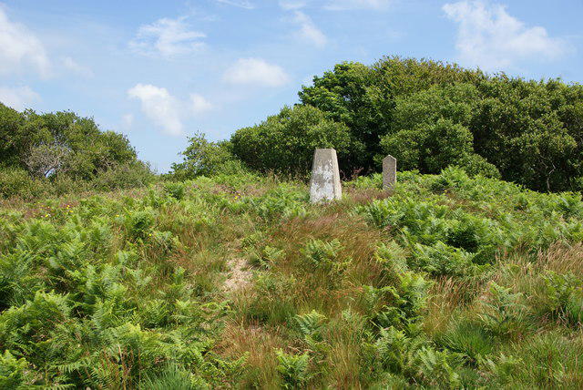 Photo could not load
SW7221 : Trig point on Cruc Draenoc
Bill Boaden
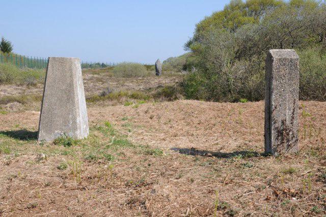 Photo could not load
SW7221 : Trig point and standing stone
Philip Halling
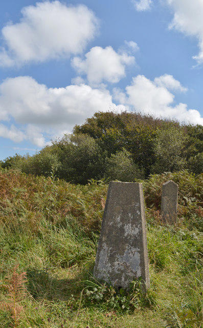 Photo could not load
SW7221 : Trig point, Goonhilly Downs
habiloid
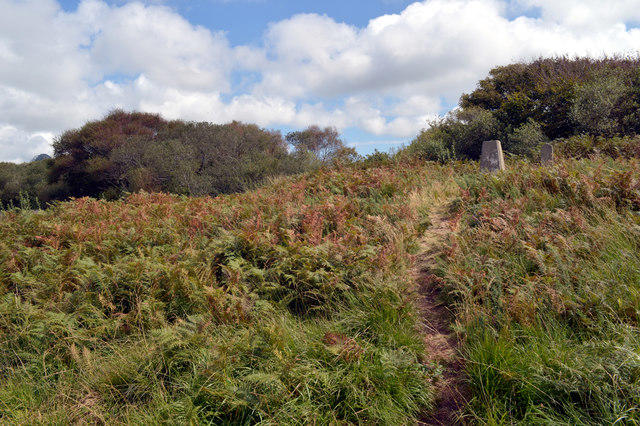 Photo could not load
SW7221 : Trig point, Goonhilly Downs
habiloid
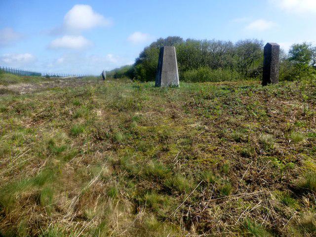 Photo could not load
SW7221 : Goonhilly Down
Rude Health
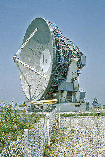
SW7221 : Goonhilly Satellite Tracking Station, antenna 'Arthur', 1969
Ben Brooksbank
Hill facts and local notes
Classifications
Elevation
114m
374 ft
Prominence
54m
Coordinates
50.0475, -5.1780
SW725212
OS Map
204
Explorer: 103
At the Summit
At the summit, hikers will find a trig point that offers a perfect photo op. A range of satellite dishes from the nearby Earth Station can also be spotted, providing a unique technological juxtaposition against the natural landscape.
Terrain & Geology
Goonhilly Down is primarily composed of granite, typical of the Cornish landscape. The ground is sprinkled with remnants of ancient volcanic activity, offering a glimpse into the geological history of the region.
Views & Scenery
Spectacular views of the Lizard Peninsula, Mounts Bay, and on clear days, the Isles of Scilly can be seen in the distance. It's quite the sight, so remember to bring your binoculars!
History & Heritage
Name Origin
The name 'Goonhilly' is believed to derive from the Cornish 'Goon' meaning hill or eminence, perhaps suggesting that the locals were quite fond of their elevated space.
Historical Significance
Goonhilly Down has historical significance as it houses one of the world's first large-scale satellite earth stations, which has played a vital role in global communications since the 1960s.
Getting There & Facilities
Parking
The nearest parking is at the Goonhilly Earth Station visitor car park, which is well signposted from the main roads.
Public Transport
The nearest bus stop is in the village of Ruan Minor, with limited services connecting to nearby towns like Helston and Falmouth.
Nearby Facilities
After your hike, you can grab a bite at the nearby Goonhilly Earth Station café, which serves delightful Cornish cream teas. Public toilets are also available on site.
Safety Information
Known Hazards
- Occasional livestock on the paths, so keep your wits about you and maybe leave a snack or two in your rucksack for the curious sheep.
General Safety Tips
- Check weather conditions before setting out
- Carry appropriate clothing and equipment
- Let someone know your planned route
- Take a map, compass, and GPS device
- Carry emergency supplies: food, water, first aid kit, torch
Hills
Some common questions about the hills answered
Are there group walks up Goonhilly Down?
Many walkers use Walkmates to join or organise walks with others. You can check for group walks around Goonhilly Down through the maps
Are there other walkers around Goonhilly Down?
Activity varies by location and time, but Walkmates lets you see whether others have shared walks or shown interest in this area. Find other people through the walking friends search walking friends for Goonhilly Down search or of course create your own walk for Goonhilly Down
Can I organise a walk to Goonhilly Down?
Yes. If there aren’t any walks listed already, you can create a walk and make it available for others to join.
If you're signed up to Walkmates, you can create a walk to Goonhilly Down.
How do I find a walk up this hill?
There are often multiple ways to walk this hill, depending on experience and route preference. Walkmates helps you explore walks and routes that others have shared.
Can I suggest a new route up Goonhilly Down?
Yes. You can suggest or create routes to share with others. Walkmates focuses on the social side of walking, so routes are used to help people organise walks and explore areas together, rather than as detailed navigation tools or route libraries.
Other uses really appreciate knowledgeable walkers sharing their routes. Share your favourite route to Goonhilly Down here
The is an error or something incorrect about this hill. How do I let you know?
We always strive to keep the information on Walkmates as accurate as possible. If you find an error, please let us know through the contact form and we'll aim to correct it as quickly as possible
Community Discussion
Comments
Location
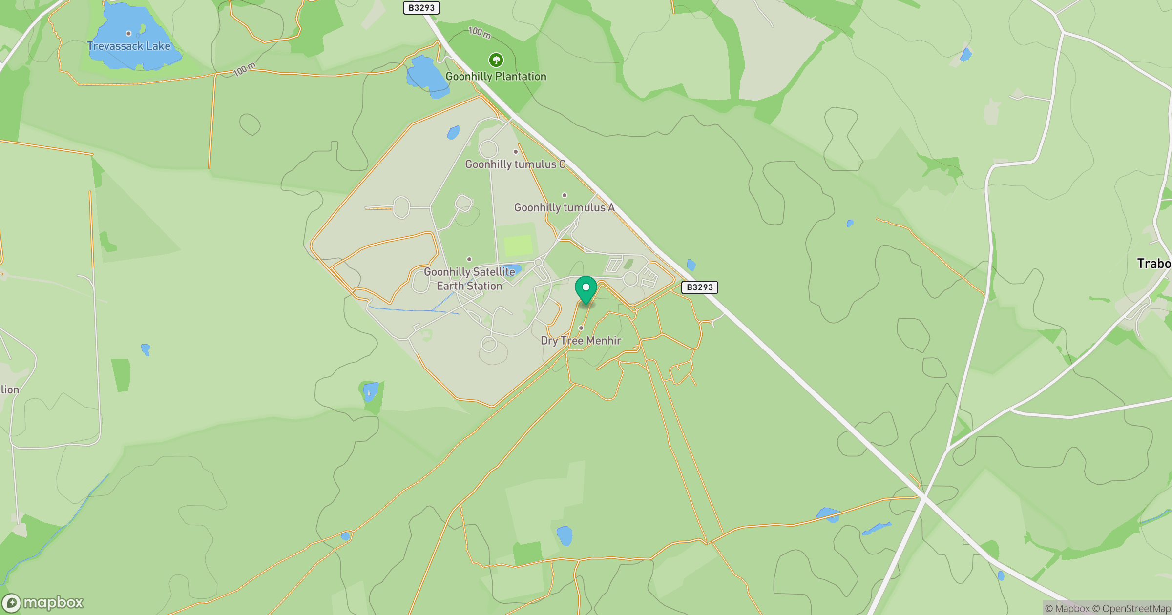
Grid reference: SW725212
View on OpenStreetMapOpens a map in a new tab, centred on the hill.
Nearby Hills
Brown Willy
420m

Brent Tor
334m

High Willhays
622m
Rhossili Down - The Beacon
193m

Dunkery Beacon
520m
No comments yet. Be the first.