
Faranaree Hill
Good walks are even better shared.
Overview
Faranaree Hill: An Overview
Faranaree Hill, nestled in the breathtaking region of South Wales, stands proud at an elevation of 620 meters. Known as a Marilyn, it attracts hikers of all abilities looking to bask in its marvelous views and enjoy the great outdoors.
Geology
Faranaree's foundation is primarily sandstone, creating a patchwork of diverse ecosystems and stunning vistas. However, take care—this rock can turn into a slippery friend if the weather decides to play tricks.
Access and Parking
Getting to Faranaree Hill is straightforward, with parking located in the quaint village of Llangynidr, just a stone's throw away. Be wary of the usual holiday crowds, as space can be a bit tight. For those preferring public transport, don't fret—local buses are your best bet from nearby towns.
Routes
- Faranaree Hill Circular: This 8km loop is perfect for those wanting a bit of a leg stretch. Expect scenic views and a few ups and downs along the way.
- Llangynidr to Summit: A quick and easy path straight to the top for those who fancy a straightforward climb.
Summit Features
At the top, you will be greeted by a sturdy trig point—great for a group photo or a idyllic pic of your sandwich. Don't forget to soak in the surroundings before making your descent.
Views
On a clear day, the views over the Brecon Beacons and the River Usk are simply breathtaking, proving that Faranaree Hill is favourite among local hikers. Ideal times to visit are in the Spring for blooming flowers or during Autumn for vibrant colours.
Hazards
Be mindful of slippery paths when the rain graces the area. The weather can change faster than you can say 'foggy summit', so be prepared for anything.
Nearby Summits
Faranaree makes a great base for exploring other nearby summits such as Pen y Fan and Corn Du. Both are undoubtedly worth a visit, just don’t forget your camera!
Facilities
While Faranaree itself is a bit of a wild place, Llangynidr has a lovely café and public toilets for a bit of creature comfort post-hike.
In Conclusion
Faranaree Hill is not just a hill; it’s a slice of Welsh splendor begging to be explored. Whether you’re chasing summits or simply enjoying a lovely walk, Faranaree has a bit of magic to offer.
You’ll find it’s a hike that’s well worth your while!
Explore routes near Faranaree Hill
Public walks starting within 80 km of this hill. Nearby does not mean a route reaches the summit; check its map and access before setting out.
No public routes are currently listed within 80 km of Faranaree Hill on Walkmates. This does not mean there are no paths here. Explore the map and check local access information before planning a walk.
Route planning notes
These notes describe possible approaches, not verified navigable routes or permission to cross land. Check current paths, local access rules and conditions before setting out.
Faranaree Hill Circular
A scenic circular route starting from the village of Llangynidr, offering a moderate trek with picturesque views.
Llangynidr to Summit
A straightforward ascent from Llangynidr which is well-marked and allows for easy navigation to the summit.
Make a day of it, together
Find someone to share the walk with, or organise a day out along a route you like.
Hill facts and local notes
Classifications
Elevation
283m
928 ft
Prominence
126m
Coordinates
52.4646, -7.4313
S387349
OS Map
67
At the Summit
The summit is crowned with a substantial trig point, providing a perfect photo opportunity and a sturdy spot to catch your breath.
Terrain & Geology
Primarily composed of sandstone, which provides a diverse substrate for local flora and can be challenging underfoot, especially when wet.
Views & Scenery
Panoramic vistas of the Brecon Beacons and the surrounding valleys, with Pen y Fan visible on clear days. Look out for the River Usk winding below.
History & Heritage
Name Origin
The name 'Faranaree' is believed to derive from the Welsh term for 'far or remote place'.
Historical Significance
Historically, this area has been used for sheep farming and features prominently in local folklore.
Getting There & Facilities
Check current local access restrictions, parking rules and transport timetables before travelling. These notes do not confirm public access to the summit.
Parking
Parking available at Llangynidr, limited spaces but typically sufficient for hikers. Please be considerate of local residents.
Public Transport
Regular bus service operates from nearby towns including Crickhowell and Abergavenny.
Nearby Facilities
There is a small café in Llangynidr for refreshments and public toilets available in the village.
Safety Information
Known Hazards
- Slippery paths during rainy weather. Watch out for sudden weather changes in higher elevations.
General Safety Tips
- Check weather conditions before setting out
- Carry appropriate clothing and equipment
- Let someone know your planned route
- Take a map, compass, and GPS device
- Carry emergency supplies: food, water, first aid kit, torch
Hills
Some common questions about the hills answered
Are there group walks up Faranaree Hill?
Many walkers use Walkmates to join or organise walks with others. You can check for group walks around Faranaree Hill through the maps
Are there other walkers around Faranaree Hill?
Activity varies by location and time, but Walkmates lets you see whether others have shared walks or shown interest in this area. Find other people through the walking friends search walking friends for Faranaree Hill search or of course create your own walk for Faranaree Hill
Can I organise a walk to Faranaree Hill?
Yes. If there aren’t any walks listed already, you can create a walk and make it available for others to join.
If you're signed up to Walkmates, you can create a walk to Faranaree Hill.
How do I find a walk up this hill?
There are often multiple ways to walk this hill, depending on experience and route preference. Walkmates helps you explore walks and routes that others have shared.
Can I suggest a new route up Faranaree Hill?
Yes. You can suggest or create routes to share with others. Walkmates focuses on the social side of walking, so routes are used to help people organise walks and explore areas together, rather than as detailed navigation tools or route libraries.
Other uses really appreciate knowledgeable walkers sharing their routes. Share your favourite route to Faranaree Hill here
The is an error or something incorrect about this hill. How do I let you know?
We always strive to keep the information on Walkmates as accurate as possible. If you find an error, please let us know through the contact form and we'll aim to correct it as quickly as possible
Community Discussion
Comments
Location
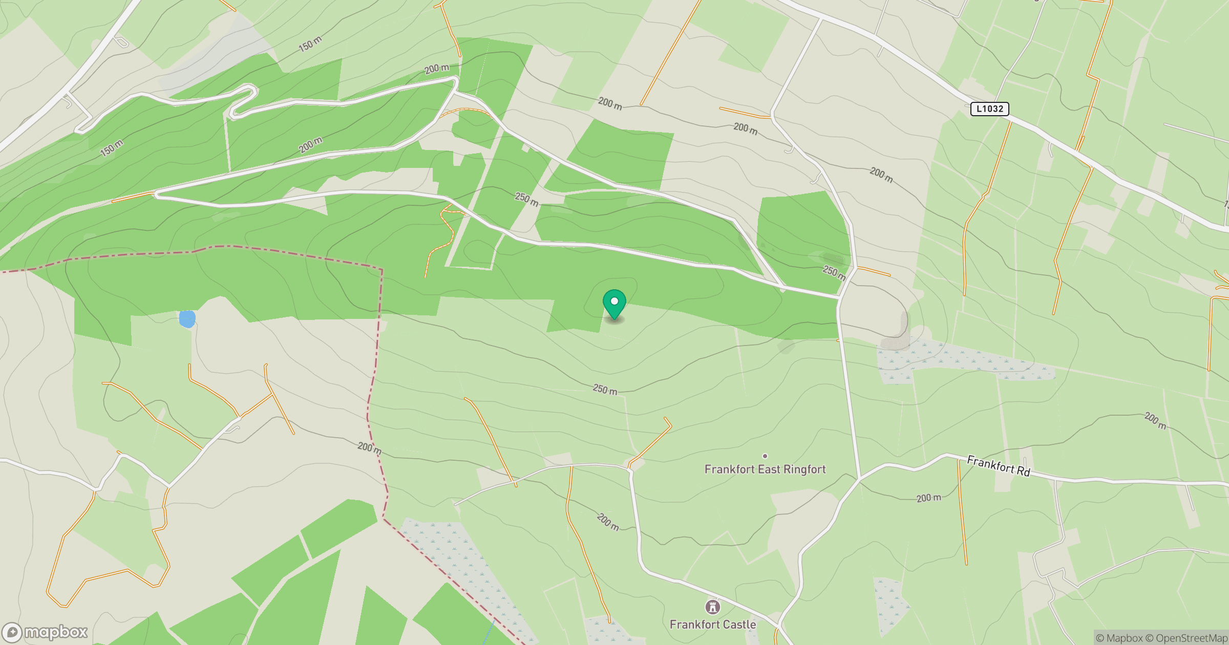
Grid reference: S387349
View on OpenStreetMapOpens a map in a new tab, centred on the hill.
Hills within 30 km
Straight-line distance, not a walking route or confirmation of access.
No comments yet. Be the first.