

Elegug Tower
Good walks are even better shared.
SR9294 : Stack Rocks - Elegug Stacks
John Horne Photo source
Overview
Elegug Tower
Nestled in the heart of the Pembrokeshire Coast National Park, Elegug Tower stands majestically as a sentinel over breathtaking landscapes. At an elevation of 220 meters, it may not be the highest peak, but it certainly offers some of the most stunning vistas along the coastline.
Geology
Elegug Tower is predominantly limestone, specifically part of a Carboniferous series that forms dramatic cliff formations. This unique geology not only shapes the breathtaking views but also supports a rich ecosystem, making it a fantastic spot for nature lovers.
Access and Parking
Accessing Elegug Tower is a breeze, particularly if you start from St Govan's Chapel. There you'll find parking facilities, perfect for tying your boots or enjoying a quick snack. It’s about a 2 km walk from the chapel to the foot of the tower, allowing you to soak in the surroundings.
For those relying on public transport, services are available from Pembroke Dock and Tenby. Be sure to check the timetables—because let’s face it, buses can sometimes be as elusive as a unicorn.
Routes
The most popular route to the summit is from the Coastal Path, offering a distance of approximately 4 km one way and a time of around 1.5 hours of moderate walking. It’s a delightful trek filled with scenic overlooks and a chance to encounter local wildlife. Just remember to keep your eyes peeled for those cheeky seals in the water below!
Summit Features
At the top, you'll be greeted by a distinctive limestone pinnacle and a small cairn that proudly announces your achievement of reaching the summit. The views are the real showstopper, however. On a clear day, the vistas stretch far and wide, showcasing the rugged beauty of the Pembrokeshire coastline.
Views & Best Seasons
Views from Elegug Tower are nothing short of stunning. You can marvel at the coastline, the islands dotting the horizon, and if you’re lucky, catch a glimpse of marine life in action. Spring and summer are the best times for these sights, especially at dawn when the light casts a magical glow over the landscape.
Hazards
While the ascent is rewarding, be cautious of the steep inclines and occasional strong winds. It’s not a mountain for the faint-hearted; keep a good grip and be prepared for the unexpected!
Nearby Summits
If you’re in the mood to explore further, consider nearby Carn Hylldrem, standing at 250 meters, which provides another fantastic vantage point over the region.
Conclusion
Elegug Tower is an unmissable gem for hiking enthusiasts and those who appreciate the natural beauty of Wales. So don your hiking boots, pack a snack, and get ready to take in some of the most picturesque sights this region has to offer! Happy hiking!
Explore routes near Elegug Tower
Walks starting near this hill. Open a route to check its map, distance and full itinerary.
Stackpole Estate: Bosherston Lily Ponds and Lodge Park Woodland Circuit
View route
Neyland to Johnston: Brunel and Westfield Railway Trail
View route
Pembrokeshire Coast Path: Newport Parrog to Fishguard via Dinas Head
View route
Gower winter wildlife and birdwatching walk
View route
Route planning notes
These notes describe possible approaches. Check a route's map and access information when planning your walk.
Approach from the Coastal Path
This delightful route leads you along the Pembrokeshire Coast Path, providing stunning views of the cliffs and sea.
Make a day of it, together
Find someone to share the walk with, or organise a day out along a route you like.
Photo Gallery
View all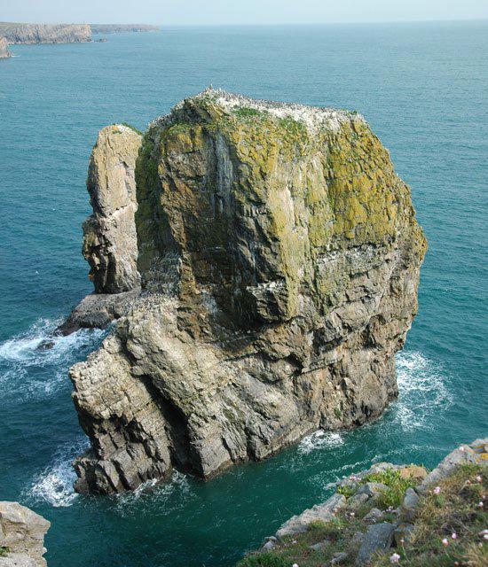 Photo could not load
SR9294 : Stack Rocks - Elegug Stacks
John Horne
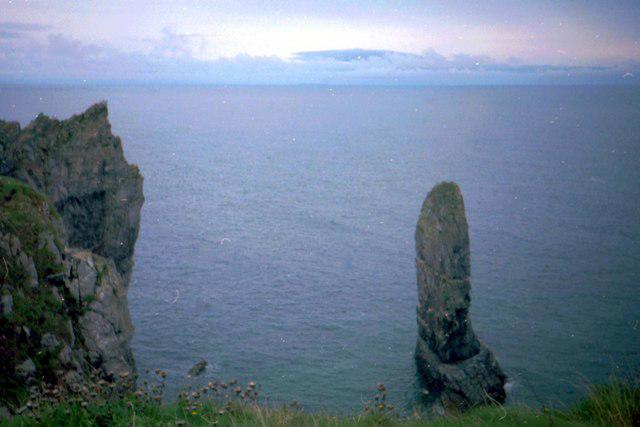 Photo could not load
SR9294 : Castlemartin - 1988
Helmut Zozmann
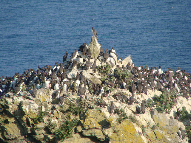 Photo could not load
SR9294 : King of the Castle
Ruth Sharville
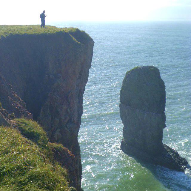 Photo could not load
SR9294 : Elegug Stacks
Gordon Hatton
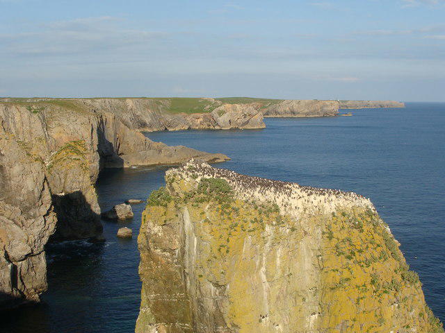 Photo could not load
SR9294 : Elegug Stack and the Pembrokeshire coastline
Ruth Sharville
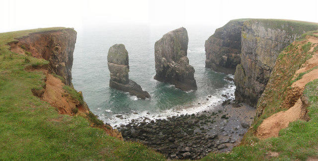 Photo could not load
SR9294 : Stack Rocks
Gareth James
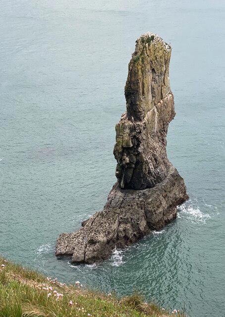 Photo could not load
SR9294 : Boot-shaped rock
Alan Hughes
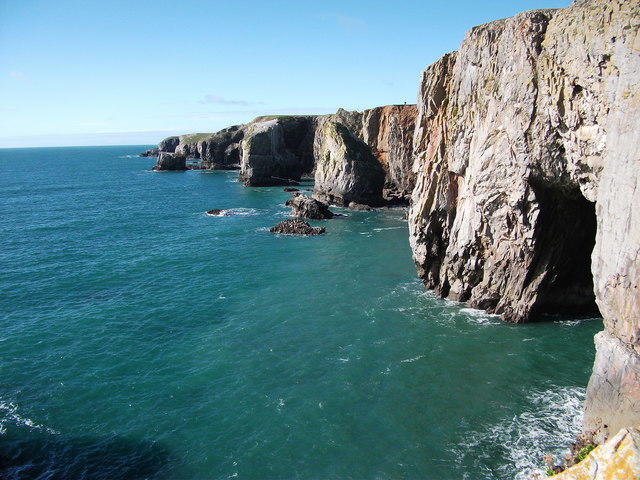 Photo could not load
SR9294 : Elegug stacks and surrounding cliffs
Alistair Hare
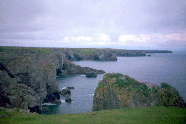 Photo could not load
SR9294 : Castlemartin - 1988
Helmut Zozmann
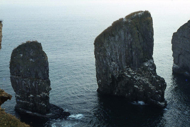
SR9294 : Elegug Stacks
Colin Park
Hill facts and local notes
Classifications
Elevation
40m
131 ft
Prominence
40m
Coordinates
51.6101, -4.9968
SR926944
OS Map
158
Explorer: OL36W
At the Summit
The summit is marked by a distinctive limestone pinnacle and offers a small stone cairn as a welcoming sight for reaching the top.
Terrain & Geology
Primarily composed of limestone, Elegug Tower is part of the Carboniferous limestone series, known for its unique cliff formations and rich biodiversity in the surrounding area.
Views & Scenery
Breath-taking views of the Pembrokeshire coastline, the nearby islands, and potentially glimpses of seals basking on the rocks.
History & Heritage
Name Origin
The name 'Elegug' is derived from the Welsh word for 'cormorant', likely referencing the many birds found in the area.
Historical Significance
The tower is a notable landmark along the Pembrokeshire coastline, rich in maritime history and local folklore.
Getting There & Facilities
Parking
There is parking available at St Govan's Chapel, which is approximately 2 km from the foot of Elegug Tower.
Public Transport
Buses from Tenby and Pembroke Dock serve nearby areas, but check schedules as they can be infrequent.
Nearby Facilities
There are no facilities at the summit, but St Govan's Chapel has a small café selling refreshments. Public toilets are also located at the chapel.
Safety Information
Known Hazards
- Steep inclines may pose a challenge; strong winds can also occur. Keep a steady grip and your wits about you!
General Safety Tips
- Check weather conditions before setting out
- Carry appropriate clothing and equipment
- Let someone know your planned route
- Take a map, compass, and GPS device
- Carry emergency supplies: food, water, first aid kit, torch
Hills
Some common questions about the hills answered
Are there group walks up Elegug Tower?
Many walkers use Walkmates to join or organise walks with others. You can check for group walks around Elegug Tower through the maps
Are there other walkers around Elegug Tower?
Activity varies by location and time, but Walkmates lets you see whether others have shared walks or shown interest in this area. Find other people through the walking friends search walking friends for Elegug Tower search or of course create your own walk for Elegug Tower
Can I organise a walk to Elegug Tower?
Yes. If there aren’t any walks listed already, you can create a walk and make it available for others to join.
If you're signed up to Walkmates, you can create a walk to Elegug Tower.
How do I find a walk up this hill?
There are often multiple ways to walk this hill, depending on experience and route preference. Walkmates helps you explore walks and routes that others have shared.
Can I suggest a new route up Elegug Tower?
Yes. You can suggest or create routes to share with others. Walkmates focuses on the social side of walking, so routes are used to help people organise walks and explore areas together, rather than as detailed navigation tools or route libraries.
Other uses really appreciate knowledgeable walkers sharing their routes. Share your favourite route to Elegug Tower here
The is an error or something incorrect about this hill. How do I let you know?
We always strive to keep the information on Walkmates as accurate as possible. If you find an error, please let us know through the contact form and we'll aim to correct it as quickly as possible
Community Discussion
Comments
Location
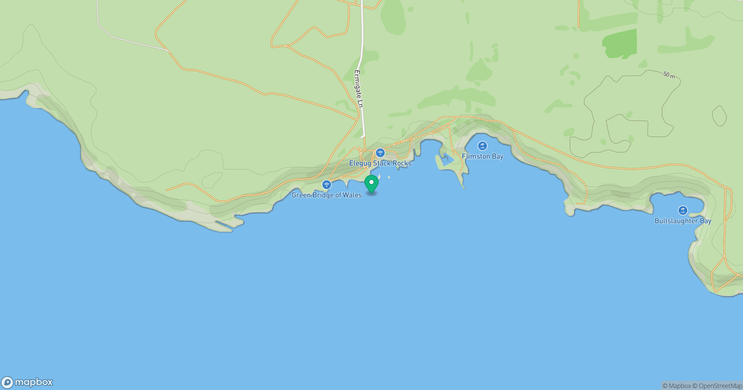
Grid reference: SR926944
View on OpenStreetMapOpens a map in a new tab, centred on the hill.
Nearby Hills
Pen y Fan
142m
Rhossili Down - The Beacon
193m
Brown Willy
420m

Brent Tor
334m

Fan Brycheiniog - Twr y Fan Foel
802m
No comments yet. Be the first.