
Donnell's Hill
Good walks are even better shared.
Overview
Donnell's Hill
Donnell's Hill, standing at an elevation of 293 meters, is a delightful Marilyn located in the picturesque Shropshire Hills. Its summit presents a tranquil spot for hikers looking to escape the hustle and bustle of daily life.
Geology
The hill is primarily constructed of sandstone, revealing a fascinating geological history. Over millennia, this region has been sculpted by natural forces, leaving behind a landscape speckled with sedimentary formations that tell tales of an ancient earth.
Routes
There’s nothing quite like the thrill of reaching the summit after a well-planned route. The popular trail starting from Dorrington is both scenic and manageable. This moderate trek takes around 2.5 hours, depending on your pace and, of course, how often you stop to take photos of those stunning views! Total distance is about 6.4 km.
Summit Features
At the summit, you will encounter a trig point – the perfect prop for your next social media post. Don't forget to add a few sheep selfies while you're at it!
Terrain
The terrain consists primarily of grassy areas with rocky outcrops and occasional muddy patches, particularly after rain. Good hiking boots are advised, unless you fancy a swim in nature's bog.
Views
The panoramic views from Donnell's Hill are second to none, especially when you spot nearby landmarks like the Long Mynd and the Stiperstones on a clear day. The best seasons for these remarkable vistas are spring and autumn, when the colours and visibility are breathtaking.
Hazards
While hiking, keep an eye out for sheep that might decide to cross your path. They may be adorable but can also be a bit obstinate! Additionally, muddy sections can present a slipping hazard.
Nearby Summits
Donnell's Hill is surrounded by notable trekking options. Adjacent summits include The Wrekin and Long Mynd, both of which offer their own unique hiking challenges and stunning views.
Access
The nearest parking area is found in Dorrington, with space for about ten cars – it’s a popular spot, so don’t miss out! Buses from Shrewsbury to Dorrington provide handy public transport options, and all of this is just a short drive from Shrewsbury itself.
Facilities
For refreshments and restrooms, trust your instincts and head back to Shrewsbury. There are a variety of cafes to fuel up after your hike.
History
The name Donnell's Hill echoes tales of ancient times, possibly hinting at historical inhabitants. Sheep farming historically played a vital role in this region's economy, adding another layer of cultural significance to your hike.
In summary, Donnell’s Hill is more than just a hike; it’s an escapade into history, geology, and breathtaking nature. So lace up your boots and prepare for an adventure that’s sure to be a memorable one!
Happy hiking!
Explore routes near Donnell's Hill
Public walks starting within 80 km of this hill. Nearby does not mean a route reaches the summit; check its map and access before setting out.
No public routes are currently listed within 80 km of Donnell's Hill on Walkmates. This does not mean there are no paths here. Explore the map and check local access information before planning a walk.
Route planning notes
These notes describe possible approaches, not verified navigable routes or permission to cross land. Check current paths, local access rules and conditions before setting out.
Dorrington to Donnell's Hill
This route begins in the village of Dorrington and offers a delightful ascent through picturesque woodlands before reaching the summit.
Make a day of it, together
Find someone to share the walk with, or organise a day out along a route you like.
Hill facts and local notes
Classifications
Elevation
243m
797 ft
Prominence
125m
Coordinates
52.2686, -7.3336
S455131
OS Map
75
At the Summit
At the summit, hikers will find a well-maintained trig point and a small cairn, offering a perfect spot for a well-deserved snack break and Instagram photo.
Terrain & Geology
The hill is primarily composed of sandstone, with a rich history of geological activity that has shaped its current profile over millions of years. The surrounding area showcases quaint sedimentary formations.
Views & Scenery
From the top, enjoy sweeping views of the Shropshire Hills, including landmarks like the Long Mynd and the Stiperstones.
History & Heritage
Name Origin
The name 'Donnell's Hill' is believed to derive from Old English, indicating a historical connection to past inhabitants.
Historical Significance
The hill was historically used for pasturing sheep, key to the local economy, and is now cherished for its recreational opportunities.
Getting There & Facilities
Check current local access restrictions, parking rules and transport timetables before travelling. These notes do not confirm public access to the summit.
Parking
There is a small car park in Dorrington off the A49, with space for approximately 10 cars. Arrive early during weekends to secure a spot!
Public Transport
Buses from Shrewsbury to Dorrington run several times a day, providing an easy transport option.
Nearby Facilities
The nearest facilities, including cafes and toilets, are found in the town of Shrewsbury, around 7 miles away.
Safety Information
Known Hazards
- Watch out for sheep grazing freely – they may look cute but can be a bit cheeky. Also, muddy patches after rain can be slippery.
General Safety Tips
- Check weather conditions before setting out
- Carry appropriate clothing and equipment
- Let someone know your planned route
- Take a map, compass, and GPS device
- Carry emergency supplies: food, water, first aid kit, torch
Hills
Some common questions about the hills answered
Are there group walks up Donnell's Hill?
Many walkers use Walkmates to join or organise walks with others. You can check for group walks around Donnell's Hill through the maps
Are there other walkers around Donnell's Hill?
Activity varies by location and time, but Walkmates lets you see whether others have shared walks or shown interest in this area. Find other people through the walking friends search walking friends for Donnell's Hill search or of course create your own walk for Donnell's Hill
Can I organise a walk to Donnell's Hill?
Yes. If there aren’t any walks listed already, you can create a walk and make it available for others to join.
If you're signed up to Walkmates, you can create a walk to Donnell's Hill.
How do I find a walk up this hill?
There are often multiple ways to walk this hill, depending on experience and route preference. Walkmates helps you explore walks and routes that others have shared.
Can I suggest a new route up Donnell's Hill?
Yes. You can suggest or create routes to share with others. Walkmates focuses on the social side of walking, so routes are used to help people organise walks and explore areas together, rather than as detailed navigation tools or route libraries.
Other uses really appreciate knowledgeable walkers sharing their routes. Share your favourite route to Donnell's Hill here
The is an error or something incorrect about this hill. How do I let you know?
We always strive to keep the information on Walkmates as accurate as possible. If you find an error, please let us know through the contact form and we'll aim to correct it as quickly as possible
Community Discussion
Comments
Location
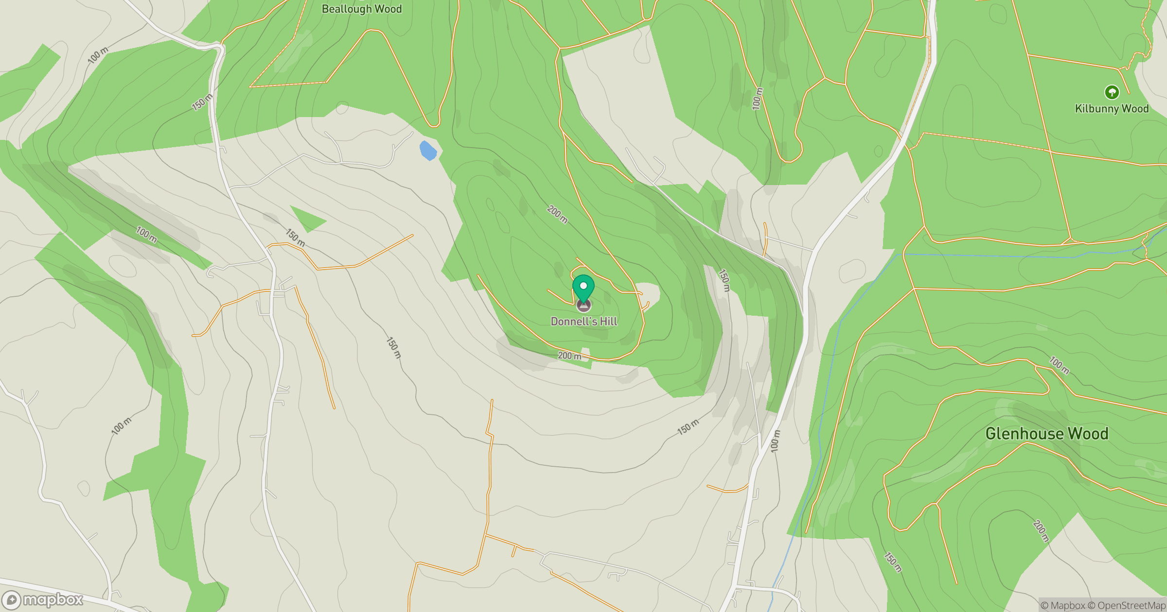
Grid reference: S455131
View on OpenStreetMapOpens a map in a new tab, centred on the hill.
Hills within 30 km
Straight-line distance, not a walking route or confirmation of access.
No comments yet. Be the first.